-
Benin: Flooding - Telephone Assessments conducted by CARE up to 16 July 2009
Telephone Assessments conducted by CARE up to 16th July, 2009. Map shows localities reporting various problems; Water, sanitation, infrastructure, health and food issues. In... -

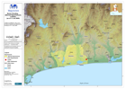
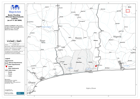
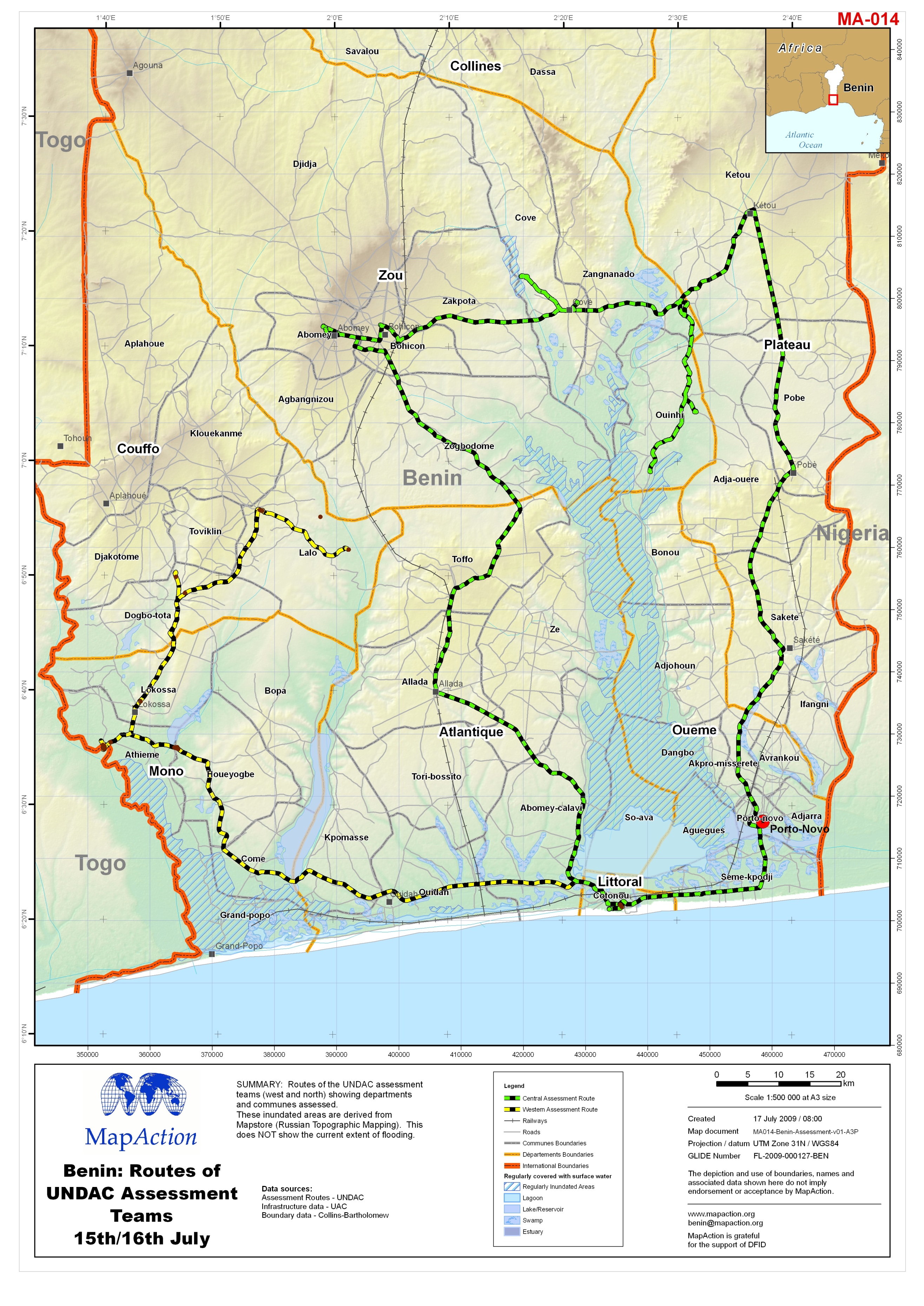
Benin: Routes of UNDAC Assessment Teams 15th/16th July
Routes of the UNDAC assessment teams (west and north) showing departments and communes assessed. These inundated areas are derived from Mapstore (Russian Topographic Mapping).... -

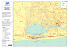
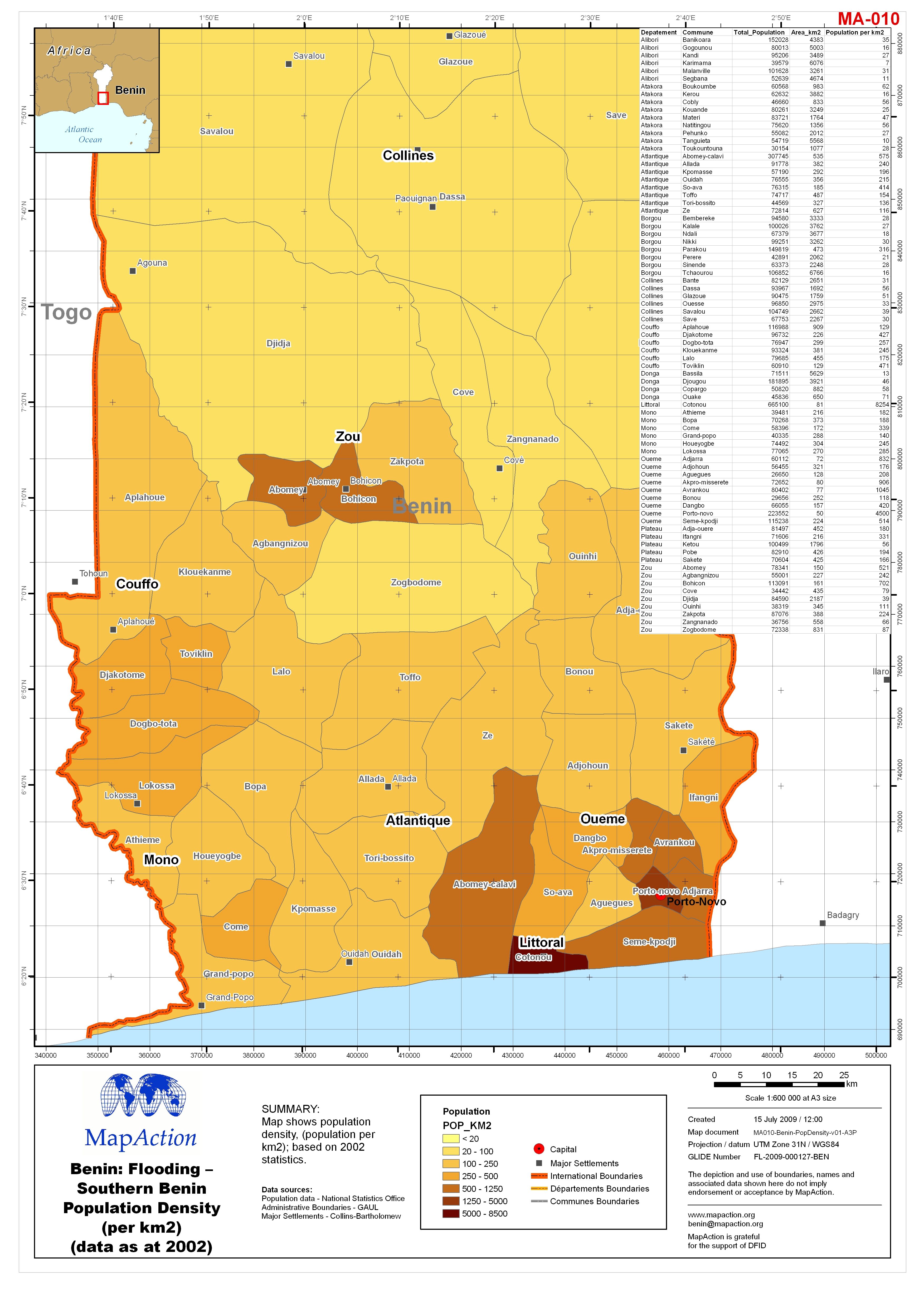
Benin: Flooding - Southern Benin Population Density (per km2) (data as at 2002)
Map shows population density, (population per km2); based on 2002 statistics. -

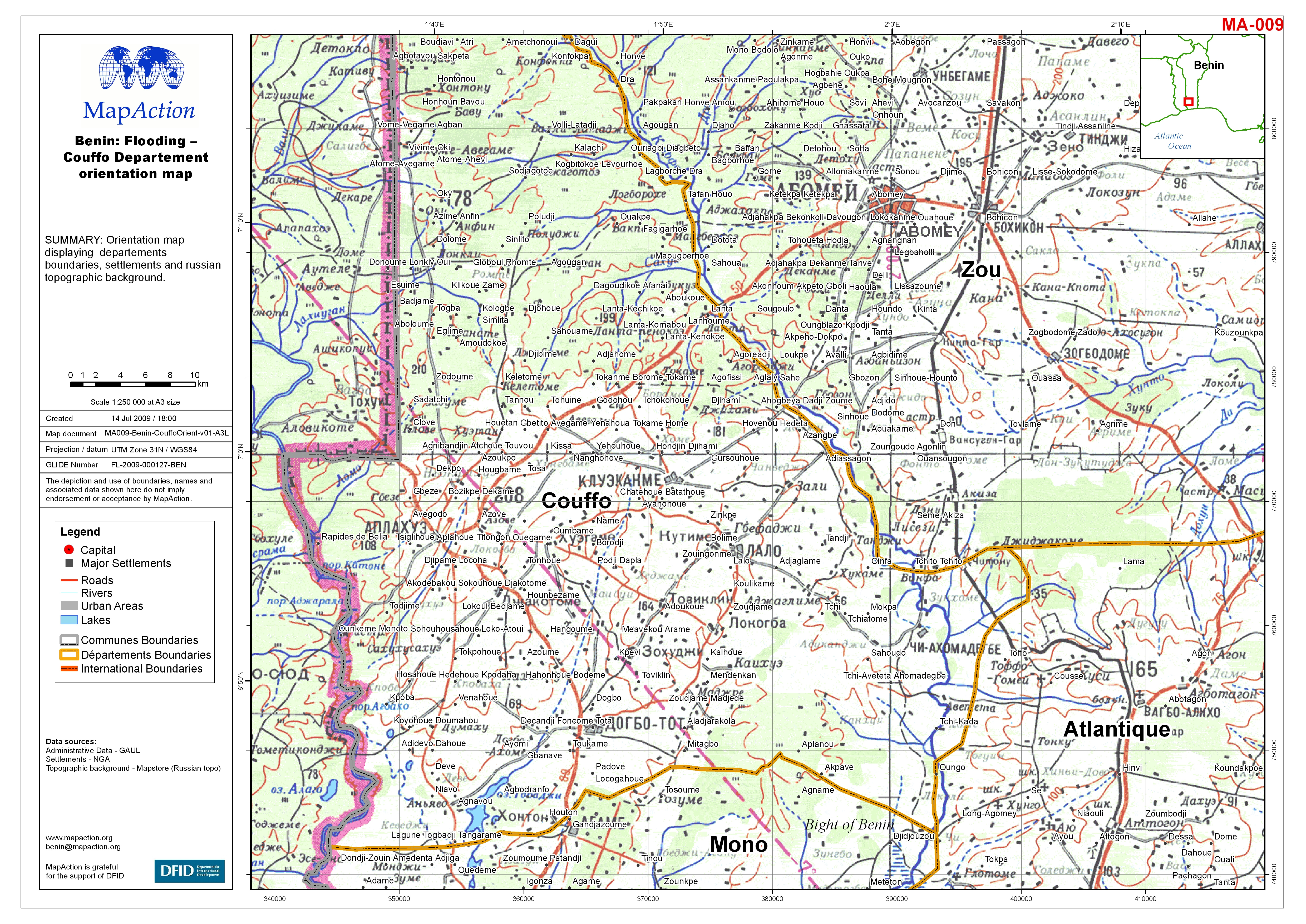
Benin: Flooding - Couffo Departement orientation map
Orientation map displaying departements boundaries, settlements and Russian topographic background. -
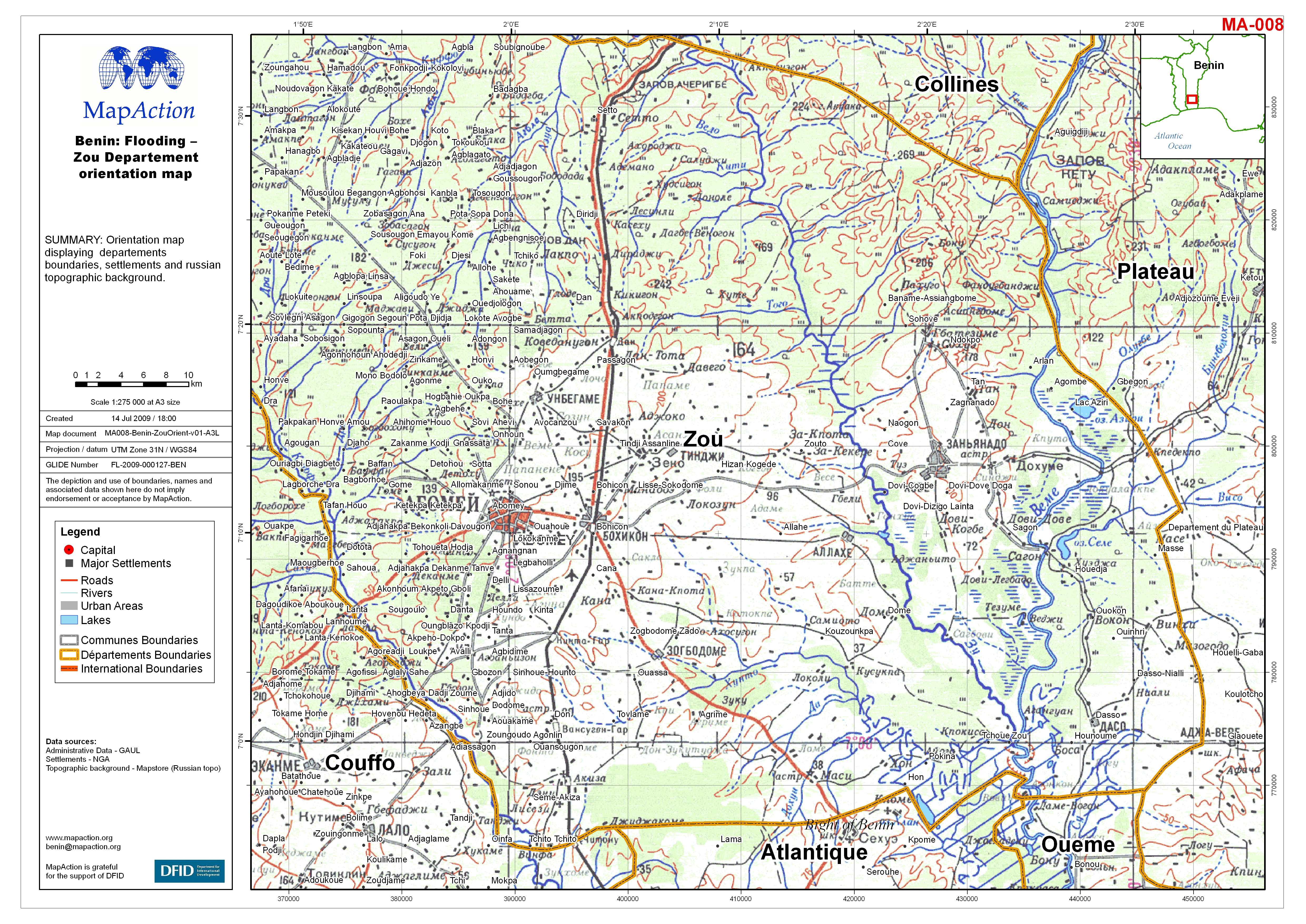
Benin: Flooding - Zou Departement orientation map
Orientation map displaying departements boundaries, settlements and Russian topographic background. -
Benin: Flooding - Littoral, Atlantique and Oueme Departements: Villages Asses...
Villages and other localities reported as assessed by Government of Benin by 8 July 2009, and International Federation for Red Cross and Red Crescent (IFRC) by 10 July 2008. Two... -

Benin: Flooding - Mono Departement orientation map
Orientation map displaying departements boundaries, settlements and russian topographic background. -
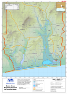
Benin: Flooding - Areas Regularly Covered by Surface Water
Areas in south Benin which are often covered by water, including lagoonal waters and estuaries, swamps, freshwater lakes and reservoirs, and flood plain which is regularly and... -

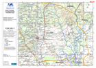
Benin: Flooding - Administrative Areas & Topography
This orientation map shows the administrative boundaries, to communes level, with a background of russian 1:500,000 topographic mapping. -

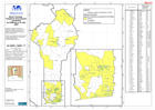
Benin: Flooding - Affected Communes (up to 12 July 2009)
This map shows the 43 of the 77 communes reported as particularly affected by floods and tornados as of 12 July, 2009. -
Benin: Flooding - Affected Departments In Benin (as of 11 Jul 2009)
Map shows the Benin Departments affected by flooding as of 11 July 2009 -
Benin: Flooding - Affected Departments In Benin (as of 11 Jul 2009)
Map shows the Benin Departments affected by flooding as of 11 July 2009. (Black and White version) -

Pakistan: IDPs staying in Host Communities MCRAM (Multi-cluster rapid assessm...
Map showing number of households surveyed by district, number of IDPs and persons within host community residing in a surveyed household hosting IDPs, length of stay in... -

Pakistan: Health Facilities and Status, selected districts of NWFP (Health fa...
This data was provided by WHO in June 2009 but the status of the health facilities was assessed in February 2009 with the exception of SWAT which was assessed in April 2009 -

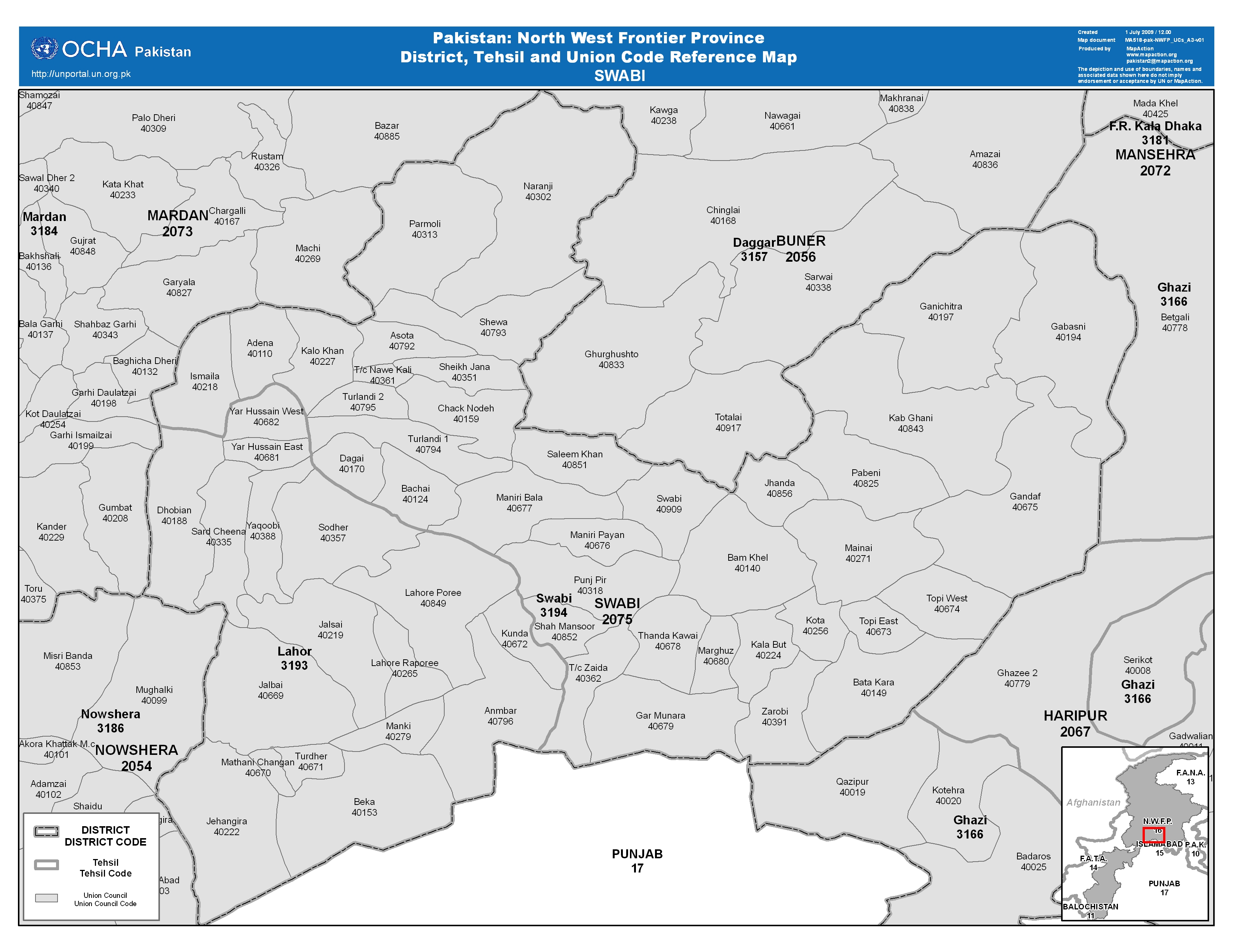
Pakistan: North West Frontier Province District, Tehsil and Union Code Refere...
This dataset has no description
-

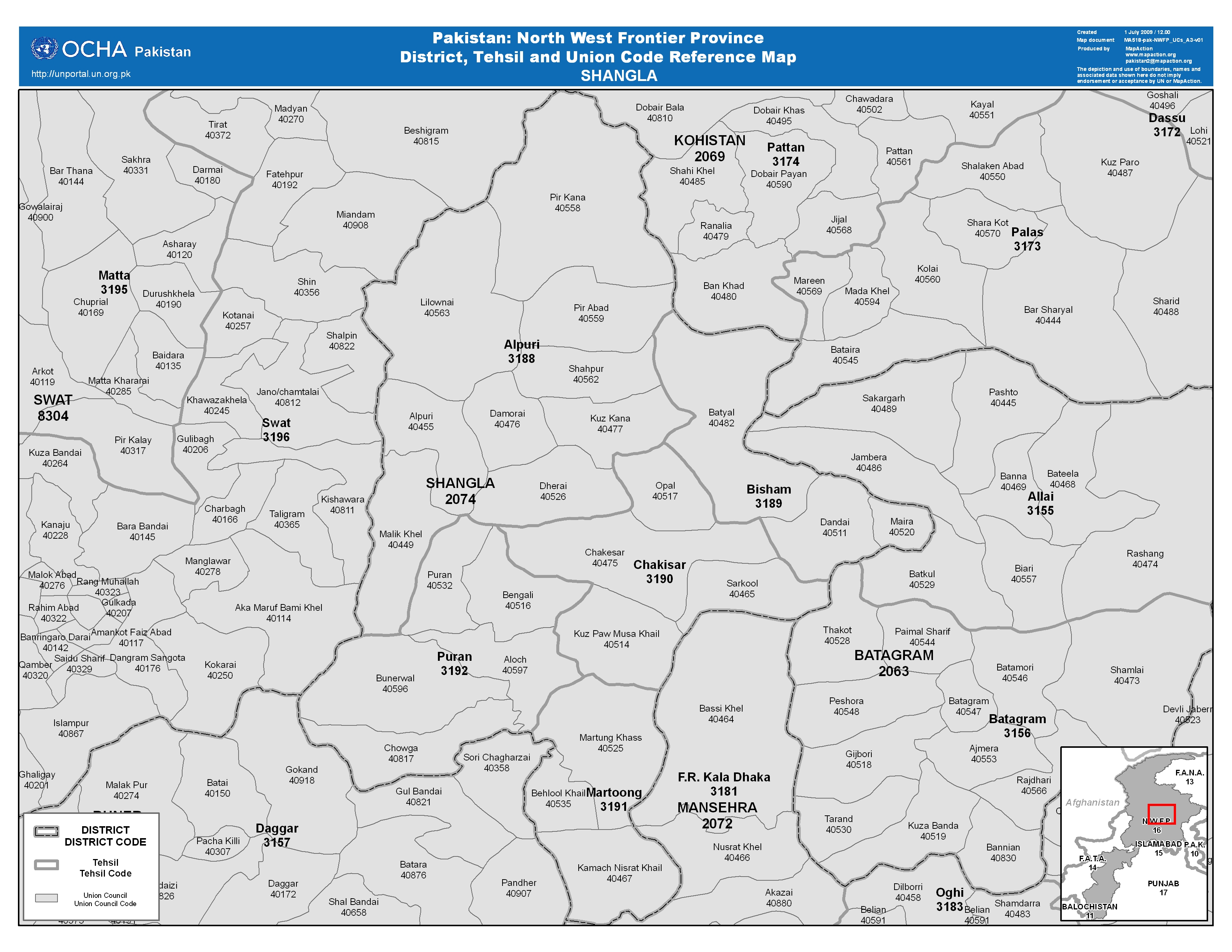
Pakistan: North West Frontier Province District, Tehsil and Union Code Refere...
This dataset has no description
-

Pakistan: North West Frontier Province District, Tehsil and Union Code Refere...
This dataset has no description
-

Pakistan: North West Frontier Province District, Tehsil and Union Code Refere...
This dataset has no description
-

Pakistan: North West Frontier Province District, Tehsil and Union Code Refere...
This dataset has no description
-

Pakistan: North West Frontier Province District, Tehsil and Union Code Refere...
This dataset has no description