-
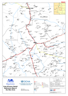
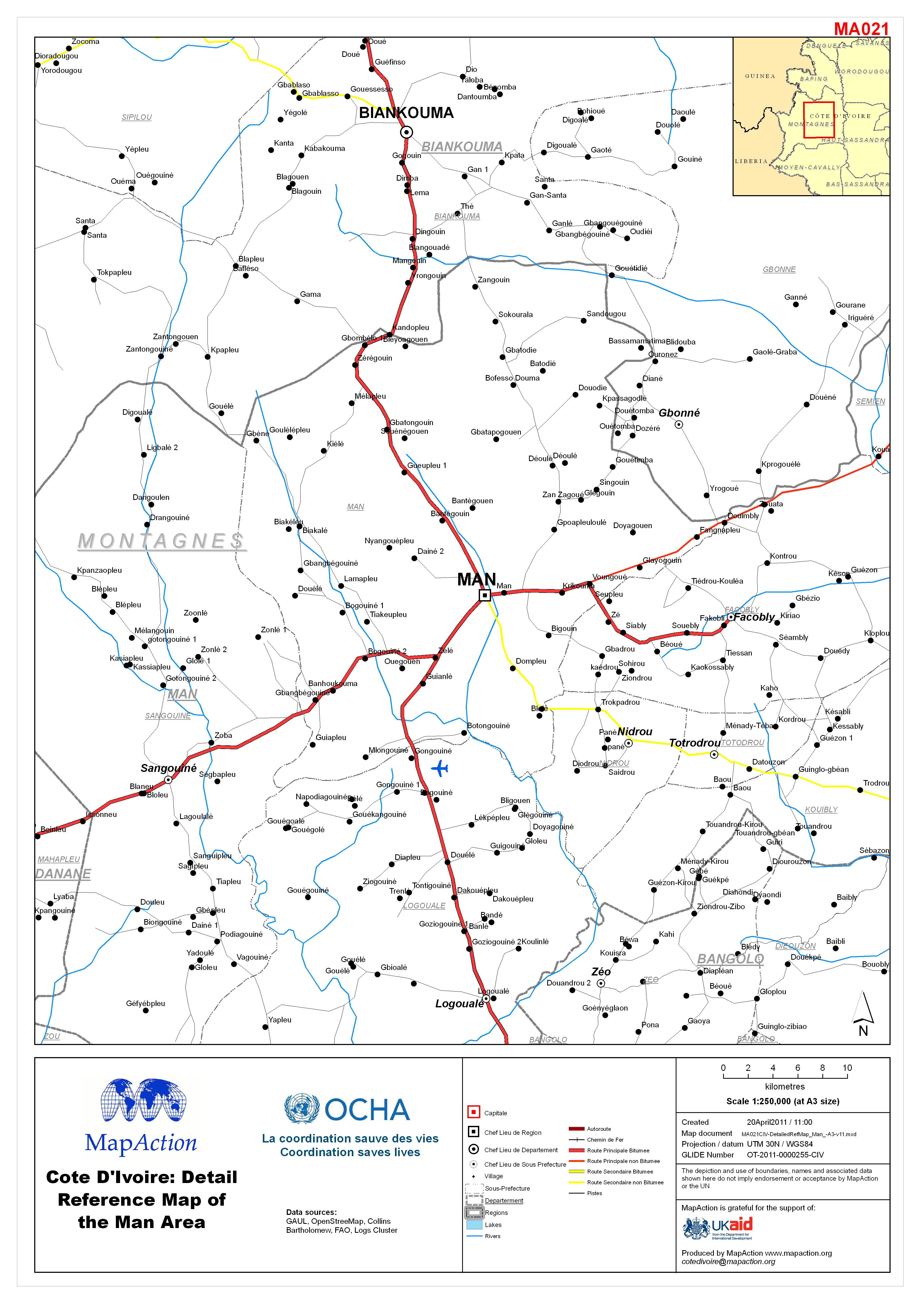
Côte d’Ivoire: Detail Reference Map of the Man Area
Côte d’Ivoire: Detail Reference Map of the Man Area -

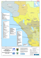
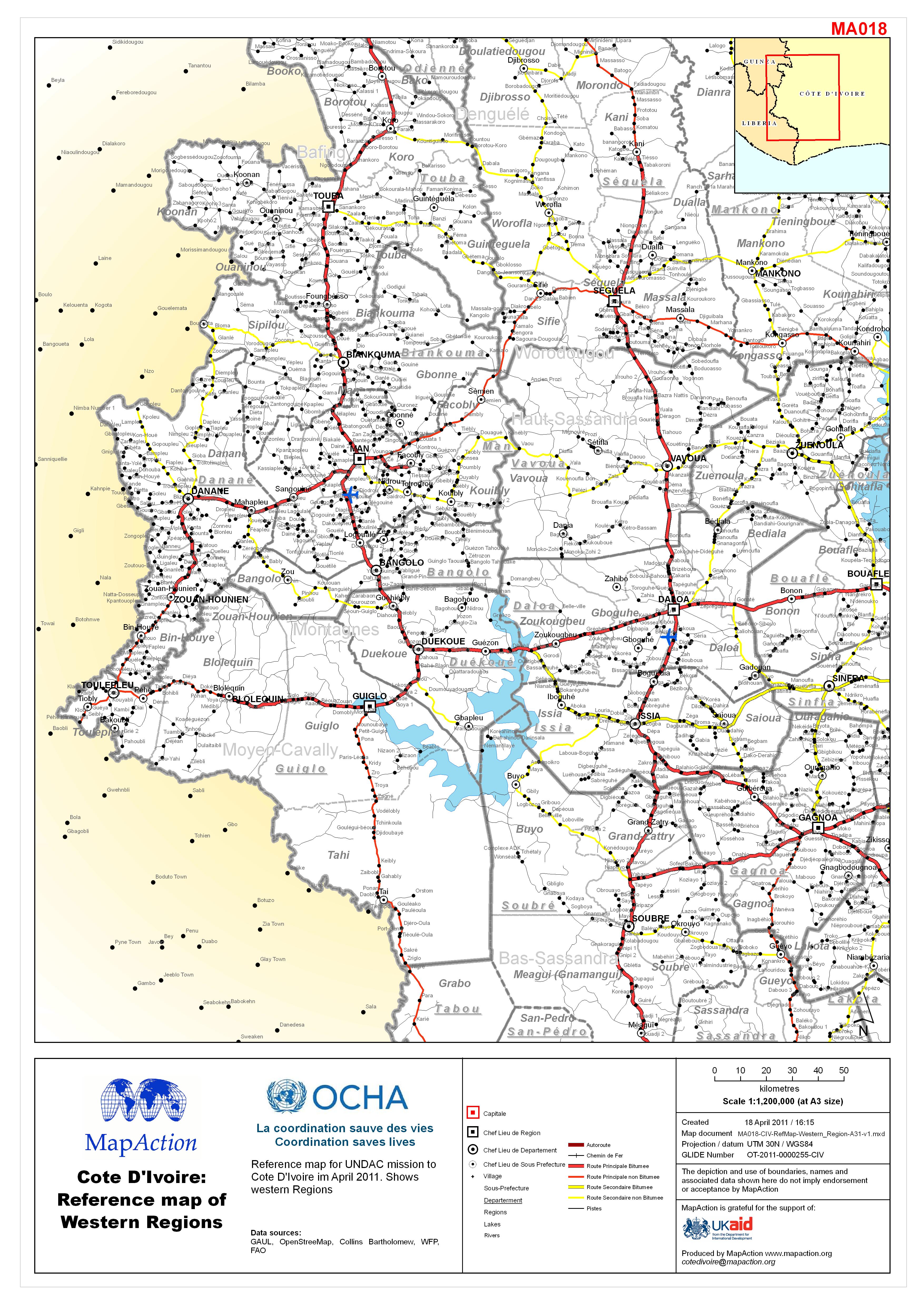
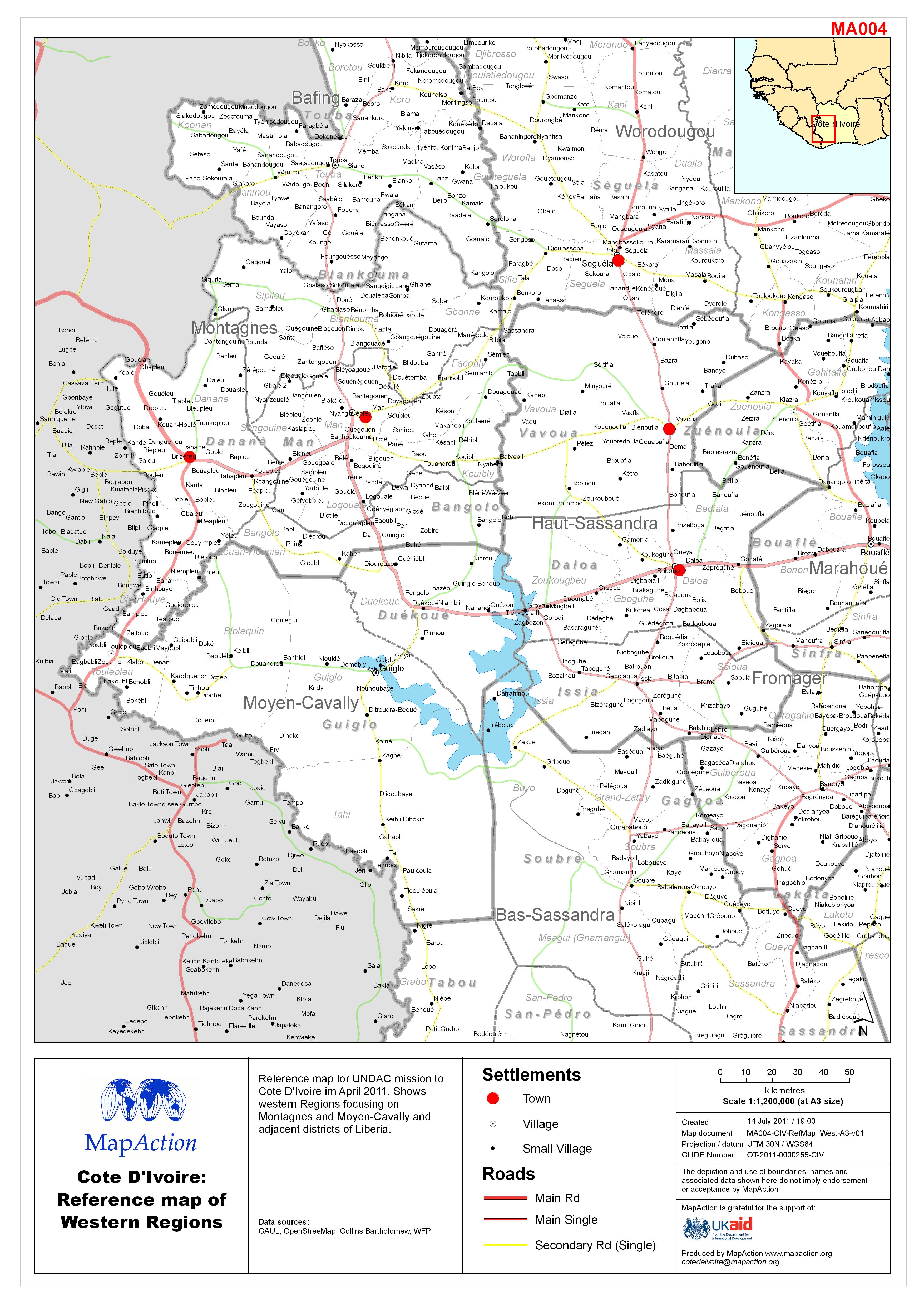
Côte d’Ivoire: Reference map of Western Regions
Reference map for UNDAC mission to Côte d’Ivoire im April 2011. Shows western Regions -
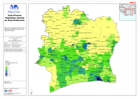
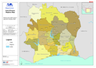
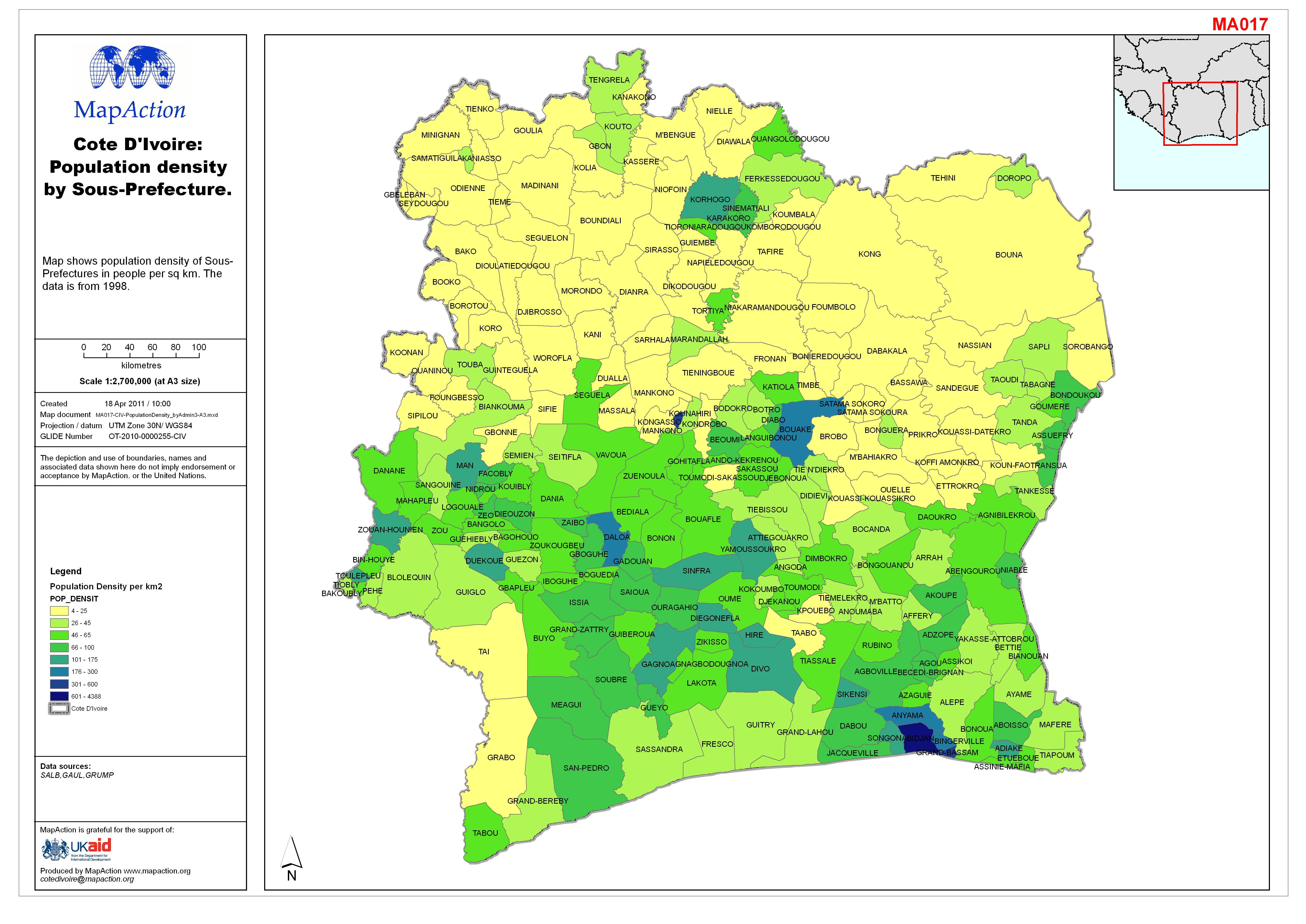
Côte d’Ivoire: Population density by Sous-Prefecture.
Map shows population density of Sous-Prefectures in people per sq km. The data is from 1998. -
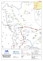
Côte d’Ivoire: Detail Reference Map of the Danane Area
Côte d’Ivoire: Detail Reference Map of the Danane Area -
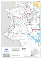
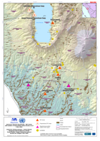
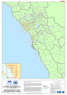
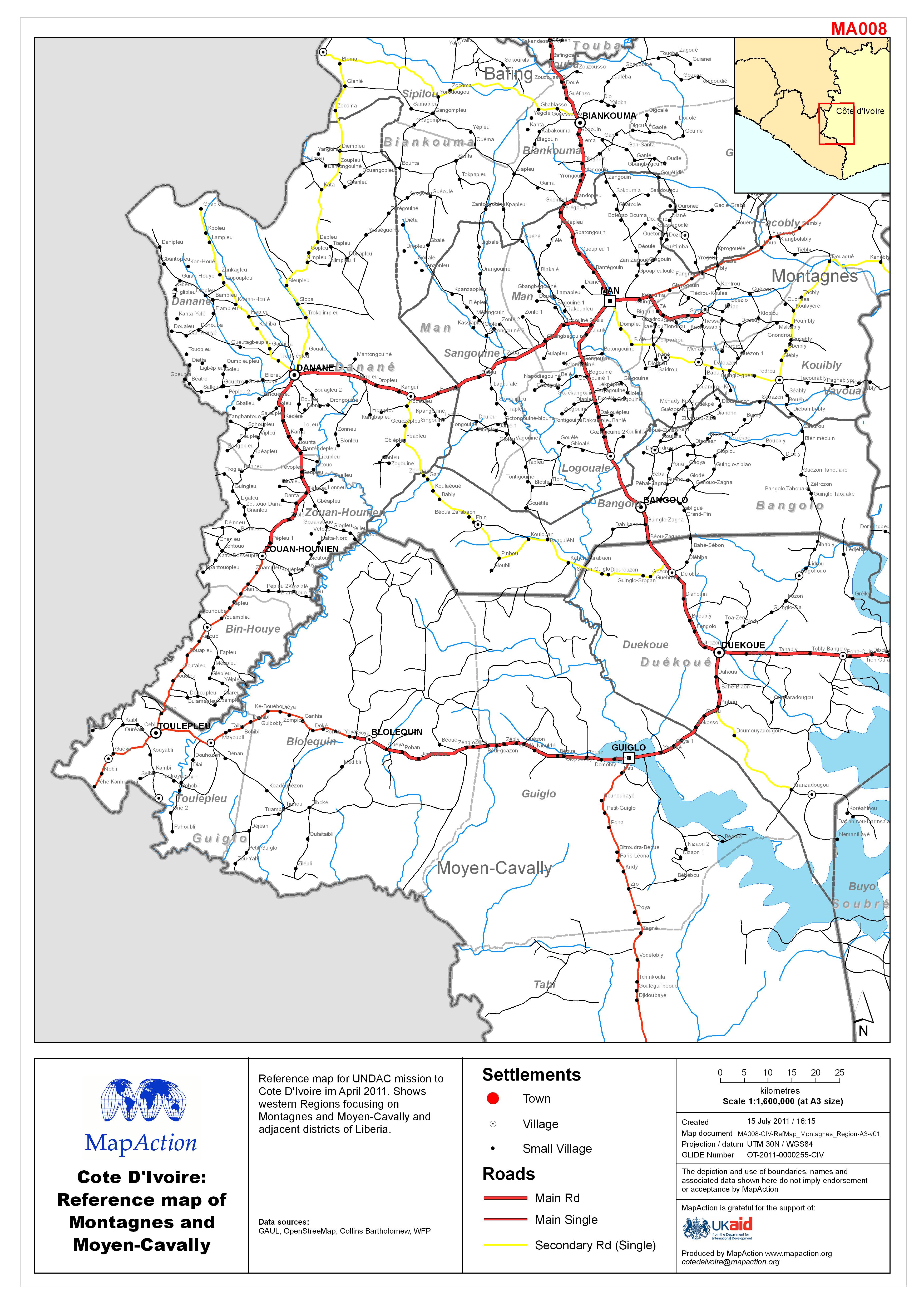
Côte d’Ivoire: Reference map of Montagnes and Moyen-Cavally Regions
Reference map for UNDAC mission to Côte d’Ivoire in April 2011. Shows western Regions focusing on Montagnes and Moyen-Cavally and adjacent districts of Liberia. -
Côte d’Ivoire: Regions Map
Reference map for UNDAC mission to Côte d’Ivoire in April 2011. Regions (admin level 1) boundaries shown. -

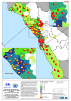
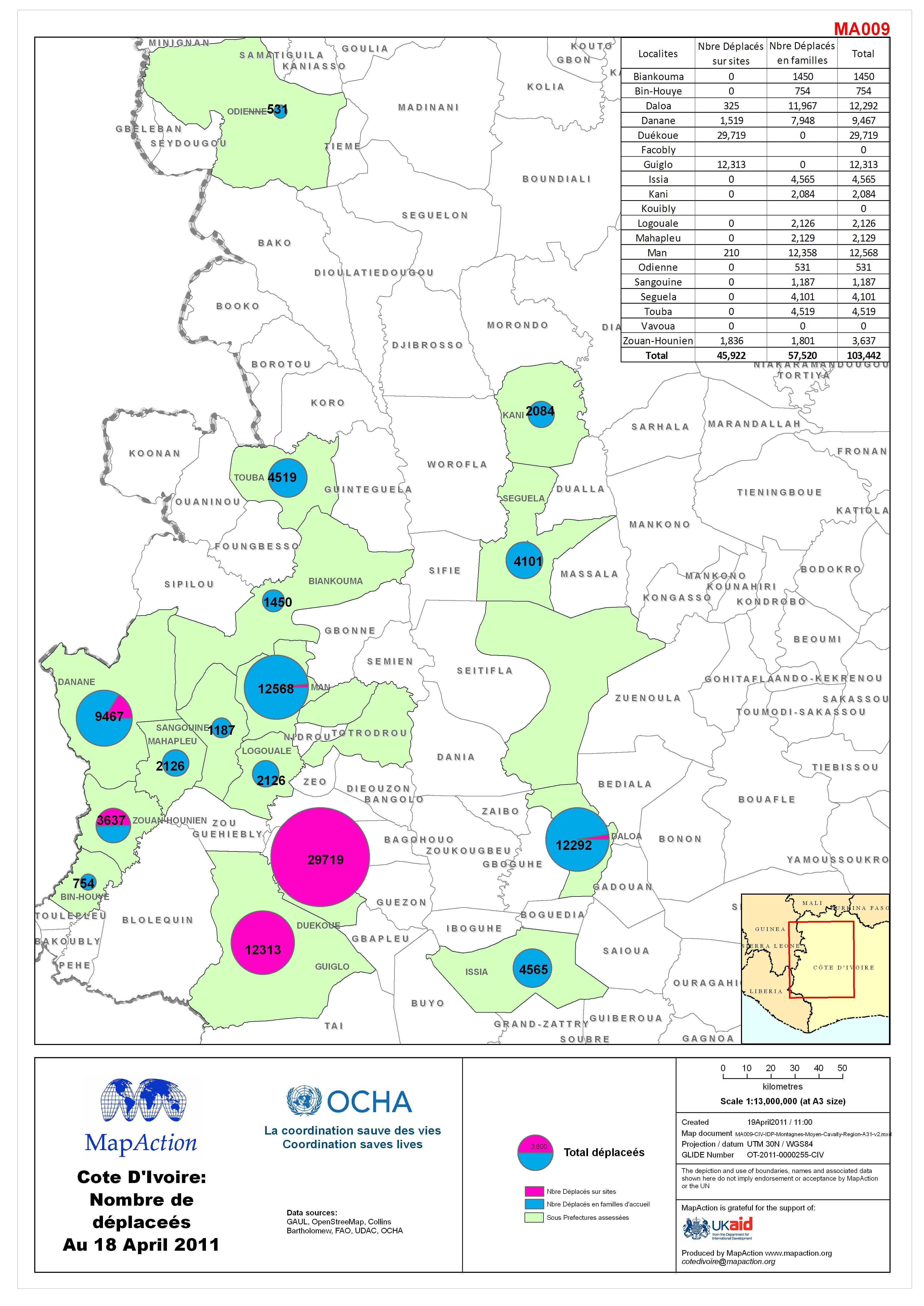
Côte d’Ivoire: Nombre de déplaceés Au 18 April 2011
Reference map for UNDAC mission to Côte d’Ivoire - April 2011. IDP numbers by Sous-Prefecture in Montagnes and Moyen-Cavally area of Côte d’Ivoire. Situation as assessed by mid... -
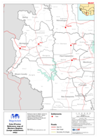
Côte d’Ivoire: Reference map of Western Regions (Large settlements only)
Reference map for UNDAC mission to Côte d’Ivoire in April 2011. Shows western Regions focusing on Montagnes and Moyen-Cavally and adjacent districts of Liberia. -
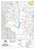
Côte d’Ivoire: Reference map of Western Regions
Reference map for UNDAC mission to Côte d’Ivoire in April 2011. Shows western Regions focusing on Montagnes and Moyen-Cavally and adjacent districts of Liberia. -

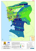
Côte d’Ivoire: Indicative population map
Reference map for UNDAC mission to Côte d’Ivoire in April 2011.GRUMP population density data. The settlement population data is from 1988 and should be used as indicative only... -

PowerPoint Maps for Côte d’Ivoire
The MapAction PowerPoint Map Pack contains a set of country level reference maps and individual Regions(admin 1 level) maps. These maps are designed for the user to use in... -

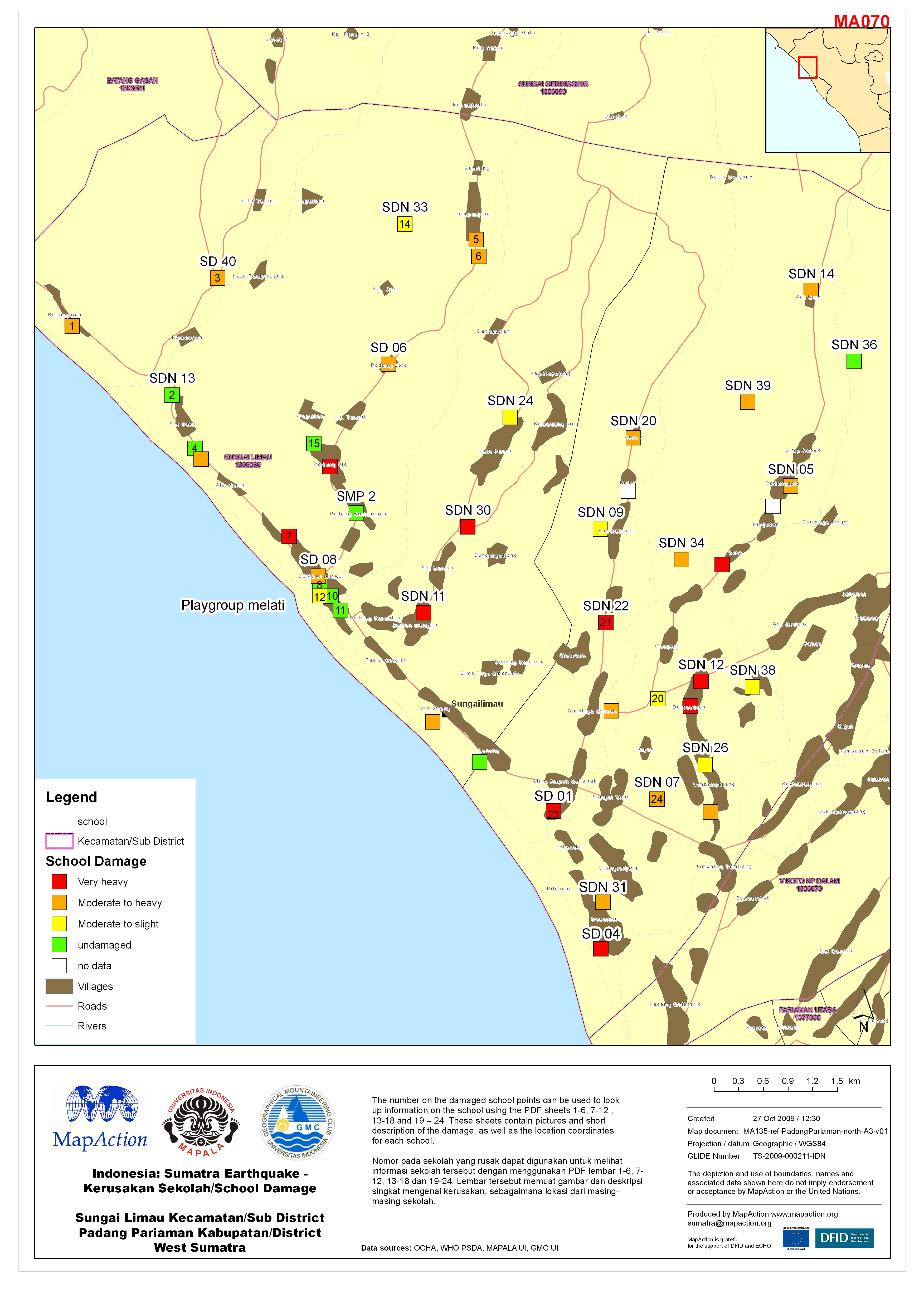
Indonesia: Sumatra Earthquake - Kerusakan Sekolah/School Damage Sungai Limau ...
This dataset has no description
-
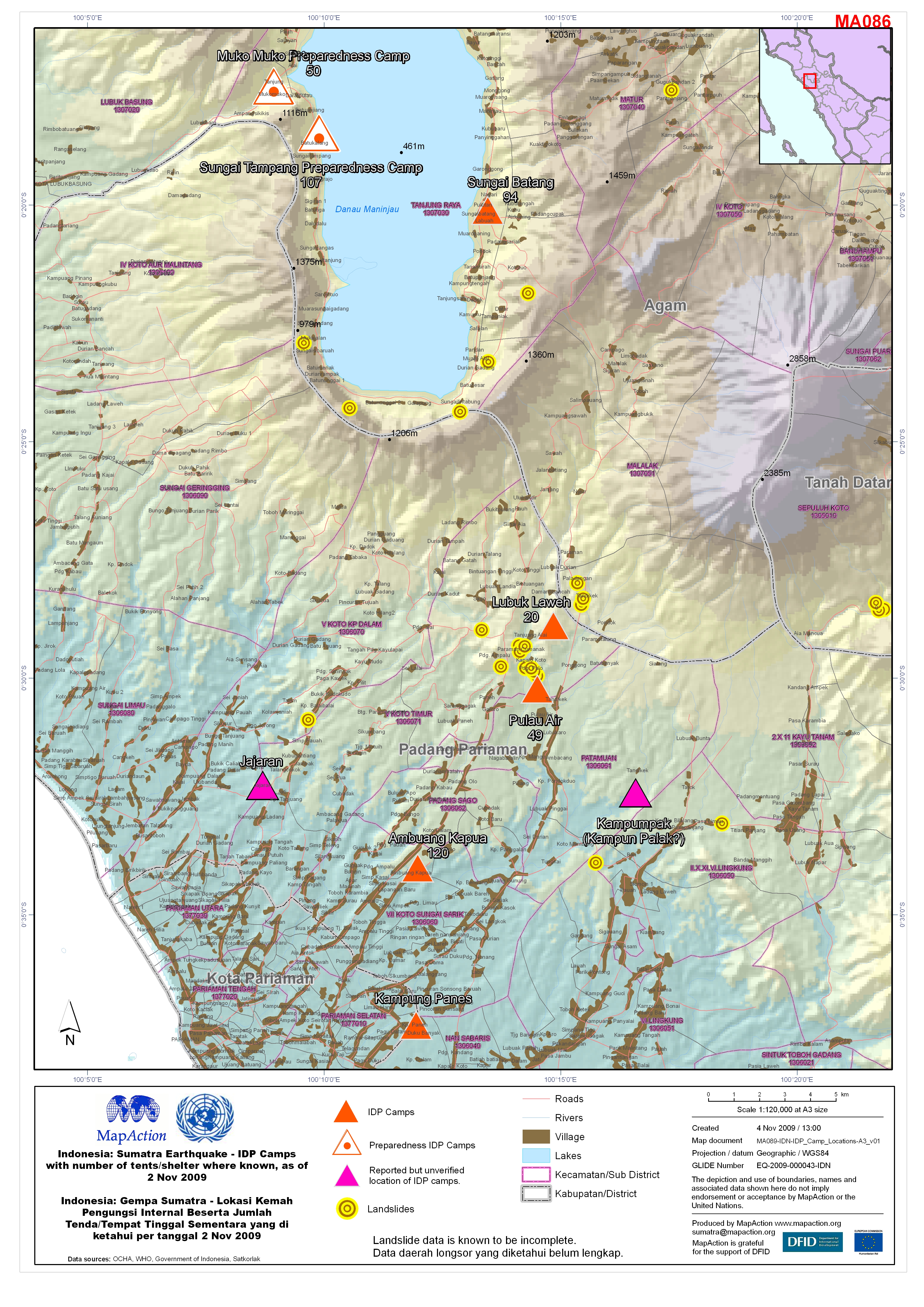
Indonesia: Sumatra Earthquake - IDP Camps with number of tents/shelter where ...
This dataset has no description
-

Indonesia: Sumatra Earthquake - Shelter Cluster - 2W Nagari Map as at 3 Nov 2...
i.This map shows where Shelter Cluster members are carrying out all emergency and transitional shelter activities in the affected districts of West Sumatra at nagari level.... -
Indonesia: Sumatra Earthquake - Health Cluster Who-What-Where (3W) as at 28-O...
Peta menunjukkan data kemanusiaan di Cluster Kesehatan untuk Provinsi Sumatra Barat. Data tersedia bagi Cluster Kesehatan di Padang pada tanggal 28 Oktober 2009. Harap... -
Indonesia: Sumatra Earthquake - Shelter Cluster - Emergency Shelter Distribut...
(1)The charts show the proportion of households (HHs) that are receiving emergency shelter versus the numbers of (severe and moderate) earthquake-damaged houses, at sub-district... -

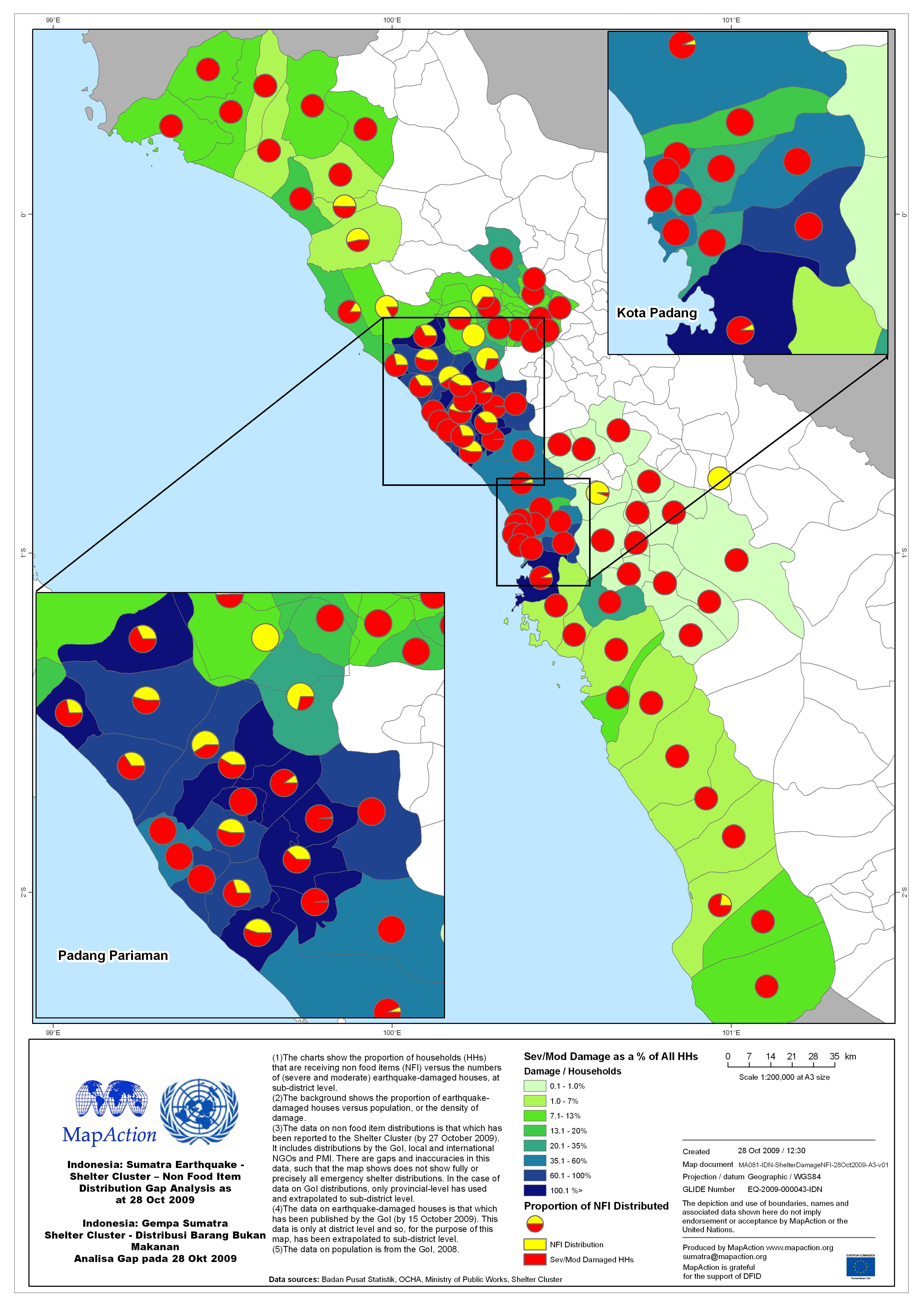
Indonesia: Sumatra Earthquake - Shelter Cluster - Non Food Item Distribution ...
(1)The charts show the proportion of households (HHs) that are receiving non food items (NFI) versus the numbers of (severe and moderate) earthquake-damaged houses, at... -
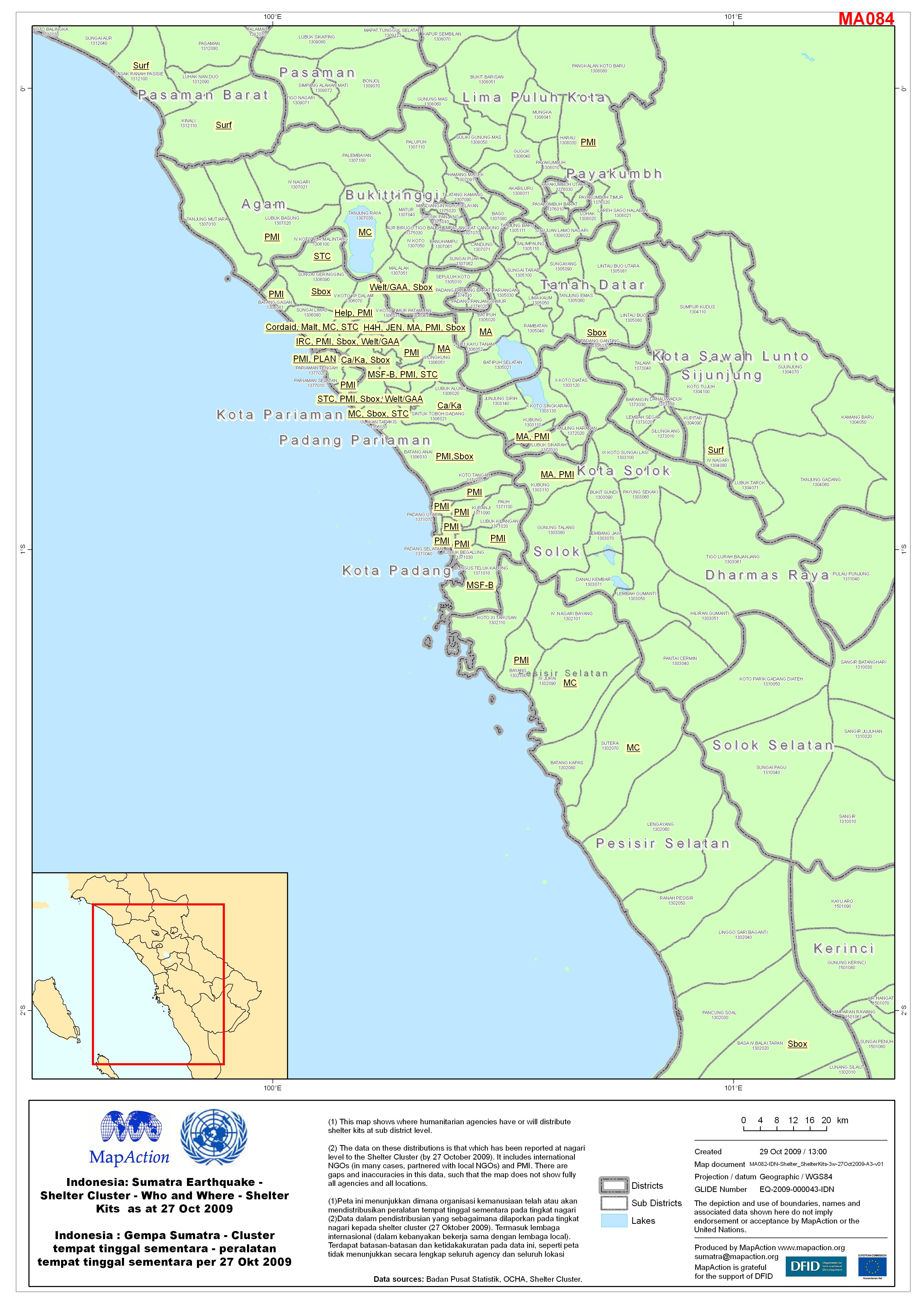
Indonesia: Sumatra Earthquake - Shelter Cluster - Who and Where - Shelter Kit...
(1) This map shows where humanitarian agencies have or will distribute shelter kits at sub district level. (2) The data on these distributions is that which has been reported at... -

Indonesia: Sumatra Earthquake - Education cluster - 3W map as at 25 Oct 2009 ...
This map shows the location (by sub-district) of organisations implementing education activities. It is based only on information reported to the Education Cluster coordination... -
Indonesia: Sumatra Earthquake 21 October 2009 Data tingkat kerusakan rumah ak...
Peta menggambarkan persebaran kerusakan rumah yang dibagi berdasarkan tiga kriteria tingkat kerusakan yaitu, rusak berat, rusak sedang dan rusak ringan per kelurahan di Kota...