-

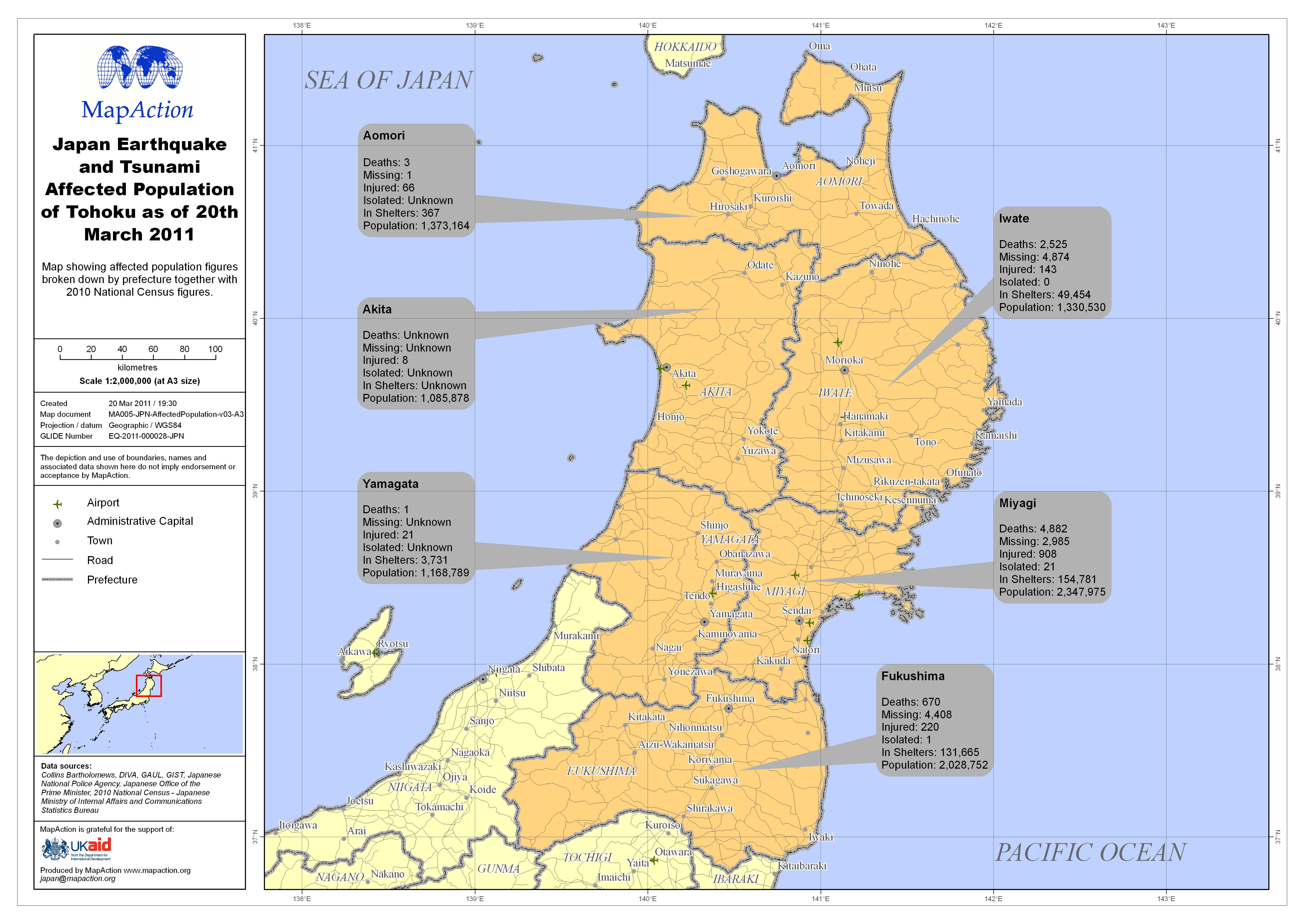
Japan Earthquake and Tsunami Affected Population of Tohoku as of 20th March 2011
Map showing affected population figures broken down by prefecture together with 2010 National Census figures. -

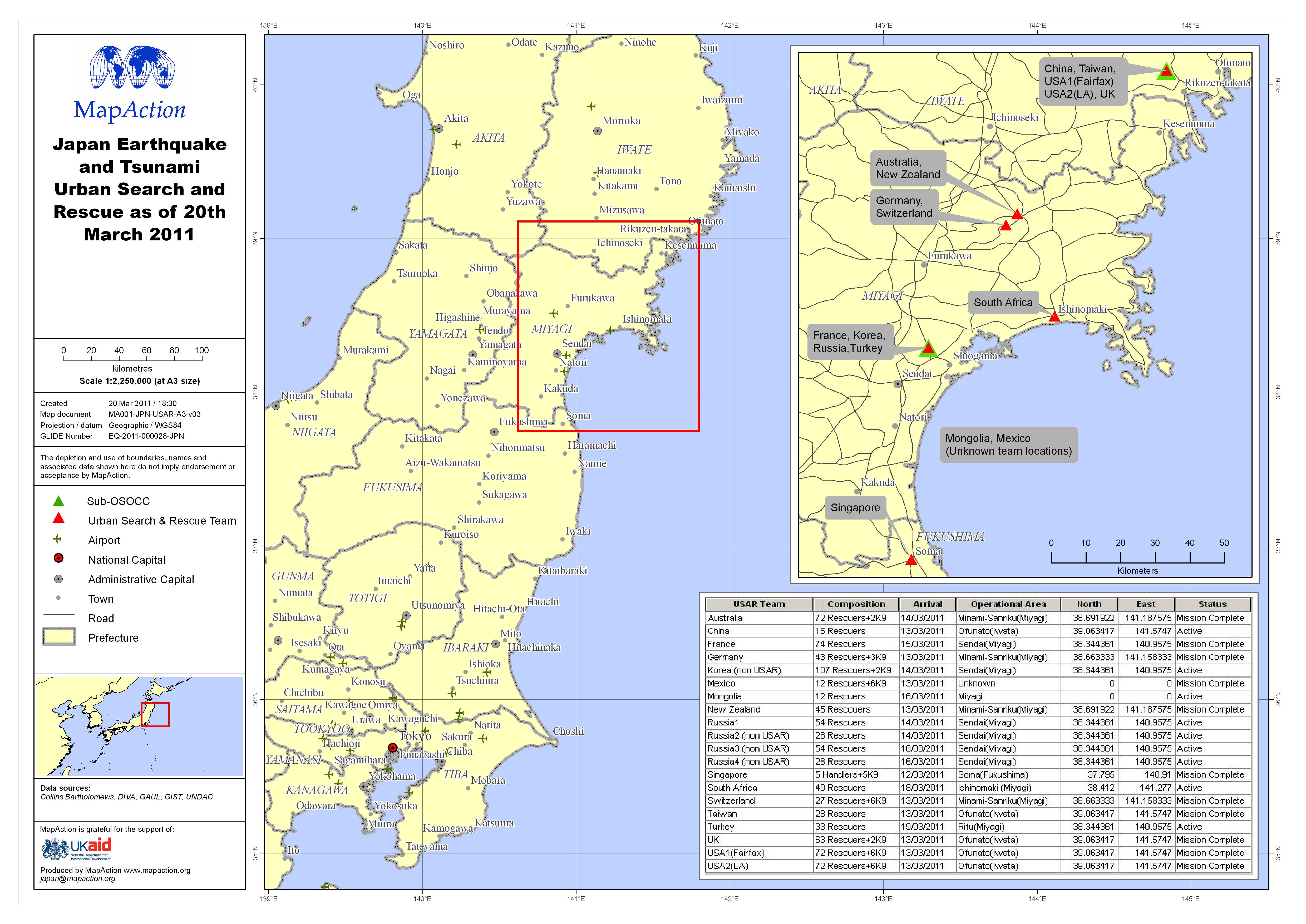
Japan Earthquake and Tsunami Urban Search and Rescue as of 20th March 2011
This dataset has no description
-

Japan Earthquake and Tsunami Coordination Hubs
Map showing Japanese government coordination hubs. -

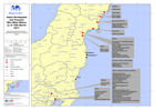
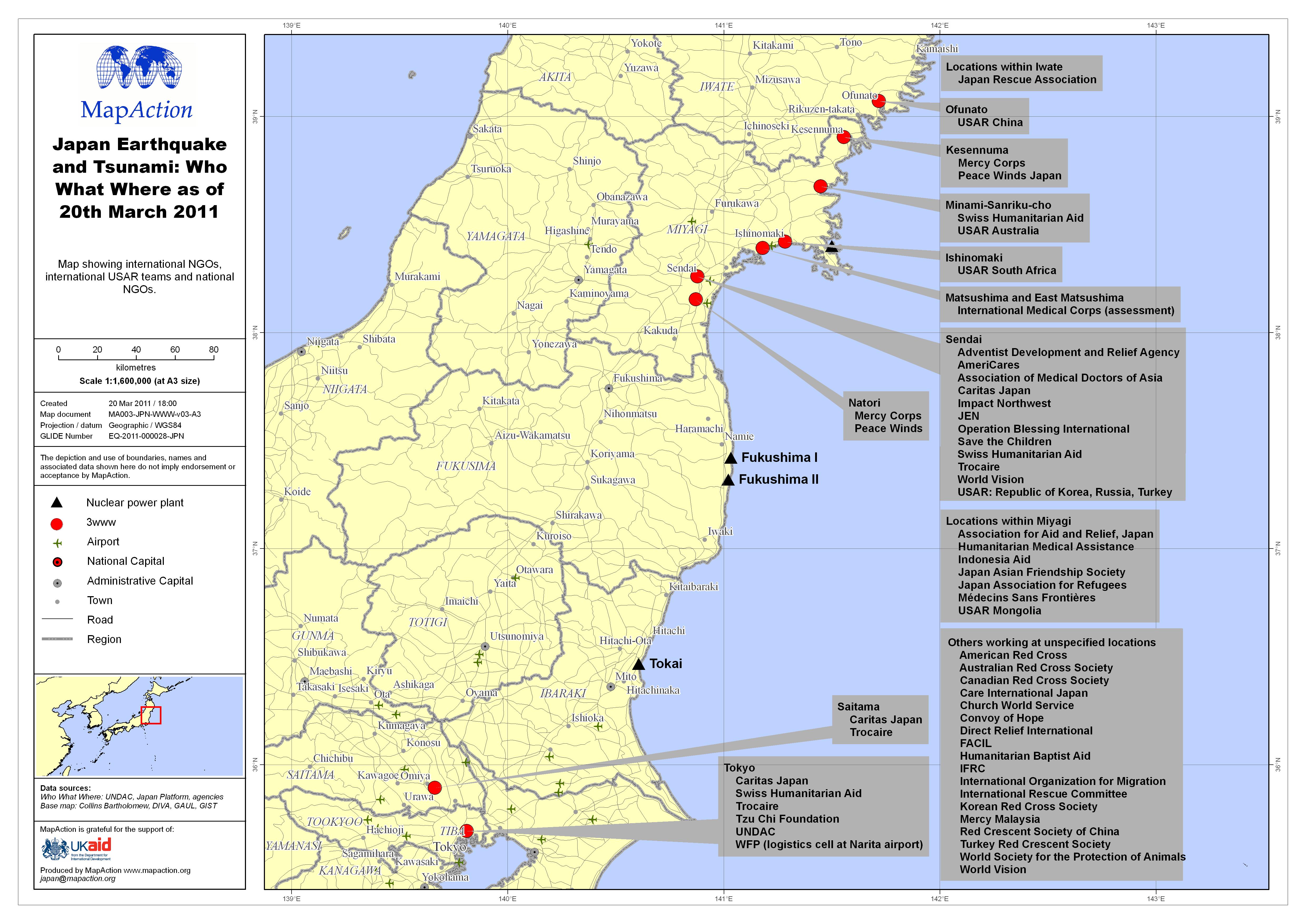
Japan Earthquake and Tsunami: Who What Where as of 20th March 2011
Map showing international NGOs, international USAR teams and national NGOs. -

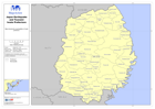
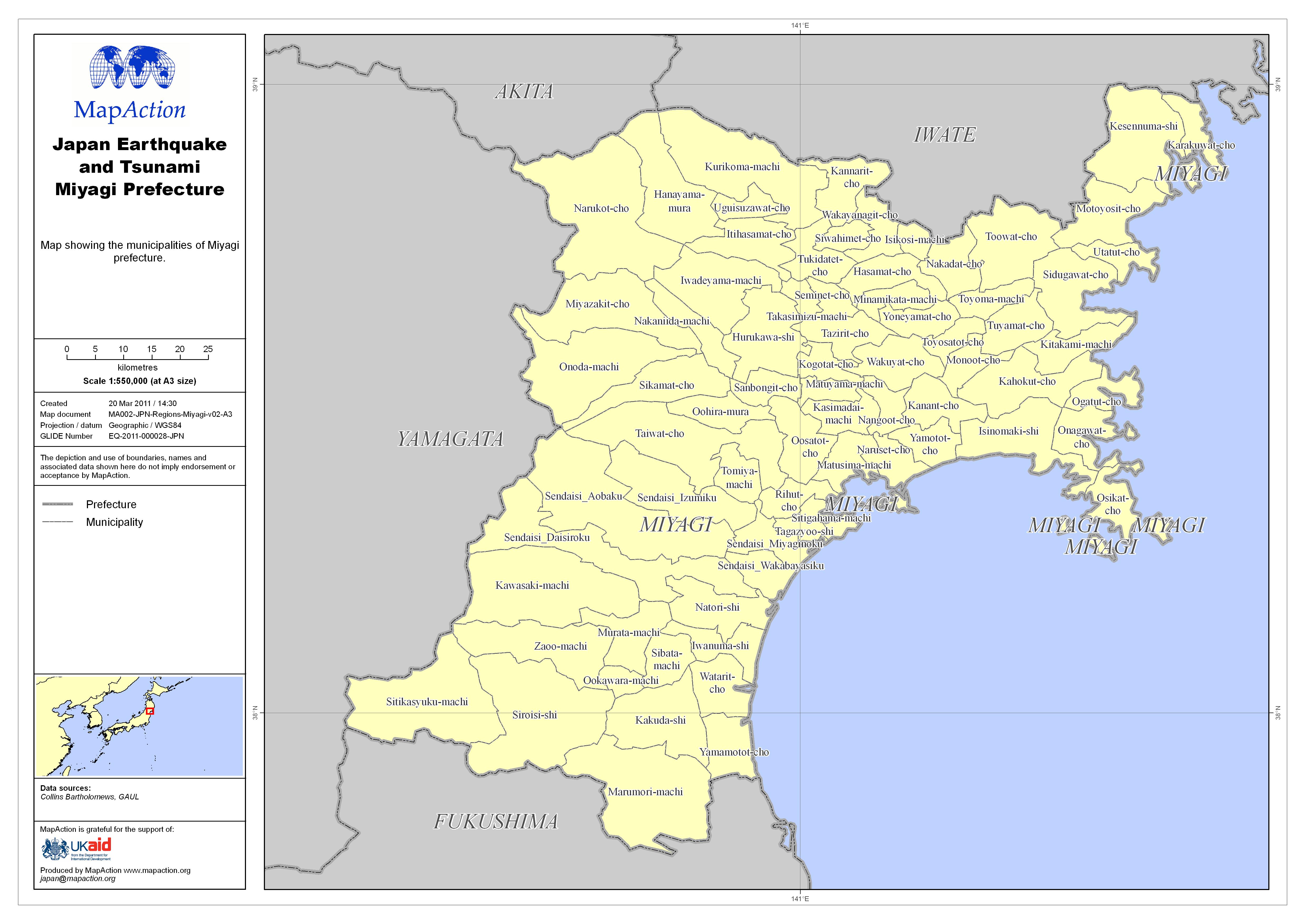
Japan Earthquake and Tsunami Miyagi Prefecture
Map showing the municipalities of Miyagi prefecture. -
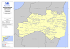
Japan Earthquake and Tsunami Iwate Prefecture
Map showing the municipalities of Iwate prefecture. -
Japan Earthquake and Tsunami Fukushima Prefecture
Map showing the municipalities of Fukushima prefecture. -
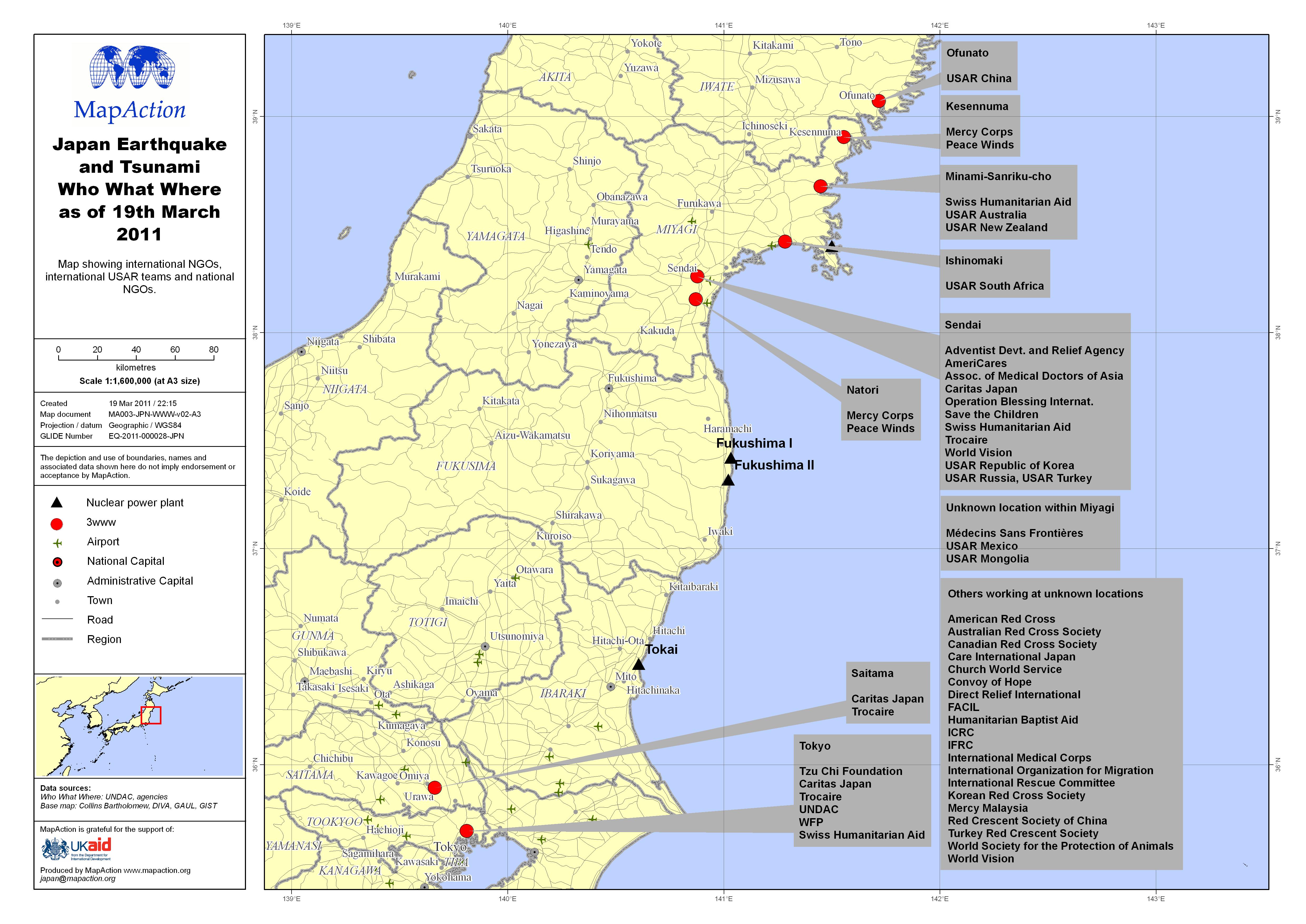
Japan Earthquake and Tsunami Who What Where as of 19th March 2011
Map showing international NGOs, international USAR teams and national NGOs. -

Japan Earthquake and Tsunami Urban Search and Rescue as of 19th March 2011
This dataset has no description
-

Japan Earthquake and Tsunami Affected Population of Tohoku as of 18th March 2011
Map showing affected population figures broken down by region together with 2010 National Census figures. -

Japan Earthquake and Tsunami Miyagi Region
Shows base of operations for Australia Germany, New Zealand, Russia, Switzerland, UK, USA (2 teams), with two sub-OSOCC locations. -
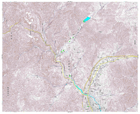
Japan Earthquake: 1:25,000 Topographic Sheet 584155 Sakari
Detailed topographic mapping, scale 1:25,000. Each sheet covers approximately 11 x 9 km. For use only in disaster relief activities, by kind permission of Geospatial Information... -
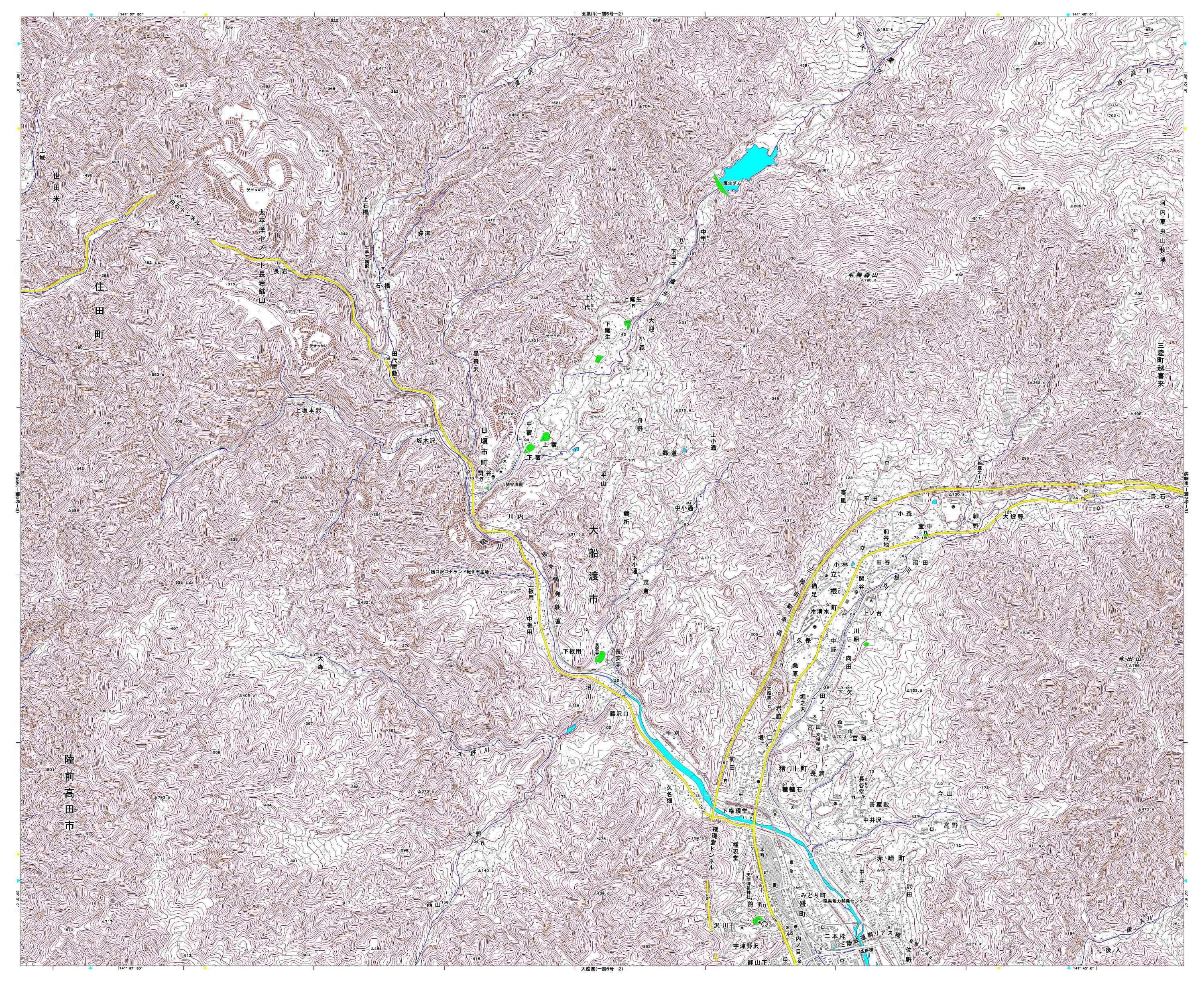
Japan Earthquake: 1:25,000 Topographic Sheet 584145 Ohfunato
Detailed topographic mapping, scale 1:25,000. Each sheet covers approximately 11 x 9 km. For use only in disaster relief activities, by kind permission of Geospatial Information... -

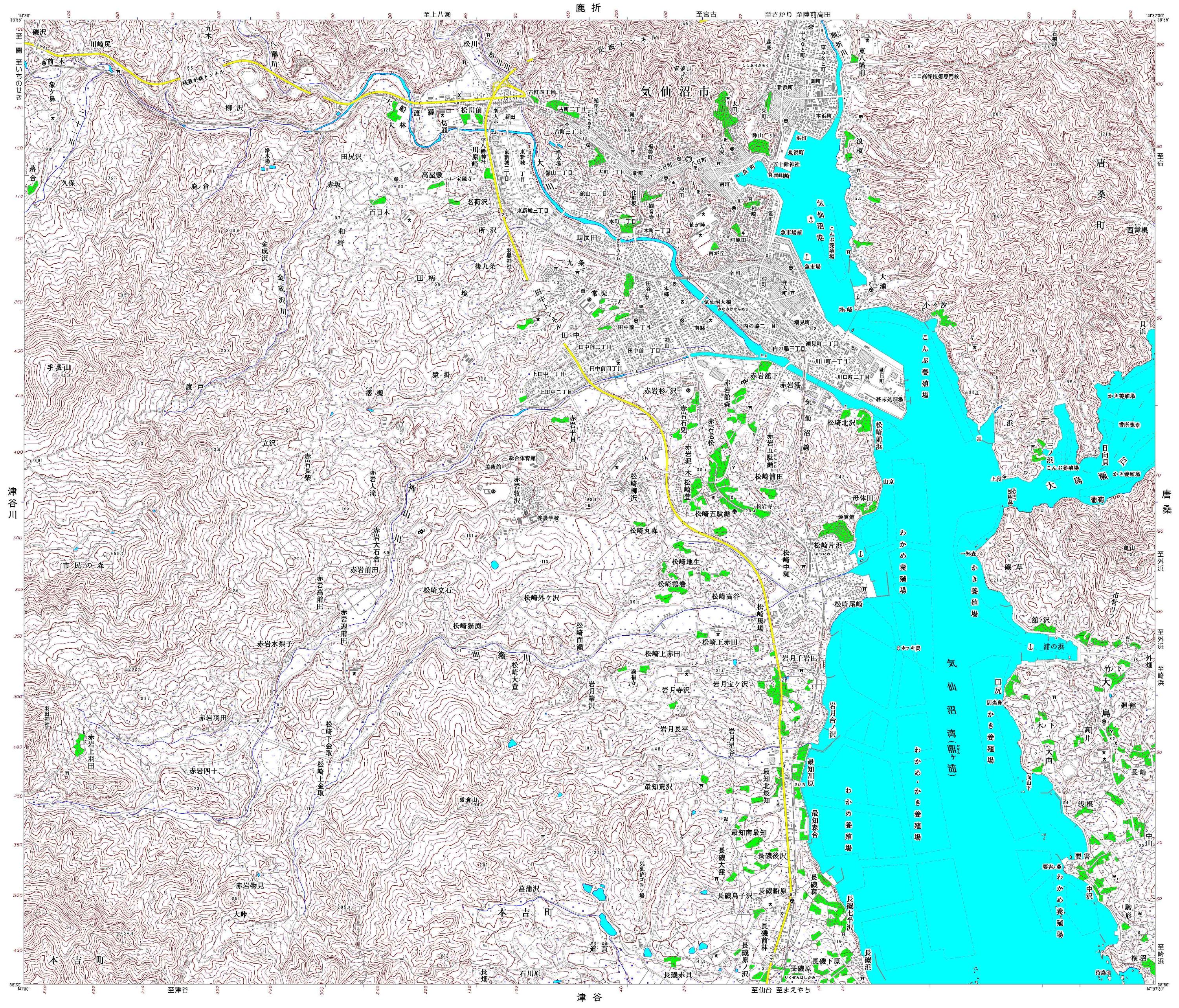
Japan Earthquake: 1:25,000 Topographic Sheet 584124 Kesennuma
Detailed topographic mapping, scale 1:25,000. Each sheet covers approximately 11 x 9 km. For use only in disaster relief activities, by kind permission of Geospatial Information... -

Japan Earthquake: 1:25,000 Topographic Sheet 584103 Minamisannriku
Detailed topographic mapping, scale 1:25,000. Each sheet covers approximately 11 x 9 km. For use only in disaster relief activities, by kind permission of Geospatial Information... -

Japan Earthquake: 1:25,000 Topographic Sheet 574171 Nishino
Detailed topographic mapping, scale 1:25,000. Each sheet covers approximately 11 x 9 km. For use only in disaster relief activities, by kind permission of Geospatial Information... -

Japan Earthquake: 1:25,000 Topographic Sheet 574170 Takashimizu
Detailed topographic mapping, scale 1:25,000. Each sheet covers approximately 11 x 9 km. For use only in disaster relief activities, by kind permission of Geospatial Information... -

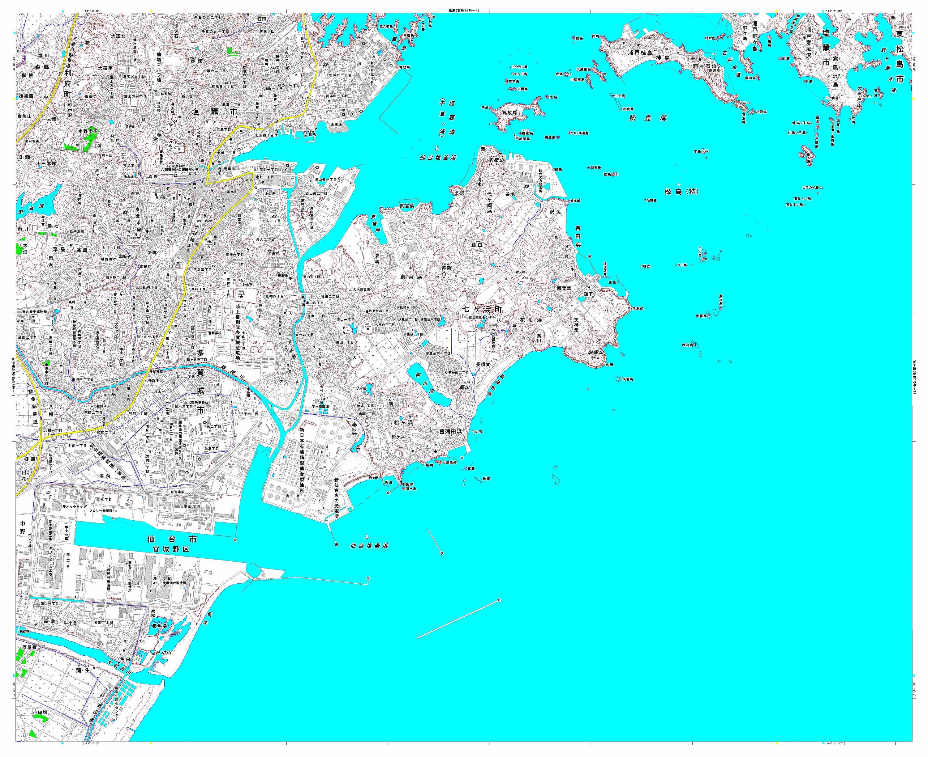
Japan Earthquake: 1:25,000 Topographic Sheet 574140 Matsushima
Detailed topographic mapping, scale 1:25,000. Each sheet covers approximately 11 x 9 km. For use only in disaster relief activities, by kind permission of Geospatial Information... -

Japan Earthquake: 1:25,000 Topographic Sheet 574130 Shiogama
Detailed topographic mapping, scale 1:25,000. Each sheet covers approximately 11 x 9 km. For use only in disaster relief activities, by kind permission of Geospatial Information... -

Japan Earthquake: 1:25,000 Topographic Sheet 574047 Tomiya
Detailed topographic mapping, scale 1:25,000. Each sheet covers approximately 11 x 9 km. For use only in disaster relief activities, by kind permission of Geospatial Information...