-

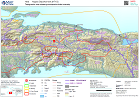
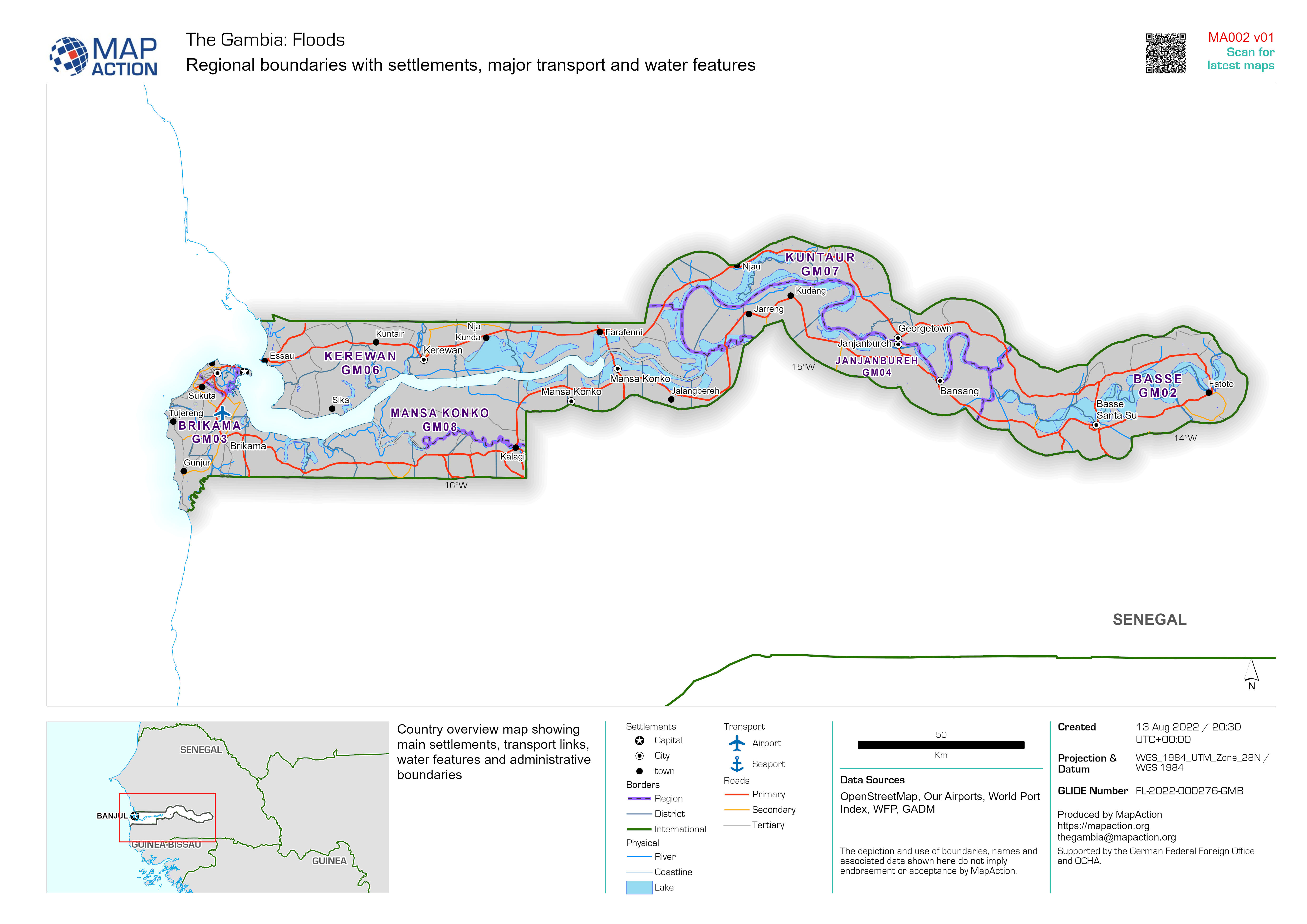
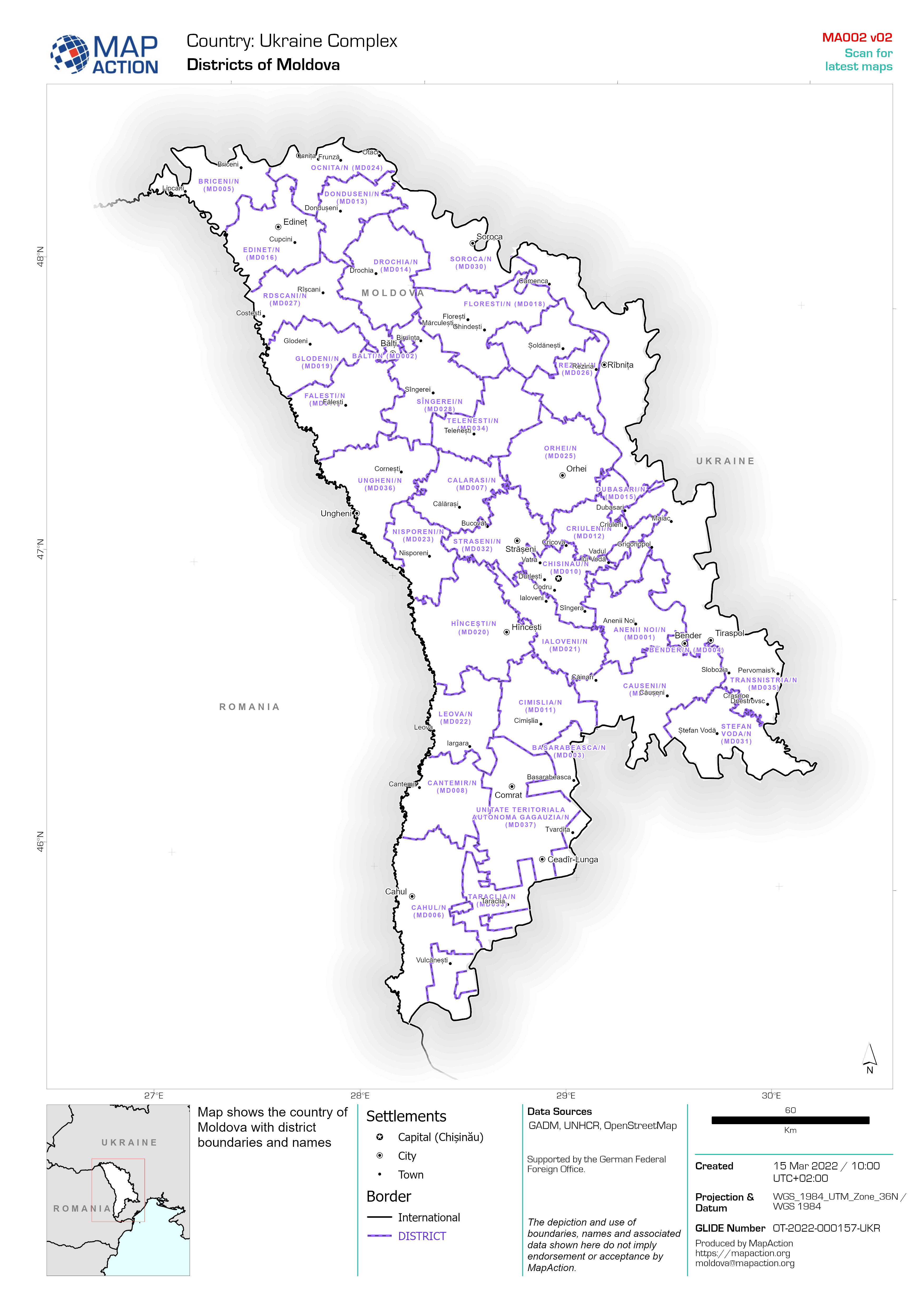
Regional boundaries with settlements, major transport and water features
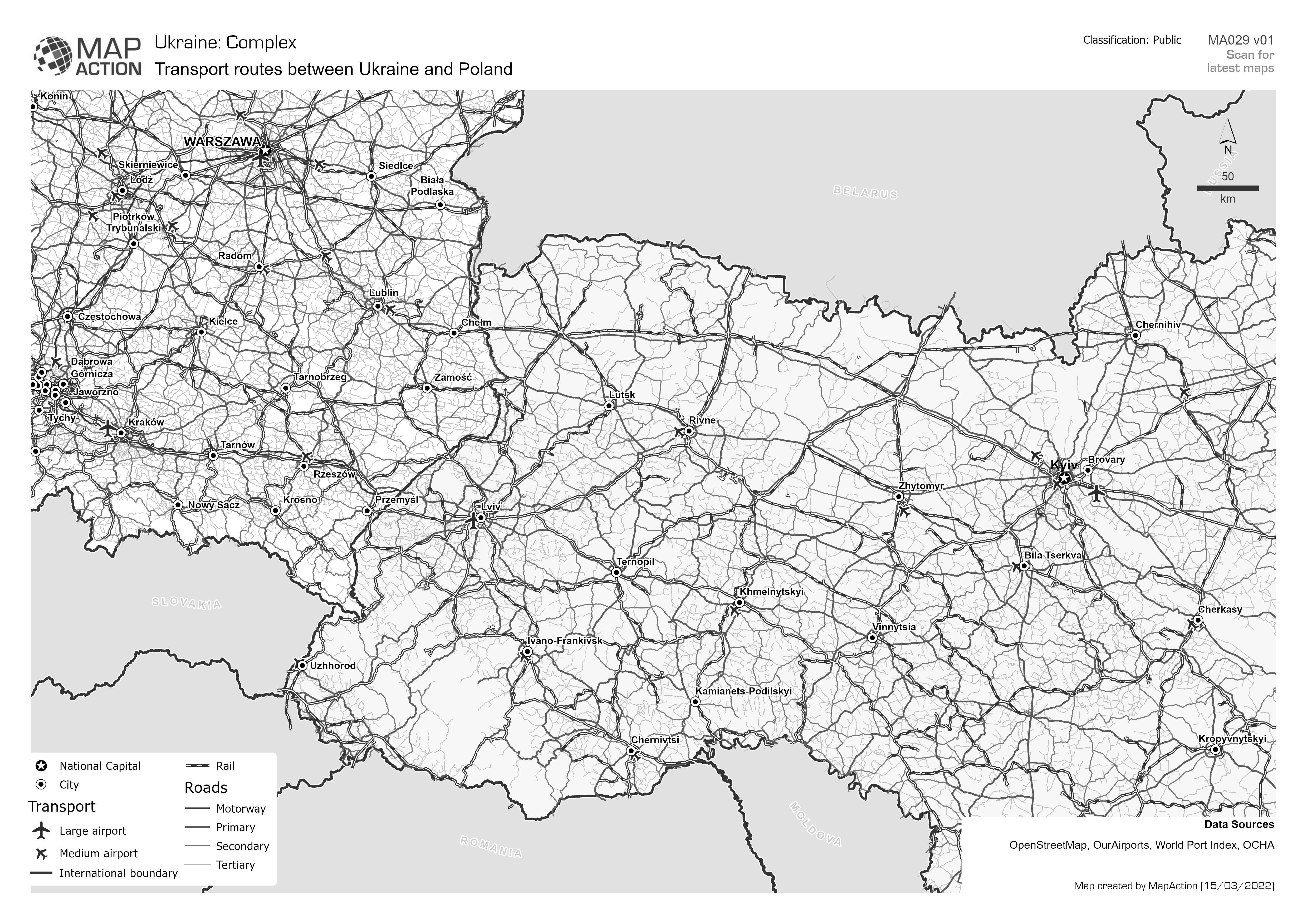
Country overview map showing main settlements, transport links, water features and administrative boundaries -

-

-
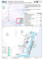
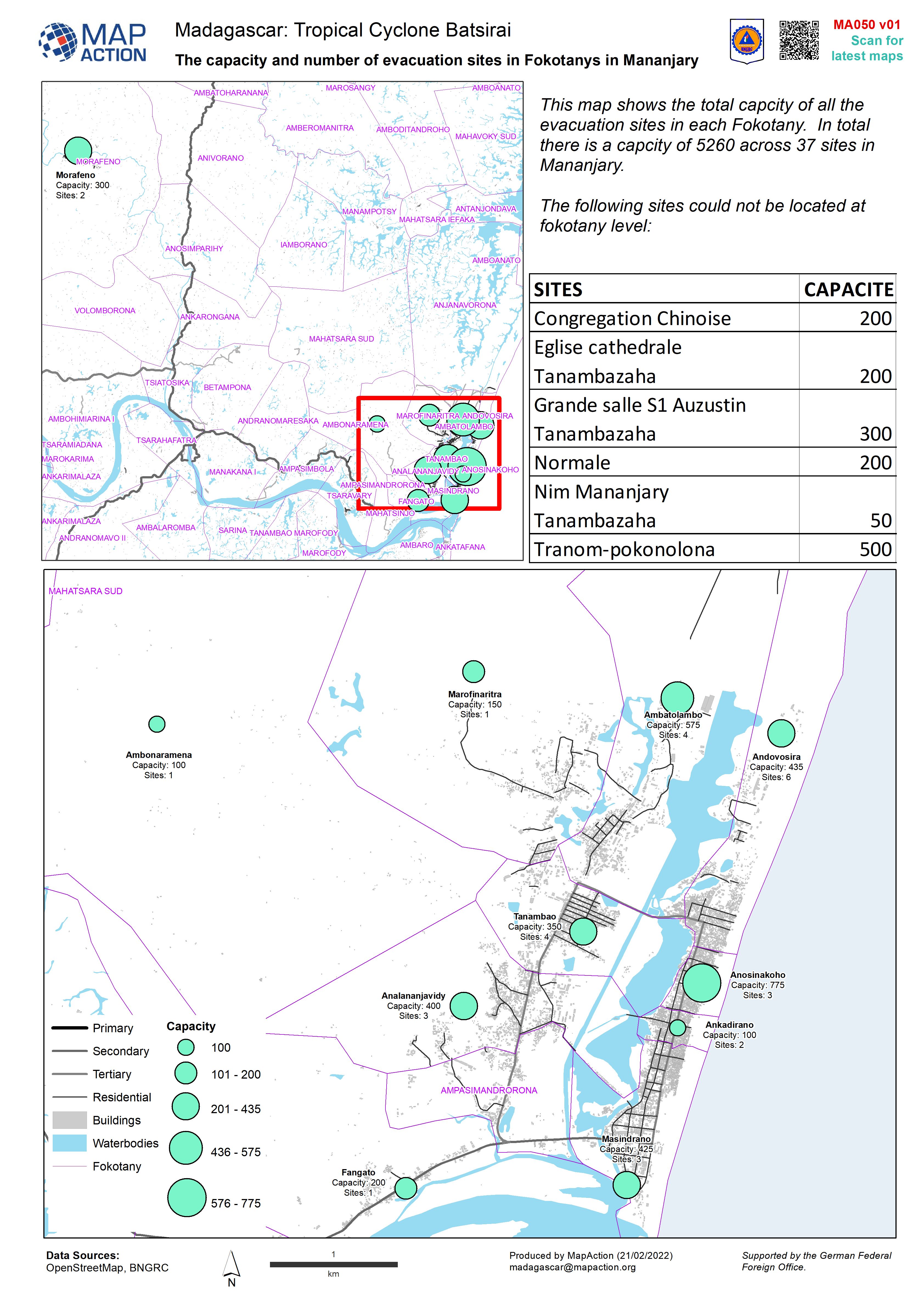
The capacity and number of evacuation sites in Fokotanys in Mananjary
This dataset has no description
-
Topographic map showing earthquake shake intensity
Topographic maps of southern Haiti, with earthquake shake intensity contours -
Afghanistan: People affected by flood events from 26 January to 28 July 2021
This dataset has no description
-

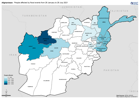
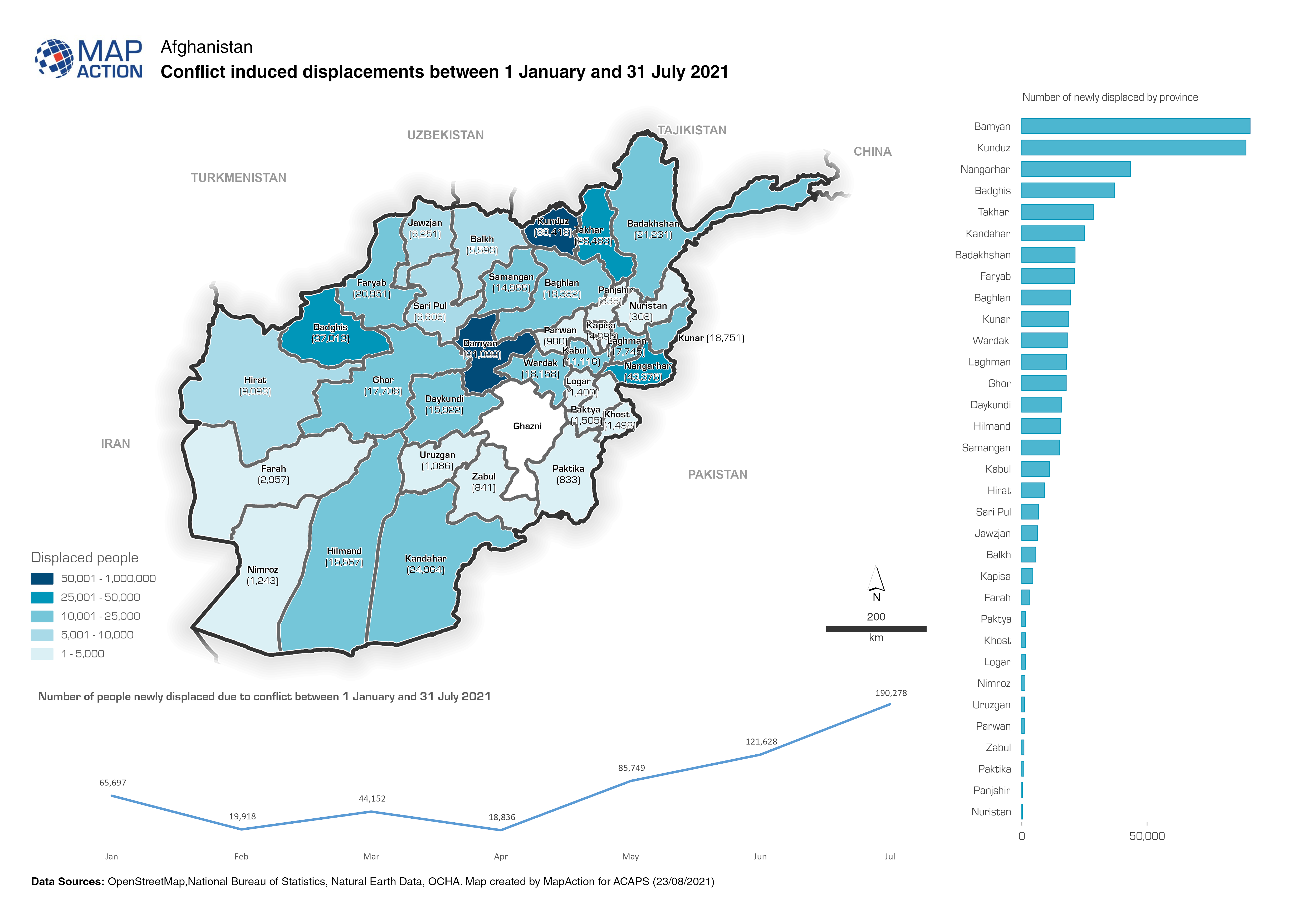
Afghanistan: Conflict induced displacements between 1 January and 31 July 2021
Map shows the number of people newly displaced due to conflict between 1 January and 31 July 2021 -

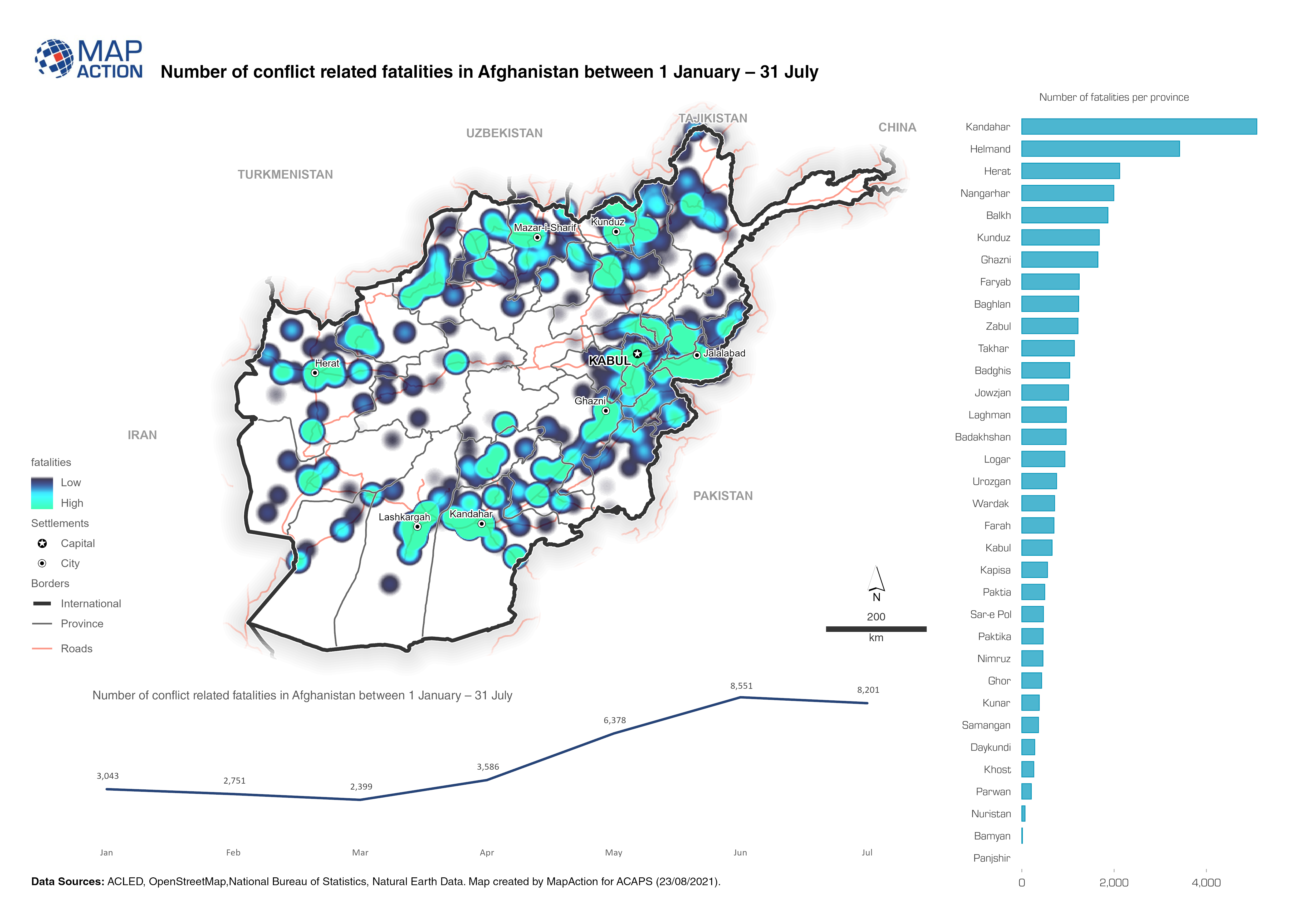
Afghanistan: Number of fatalities per event type (1 January to 31 July 2021)
The map provides an overview of different security related incidents and fatalities. -

Baseline Population Demographics of Most Affected Communes
Baseline population data (Worldpop 2020) presented in gender specific age demographic charts (in order of total population) for seven of the most affected communes based on... -
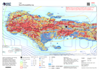
Hazard Susceptibility map
Hazard susceptibility map, showing flood zones and landslide susceptibility mapping, together with earthquake shake intensity information and rainfall isohyets from the last 7... -
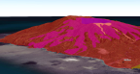
La Soufrière volcano 3D overview
Web map shows the key volcanic events and hazards the La Soufrière volcano -

Fiji: Reference map atlas
Atlas series of maps showing borders, settlements, physical and transport features for each Division. -
Fiji: Admininistration boundaries atlas
Atlas shows the Division (Admin level 1), Province (Admin level 2) and Districts (Admin level 3) boundaries with their associated pcode. -
Guatemala: Resumen de inundaciones en lugares poblados (al 28/11/2020)
Flood extent between 1st and 26th November at department level (map series) / Areas inundados entre el 1 y el 26 de noviembre a nivel de departamento (serie de mapas) -
Guatemala: Viviendas en riesgo y número de viviendas con daños por Municipio ...
Homes at risk and number of damaged homes by Municipality in Alta Verapaz (as of Nov 27, 2020) -
Guatemala: Evaluaciones (CONRED) en el departamento de Izabal (al 02/12/2020)
Map shows the number of reported assessments carried out by CONRED per Municipality in Izabal, Guatemala. -
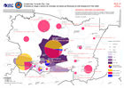
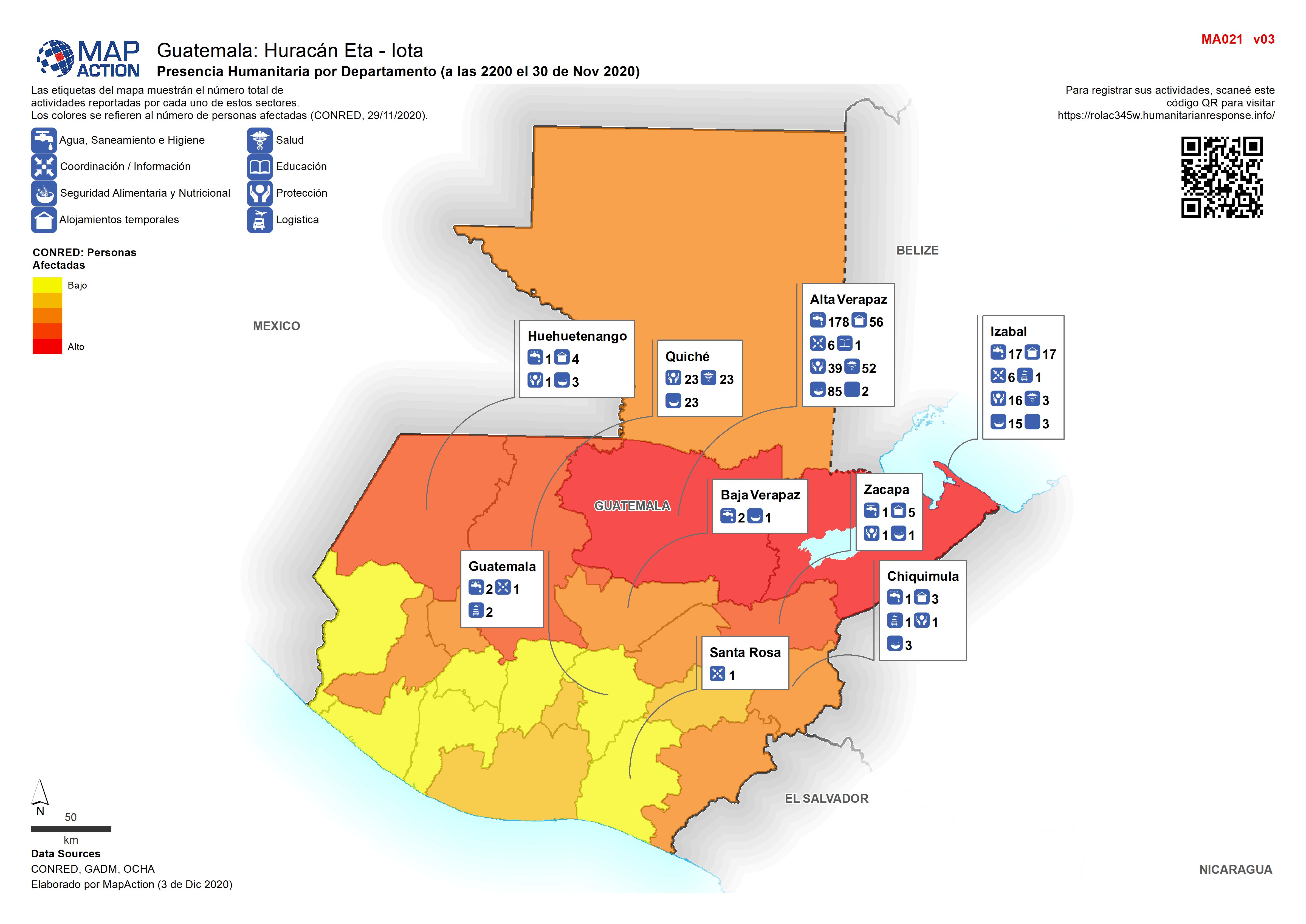
Guatemala: Presencia Humanitaria por Departamento (a las 2200 el 30 de Nov 2020)
Map shows the number of reported activities per Sector per Department in Honduras. Affected population by department is also shown. -

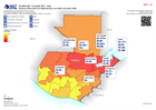
Guatemala: Personas afectadas y personas en riesgo por departamento (al 26 No...
Map shows the number of reported activities per Sector per Department in Honduras. Critical and High priority response areas are also shown.