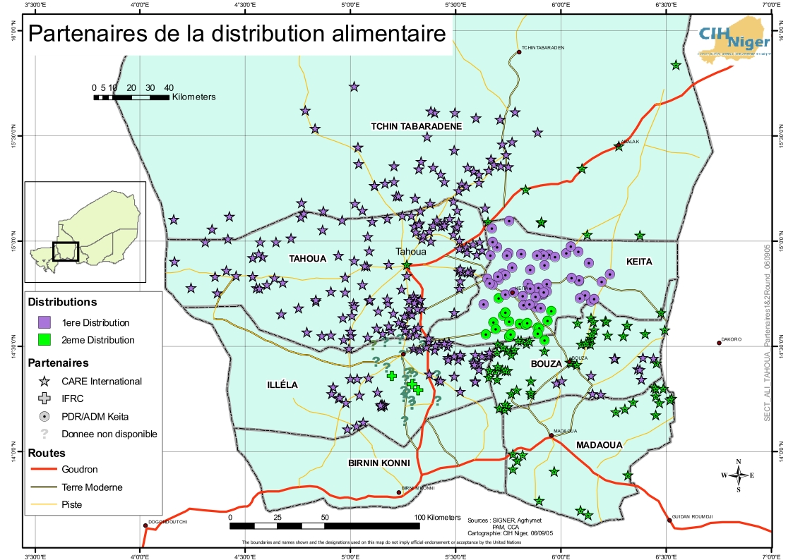
Skip to content
  • Log in
  • Register

Latest maps and data

  • Floods:Libya
MapAction
  • Home
  • About us
    • Impact
    • Strategy
    • Services
    • Values
    • Where we work
    • History
    • Governance
    • Annual reports
  • Partners
    • Operational partners
    • Funders
    • Supporters
    • Team
  • News
    • Advocacy
    • Blog
    • LIVE Blogs
  • Maps and data
    • All maps and data
    • Example product catalogue
    • Other resources
  • Get Involved
    • Fundraise
    • Corporate partnerships
    • Payroll giving
    • Trusts and foundations
    • Leave a gift in your will
    • Donation FAQs
    • Volunteer
    • Join us
    • Contact us
  • Donate
  • Locations
  • Events
    You are here:
  1. Home
  2. Maps and Data Home
  3. Niger: Food security, August 2005
  • Datasets
  • About

4 datasets found

Filter Results
  • Tahoua Food Pipeline Agencies

    This dataset has no description

    • View
    • JPEG
  • Grocery Distributions and Agencies responsible.

    This dataset has no description

    • View
    • JPEG
  • Nutrition centres in Tahoua

    This dataset has no description

    • View
    • JPEG
  • Zinder Transportation

    This dataset has no description

    • GIF
2005-ner-001

Niger: Food security, August 2005

Two MapAction volunteers are deployed to establish a GIS/mapping cell during a food crisis aggravated by severe drought and locust invasion. read more

Followers
0
Datasets
4
Event RSS

MapAction

  • Home page
  • Help Centre
  • About us
  • Our impact
  • Get Involved
  • Volunteer
  • Donate
  • Donation FAQs
  • Contact us
  • Privacy and cookies
  • Stichting MapAction Netherlands
  • Feedback

Newsletter

Subscribe to our regular email updates

Subscribe

Your details will not be passed on and you can unsubscribe at any time.

Fundraising Regulator Registered charity 1126727; registered company limited by guarantee 6611408 (England and Wales)

Copyright © MapAction