-

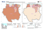
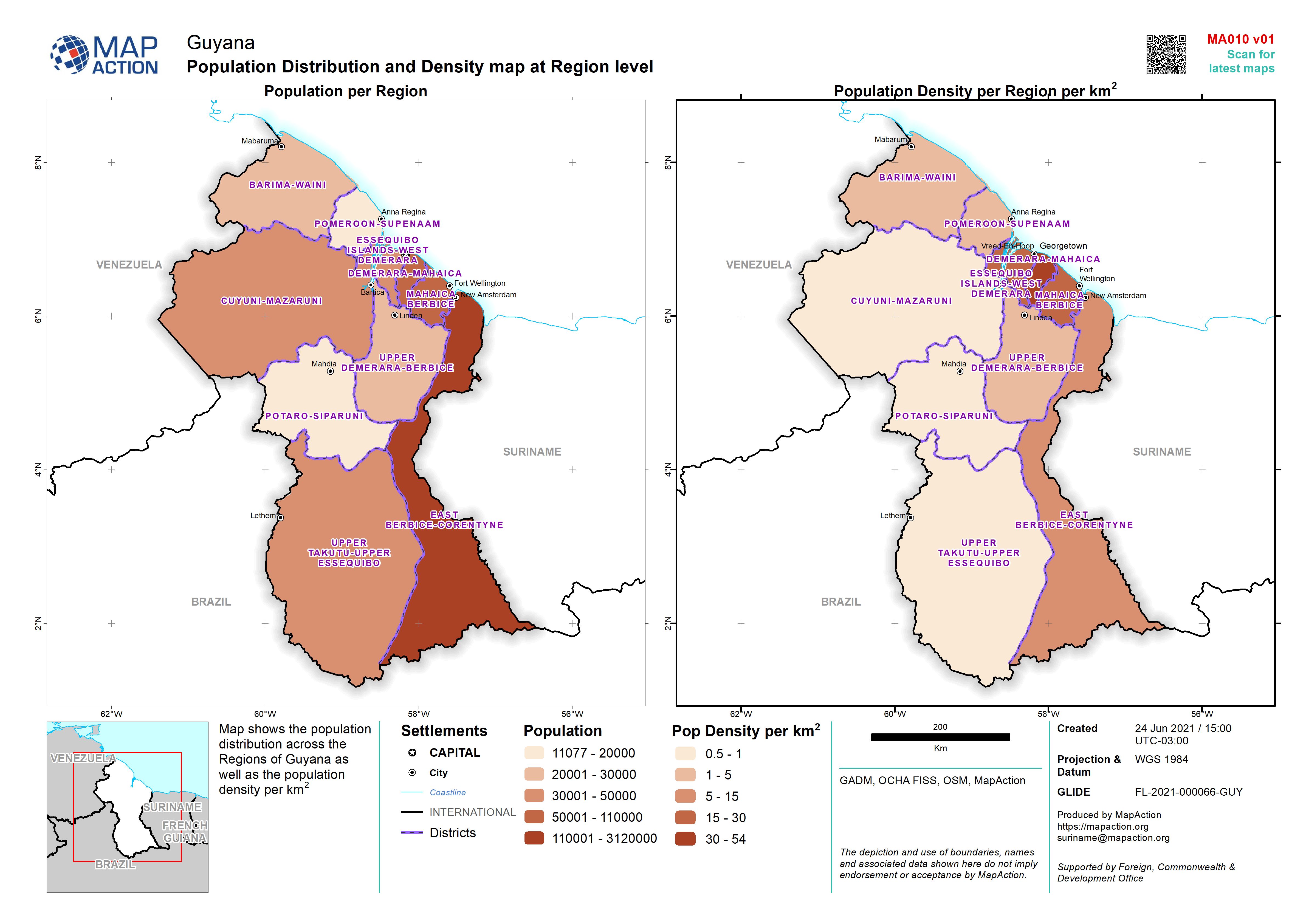
Population Distribution and Density map at Region level
Map shows the population distribution across the Regions of Guyana as well as the population density per km2 -
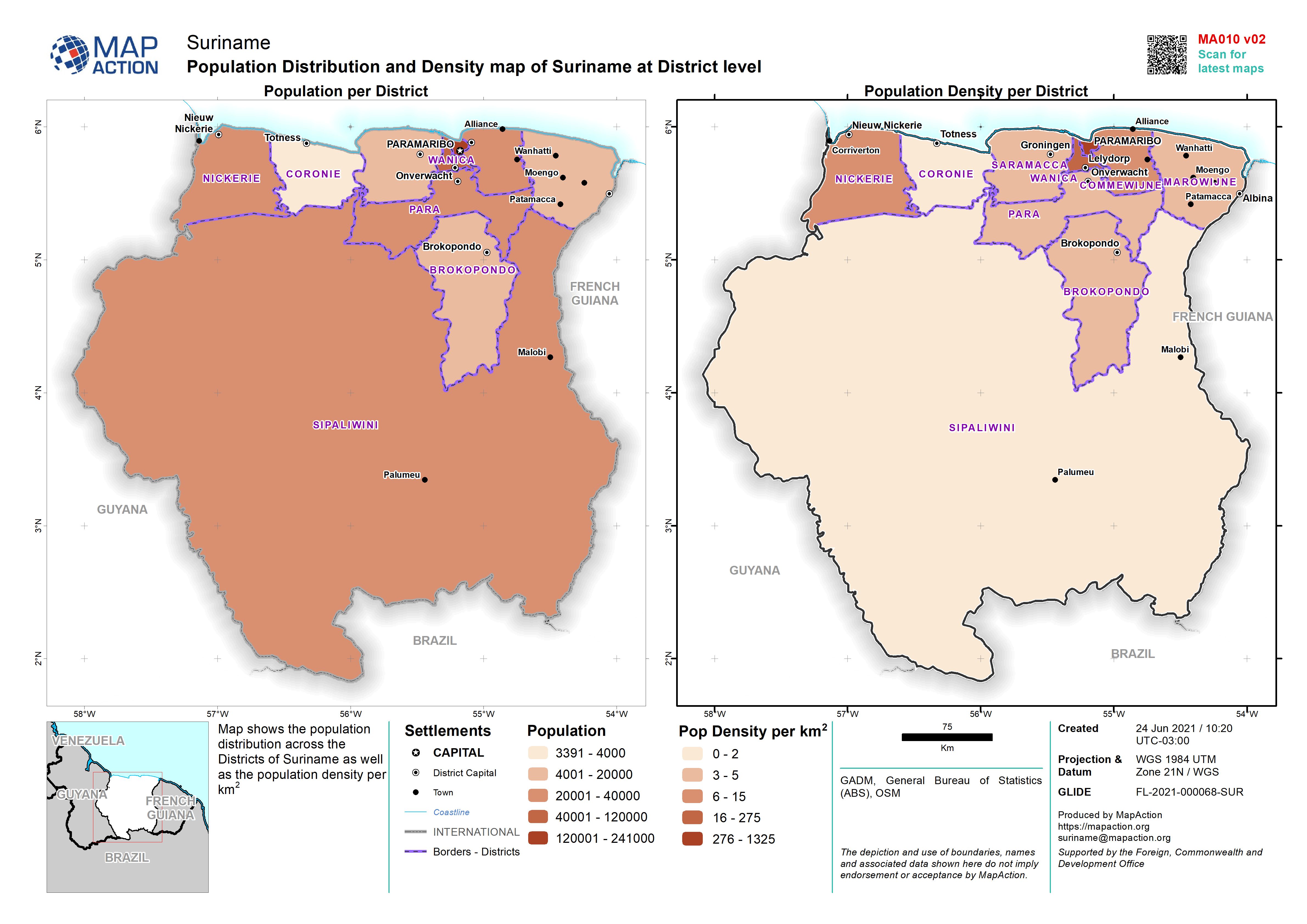
Population Distribution and Density map of Suriname at District level
Map shows the population distribution across the Districts of Suriname as well as the population density per km2 -

Population Distribution and Density map of Suriname at District level
Map shows the population distribution across the Districts of Suriname as well as the population density per km2 -
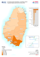
Population Baseline (derived from Census 2012)
Map shows population by census districts. This is on the basis of information obtained from the 2012 Population and Housing Censuses. -

Presencia humanitaria: quién hace qué, dónde en cada municipio. Departmento: ...
Mapbook shows who is delivering Sector activities, per Municipality in Honduras. Population density, number of shelters and occupants per Municipality -

Presencia humanitaria: quién hace qué, dónde en cada municipio por department...
Mapbook shows the number of reported activities per Sector, and who is delivering them, per Municipality in Honduras. Critical and High priority response areas are also shown,... -
Presencia humanitaria: quién hace qué, dónde en cada municipio por department...
Mapbook shows who is delivering Sector activities, per Municipality in Honduras. Population density, number of shelters and occupants per Municipality -

Presencia humanitaria: quién hace qué, dónde en cada municipio, por departmen...
Mapbook shows the number of reported activities per Sector, and who is delivering them, per Municipality in Honduras. Critical and High priority response areas are also shown,... -

Presencia humanitaria: quién hace qué, dónde en cada municipio por department...
Mapbook shows who is delivering Sector activities, per Municipality in Honduras. Population density, number of shelters and occupants per Municipality -

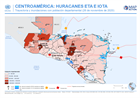
CENTROAMÉRICA: HURACANES ETA E IOTA - Honduras y Guatemala: personas afectada...
This map shows the storm tracks and flood extents for hurricane Eta and Iota. Across Honduras and in the two most highly affected departments in Guatemala the map shows affected... -

Presencia humanitaria: quién hace qué, dónde en cada municipio, departmento (...
Mapbook shows the number of reported activities per Sector, and who is delivering them, per Municipality in Honduras. Critical and High priority response areas are also shown,... -
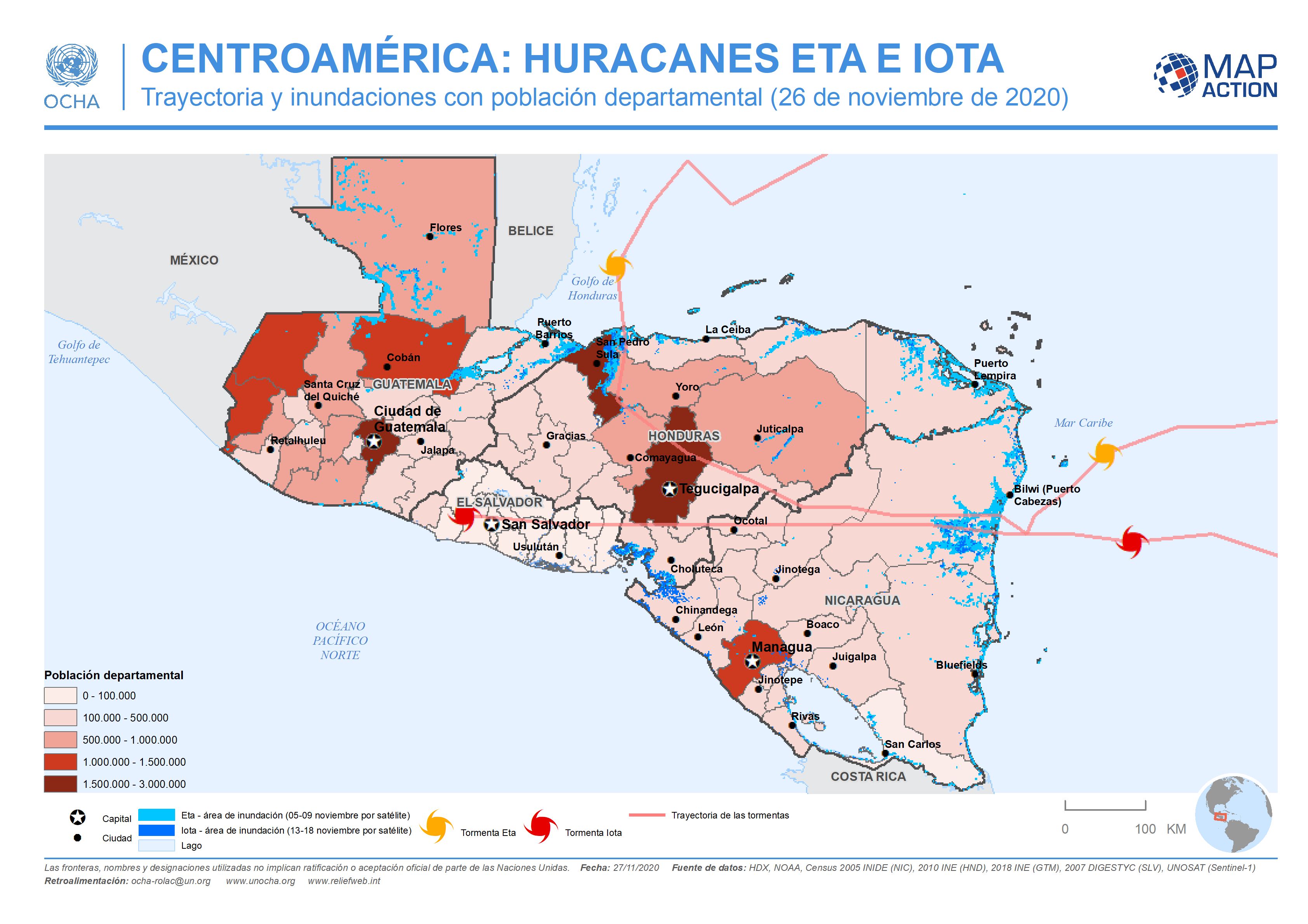
CENTROAMÉRICA: HURACANES ETA E IOTA - Trayectoria y inundaciones con població...
This map shows the storm tracks and flood extents for hurricane Eta and Iota, with baseline administrative 1 level departmental population figures across the affected region... -

CENTROAMÉRICA: HURACÁN IOTA - Trayectoria potencial y poblaciones departament...
This map shows the potentially affected administration level 1 departments, with departmental population for Nicaragua and Honduras, and the predicted hurricane path cone. -
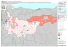
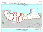
HONDURAS: Presencia humanitaria: quién hace qué, dónde en cada municipio (a l...
Esta serie de mapas muestra quién está realizando actividades por sector y municipio en Honduras. La densidad de población, el número de albergues y su ocupación por municipio... -
Presencia humanitaria: quién hace qué, dónde en cada municipio, departmento (...
Esta serie de mapas muestra quién está realizando actividades por sector y municipio en Honduras. La densidad de población, el número de albergues y su ocupación por municipio... -
Presencia humanitaria: quién hace qué, dónde en cada municipio, departmento (...
Mapbook shows the number of reported activities per Sector, and who is delivering them, per Municipality in Honduras. Critical and High priority response areas are also shown,... -
Presencia humanitaria: quién hace qué, dónde en cada municipio, departmento: ...
Mapbook shows the number of reported activities per Sector, and who is delivering them, per Municipality in Honduras. Critical and High priority response areas are also shown,... -
Presencia humanitaria: quién hace qué, dónde en cada municipio, departmento: ...
Mapbook shows who is delivering Sector activities, per Municipality in Honduras. Population density, number of shelters and occupants per Municipality -

Honduras: Presencia humanitaria: quién hace qué, dónde en cada municipio, dep...
Mapbook shows who is delivering Sector activities, per Municipality in Honduras. Critical and High priority response areas with population density, number of shelters and... -
Honduras: Presencia humanitaria: quién hace qué, dónde en cada municipio, dep...
Mapbook shows the number of reported activities per Sector, and who is delivering them, per Municipality in Honduras. Critical and High priority response areas and satellite...