-

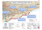
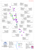
Yemen: Cyclone Chapala -NFI Transportation(as of 16 Nov 2015)
Map shows Non-Food Item (NFI) transportation to Shabwah and Al Mukalla by the Logistic Cluster. Data from OCHA Flash Report (16 Nov) -
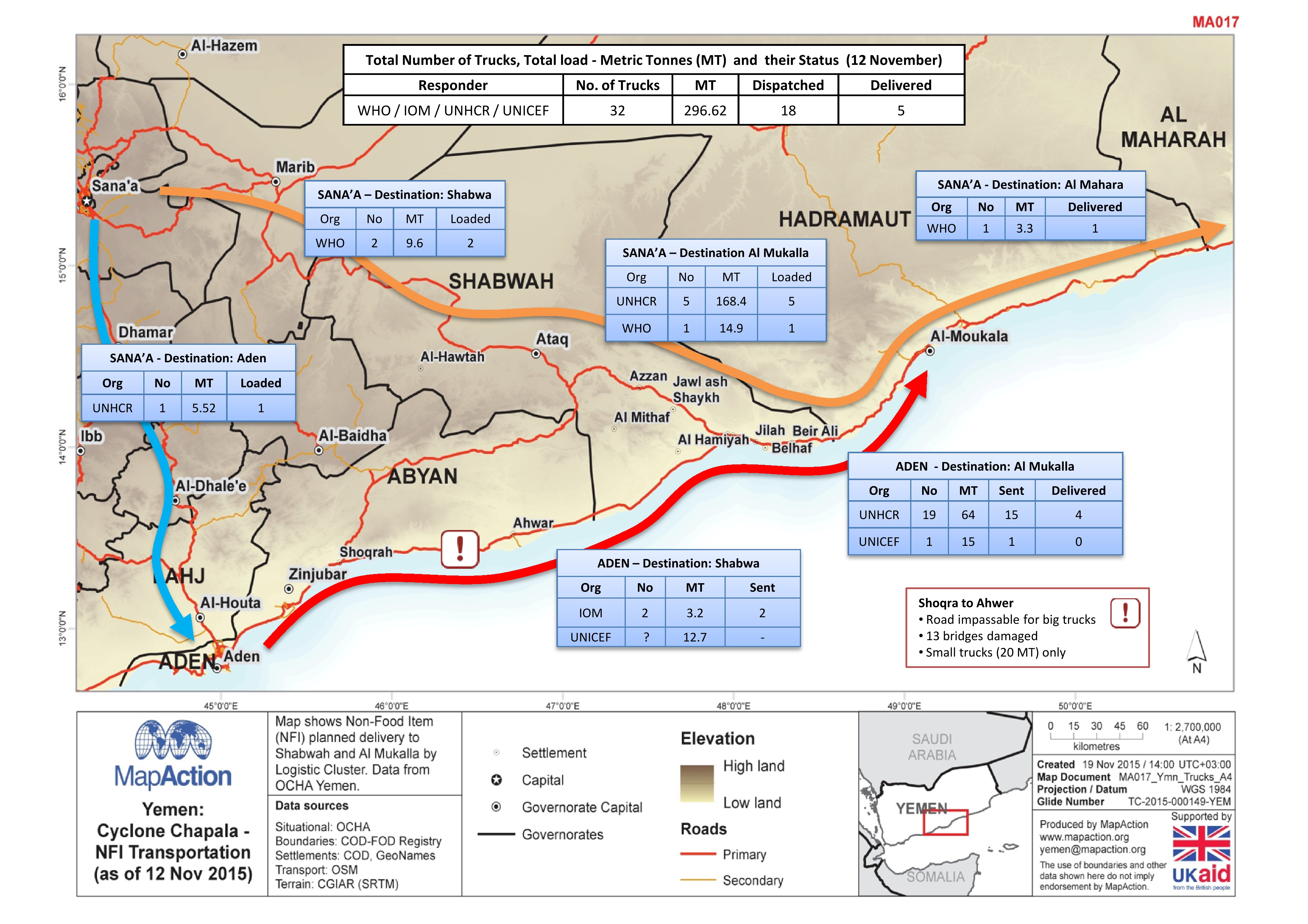
Yemen: Cyclone Chapala -NFI Transportation (as of 12 Nov 2015)
Map shows Non Food Item (NFI) planned delivery to Shabwah and Al Mukalla by Logistic cluster. Data from OCHA Yemen. -
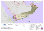
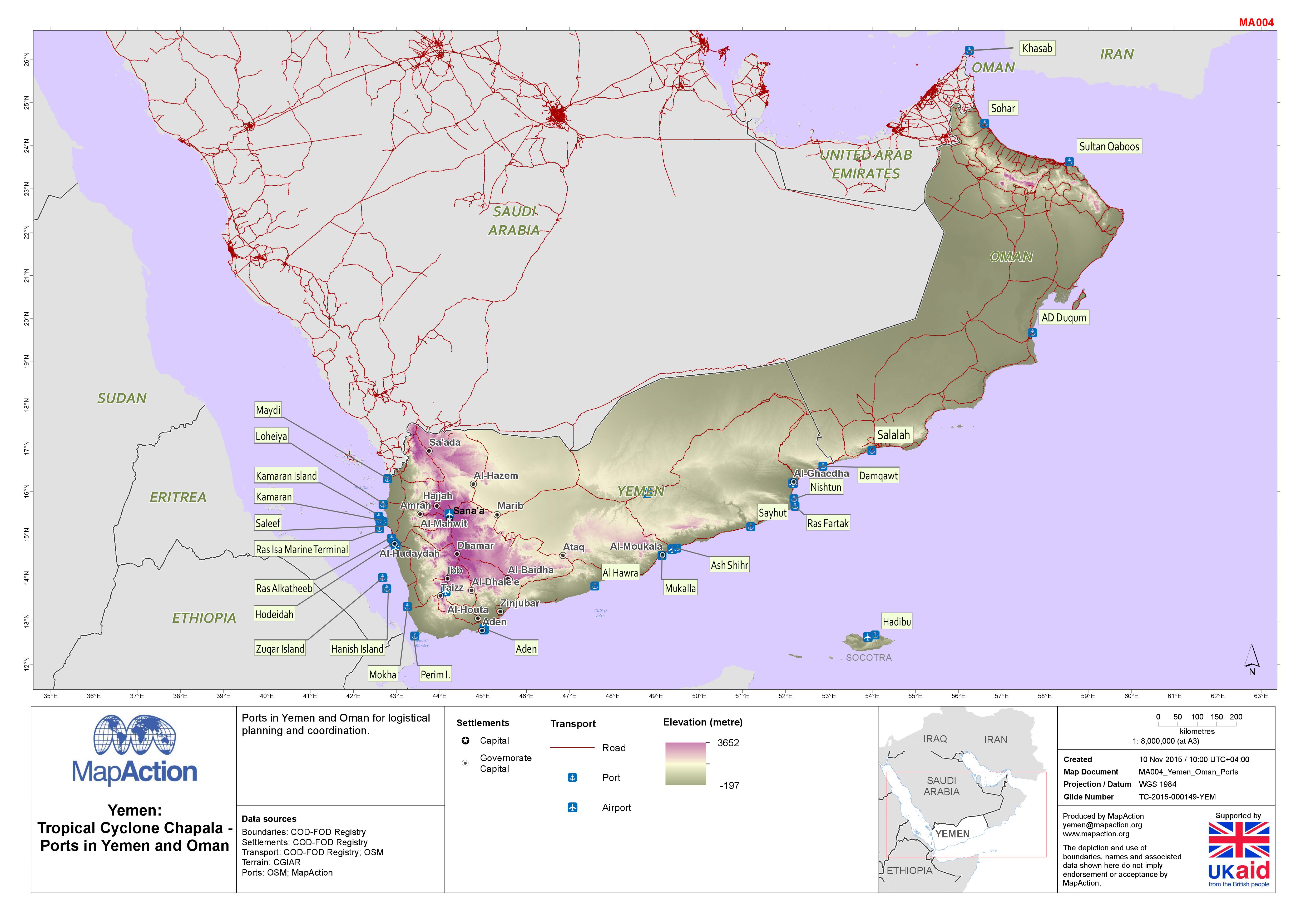
Yemen: Tropical Cyclone Chapala - Ports in Yemen and Oman
Map shows coastal ports in Yemen and Oman together with the land terrain and major roads. -

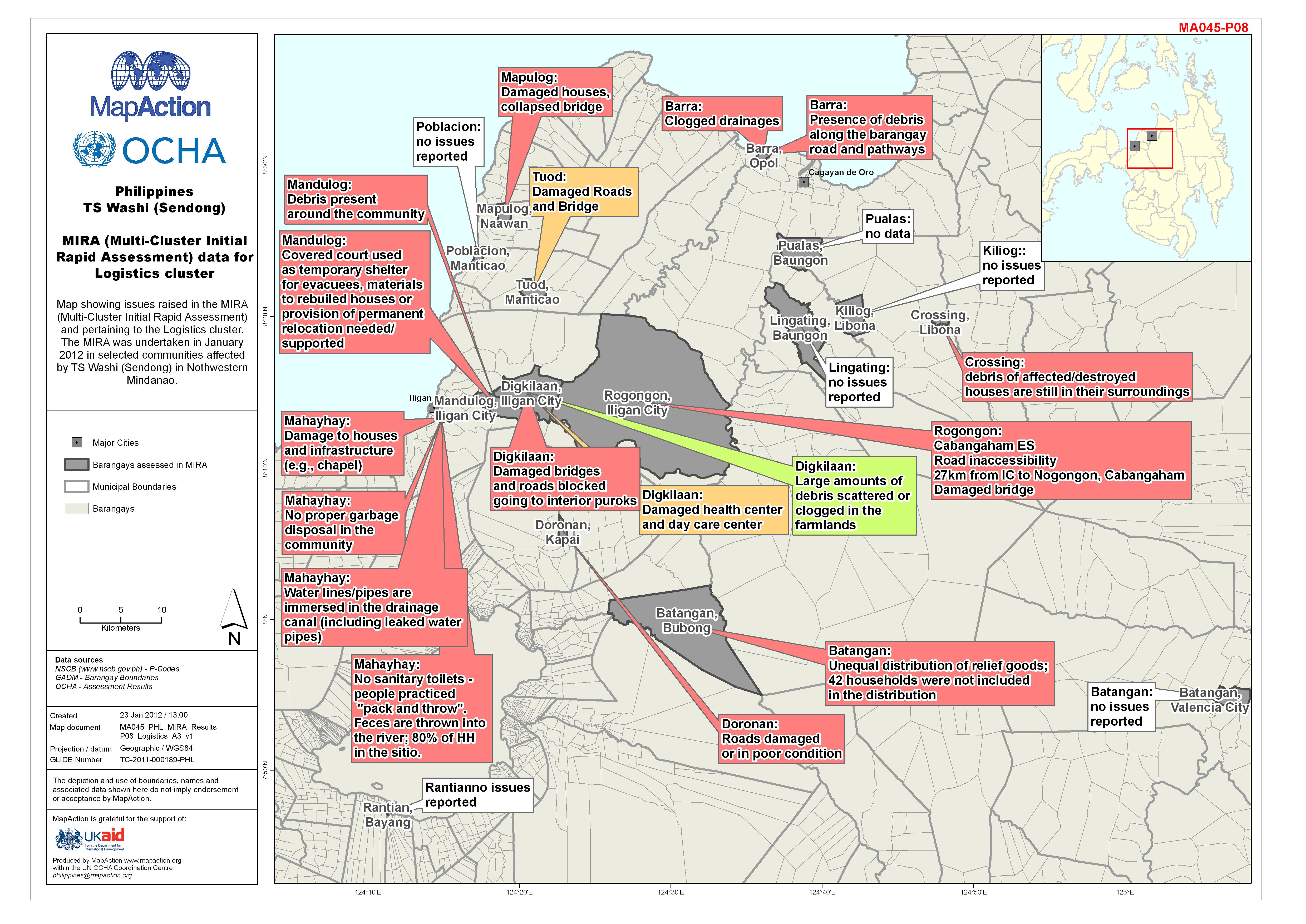
Philippines TS Washi (Sendong) MIRA (Multi-Cluster Initial Rapid Assessment) ...
Map shows logistics issues reported by the Multi-Cluster Initial Rapid Assessment, January 2012. -
Philippines Tropical Storm Washi (Sendong) Cash Transfer Programme: Humanitar...
Map shows Cash Transfer Programme: Humanitarian Actors by Municipality -

Japan Earthquake and Tsunami Coordination Hubs
Map showing Japanese government coordination hubs. -
Vanuatu: Cyclone PAM - Helicopter landing zones in the Shepherd Islands(as of...
This dataset has no description
-
Vanuatu: Cyclone PAM - Status of Airports (as of 18 March 2015)
Based on Vanuatu Aerodromes information from 2013 giving runway length and width, runway surface and aircraft types. Additional data including status of runway and status of... -
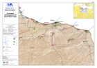
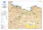
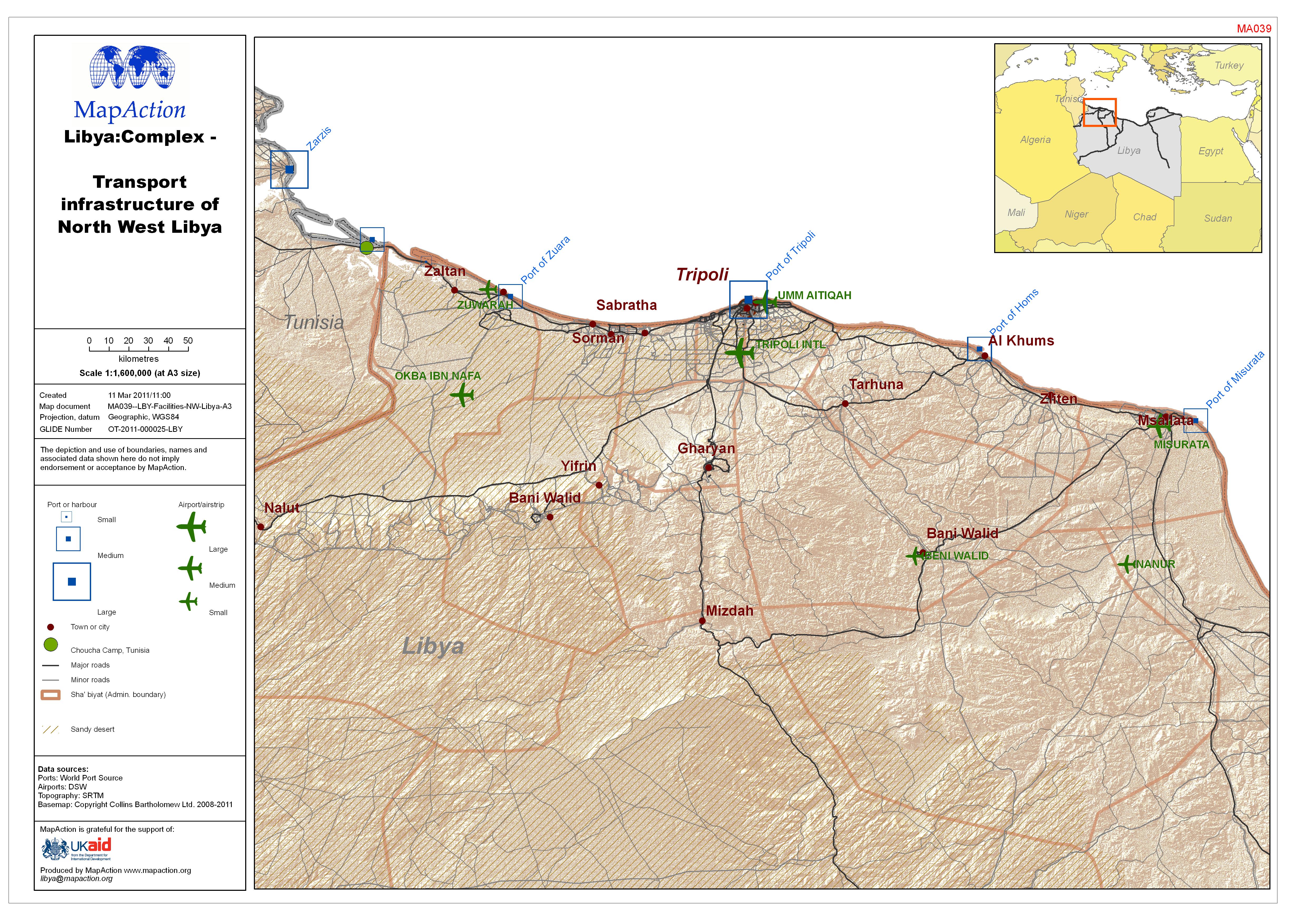
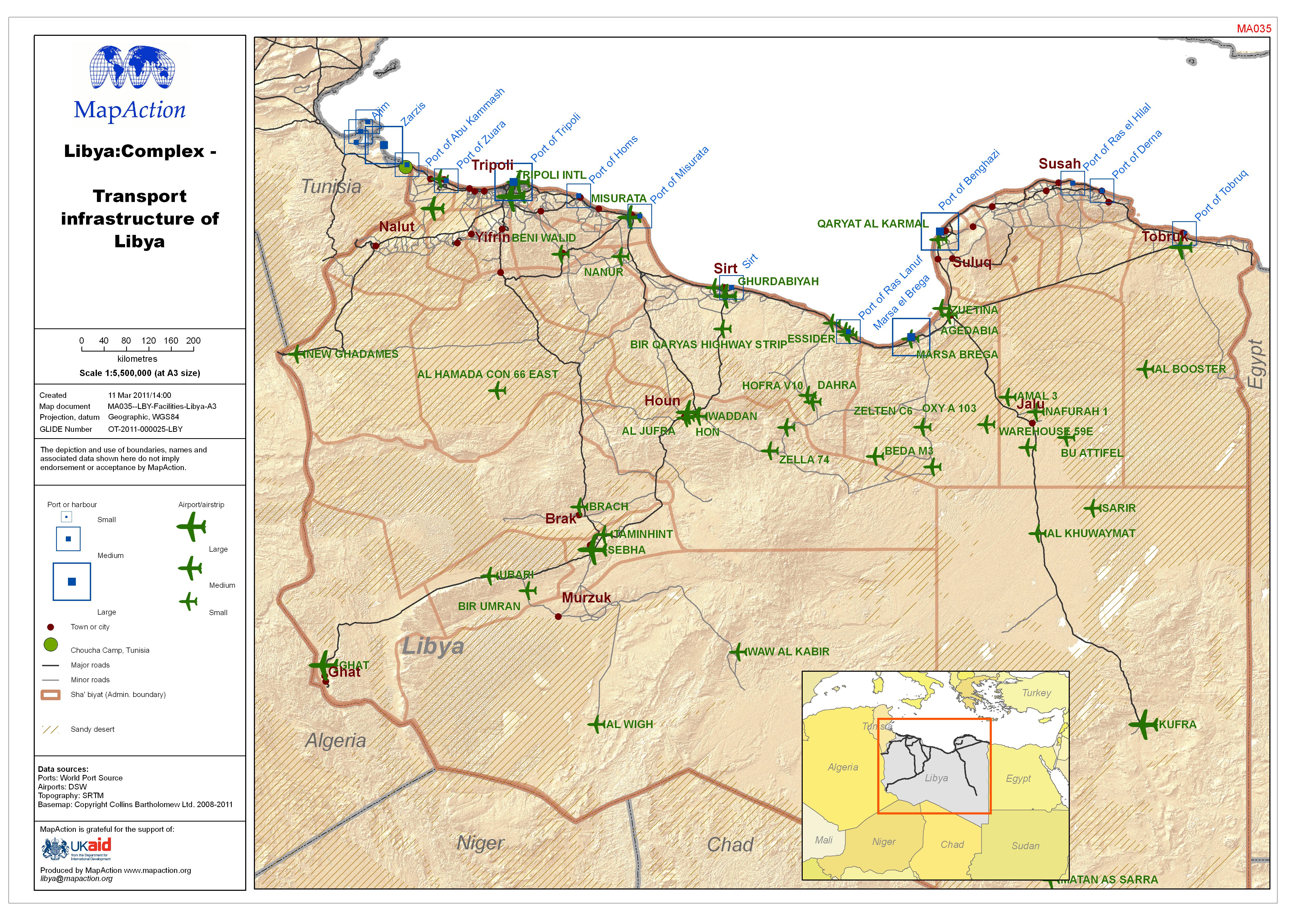
Libya: Complex - Transport infrastructure of North West Libya
This dataset has no description
-
-
-