-
Situation Overview
Situation overview as of 08 July 2024. Showing settlements, baseline population, affected areas for assessment and populated evacuation centers -

Flood Extent (02 Dec) and Baseline Population for South Somalia
The maps show the flood extent combined with population density to highlight potentially affected areas. The table shows the estimated baseline population by district (2021).... -

Flood Extents (As of 02 Dec 2023) and Baseline Population
Table shows estimated baseline population in 2022 for affected regions in South Somalia. Population distribution shown on map is based on Worldpop estimate for 2020. Flood... -

Shake Intensity and Epicentre with Regions affected and population
Shake Intensity focused on the affected / reported Regions from discussions in the UN Assessment & Analysis cell -

Storm path tropical cyclone Mocha (as of 15 May 2023) with baseline populatio...
Storm path as reported by Joint Typhoon Warning Centre. Population totals in table are 2022 estimates by UNFPA and US Census Bureau (USCB). Baseline population distribution... -

Densidad de población (2020) y área de inundación detectada a partir del 01/0...
Inundación de aguas detectada por UNOSAT el 01/04/2023 Estimación de la población total por departamento para el 2022 por el Instituto Nacional de Estadística e Informática y... -

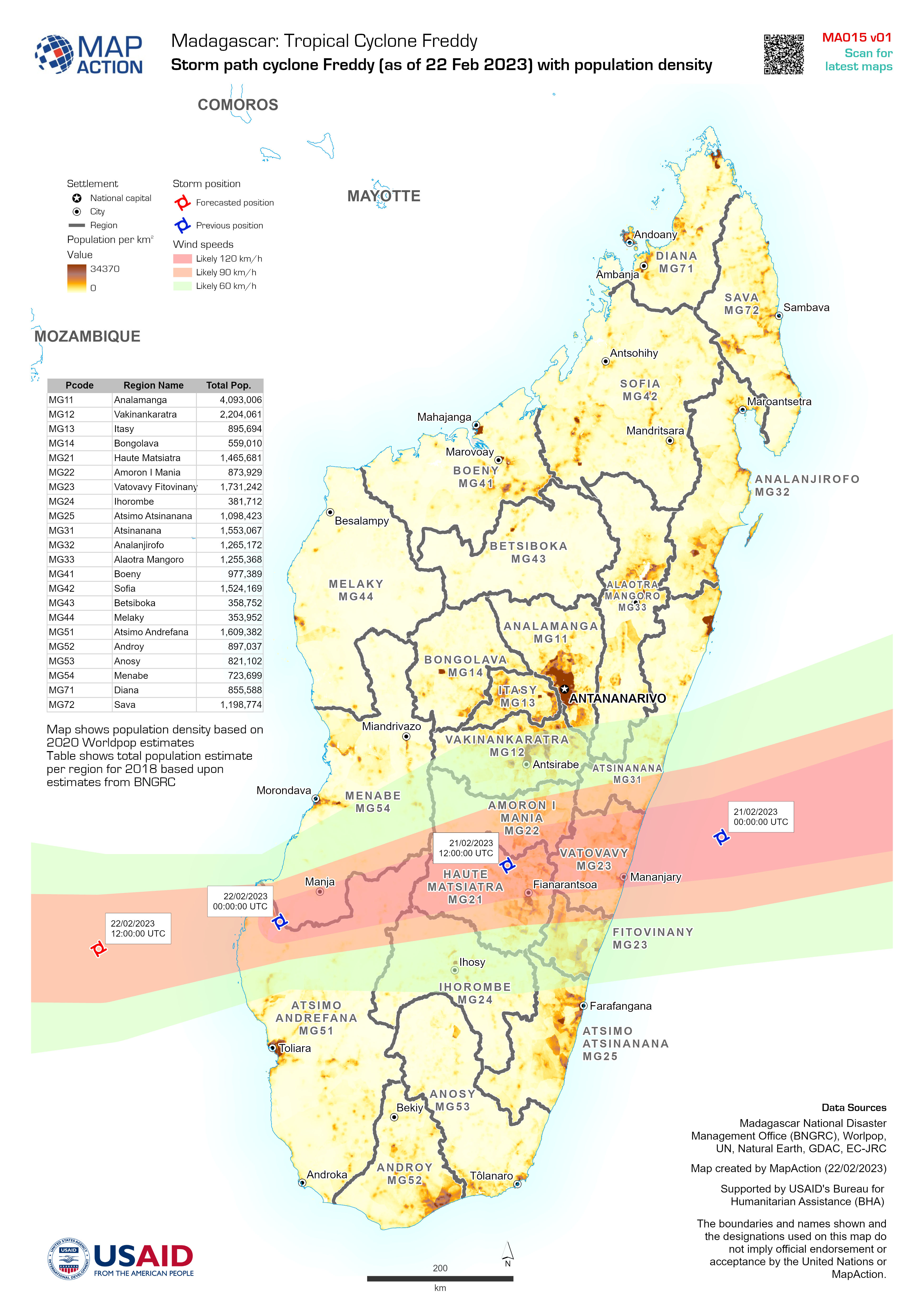
Storm path cyclone Freddy (as of 22 Feb 2023) with population density
Map shows population density based on 2020 Worldpop estimates Table shows total population estimate per region for 2018 based upon estimates from BNGRC -

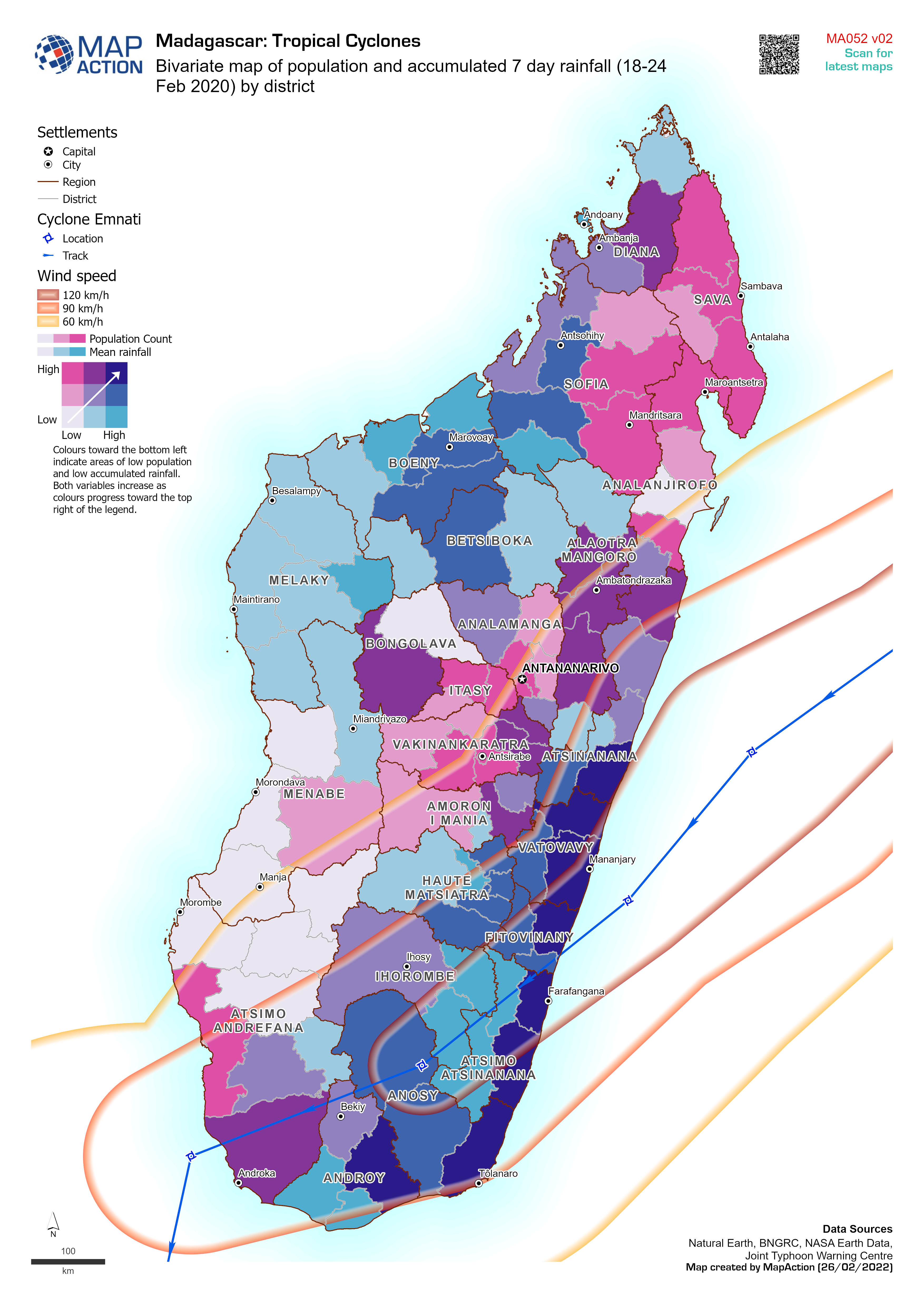
Bivariate map of population and accumulated 7 day rainfall (18-24 Feb 2020) b...
Bivariate map of population (2018 estimate) and accumulated 7 day rainfall (18-24 Feb 2022) by district. Storm track for cyclone Emnati is based on Joint Typhoon Warning Centre... -

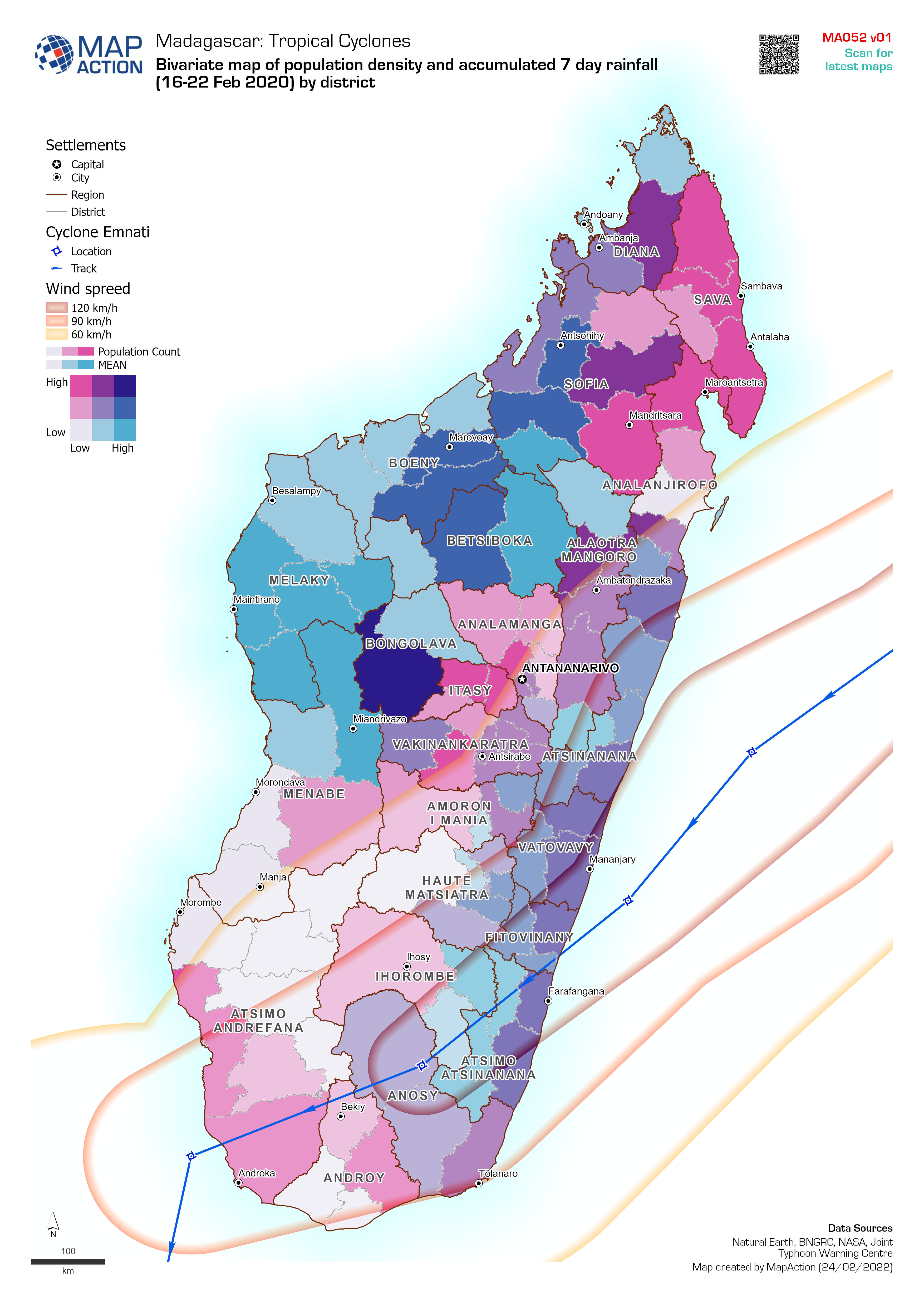
Bivariate map of population density and accumulated 7 day rainfall (16-22 Feb...
Bivariate map of population density (2018 estimate) and accumulated 7 day rainfall (16-22 Feb 2022) by district. Storm track for cyclone Emnati is based on Joint Typhoon Warning... -

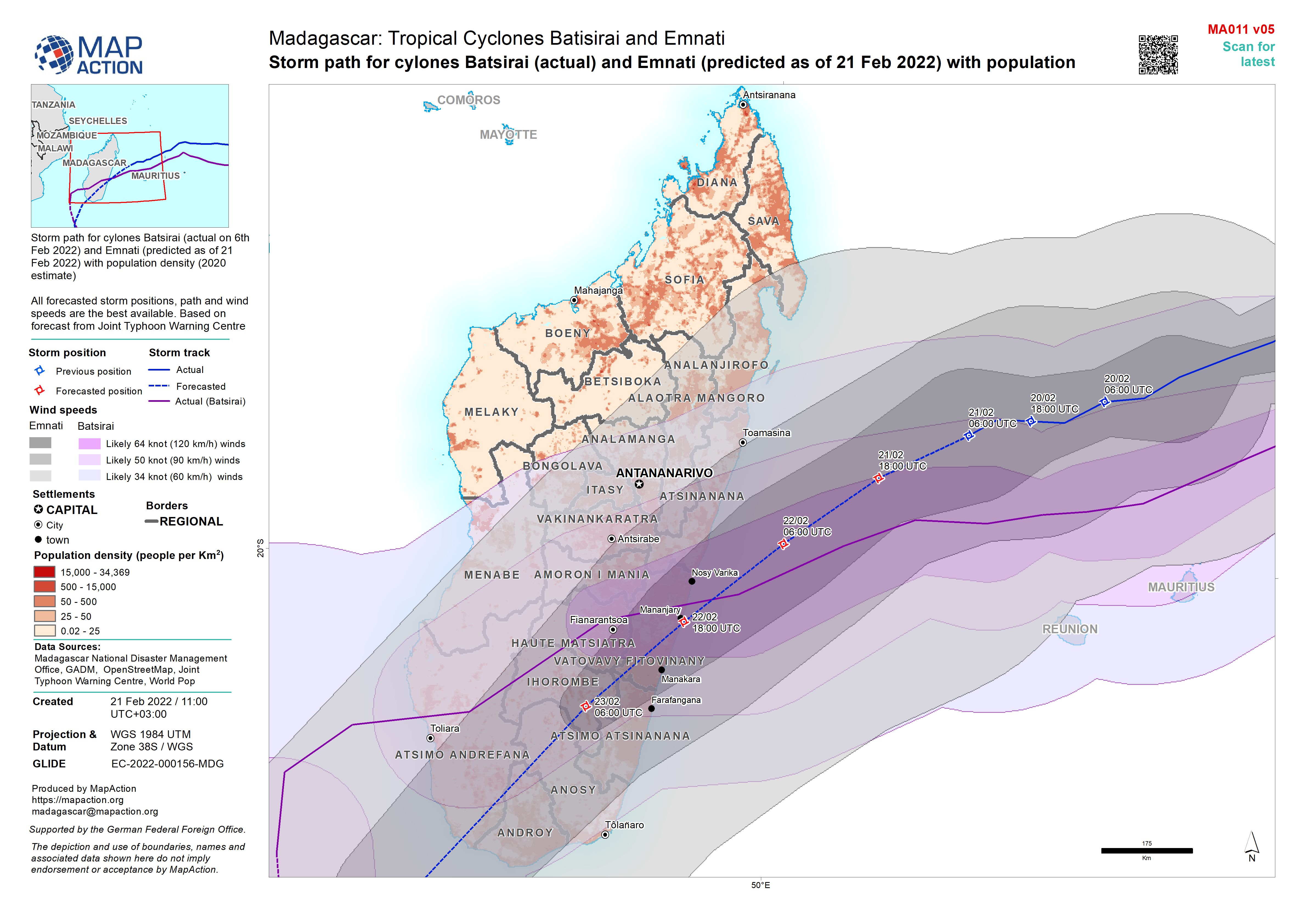
Storm path for cylones Batsirai and Emnati (as of 24 Feb 2022) with populatio...
Storm path for cyclones Batsirai (actual on 6 Feb 2022) and Emnati (predicted as of 24 Feb 2022) with population density (2020 estimate) All forecasted storm positions, path... -

Storm path for cylones Batsirai (actual) and Emnati (predicted as of 23 Feb 2...
Storm path for cyclones Batsirai (actual on 6th Feb 2022) and Emnati (predicted as of 23 Feb 2022) with population density (2020 estimate) All forecasted storm positions, path... -

Storm path for cylones Batsirai (actual) and Emnati (predicted as of 22 Feb 2...
Storm path for cyclones Batsirai (actual on 6th Feb 2022) and Emnati (predicted as of 22 Feb 2022) with population density (2020 estimate) All forecasted storm positions, path... -

Storm path for cylones Batsirai (actual) and Emnati (predicted as of 21 Feb 2...
Storm path for cylones Batsirai (actual on 6th Feb 2022) and Emnati (predicted as of 21 Feb 2022) with population density (2020 estimate) All forecasted storm positions, path... -

Storm path for cylones Batsirai (actual) and Emnati (predicted as of 19 Feb 2...
Storm path for cylones Batsirai (actual on 6th Feb 2022) and Emnati (predicted as of 19 Feb 2022) with population density (2020 estimate) All forecasted storm positions, path... -

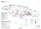
Presencia humanitaria: quién hace qué, dónde en cada municipio por department...
Mapbook shows the number of reported activities per Sector, and who is delivering them, per Municipality in Honduras. Critical and High priority response areas are also shown,... -

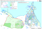
CENTROAMÉRICA: HURACANES ETA E IOTA - Honduras y Guatemala: personas afectada...
This map shows the storm tracks and flood extents for hurricane Eta and Iota. Across Honduras and in the two most highly affected departments in Guatemala the map shows affected... -
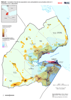
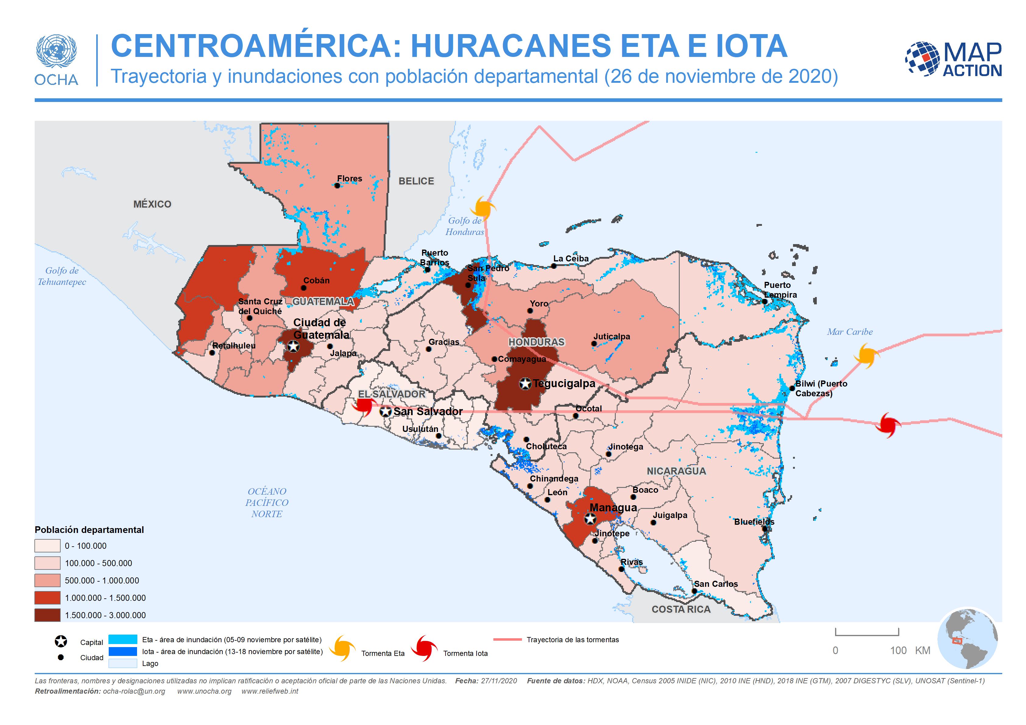
CENTROAMÉRICA: HURACANES ETA E IOTA - Trayectoria y inundaciones con població...
This map shows the storm tracks and flood extents for hurricane Eta and Iota, with baseline administrative 1 level departmental population figures across the affected region... -

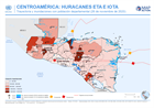
CENTROAMÉRICA: HURACÁN IOTA - Trayectoria potencial y poblaciones departament...
This map shows the potentially affected administration level 1 departments, with departmental population for Nicaragua and Honduras, and the predicted hurricane path cone. -
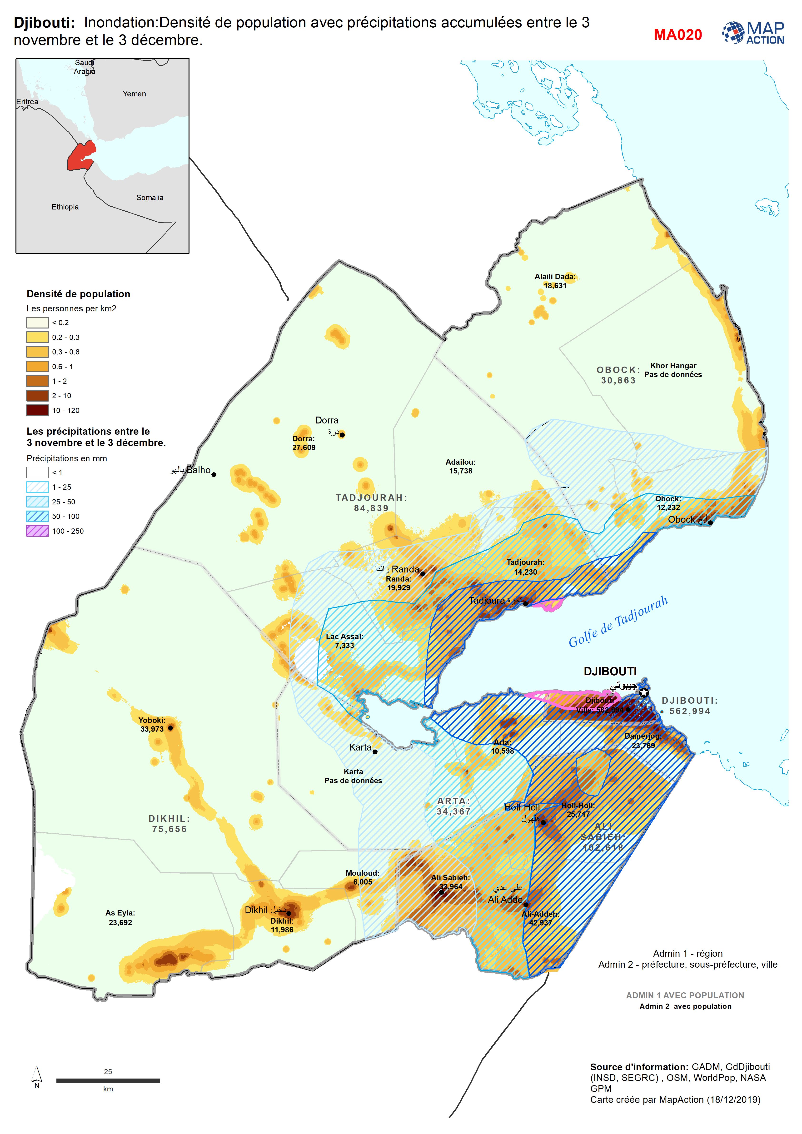
Djibouti: Inondation:Densité de population avec précipitations accumulées ent...
Population Density for 2018 with accumulated rainfall between 3 Nov - 3 Dec. -
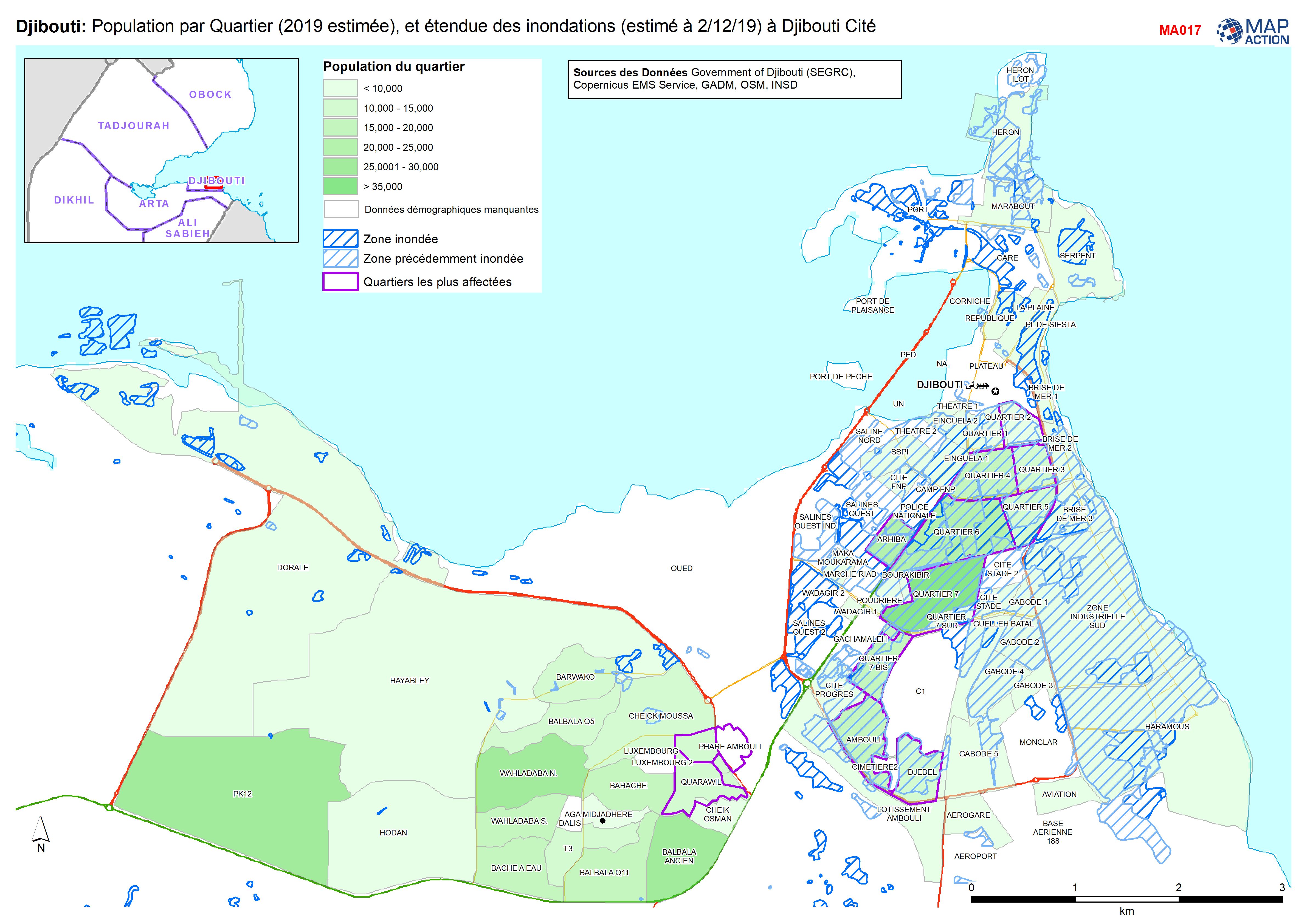
Djibouti: Population par Quartier (2019 estimée), et étendue des inondations ...
Population par Quartier (2019, estimée), et étendue des inondations (estimé à 2/12/19) à Djibouti Cité