-

Precipitación acumulada en los departamentos afectados entre el 28 de marzo y...
Lluvia acumulada en los departamentos afectados entre el 28 de marzo y el 10 de abril de 2023 -

Categorías de Sequía (US Drought Monitor) 26 Junio 2022 al 25 Septiembre 2022
MIRA - Comunidades identificadas para la recolección de datos primarios en los departamentos de Boquerón, Presidente Hayes -
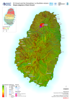
Slopes (degrees) of Saint Vincent
Map shows the slopes of Saint Vincent and the extent of the ash from the La Soufrière eruptions. -
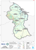
Guyana Reference Map: Administrative Regions
This reference map shows digital elevation data at 90m resolution, with primary roads, airports, major settlements and administrative regions for Guyana. -

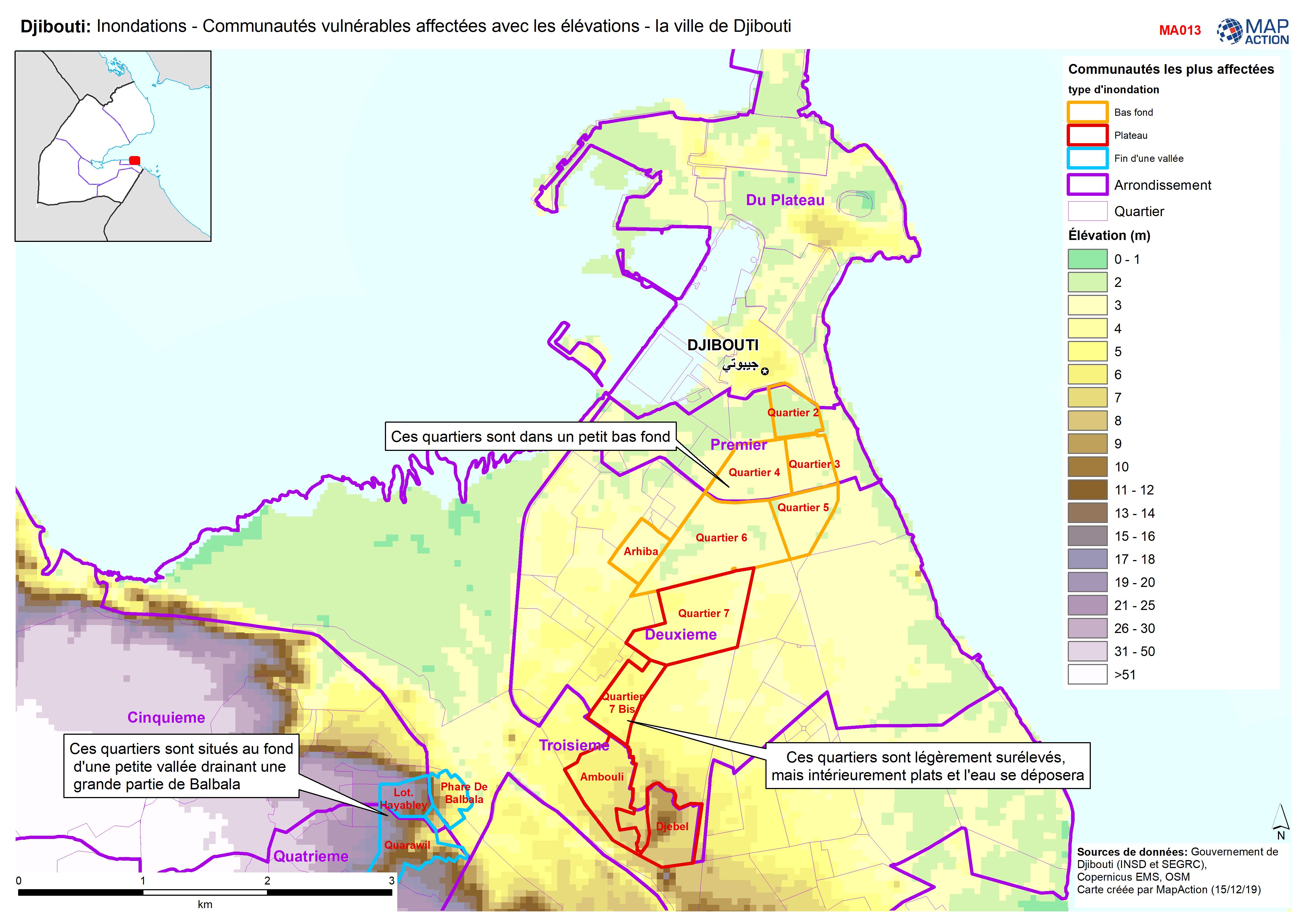
Djibouti: Inondations - Communautés vulnérables affectées avec les élévations...
Djibouti City - Map shows the most affected flooded communities, containing the most vulnerable populations, alongside elevation data to demonstrate the effects of elevation and...