-

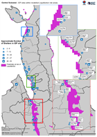
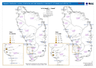
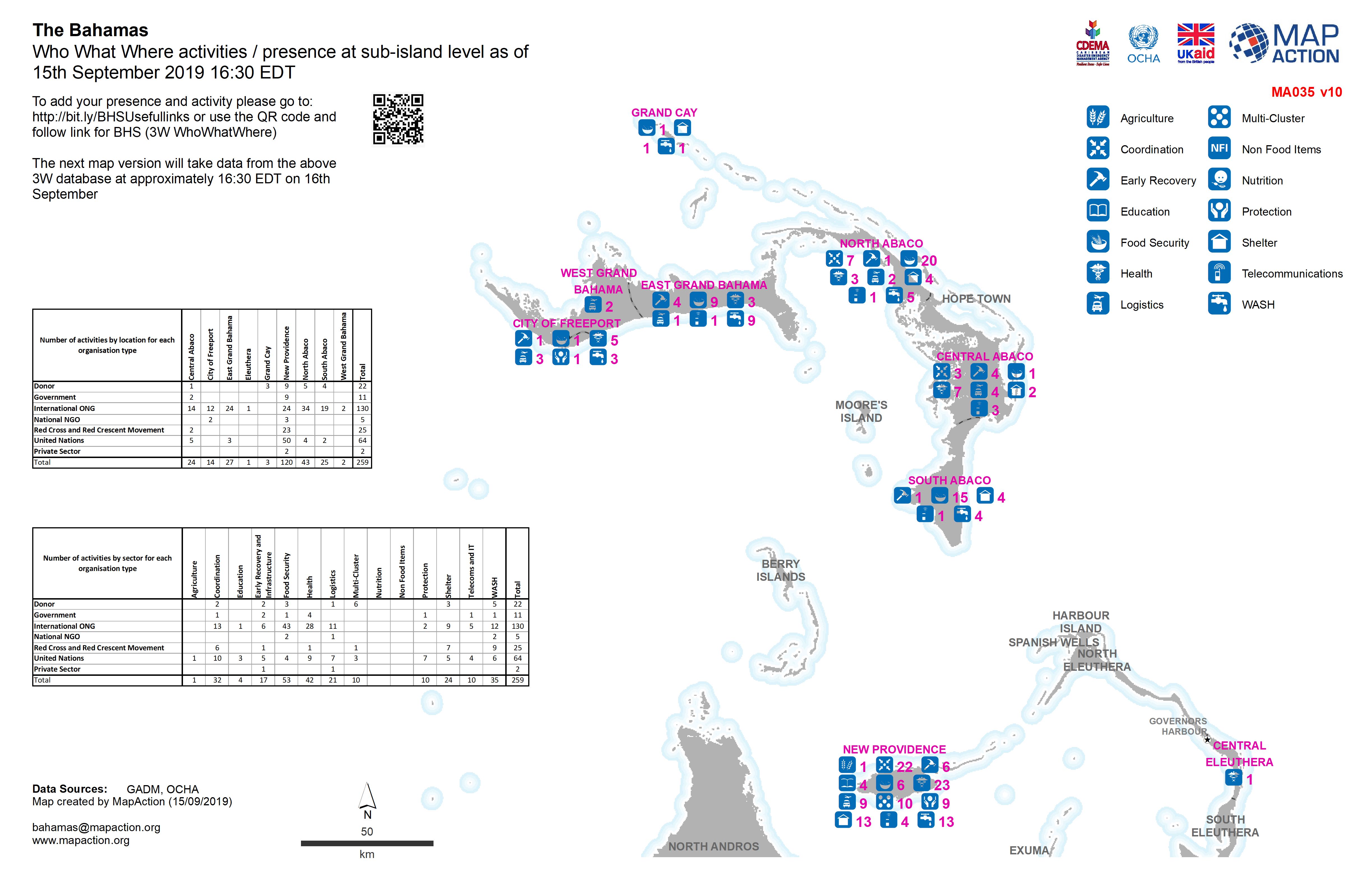
Who What Where activities / presence at sub-island level as of 15th September...
Who What Where activities / presence at sub-island level as of 15th September 2019 16:30 EDT -
Who What Where activities / presence at sub-island level as of 14th September...
Who What Where activities / presence at sub-island level as of 14th September 2019 16:30 EDT -
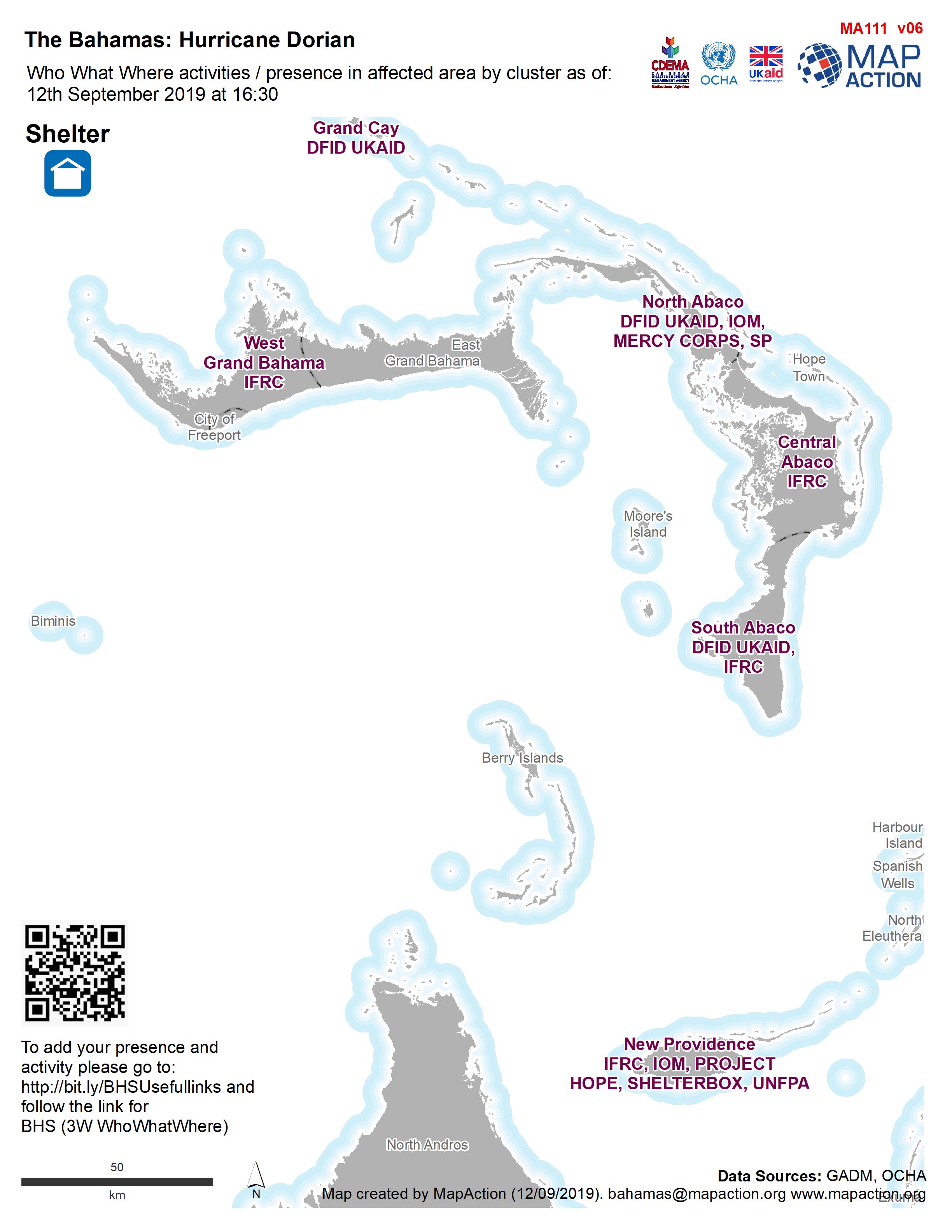
Who What Where activities / presence in affected area by cluster as of: 12th ...
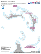
Who, What, Where for Shelter -

Who What Where activities / presence at sub-island level as of 13th September...
Who What Where activities / presence at sub-island level as of 13th September 2019 16:30 EDT -
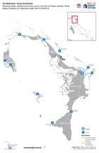
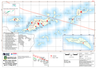
Showing roads, shelters and clinics as an overview for Abaco Islands. Road st...
Map showing, roads, clinics and shelters -

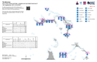
Who What Where activities / presence at sub-island level as of 12th September...
Who What Where activities / presence at sub-island level as of 12th September 2019 16:30 EDT -
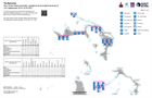
Who What Where activities / presence at sub-island level as of 11th September...
Who What Where activities / presence at sub-island level as of 11th September 2019 16:30 EDT -

Who What Where activities / presence in affected area for Protection and Shel...
3W for Protection and Shelter as of 10th September 2019 -
Central Sulawesi: IDP sites within modelled Liquefaction risk areas.
Map shows IDP sites as identified through analysis of Digital Globe imagery from 2nd - 5th October, and areas at risk of liquefaction as determined through the USGS preferred... -
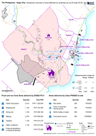
The Philippines - Naga City: Situational overview of area affected by landsli...
Map shows the affected areas, number of displaced and location of the evacuation centres being used as a result of the landslide to hit Naga city. The table below shows the... -
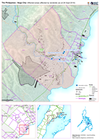
The Philippines - Naga City: Affected areas affected by landslide (as at 28 S...
Map shows the affected by the landslide in Naga City, Cebu. -
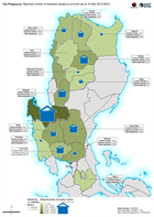
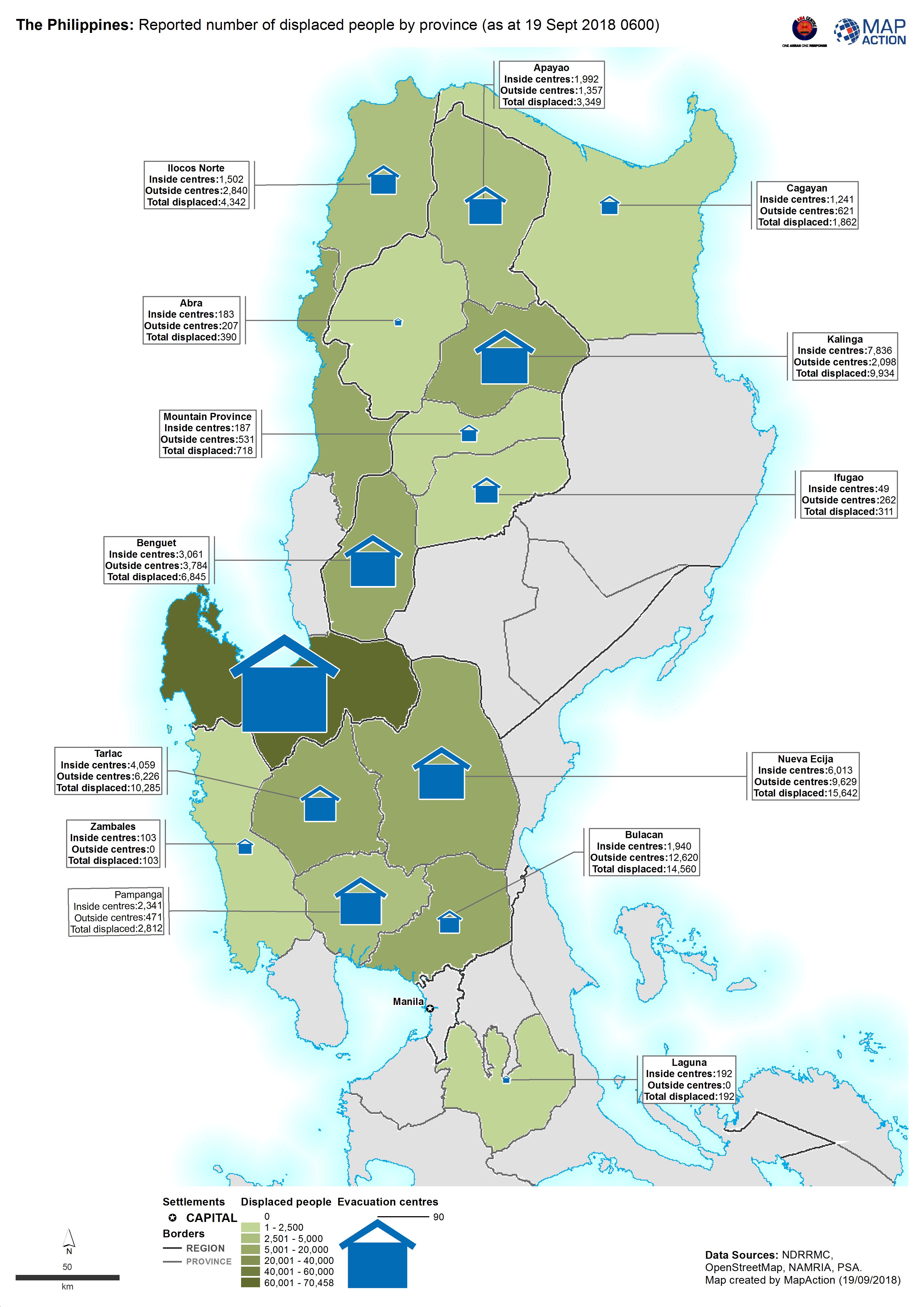
The Philippines: Reported number of displaced people by province (as at 19 Se...
Map shows the reported number of displaced people per province. -
Tarpaulin Distribution: number of deliveries and total tarpaulins in standard...
Map shows tarpaulin distributions up to 8th October 2017 -
British Virgin Islands: Hurricane Irma- Tortola Shelters Status (as of 13 Sep...
Tortola Hurricane Government Emergency Shelters Status as of 13 September 2017. -

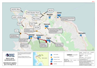
Sierra Leone Landslide/floods - Operations/Logistics (as of 23 Aug 2017)
Map shows key operational locations and the activies being conducted at each site. Points of Interest relevant to the operational setting are also provided. -
Sierra Leone Landslide/floods - Operations/Logistics (as of 23 Aug 2017)
Map shows key operational locations and the activies being conducted at each site. Points of Interest relevant to the operational setting are also provided. -
Sierra Leone Landslide & Floods Shelter Sites as of 23 August 2017
Map indicates the location of active and proposed shelters in Freetown identified by national agencies. Confirmation is needed of the status and population of these shelters. -
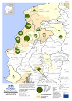
Ecuador: Terremoto Personas Albergades (a 24 Abril 2016)
El mapa muestra el numero de personas albergadas en refugios communidades a 24 abríl. Remarca que la cantidad de personas desplazadas pueda ser elevado. Los cantones afectados y... -
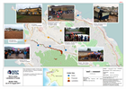
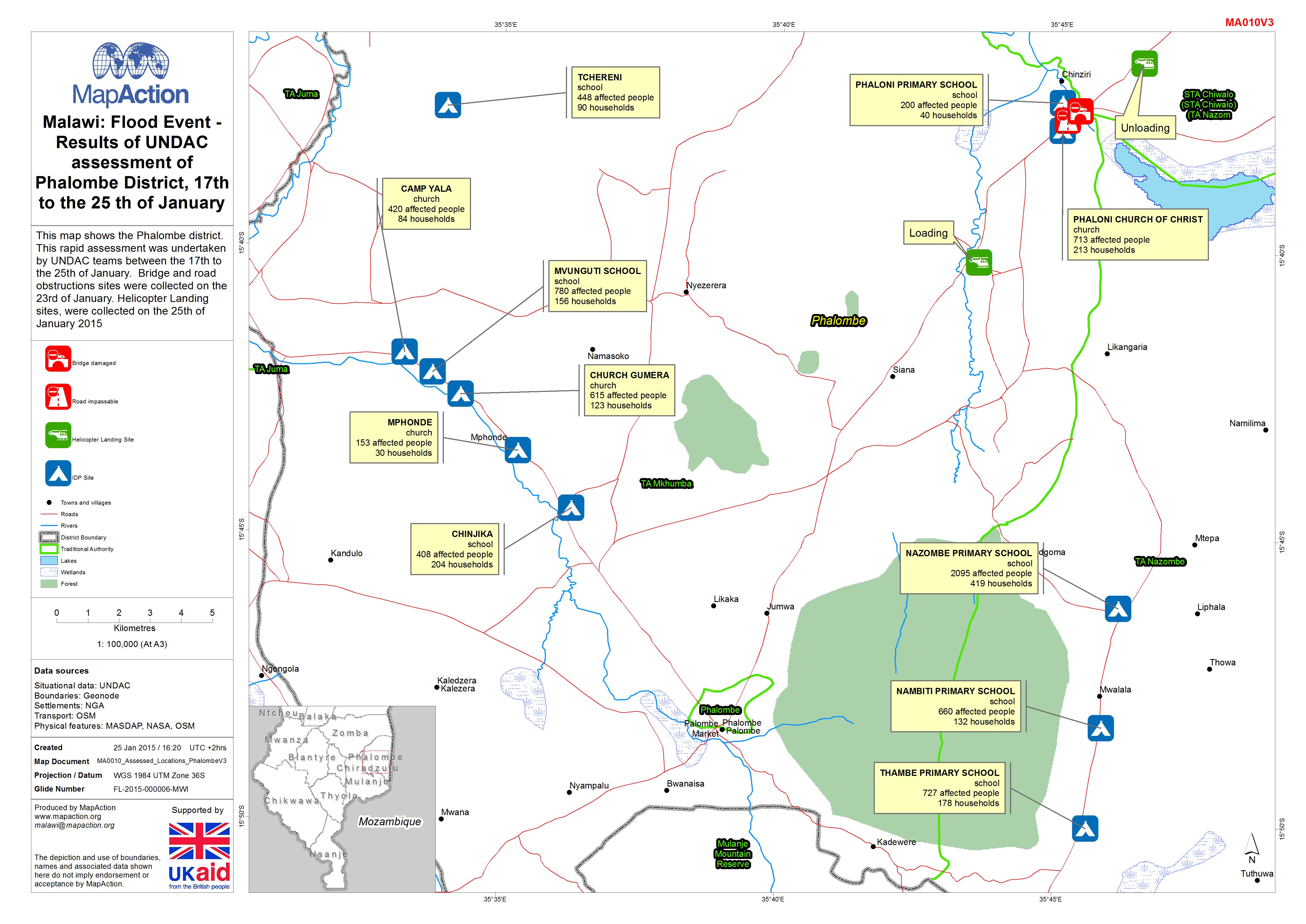
Malawi: Floods - Results of UNDAC assessment of Phalombe District, 17th to th...
This dataset has no description
-
Bahamas: Hurricane Matthew- Rapid Assessment Housing Damage Estimate New Prov...
Estimates of housing damage in areas assessed for CDEMA. Level 0 - no damage, Level 1 - superficial damage, Level 2 - significant damage but habitable, Level 3 - not...