-
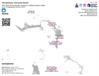
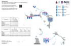
Who What Where activities / presence in affected area - Multi-cluster: As of ...
Who, What, Where for Coordination - Multi-Cluster -
Who What Where activities / presence in affected area by cluster: Emergency S...
Who, What, Where for Coordination: Emergency Shelter -
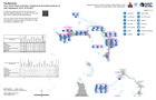
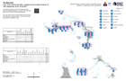
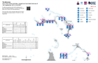
Who What Where activities / presence at sub-island level as of 20th September...
Who What Where activities / presence at sub-island level as of 20th September 2019 16:30 EDT -

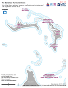
Who What Where activities / presence in affected area by cluster: Shelter - A...
Who, What, Where for Shelter -
Who What Where activities / presence at sub-island level as of 18th September...
Who What Where activities / presence at sub-island level as of 18th September 2019 16:30 EDT -

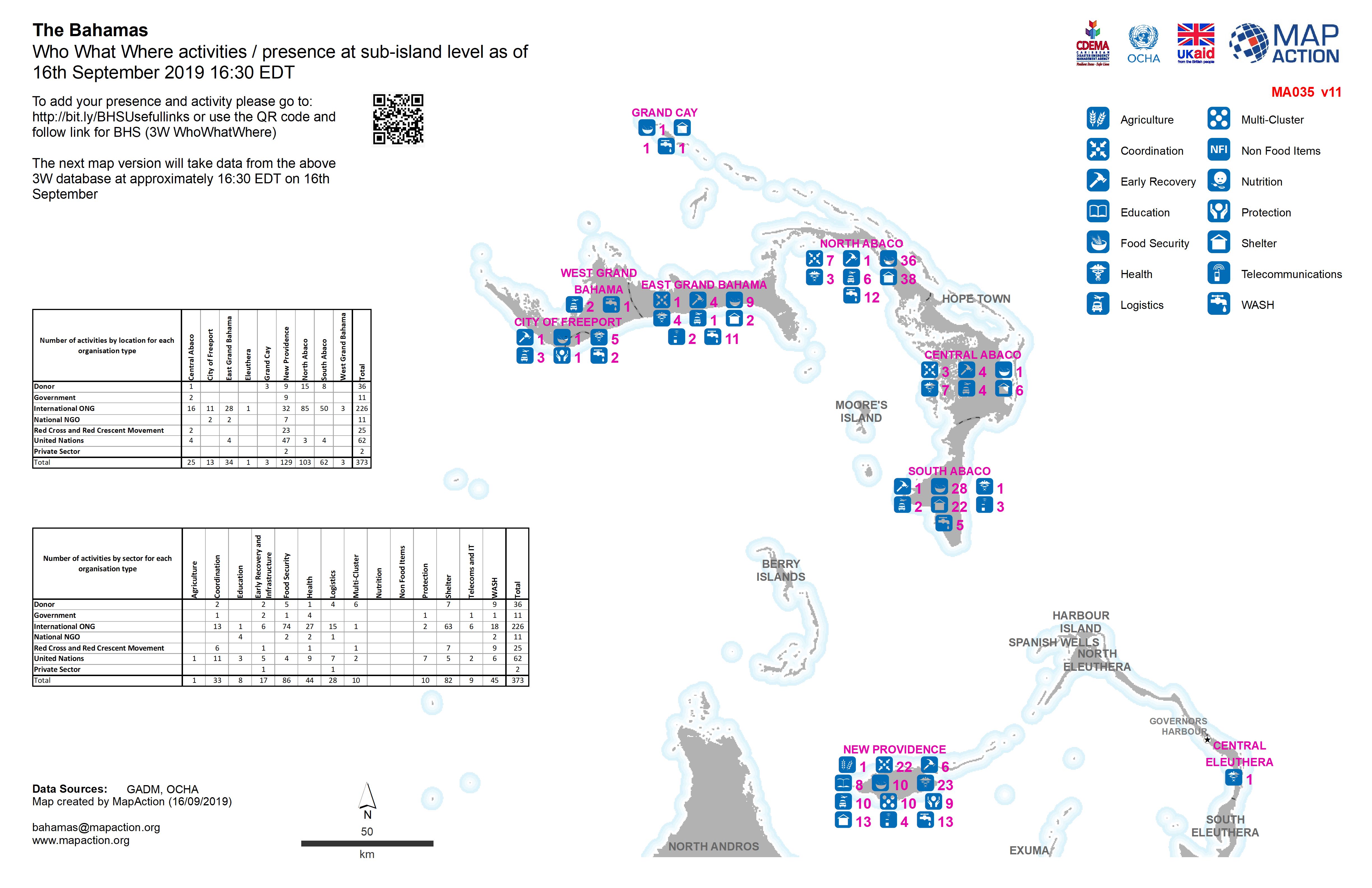
Who What Where activities / presence at sub-island level as of 16th September...
Who What Where activities / presence at sub-island level as of 16th September 2019 16:30 EDT -
Who What Where activities / presence in affected area by cluster - Shelter: A...
Who, What, Where for Shelter -

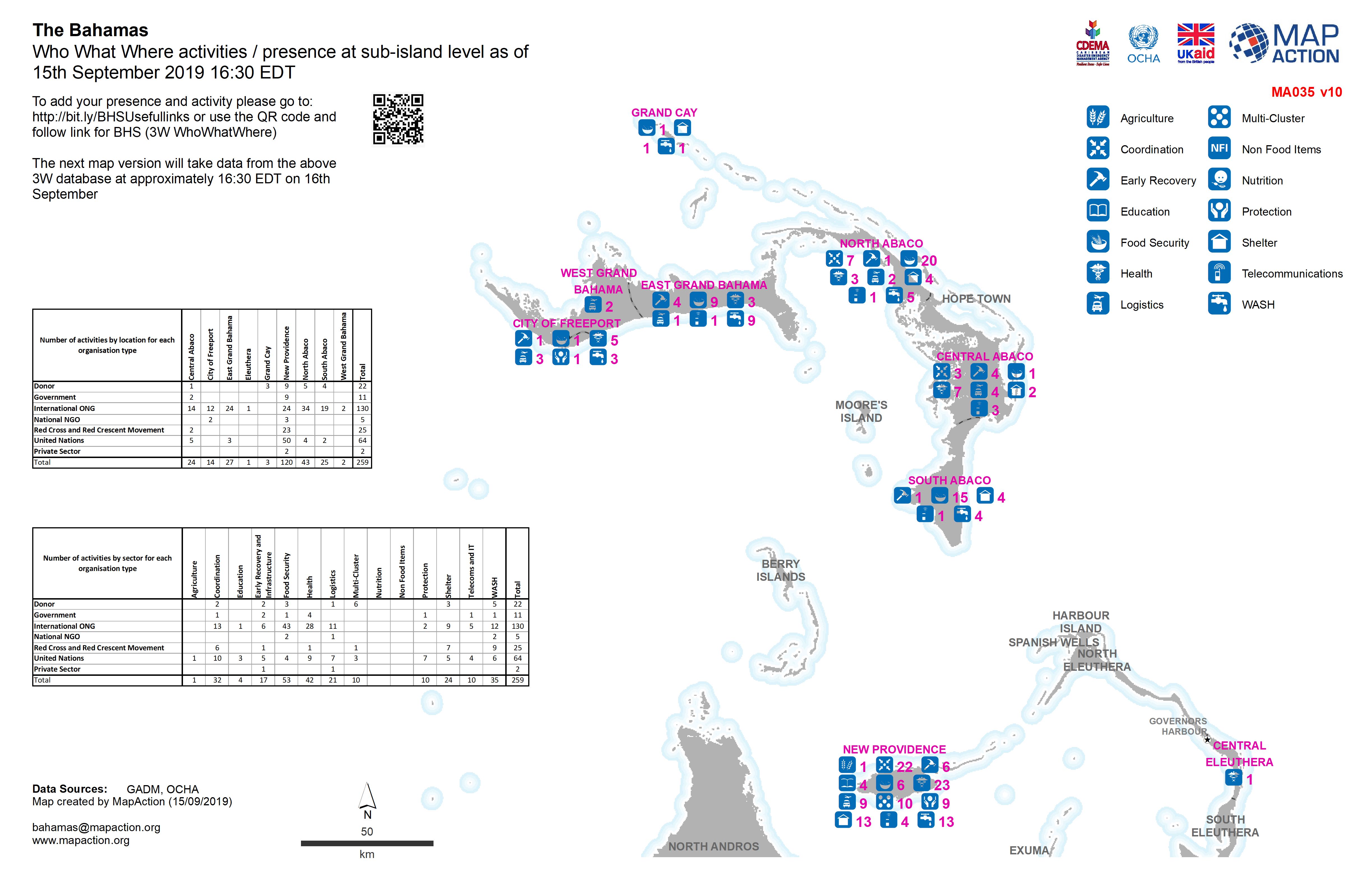
Who What Where activities / presence at sub-island level as of 15th September...
Who What Where activities / presence at sub-island level as of 15th September 2019 16:30 EDT -
Who What Where activities / presence at sub-island level as of 14th September...
Who What Where activities / presence at sub-island level as of 14th September 2019 16:30 EDT -
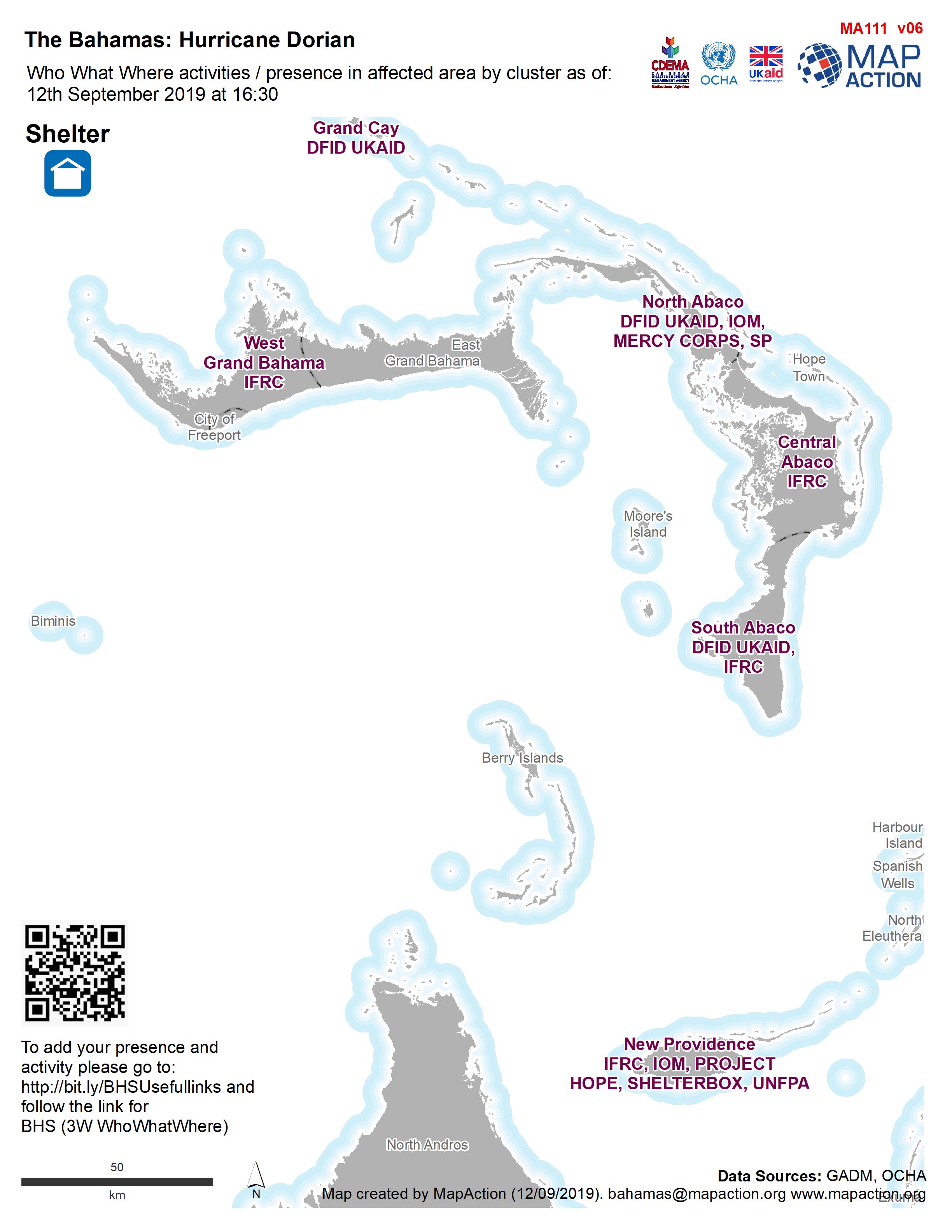
Who What Where activities / presence in affected area by cluster as of: 12th ...
Who, What, Where for Shelter -

Who What Where activities / presence at sub-island level as of 13th September...
Who What Where activities / presence at sub-island level as of 13th September 2019 16:30 EDT -
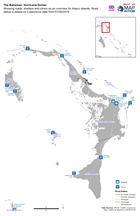
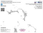
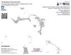
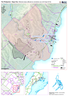
Showing roads, shelters and clinics as an overview for Abaco Islands. Road st...
Map showing, roads, clinics and shelters -

Who What Where activities / presence at sub-island level as of 12th September...
Who What Where activities / presence at sub-island level as of 12th September 2019 16:30 EDT -
Who What Where activities / presence at sub-island level as of 11th September...
Who What Where activities / presence at sub-island level as of 11th September 2019 16:30 EDT -

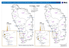
Who What Where activities / presence in affected area for Protection and Shel...
3W for Protection and Shelter as of 10th September 2019 -
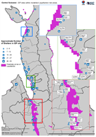
Central Sulawesi: IDP sites within modelled Liquefaction risk areas.
Map shows IDP sites as identified through analysis of Digital Globe imagery from 2nd - 5th October, and areas at risk of liquefaction as determined through the USGS preferred... -
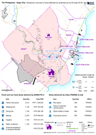
The Philippines - Naga City: Situational overview of area affected by landsli...
Map shows the affected areas, number of displaced and location of the evacuation centres being used as a result of the landslide to hit Naga city. The table below shows the... -
The Philippines - Naga City: Affected areas affected by landslide (as at 28 S...
Map shows the affected by the landslide in Naga City, Cebu. -
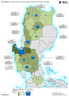
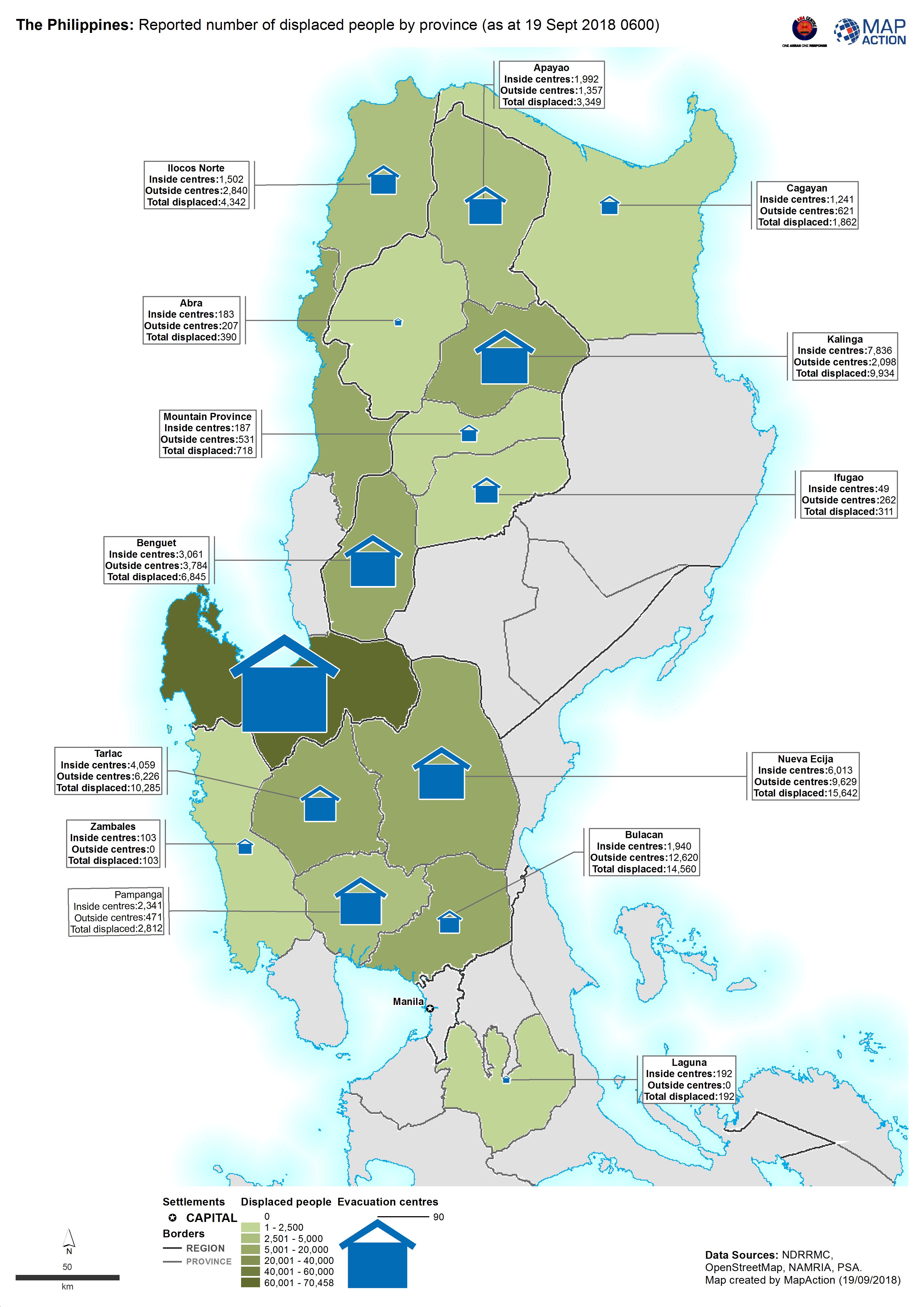
The Philippines: Reported number of displaced people by province (as at 19 Se...
Map shows the reported number of displaced people per province. -
Tarpaulin Distribution: number of deliveries and total tarpaulins in standard...
Map shows tarpaulin distributions up to 8th October 2017