-
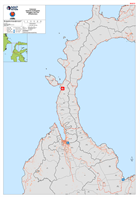
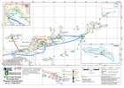
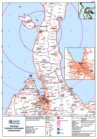
Indonesia Sulawesi Earthquake Donggala and Palu Infrastructure
Maps shows the main roads and settlements of the Pula and Donggala districts of Central Sulawesi, Indonesia -
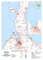
Sulawesi Earthquake - Infrastructure
Map shows level 3 admininstration boundaries and settlements. Roads and ports are also shown. -
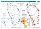
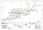
Potable Water status: litres delivered in last 5 days and remaining days supp...
Map shows potable water distributions and remaining supplies up to 8th October 2017 -
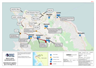
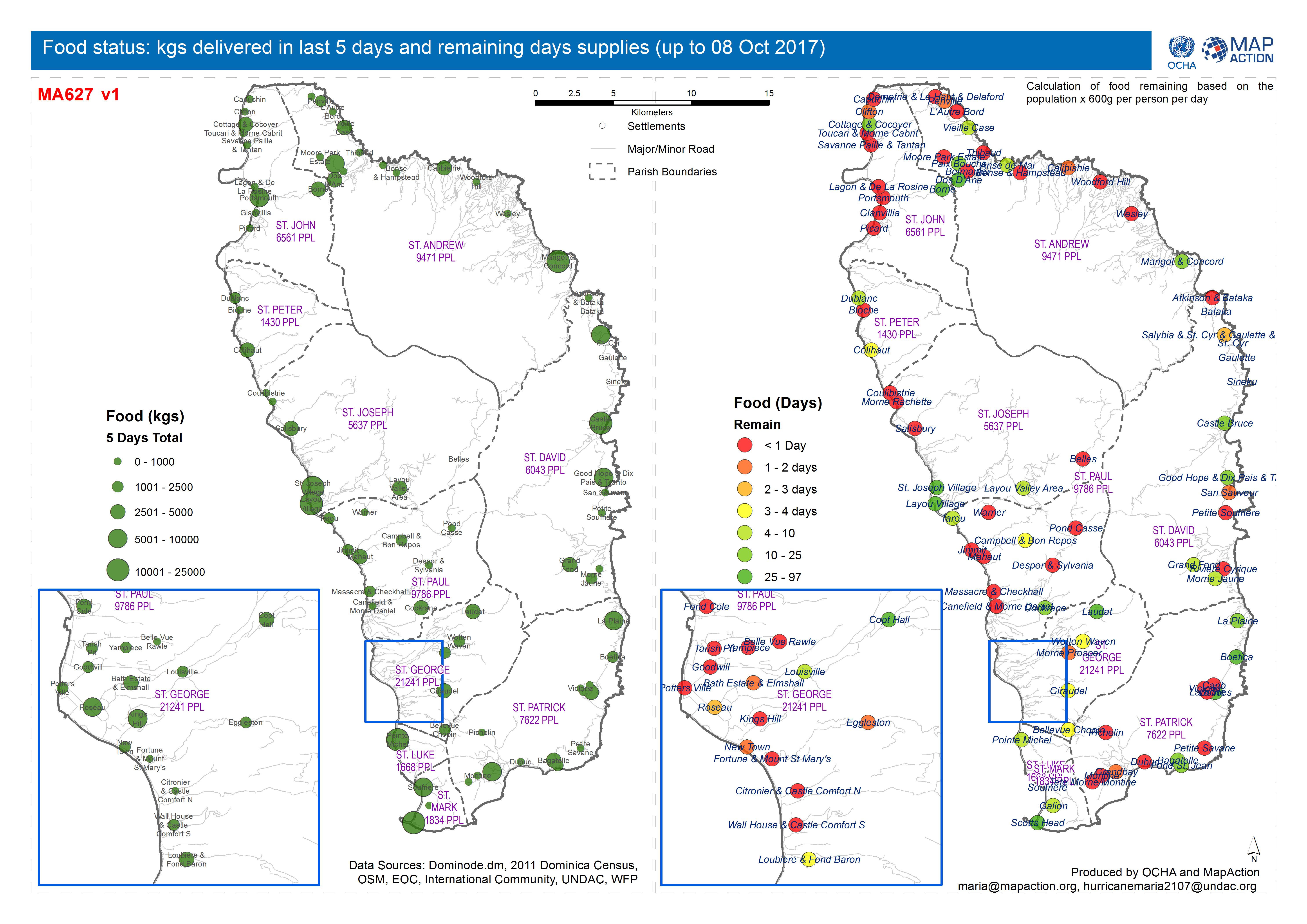
Food status: kgs delivered in last 5 days and remaining days supplies (up to ...
Map shows food status and gap analysis up to 8th October 2017 -
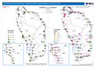
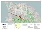
Tarpaulin Distribution: tarpaulins required per settlement and total tarpauli...
Map shows tarpaulin distribution and gap analysis up to 8th October 2017. -
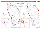
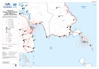
DOMINICA: Food and water distributions (to end of 30 September 2017)
Map shows food and water distributions to the end of 30th September 2017 -

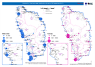
DOMINICA: CN, FR, NL, UK and VZ food and water distributions (as of 27 Septem...
Map shows food and water distributions on 27th September 2017 -
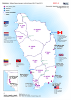
Dominica: Military Resources and Activity Areas (26-27 Sep 2017)
Shows the approx areas of response of the International Military Assets -
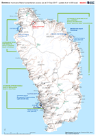
Dominica: Hurricane Maria humanitarian access (as at 21 Sep 2017 - update 4 a...
Map of humanitarian access, as reported to the EOC in Roseau up to 14.00 local time on 21 September. This map will change frequently as access conditions change and more... -
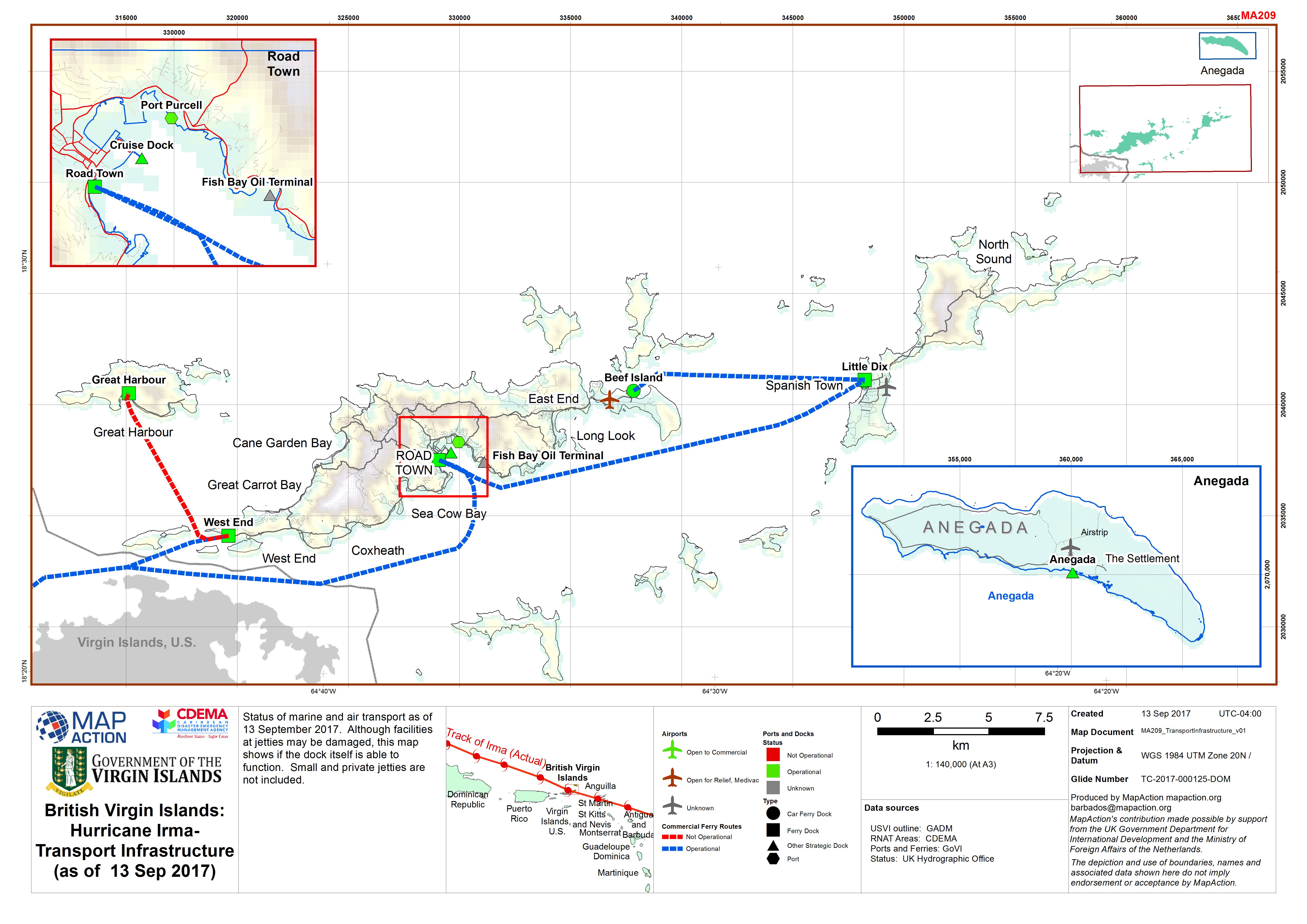
British Virgin Islands: Hurricane Irma- Transport Infrastructure (as of 13 Se...
Status of marine and air transport as of 13 September 2017. Although facilities at jetties may be damaged, this map shows if the dock itself is able to function. Small and... -
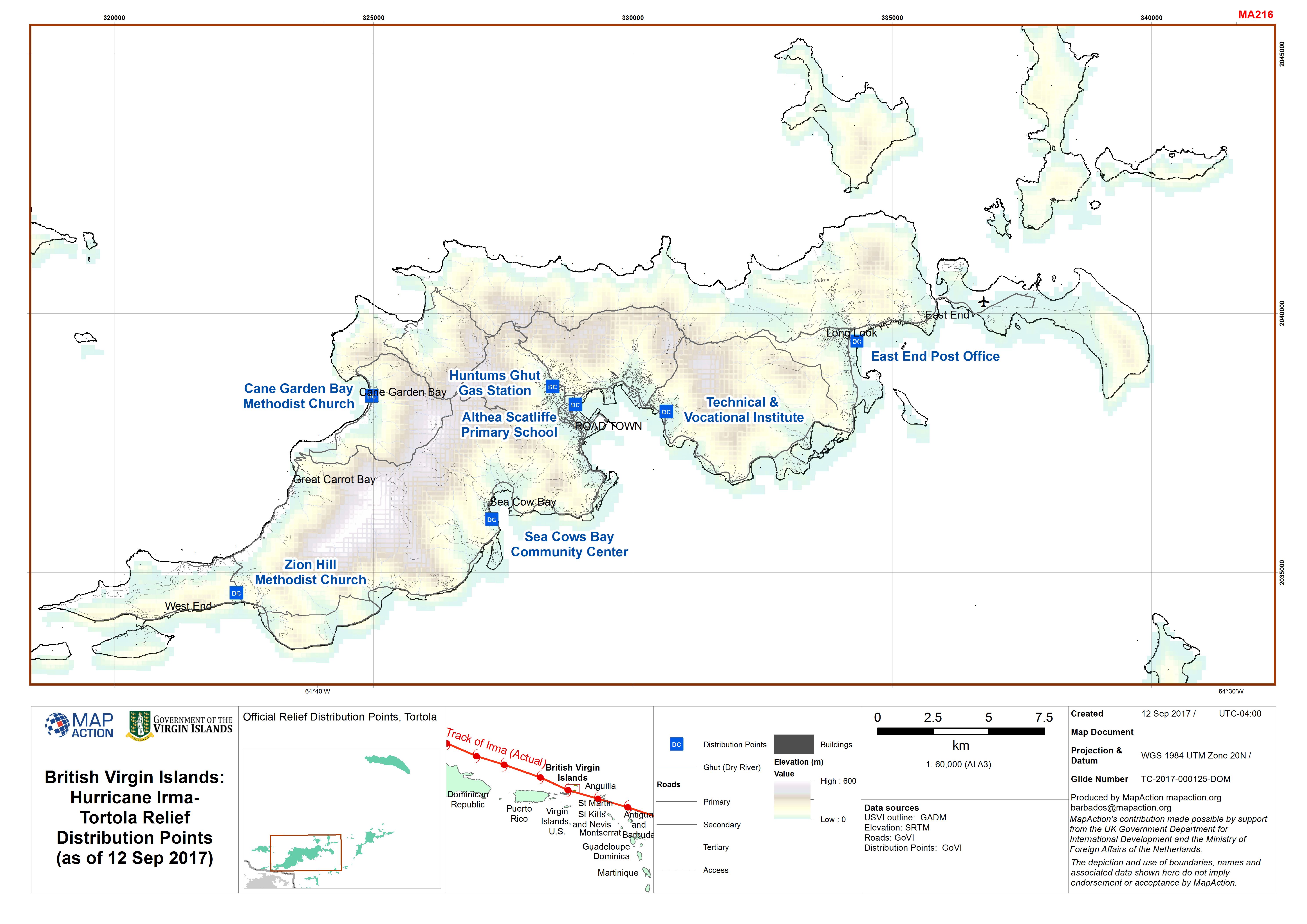
British Virgin Islands: Hurricane Irma- Tortola Relief Distribution Points (a...
Official Relief Distribution Points, Tortola -

Sierra Leone Landslide/floods - Operations/Logistics (as of 23 Aug 2017)
Map shows key operational locations and the activies being conducted at each site. Points of Interest relevant to the operational setting are also provided. -
Sierra Leone Landslide/floods - Operations/Logistics (as of 23 Aug 2017)
Map shows key operational locations and the activies being conducted at each site. Points of Interest relevant to the operational setting are also provided. -
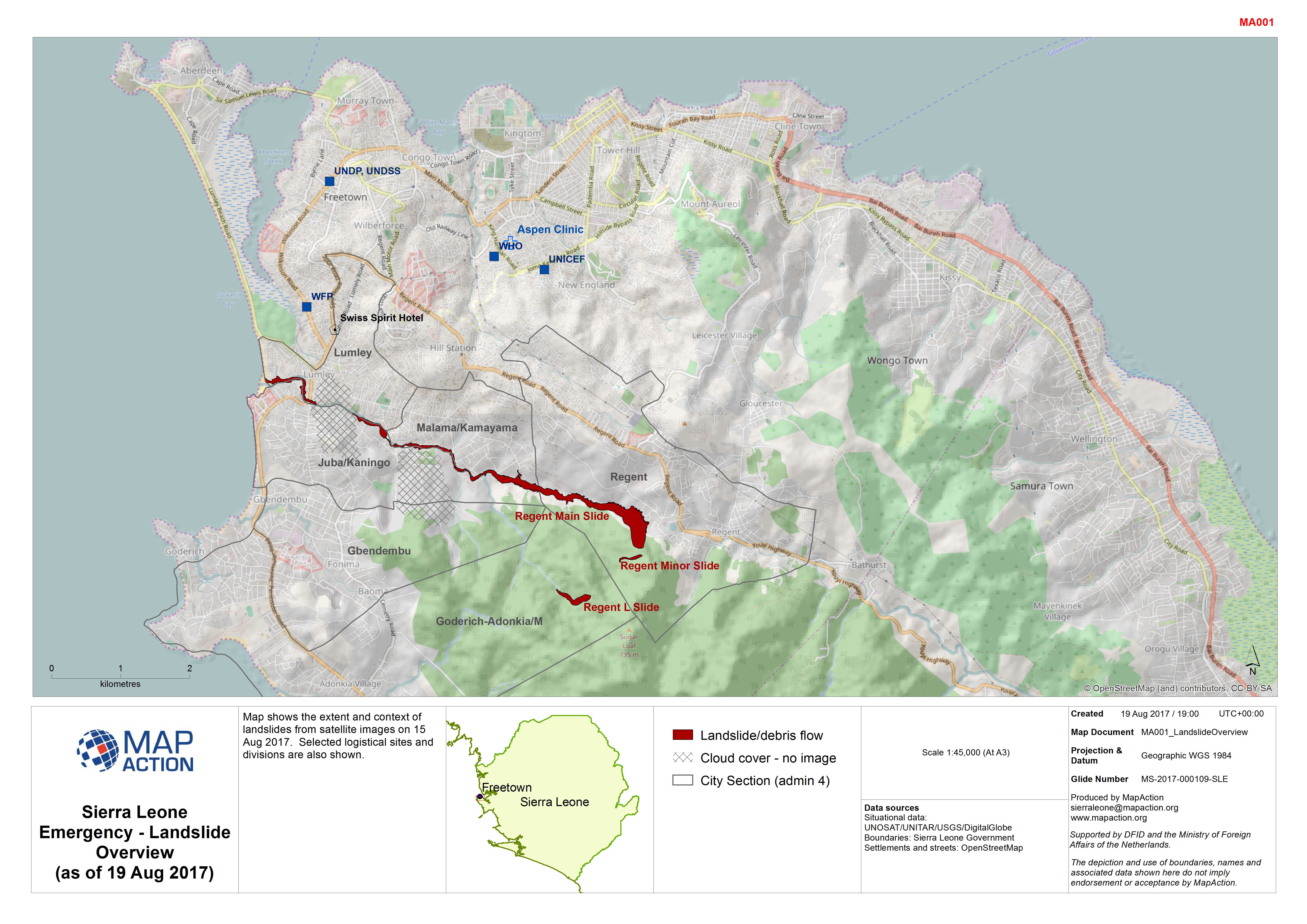
Sierra Leone Emergency - Landslide Overview (as of 19 Aug 2017)
Map shows the extent and context of landslides from satellite images on 15 Aug 2017. Selected logistical sites and divisions are also shown. -

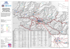
Ecuador: Earthquake - Road and Airport Status (as of 18 April 2016)
Map shows the reported status of roads (as of 18 April 2016) and airports (as of 17 April 2016) following the earthquake. -
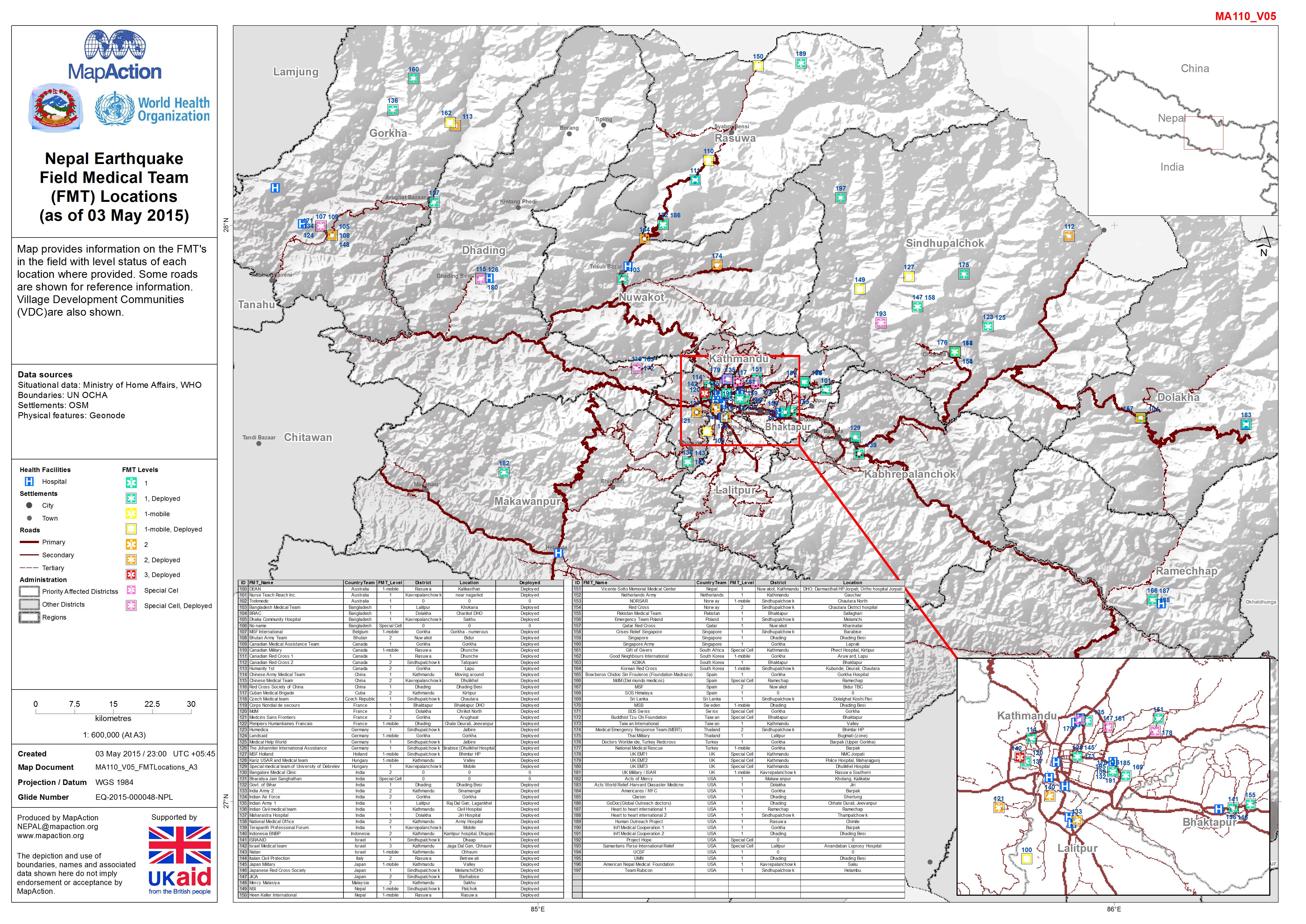
Nepal: Earthquake - Field Medical Team (FMT) Locations (as of 03 May 2015)
Map provides information on the FMT's in the field with level status of each location where provided. Some roads are shown for reference information. Village Development... -
Philippines Typhoon Haiyan (Yolanda): Radio Stations in operation (06-Dec-2013)
Map shows radio stations that are currently operating with approximate coverage areas. -

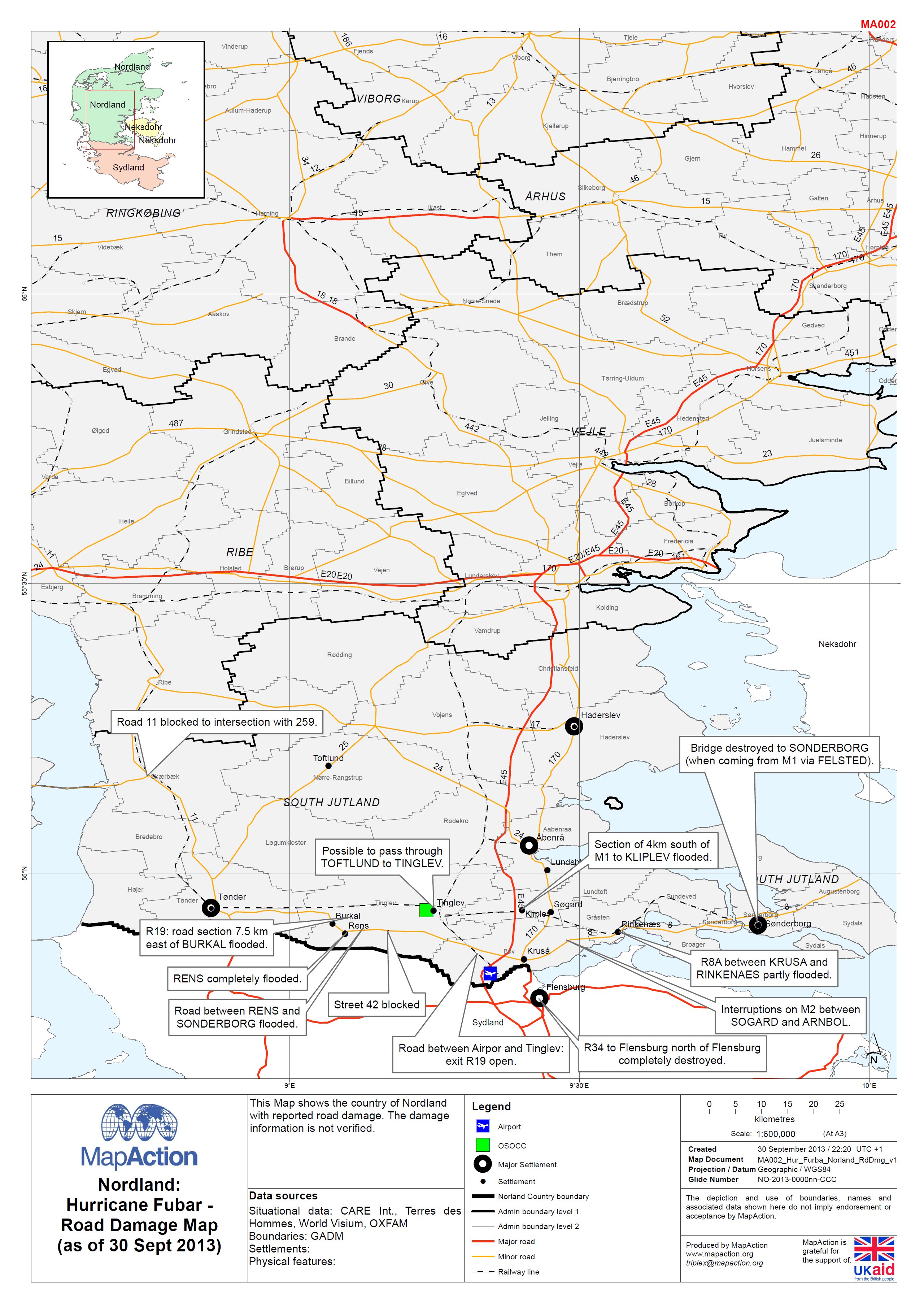
EXERCISE - Norldand: Hurricane FUBAR - Road Damage Map (as of 30 Sept 2013)
This map shows the country of Nordland with reported road damage. The damage information is not verified. -

Serbia: Floods - UNDAC Assessment of Logistics Capacity, 26 May 2014
UNDAC logistics capacity assessment mission, conducted 26/5/14. Refer to assessment report for results and full details. Route: Belgrade - Kolari - Pozarevac - Petrovac - Velika... -
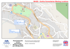
Nepal: Earthquake - Gorkha Humanitarian Meeting Locations (as of 08-May-2015)
Map shows the current meeting locations in use by the OCHA Humanitarian team.Basemap - Openstreetmap