-

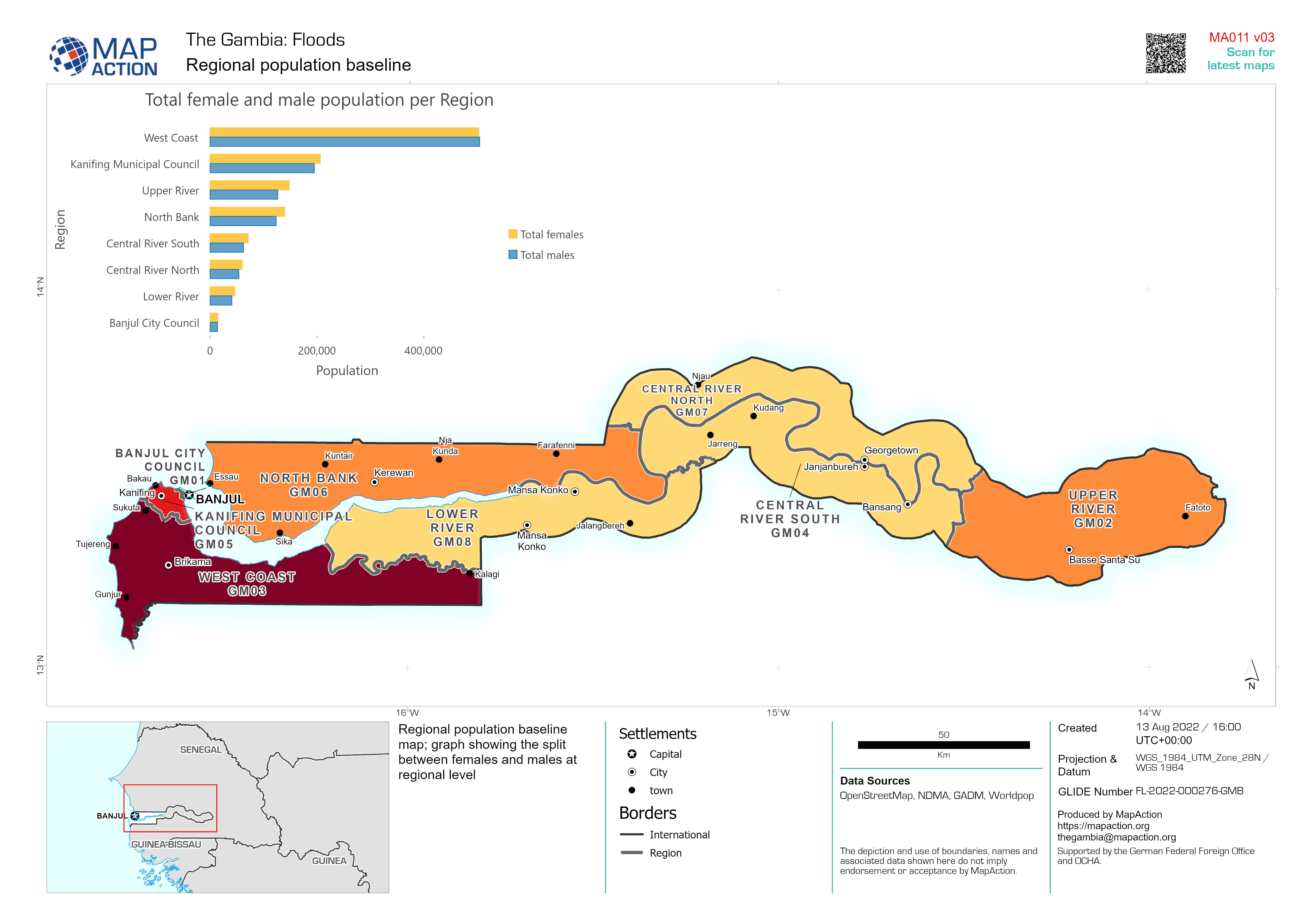
Regional population baseline
Regional population baseline map; graph showing the split between females and males at regional level -
District population baseline
District population baseline and graph shows the split between females and males -
Regional population baseline
Regional population baseline and graph shows the split between females and males -

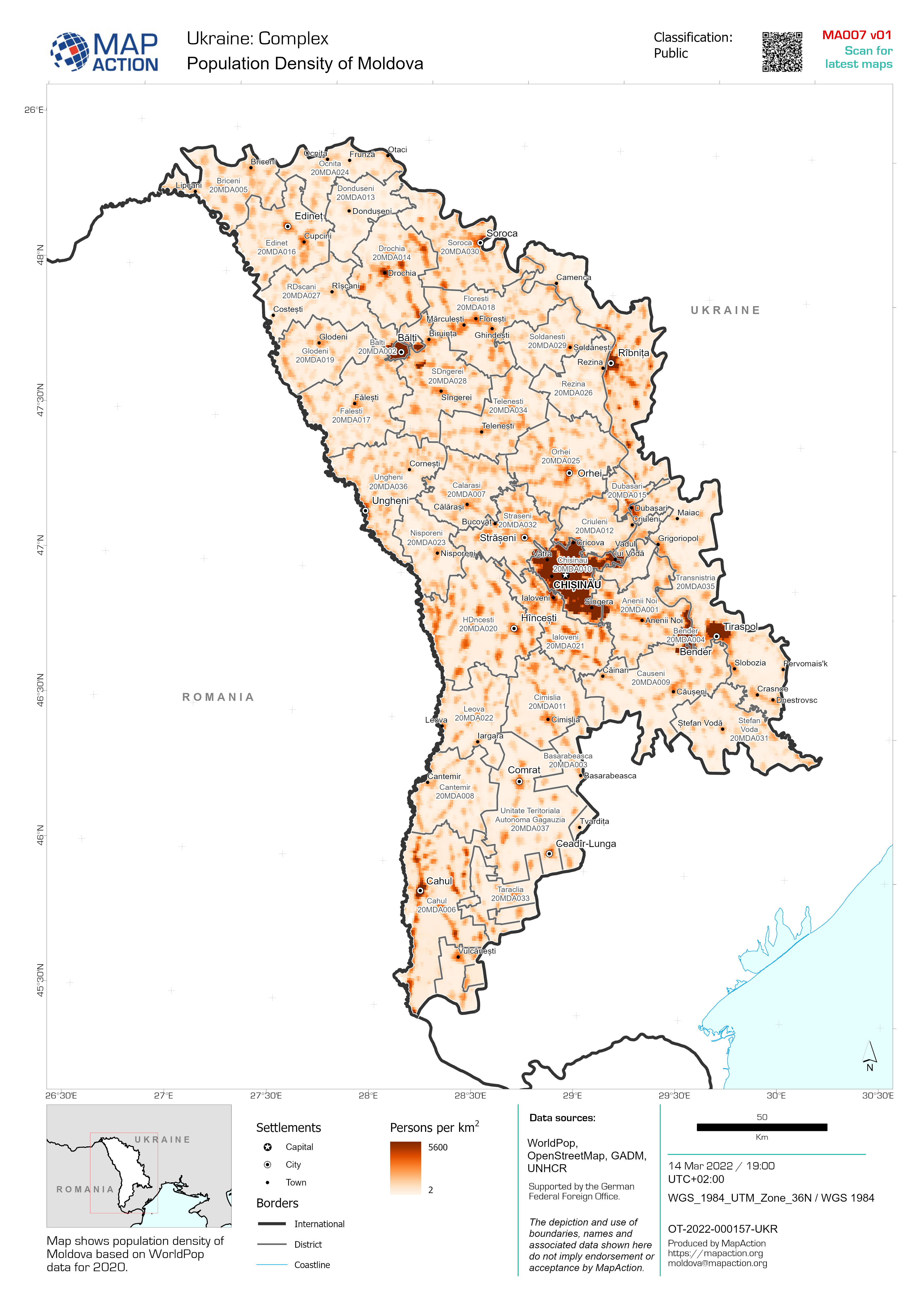
Population Density of Moldova
Map shows population density of Moldova based on WorldPop data for 2020. -

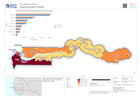
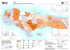
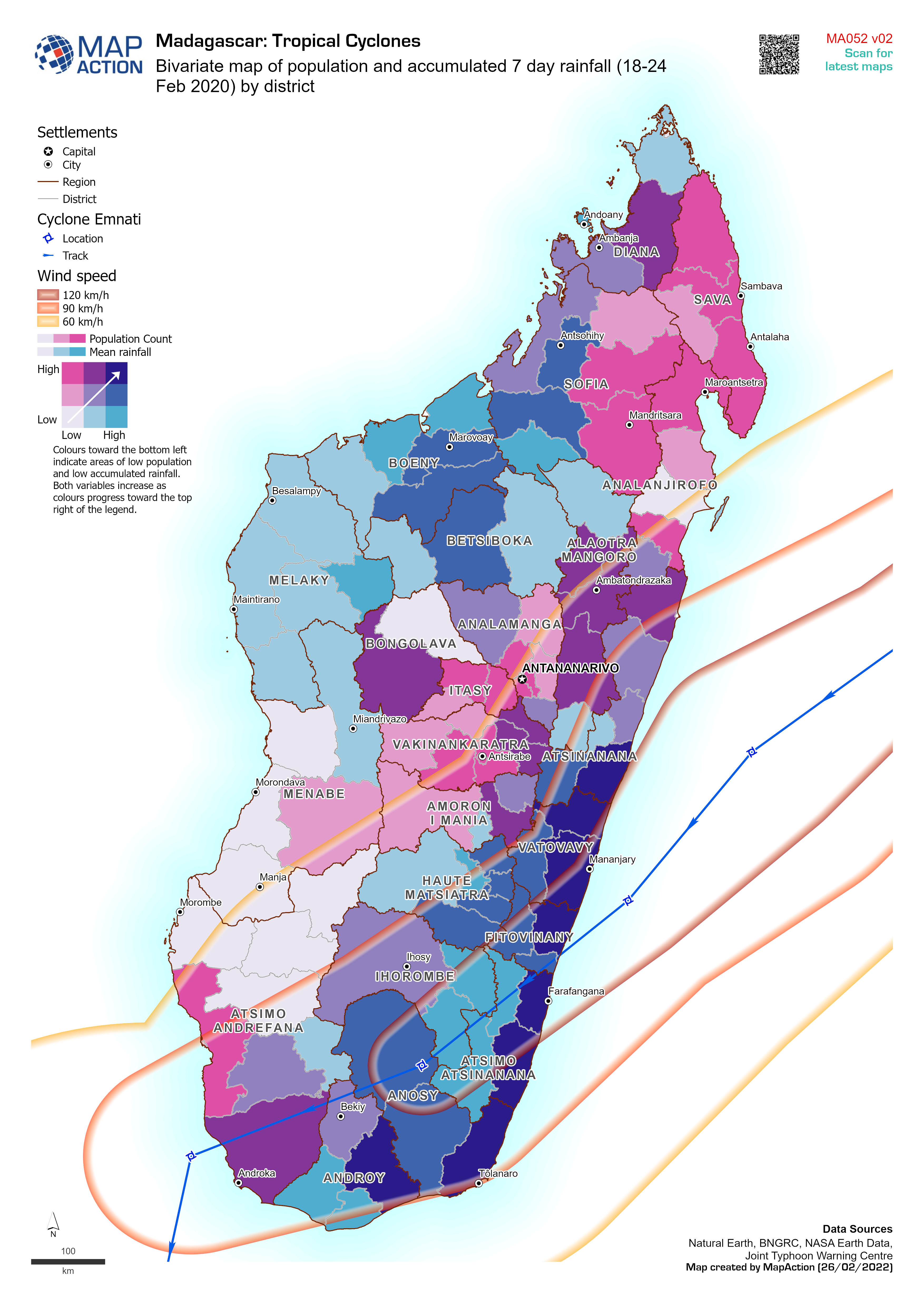
Bivariate map of population and accumulated 7 day rainfall (18-24 Feb 2020) b...
Bivariate map of population (2018 estimate) and accumulated 7 day rainfall (18-24 Feb 2022) by district. Storm track for cyclone Emnati is based on Joint Typhoon Warning Centre... -

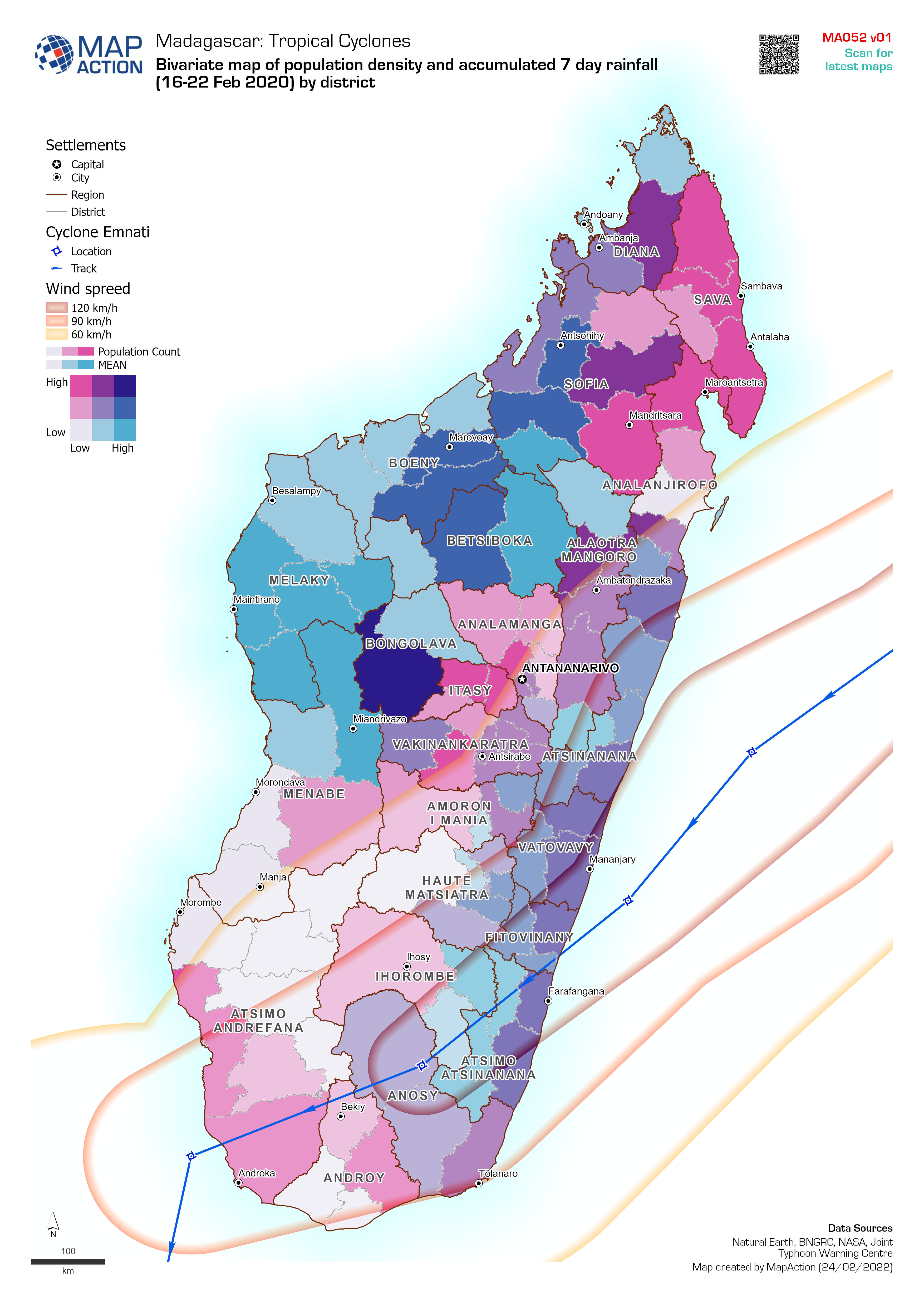
Bivariate map of population density and accumulated 7 day rainfall (16-22 Feb...
Bivariate map of population density (2018 estimate) and accumulated 7 day rainfall (16-22 Feb 2022) by district. Storm track for cyclone Emnati is based on Joint Typhoon Warning... -

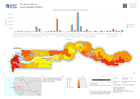
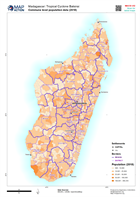
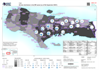
Storm path for cylones Batsirai and Emnati (as of 24 Feb 2022) with populatio...
Storm path for cyclones Batsirai (actual on 6 Feb 2022) and Emnati (predicted as of 24 Feb 2022) with population density (2020 estimate) All forecasted storm positions, path... -

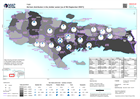
Storm path for cylones Batsirai (actual) and Emnati (predicted as of 23 Feb 2...
Storm path for cyclones Batsirai (actual on 6th Feb 2022) and Emnati (predicted as of 23 Feb 2022) with population density (2020 estimate) All forecasted storm positions, path... -

Storm path for cylones Batsirai (actual) and Emnati (predicted as of 22 Feb 2...
Storm path for cyclones Batsirai (actual on 6th Feb 2022) and Emnati (predicted as of 22 Feb 2022) with population density (2020 estimate) All forecasted storm positions, path... -

Storm path for cyclones Batsirai (actual) and Emnati (predicted as of 22 Feb ...
Storm path for cylones Batsirai (actual on 6th Feb 2022) and Emnati (predicted as of 22 Feb 2022) with population density (2020 estimate) All forecasted storm positions, path... -
Storm path for cylones Batsirai (actual) and Emnati (predicted as of 22 Feb 2...
Storm path for cyclones Batsirai (actual on 6th Feb 2022) and Emnati (predicted as of 22 Feb 2022) with population density (2020 estimate) All forecasted storm positions, path... -

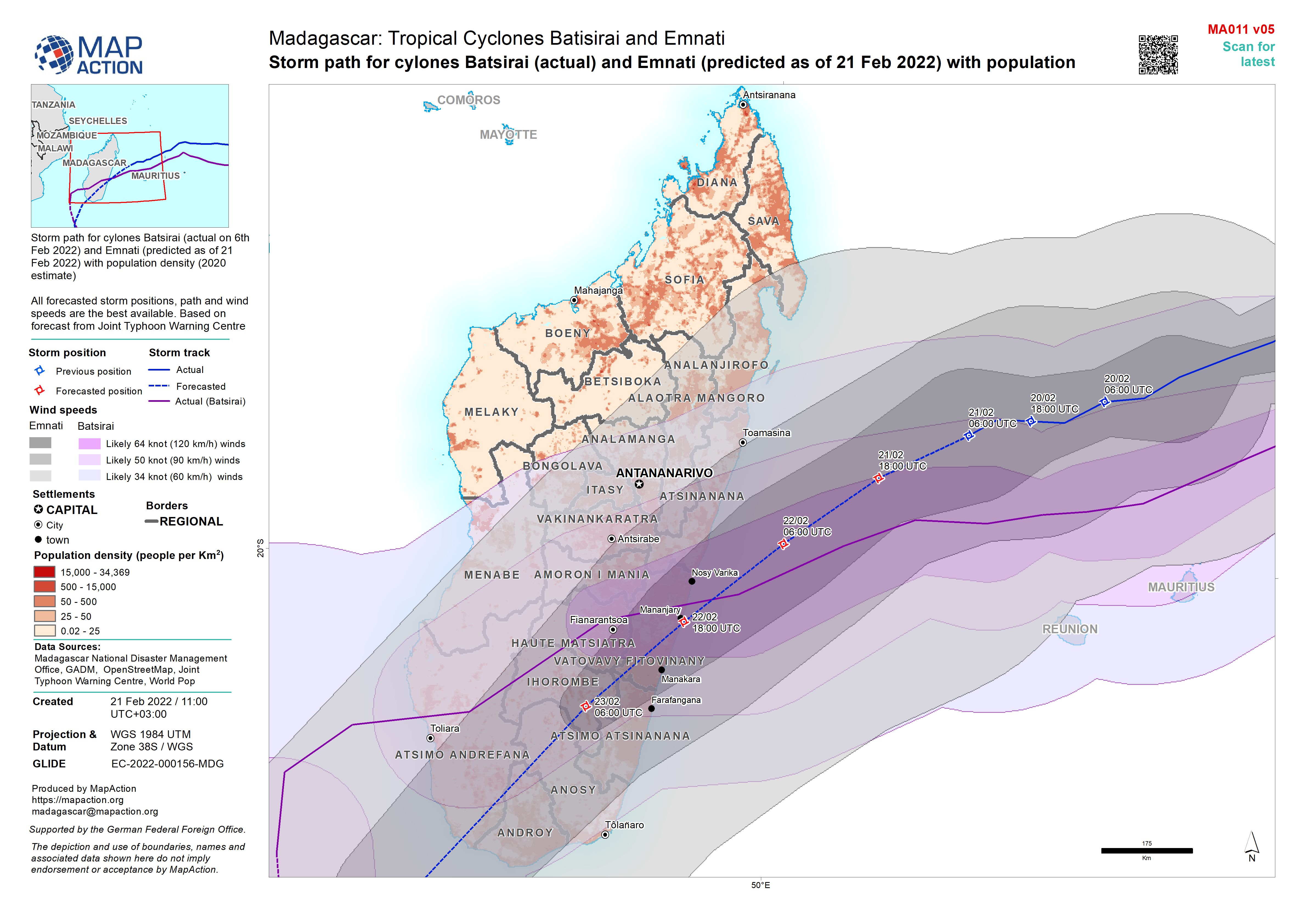
Storm path for cylones Batsirai (actual) and Emnati (predicted as of 21 Feb 2...
Storm path for cylones Batsirai (actual on 6th Feb 2022) and Emnati (predicted as of 21 Feb 2022) with population density (2020 estimate) All forecasted storm positions, path... -

Storm path for cylones Batsirai (actual) and Emnati (predicted as of 19 Feb 2...
Storm path for cylones Batsirai (actual on 6th Feb 2022) and Emnati (predicted as of 19 Feb 2022) with population density (2020 estimate) All forecasted storm positions, path... -
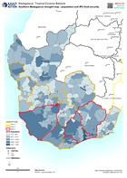
Southern Madagascar drought map - population and IPC food security
Map of southern madagascar -
-
Number of persons with disabilities per Commune
Map shows the total number of persons with disabilities per Commune and, where available, disaggregated by age and gender. -
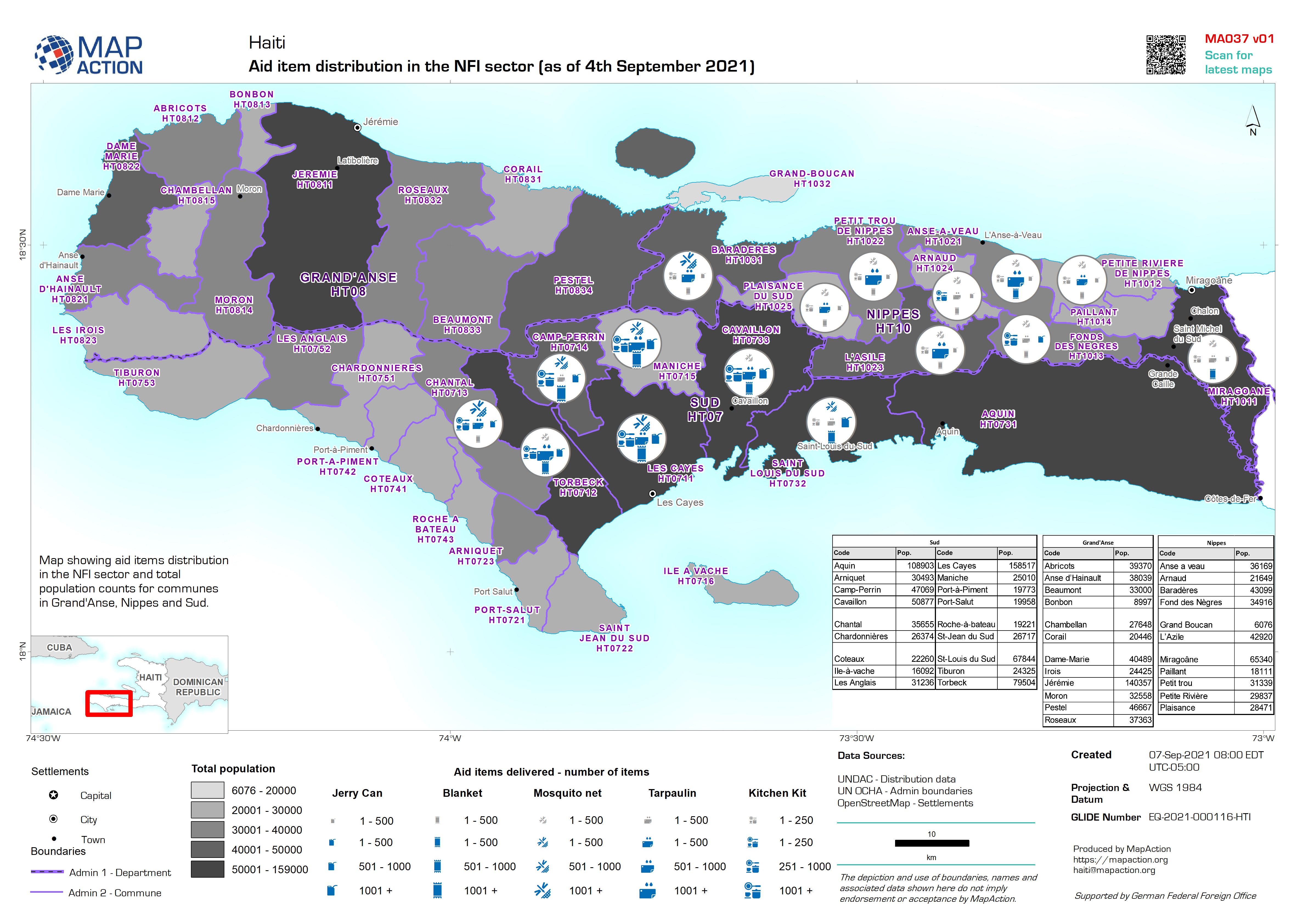
Aid item distribution in the NFI sector (as of 4th September 2021)
Map showing aid items distribution in the NFI sector and total population counts for communes in Grand'Anse, Nippes and Sud. -

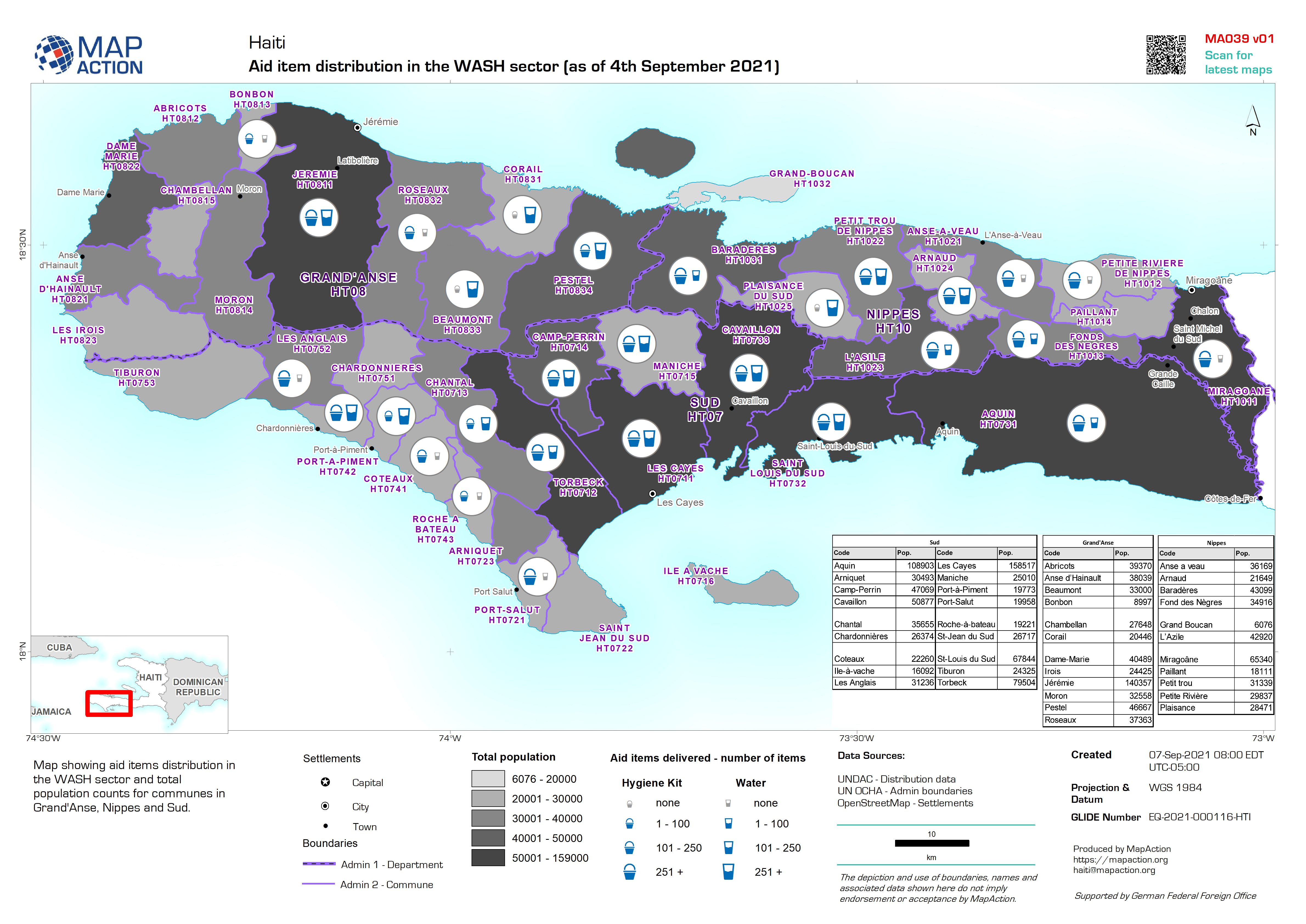
Aid item distribution in the WASH sector (as of 4th September 2021)
Map showing aid items distribution in the WASH sector and total population counts for communes in Grand'Anse, Nippes and Sud. -
Aid item distribution in the shelter sector (as of 4th September 2021)
Map showing aid items distribution in the shelter sector and total population counts for communes in Grand'Anse, Nippes and Sud.