-
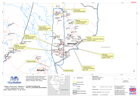
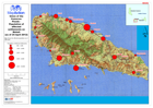
Malawi: Floods - Results of UNDAC assessement of East Bank, Nsanje District, ...
The East Bank area of north Nsanje District, Malawi, showing results of a rapid assessment undertaken by UNDAC teams on 19 January 2015 in response to recent flooding. -

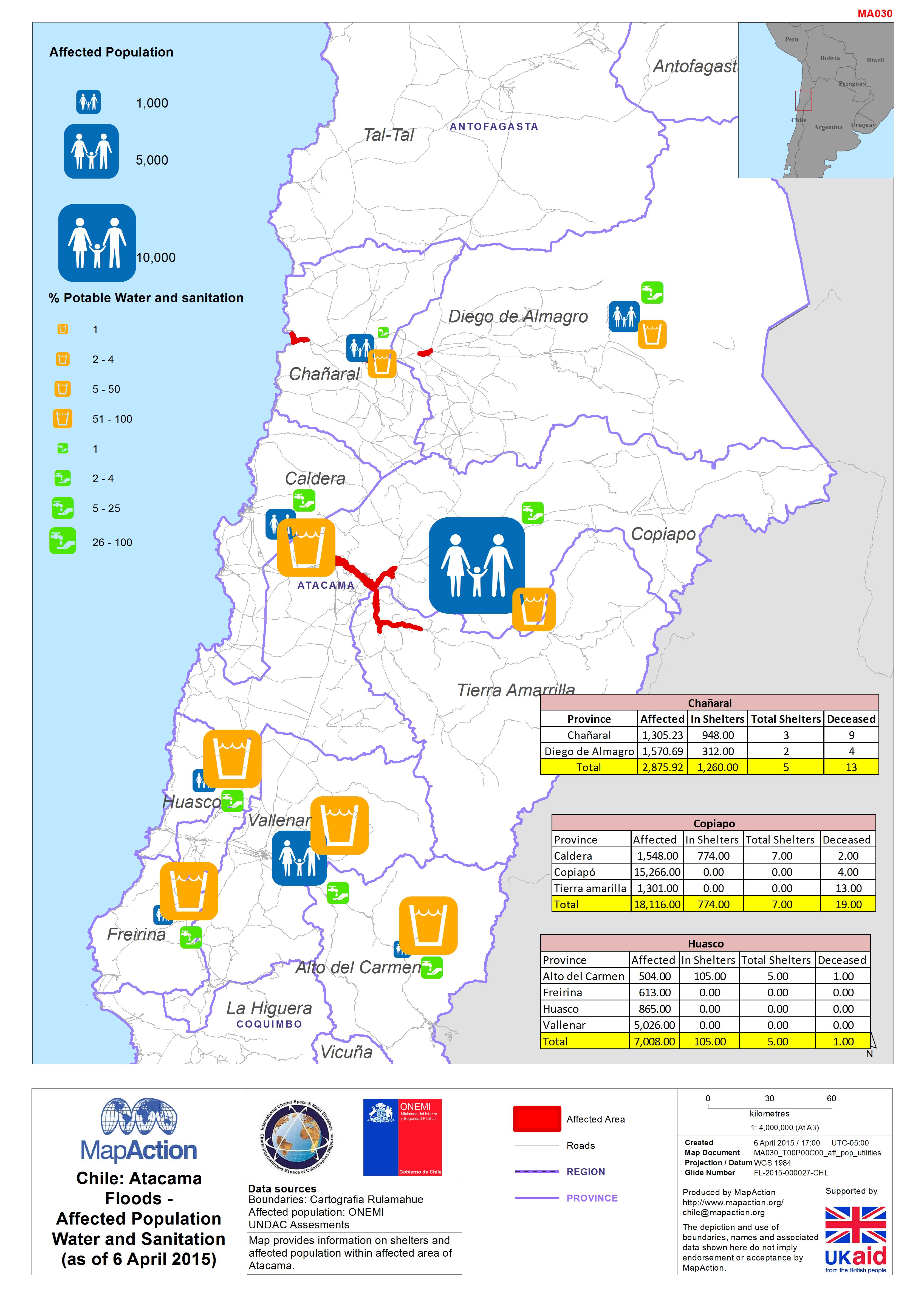
Chile: AtacamaFloods -Affected PopulationWater and Sanitation(as of 6 April 2...
Map provides information on shelters and affected population within affected area of Atacama. -

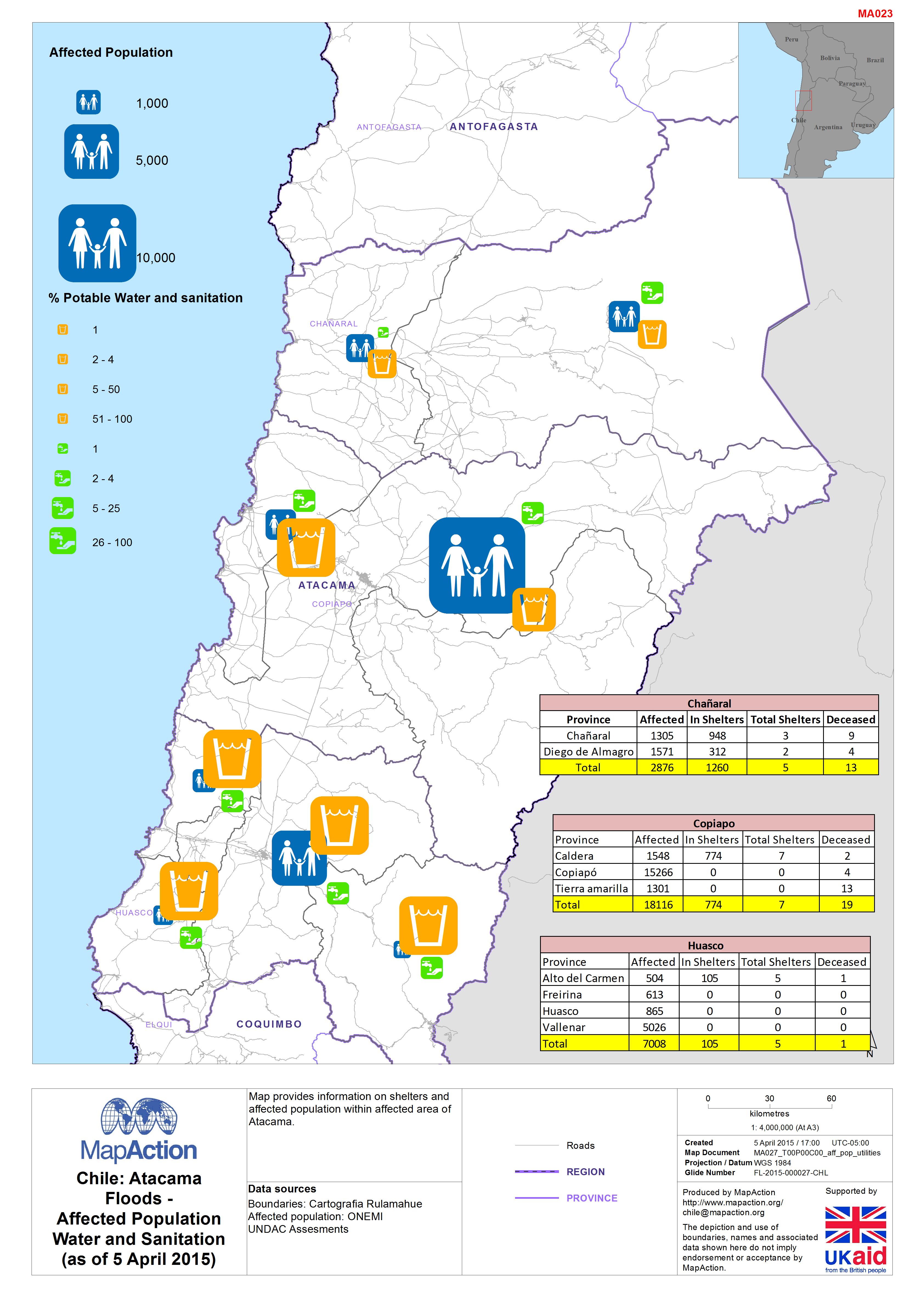
Chile: AtacamaFloods -Affected PopulationWater and Sanitation(as of 5 April 2...
This dataset has no description
-

Vanuatu: Cyclone PAM - Assessments completed (as of 19 March 2015)
Overview of assessment locations for each assessment team on 18th and 19th Mar 2015. -
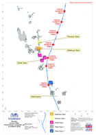
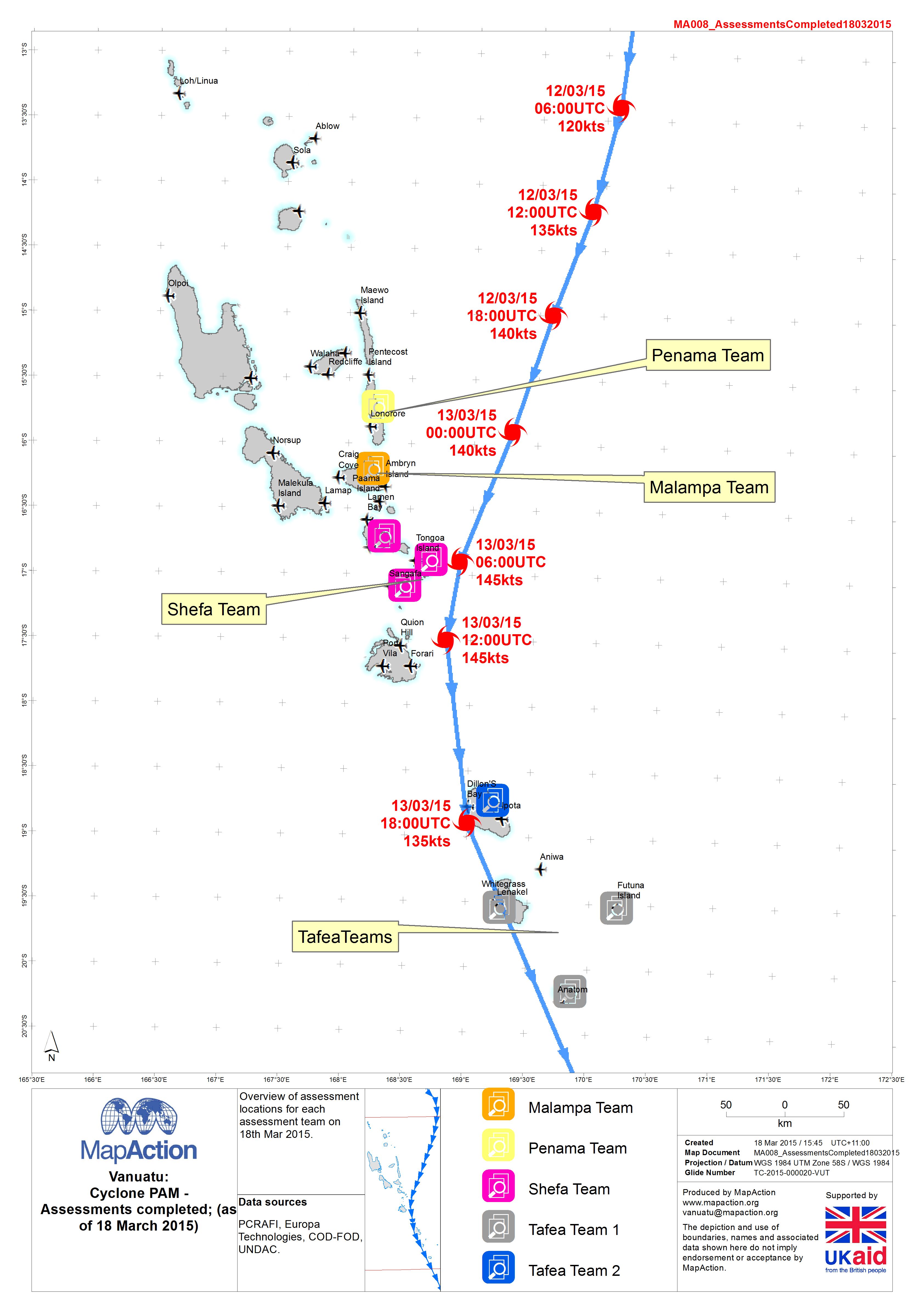
Vanuatu: Cyclone PAM - Assessments completed (as of 18 March 2015)
Overview of assessment locations for each assessment team on 18th Mar 2015. -

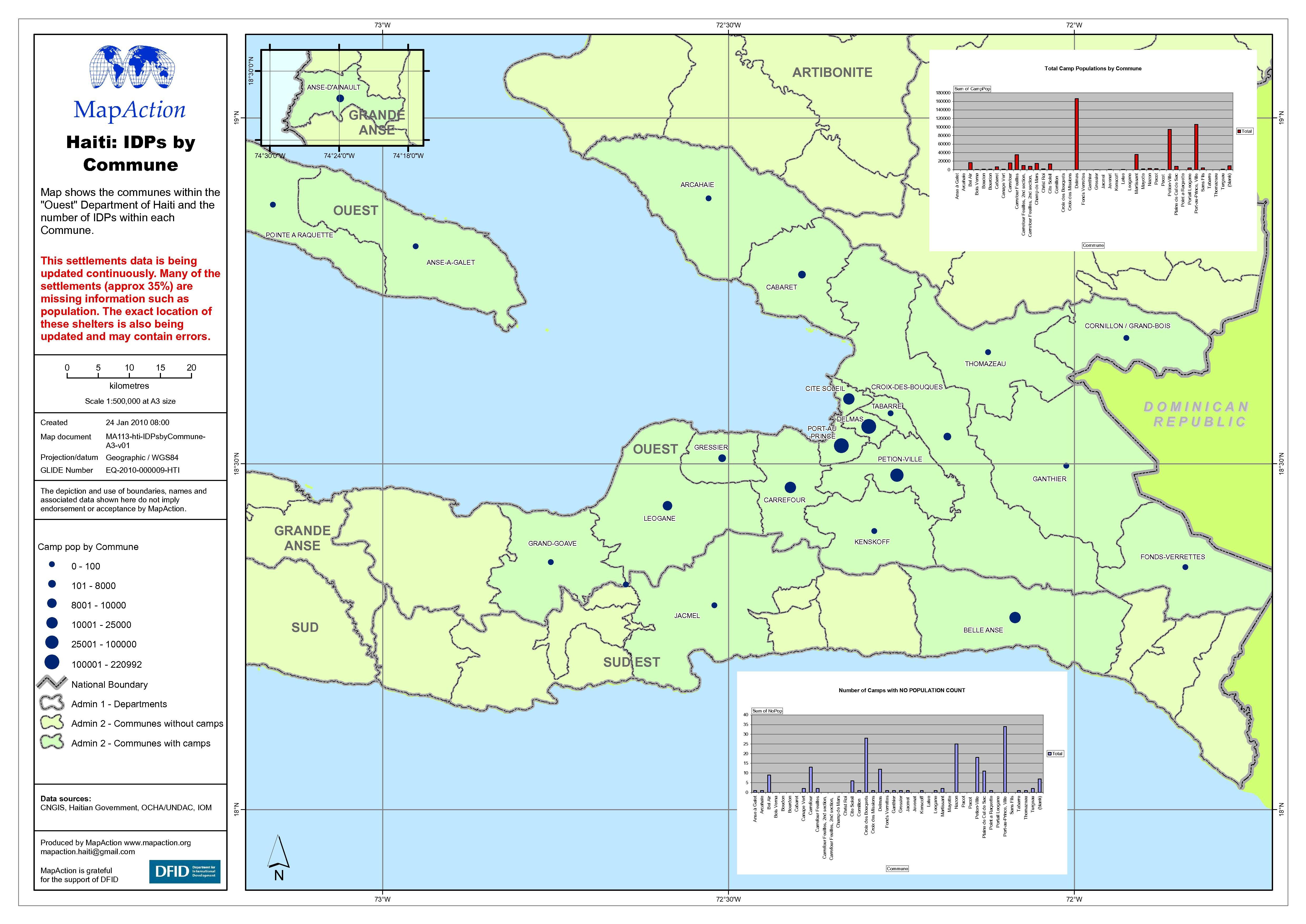
Haiti: IDP numbers by Commune
Map shows the Communes within the Ouest Department of Haiti and the number of internally displaced persons (IDPs) within each Commune. -

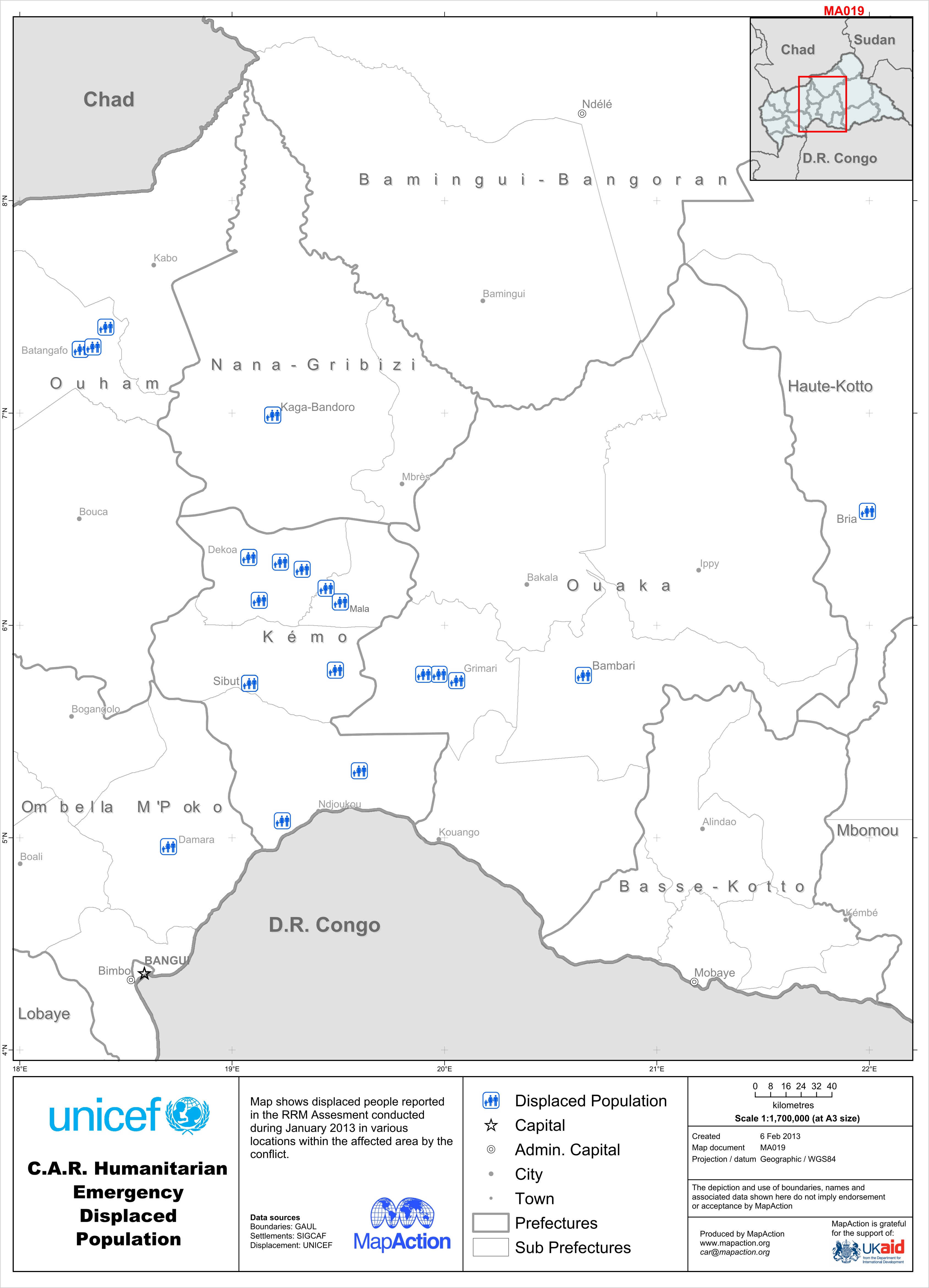
C.A.R. Humanitarian Emergency Displaced Population Version 2
Map shows displaced people reported in the RRM Assesment conducted during January 2013 in various locations within the affected area by the conflict. -

C.A.R. Humanitarian Emergency Displaced Population
Map shows displaced people reported in the RRM Assesment conducted during January 2013 in various locations within the affected area by the conflict. -

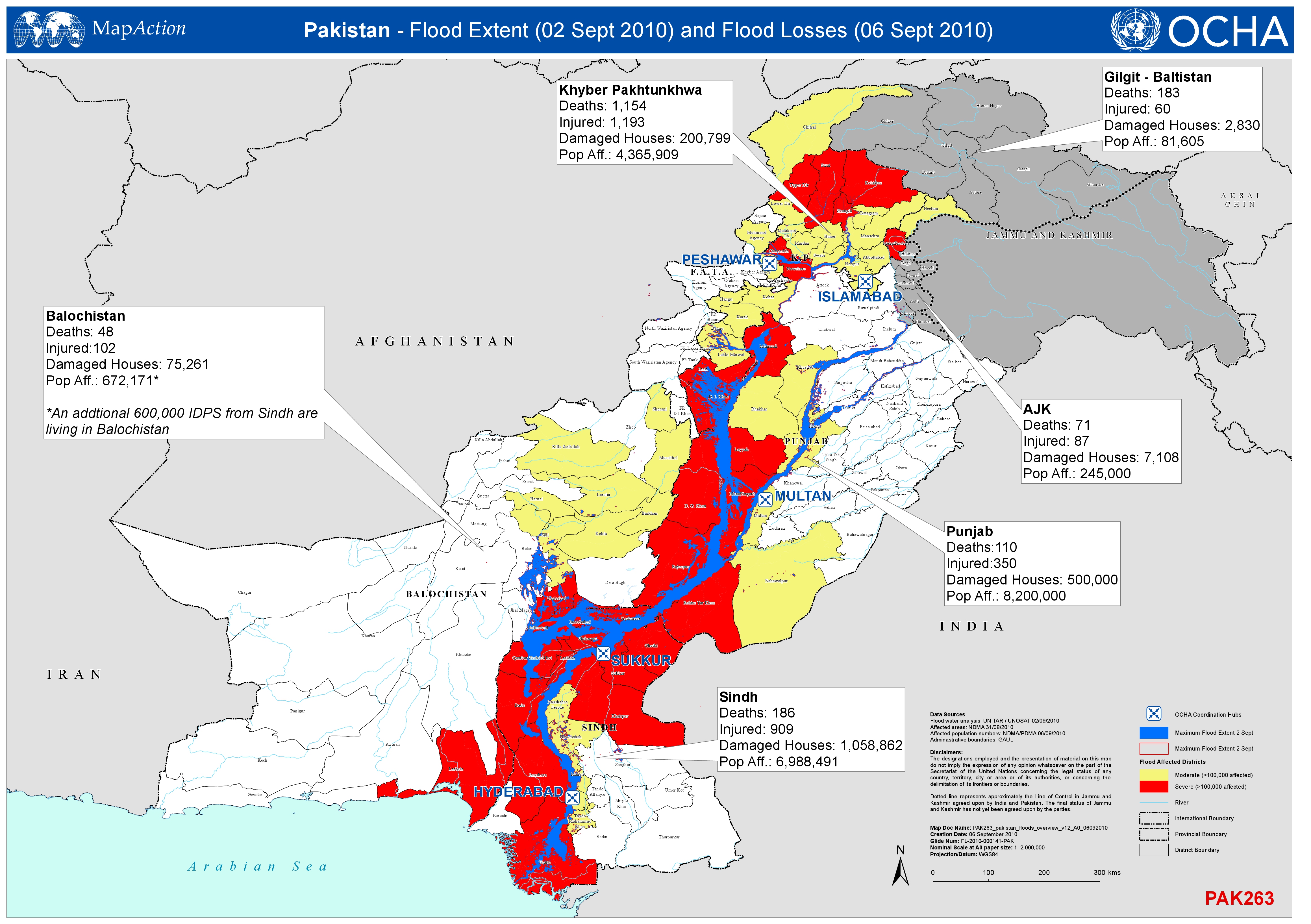
Pakistan - Flood Extent (2 Sept 2010) and Flood Losses (6 Sept 2010)
Shows the extent of the flood (2nd Sept 2010) and the numbers of deaths, injured persons, damaged houses and affected population by Province ( 6th Sept 2010). -

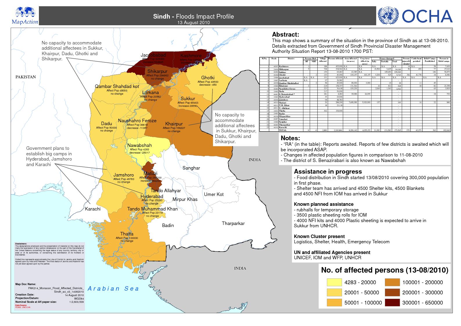
Sindh Overview - Flood Extent and Situational Information
Shows the Maximum Flood Extent and Situational Information in Sindh Province as of 05 Sept 2010. -
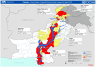
Pakistan Floods Overview - Extent and Losses
Shows the extent of the flood (2nd Sept 2010) and the numbers of deaths, injured persons, damaged houses and affected population by Province (3rd Sept 2010). -

-

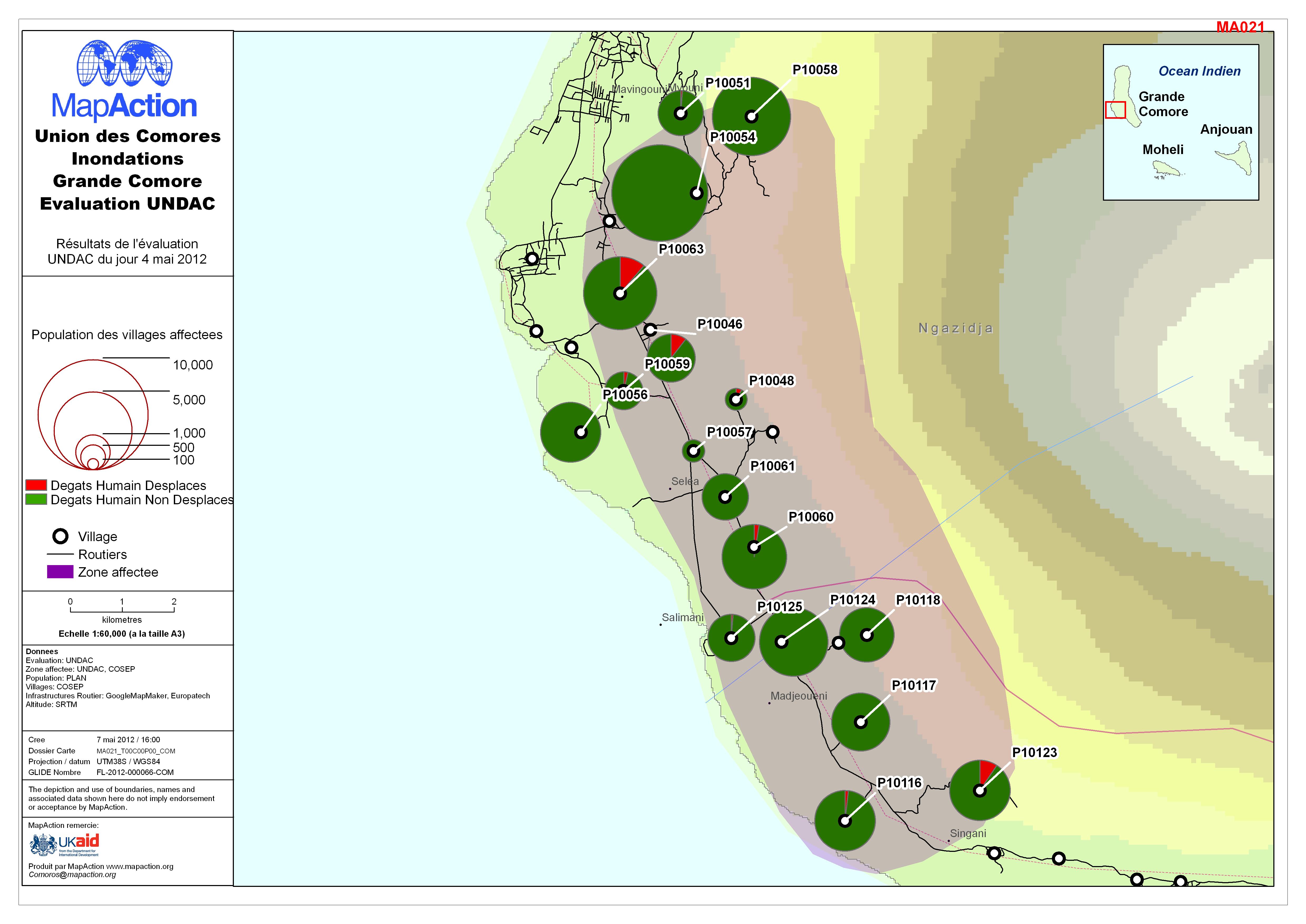
Union des Comores Inondations Grande Comore Evaluation UNDAC
UNDAC Assessment: Affected population on the western side of Grande Comore Island (in French) -
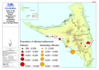
Union of the Comoros: Floods - Population of affected settlements on Anjouan ...
Map showing the population of affected settlements on Anjouan (as of 25 April 2012) -
Union of the Comoros: Floods - Population of affected settlements on Moheli (...
Map shows population numbers in affected settlements on the island of Moheli. -

Union of the Comoros: Floods - Population of Affected Villages on Grande Comore
Map shows population numbers in villages affected by flooding - Grande Comore. (25 May 2012) -

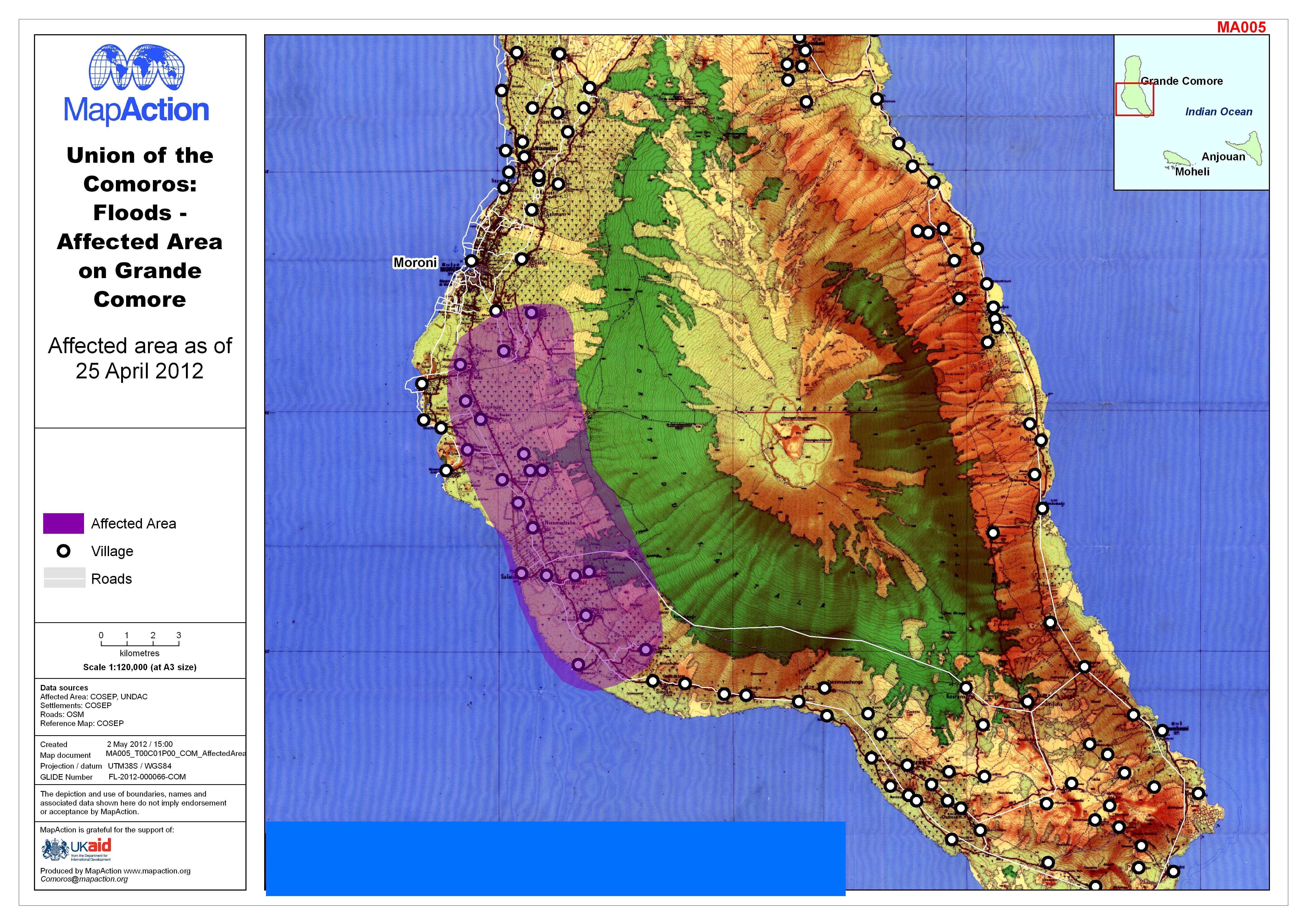
Union of the Comoros: Floods - Affected Area on Grande Comore
Map shows area affected by flooding on Grande Comore, as of 25 April 2012 -

Union of the Comoros: Floods - Population of affected settlements on Moheli (...
Map shows the affected population as of 25th April -
Libya: Complex - Individuals by nationality entering Tunisia from Libya at Ra...
Map shows the approximate total number of people, by nationality, entering Tunisia at the Ras Ajdir road border crossing. Totals are for the period 20 Feb 2011 to midnight, 12... -

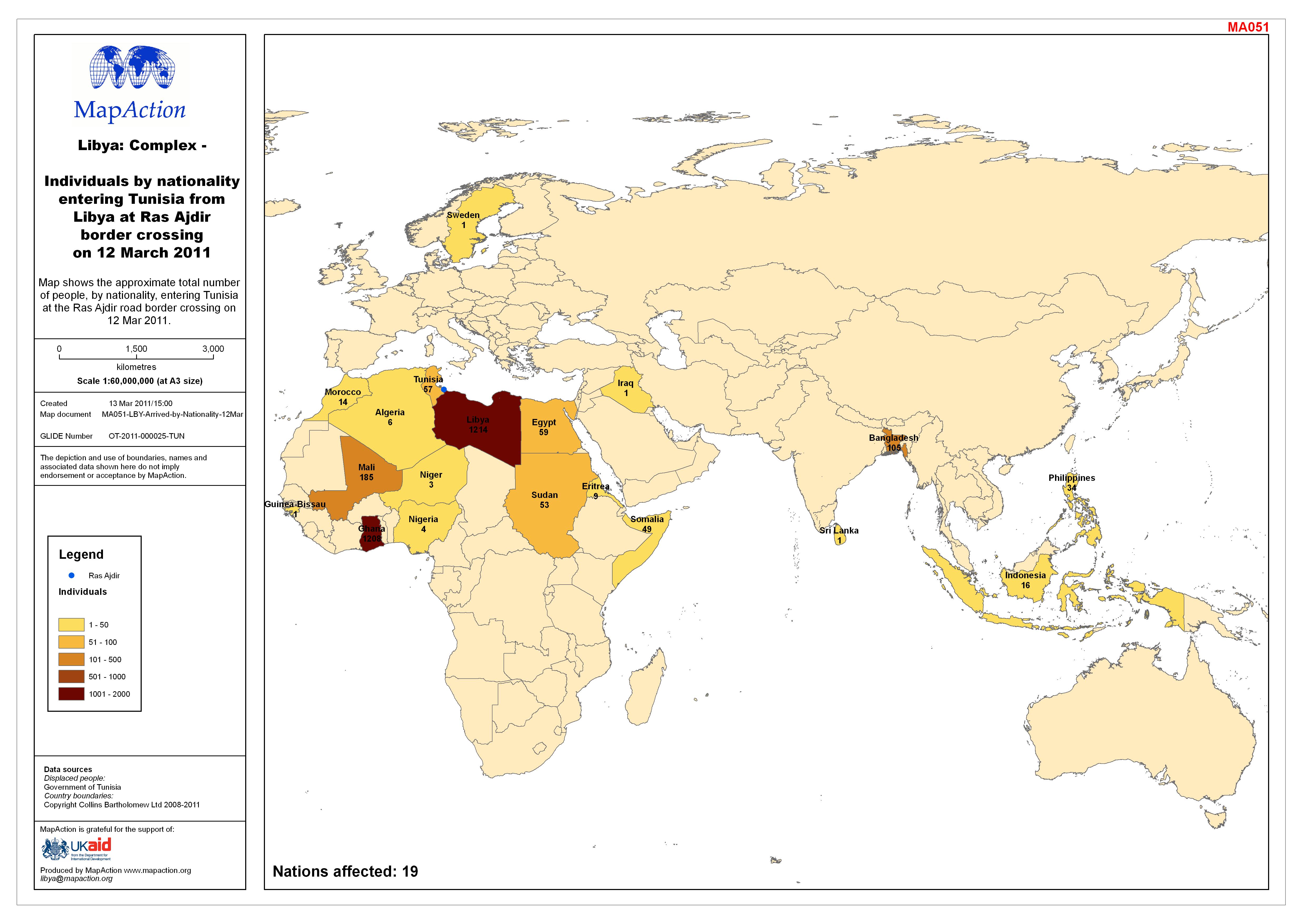
Libya: Complex - Individuals by nationality entering Tunisia from Libya at Ra...
Map shows the approximate total number of people, by nationality, entering Tunisia at the Ras Ajdir road border crossing on 12 Mar 2011.