-

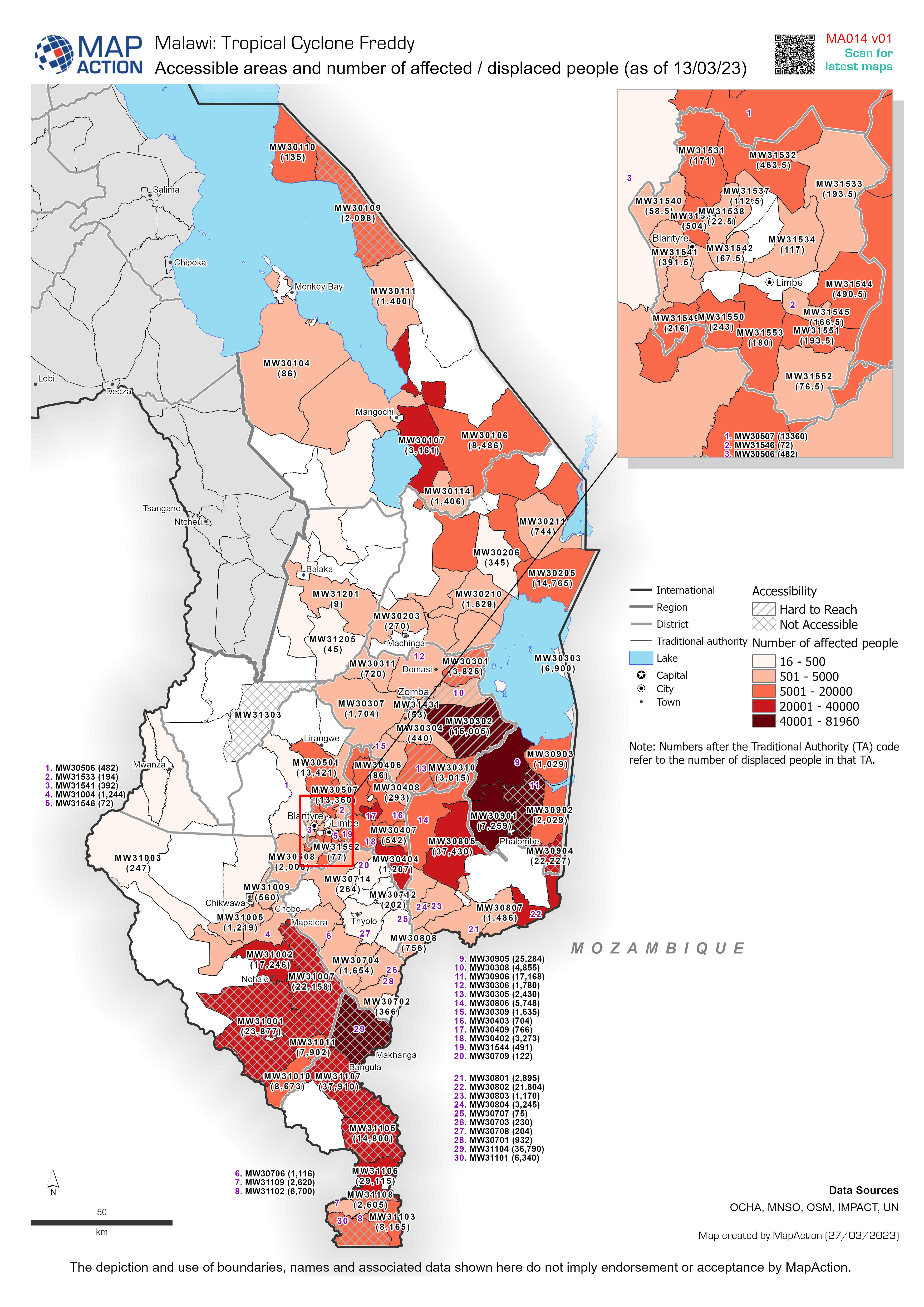
Accessible areas and number of affected / displaced people (as of 13/03/23)
Accessible areas and number of affected and displaced people (as of 13/03/23) -

Active fault lines, earthquake epicentres, and aftershocks over 4.5 magnitude...
Map showing earthquake epicentre locations and subsequent M4.5 and over aftershocks up until the 14th Feb 13:00. Earthquake data downloaded form USGS. Active fault lines... -

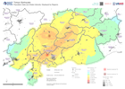
District (Level 2 Admin Boundaries) with Earthquake Intensity:
District (Level 2 Administrative Boundaries) with earthquake intensity from earthquakes on 6th Feb 2023 -
Population Data and Shake Intensity: Displayed by Regions
This map shows the region extent of the earthquake that happened in Turkey on the 6th of February. The map displays the population density in 1 kilometer grids and shake... -

Municipalities affected by flooding (as of 31 Jan 2023)
Municipalities affected by flooding (as of 31 Jan 2023) -

Flood extents and affected population estimates for 12 - 21 July and 01 - 29 ...
Flood extents for 12 - 21 July and 01 - 29 August as detected by UNOSAT and estimates of population affected based upon Worldpop data for 2020 -

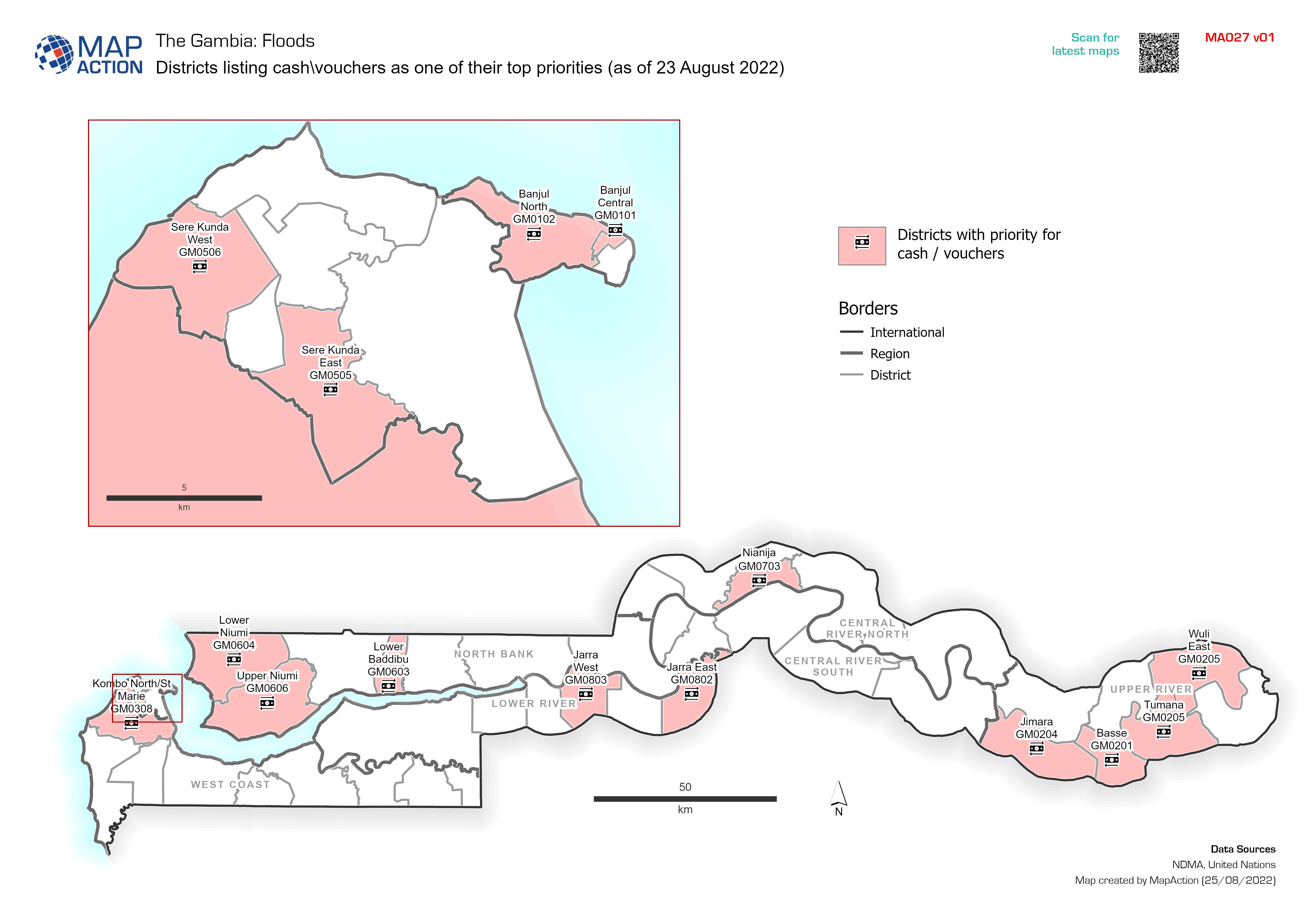
Districts listing cash\vouchers as one of their top priorities (as of 23 Augu...
Districts citing cash\vouchers as one of their top priorities (as of 23 August 2022). Data taken from MIRA -

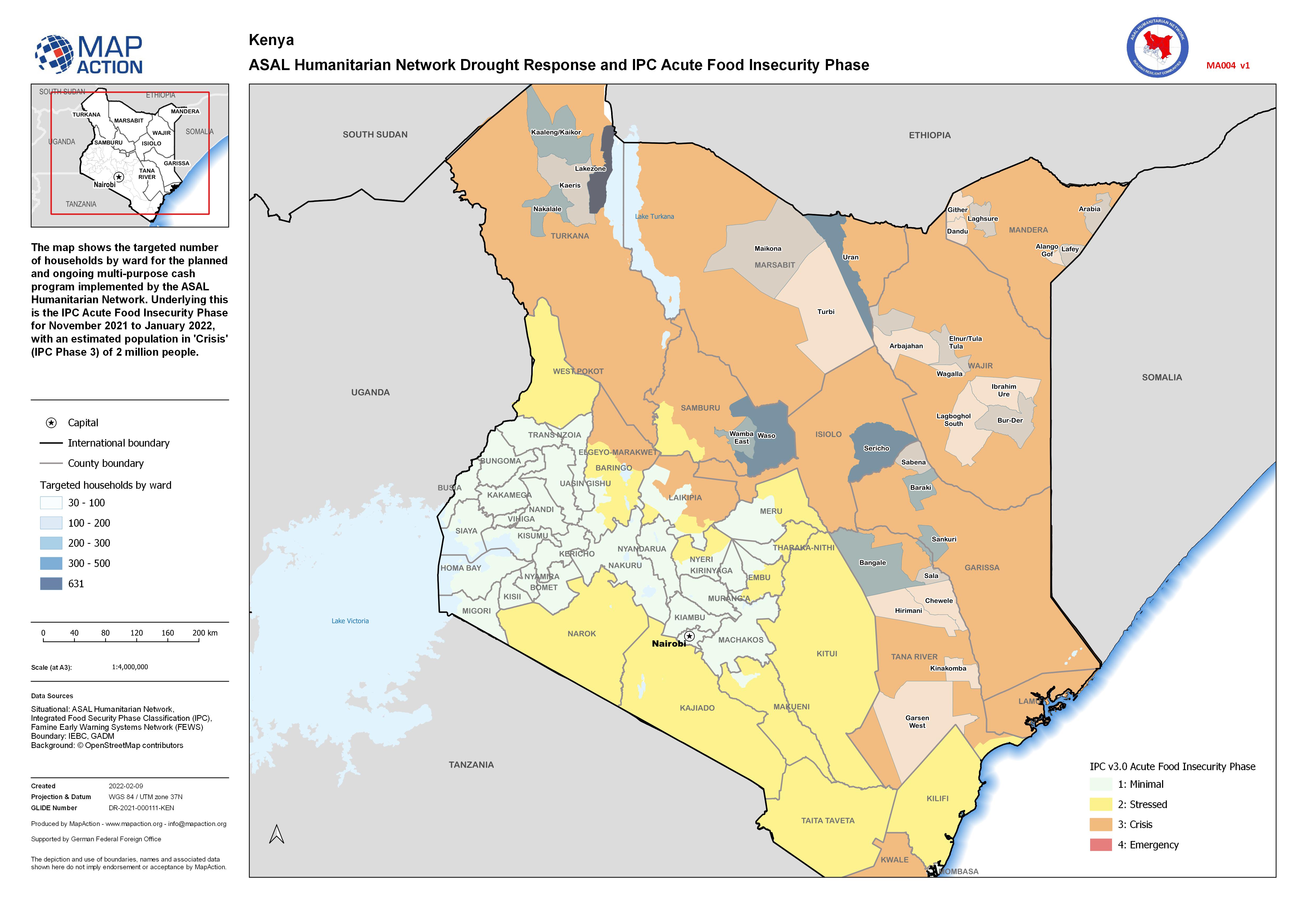
ASAL Humanitarian Network Drought Response and IPC Acute Food Insecurity Phase
The map shows the targeted number of households by ward for the planned and ongoing multi-purpose cash program implemented by the ASAL Humanitarian Network. Underlying this is... -

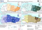
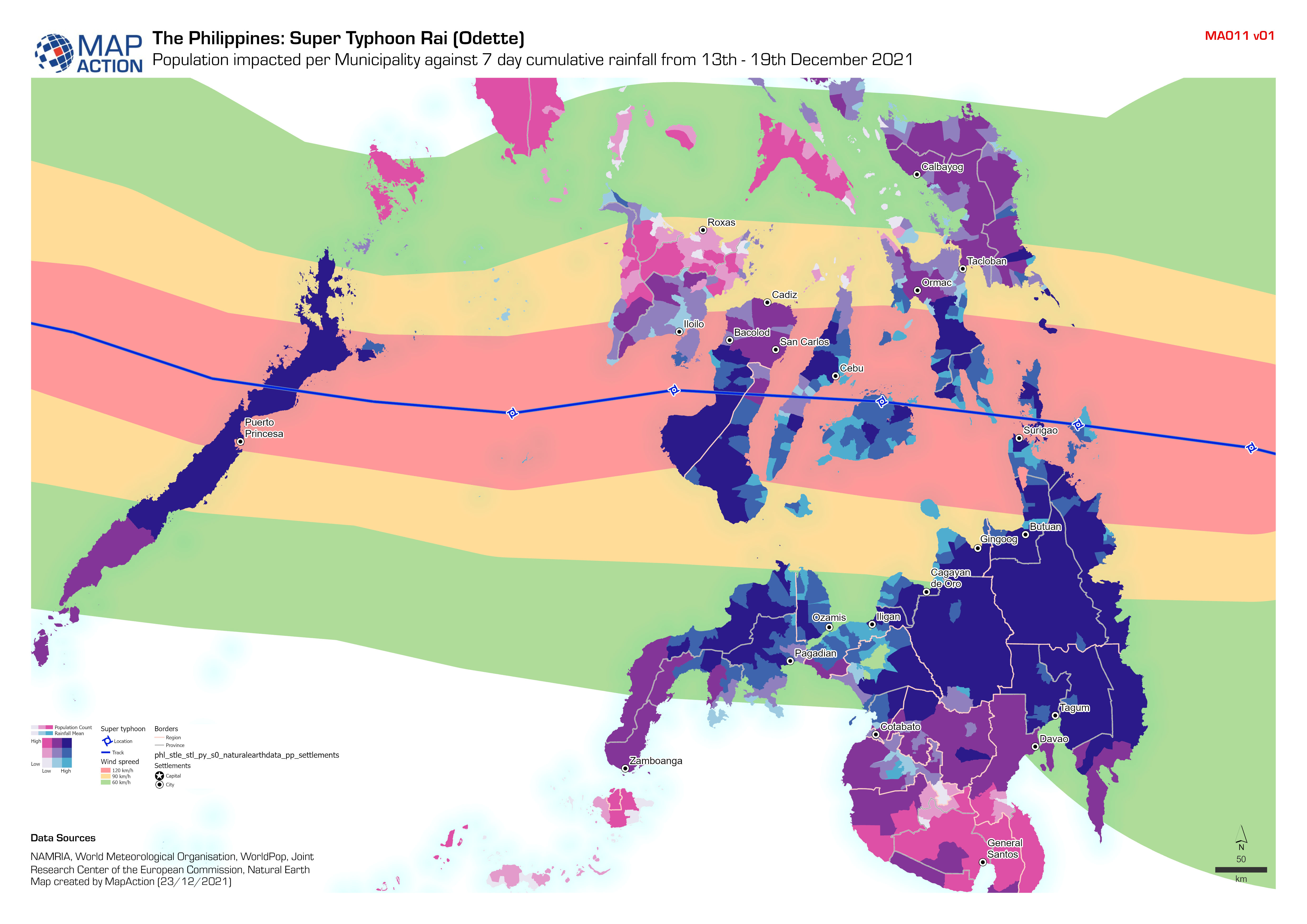
Population impacted per Municipality against 7 day cumulative rainfall from 1...
Bivariate analysis using the 7 day cumulative rainfall (from 13th - 19th December 2021) provided by the World Meteorological Organisation and the Municipality population using... -

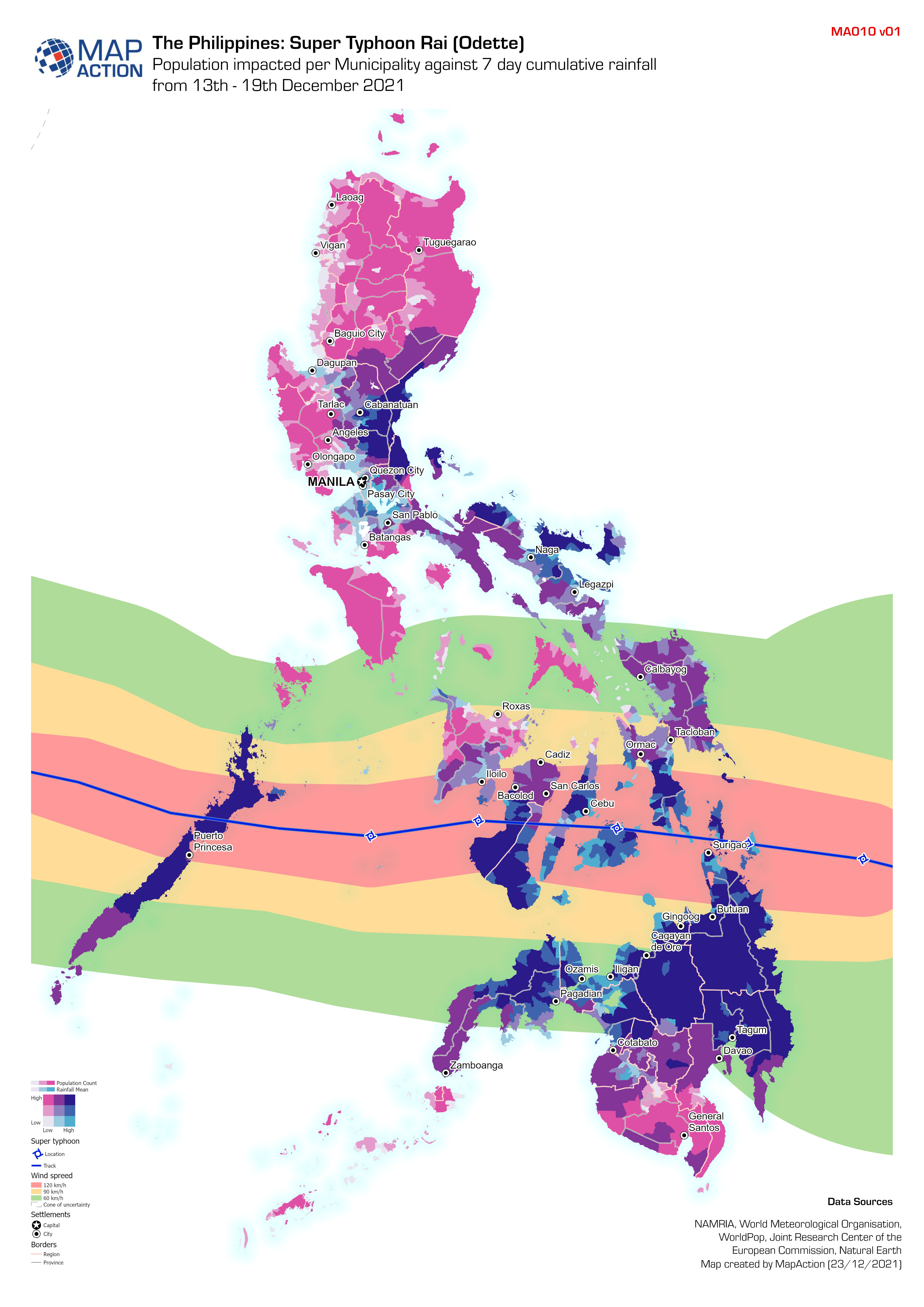
Population impacted per Municipality against 7 day cumulative rainfall from 1...
Bivariate analysis using the 7 day cumulative rainfall (from 13th - 19th December 2021) provided by the World Meteorological Organisation and the Municipality population using... -
Earthquake Casualties and Damage - Figures received on 24/08/2021
Département: Map showing earthquake damage and casualties with numbers from the Haitian Civil Protection General Directorate (DGPC). Figures were received on 24 Aug 2021. -
Situational Overview (as of 21 April 2021)
Map shows the situational overview of the current events and activities as a result of the ongoing eruption of the La Soufrière volcano. -
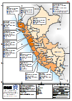
Peru: Emergencia por Temporada de Lluvias - Personas Damnificadas por Departa...
El mapa muestra la afectacion por la temporada de lluvias, diciembre 2016 a marzo 2017. Provincias en 12 departamentos han sido declaradas en Estato de Emergencia. Actualizado... -

Guatemala: Huracanes ETA e IOTA - Personas afectadas por departamento e inund...
This map shows the flood extents for hurricane Eta and Iota and the affected population at administrative 1 departmental level for Guatemala. -

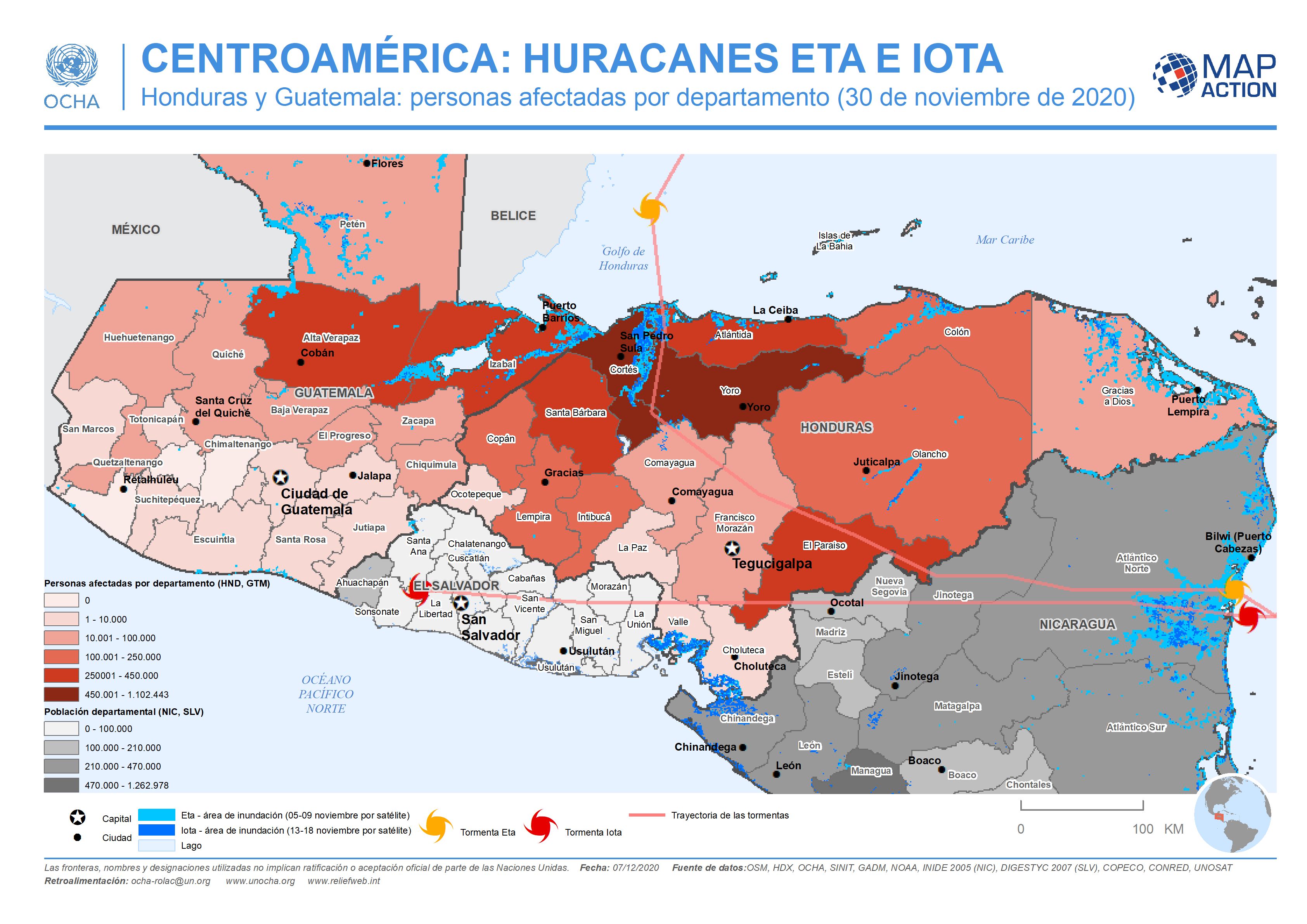
CENTROAMÉRICA: HURACANES ETA E IOTA - Honduras y Guatemala: personas afectada...
This map shows the storm tracks and flood extents for hurricane Eta and Iota. Across Honduras and in the two most highly affected departments in Guatemala the map shows affected... -

CENTROAMÉRICA: HURACANES ETA E IOTA - Honduras y Guatemala: personas afectada...
This map shows the storm tracks and flood extents for hurricane Eta and Iota. It also shows estimated affected population at administrative 1 departmental level for Honduras and... -

CENTRAL AMERICA: HURRICANES ETA AND IOTA Honduras and Guatemala: affected pop...
This map shows the storm tracks and flood extents for hurricane Eta and Iota. It also shows estimated affected population figures at administrative 1 departmental level for... -
Guatemala: Personas evacuadas y personas en albergues por Municipio en Izabal...
Personas evacuadas y personas en albergues por Municipio en Izabal (al 27 Nov 2020) -

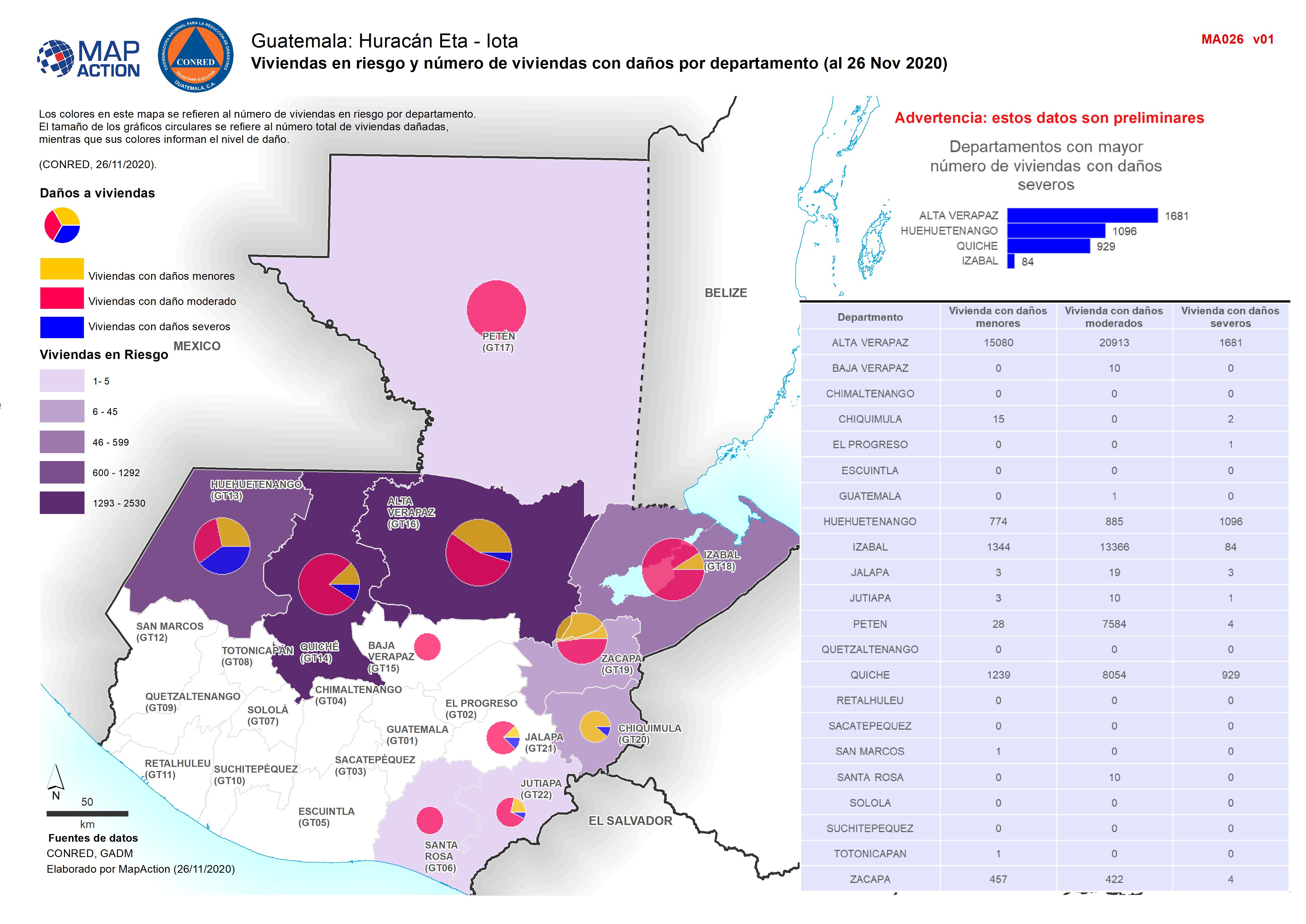
Guatemala: Affected houses by department (26 November 2020)
Map shows the number of reported activities per Sector per Department in Guatemala. Critical and High priority response areas are also shown.
