-

Shake intensity and epicentre with Regions affected
Shake Intensity focused on the affected / reported Regions from discussions in the UN Assessment & Analysis cell -

Shake Intensity and Epicentre with Regions affected and population
Shake Intensity focused on the affected / reported Regions from discussions in the UN Assessment & Analysis cell -

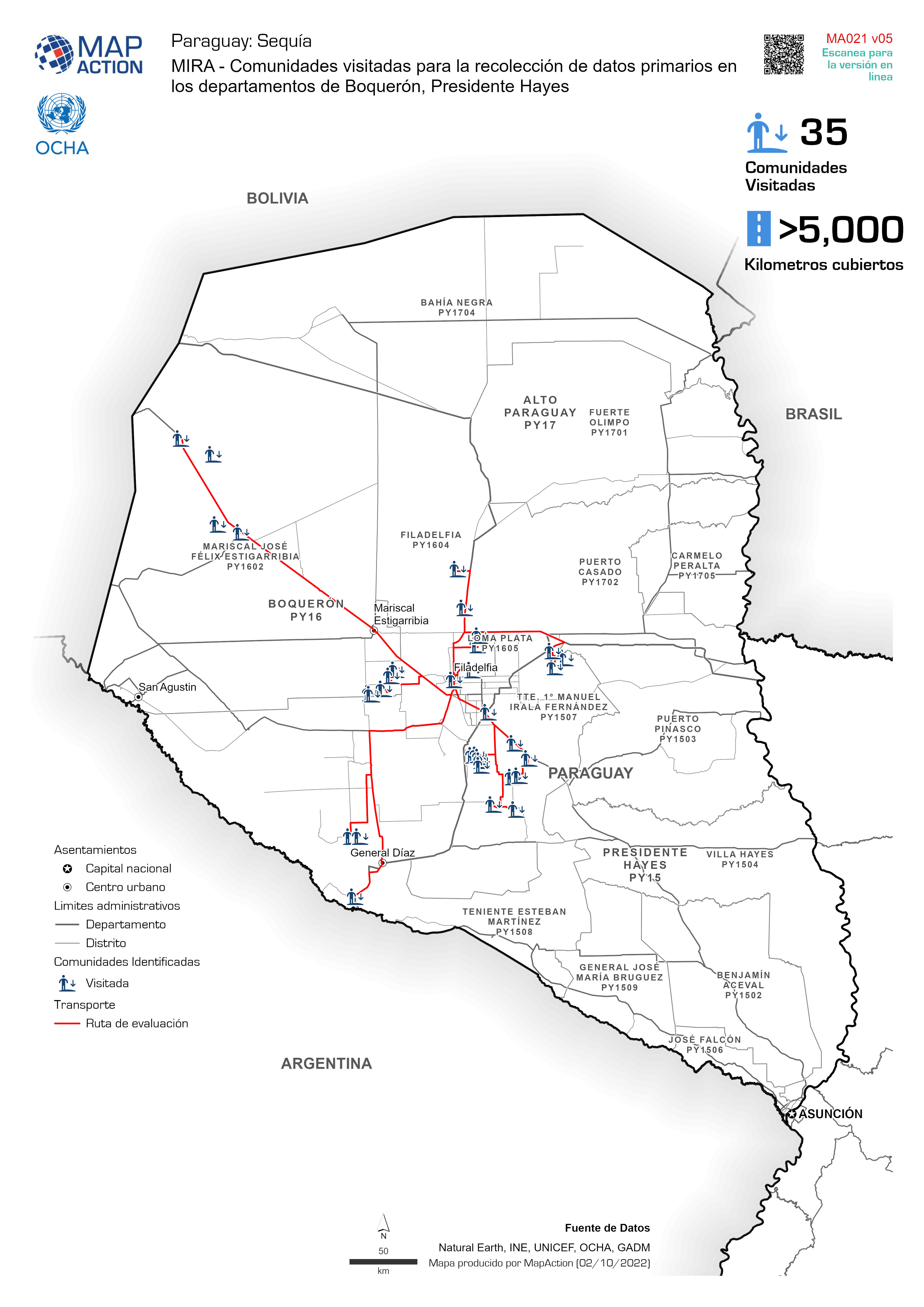
MIRA - Comunidades visitadas para la recolección de datos primarios en los de...
MIRA - Comunidades identificadas para la recolección de datos primarios en los departamentos de Boquerón, Presidente Hayes -
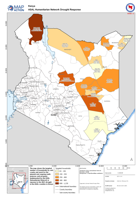
ASAL Humanitarian Network Drought Response
The map shows the targeted number of households by sub-county and ward for the planned and ongoing multi-purpose cash program implemented by the ASAL Humanitarian Network in... -

Country Overview with Admin 1 (Département) Boundaries and Topography
Country overview with topography displayed -

Topographic map showing earthquake shake intensity
Topographic map of Grande 'Anse, Nippes and South Départements, with earthquake shake intensity contours -

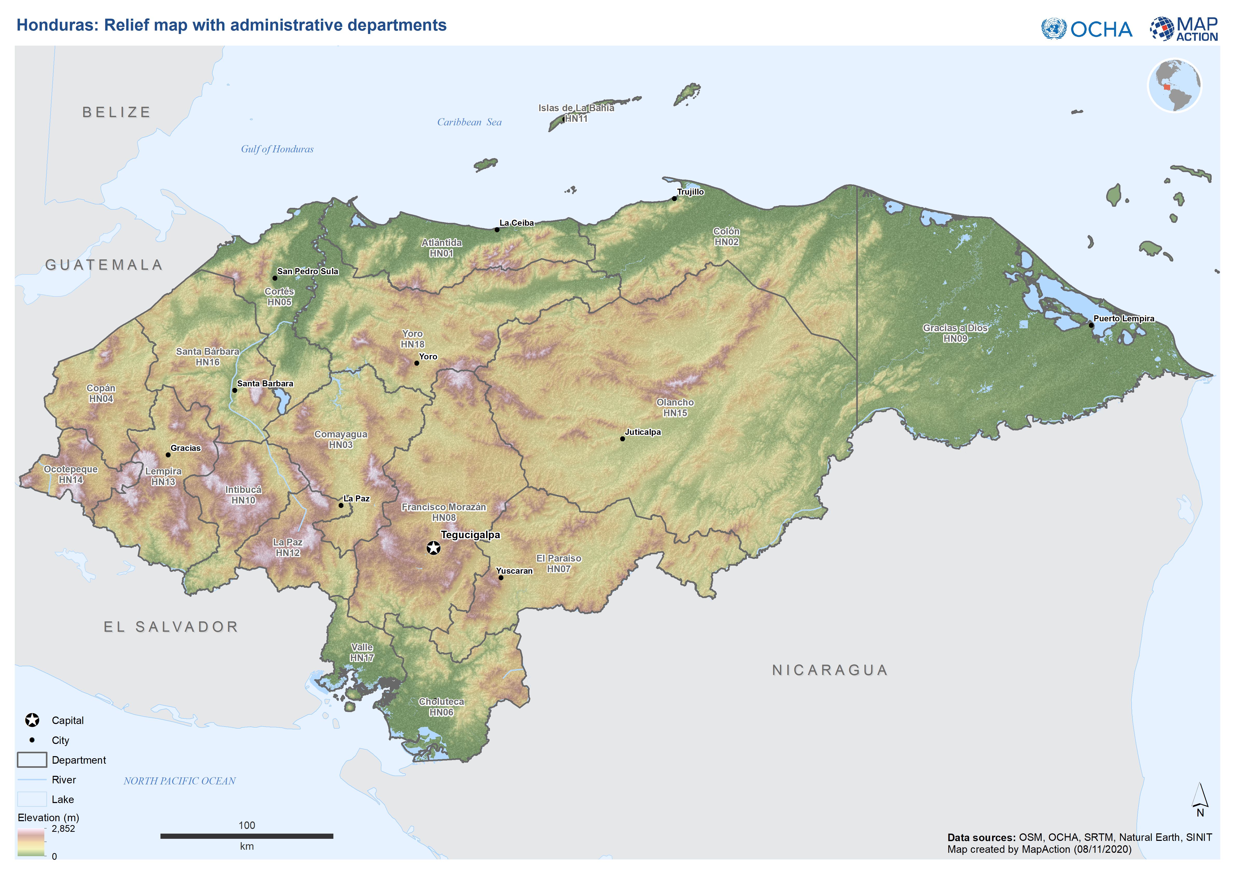
Honduras: Relief map with administrative departments
This map shows elevation, administration level 1 departments and major cities for Honduras. -
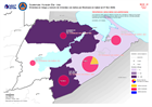
Guatemala: Viviendas en riesgo y número de viviendas con daños por Municipio ...
Homes at risk and number of damaged homes by Municipality in Izabal (as of Nov 27, 2020) -

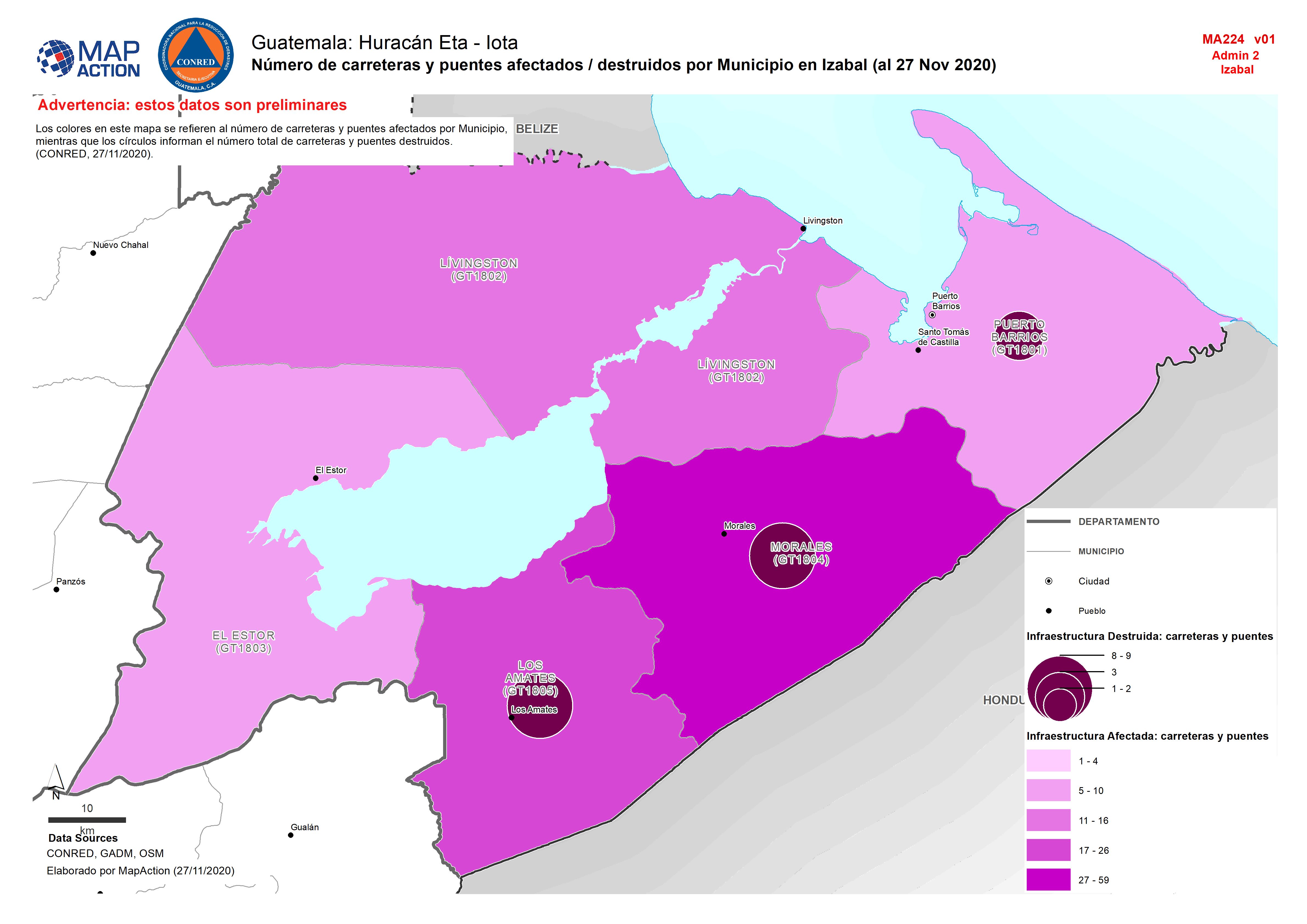
Guatemala: Número de carreteras y puentes afectados / destruidos por Municipi...
MMap shows the number of destroyed and affected roads and bridges by department. -

Centro América: Huacán Iota - Trayectoria potencial de Iota e inundaciones de...
This map shows the storm track for hurricane Iota, with potentially affected administrative departments for Nicaragua and Honduras. It also includes previous flooded areas from... -

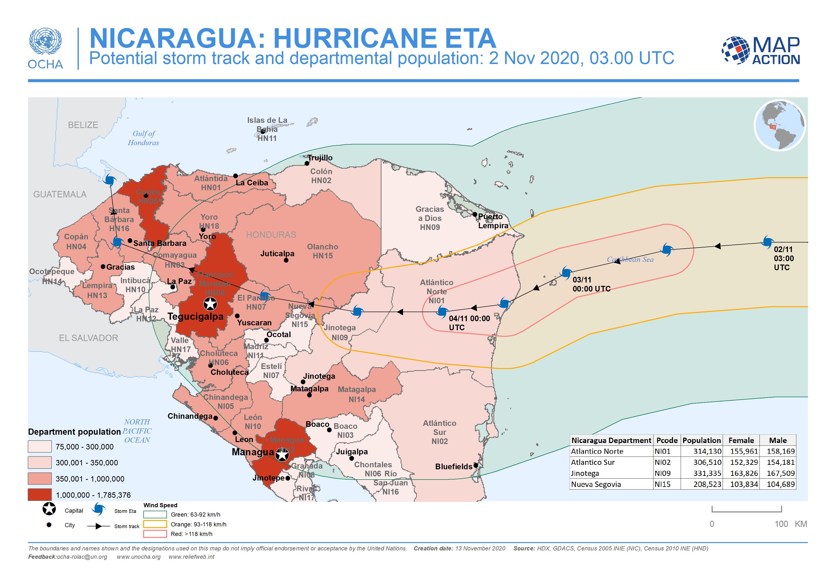
Nicaragua: Potential storm track and departmental population: 2 Nov 2020, 03....
This map shows the potentially affected administration level 1 departments for Nicaragua and Honduras, with departmental population and predicted wind speed cones. -

Nicaragua and Honduras: Potential storm track, population and municipalities:...
This map shows the potentially affected administration level 2 municipalities for Nicaragua, with departmental population for Nicaragua and Honduras, and predicted wind speed... -

Nicaragua: Potential storm track, elevation and municipalities: 4 Nov 2020, 0...
This map shows the Hurricane Eta affected administration level 2 municipalities for Nicaragua with predicted wind speed cones, aganst elevation data and settlement locations. -

Nicaragua: Potential storm track, elevation and municipalities: 3 Nov 2020, ...
This map shows the affected administration level 2 municipalities for Nicaragua, with population estimates and predicted wind speed cones. -

Paraguay: Administrative Departments with Major Towns and Elevation
This reference map shows the administration level 1 departments from 2012, with major cities and elevation. -
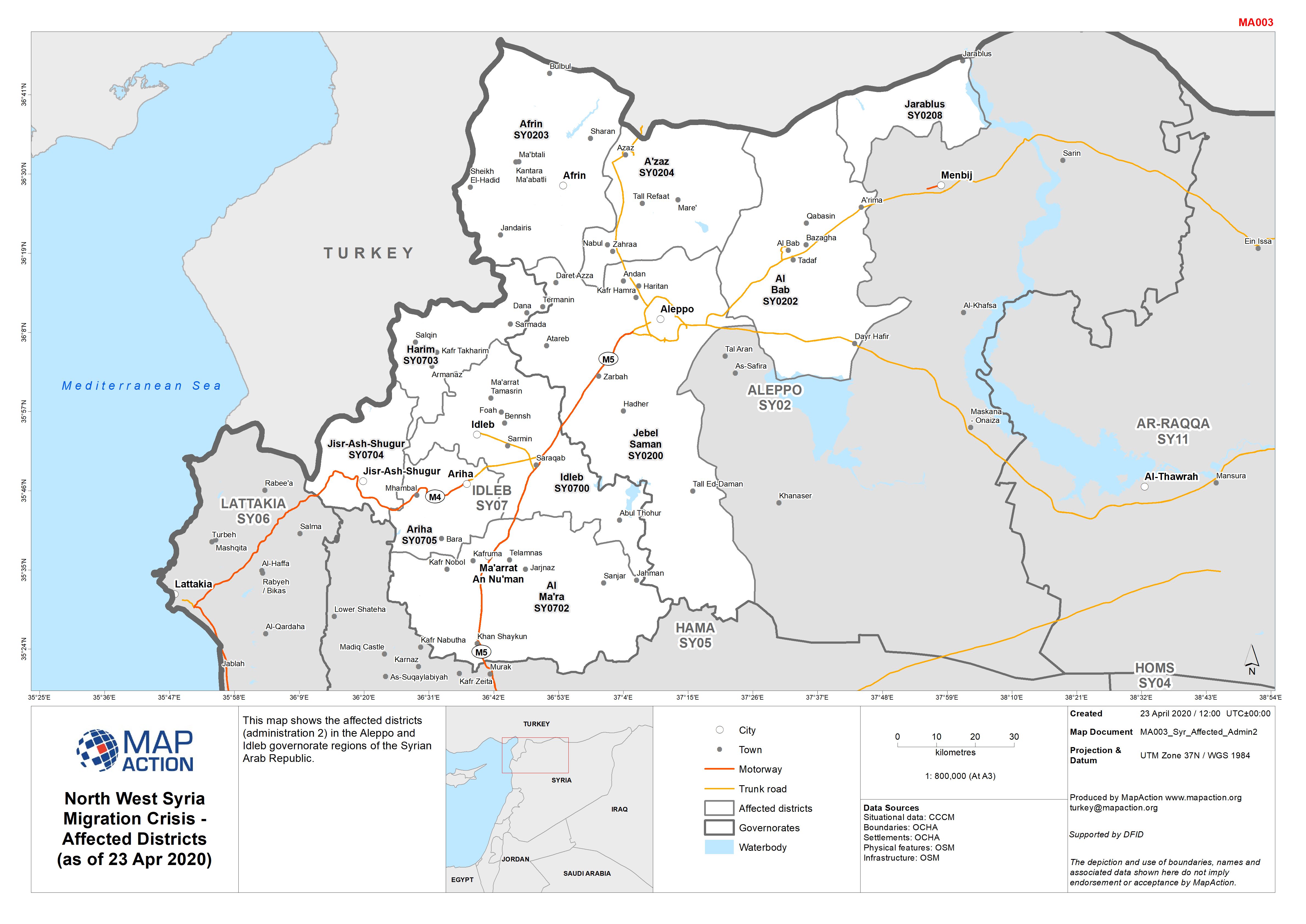
North West Syria Migration Crisis - Affected Districts (as of 23 Apr 2020)
This map shows the affected districts (administration 2) in the Aleppo and Idleb governorate regions of the Syrian Arab Republic. -

North West Syria Migration Crisis - Syria Reference Map (as of 21 Apr 2020)
This is a reference map of the Syria Arab Republic, showing cities, major towns, main roads and elevation data. -
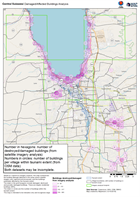
Central Sulawesi Damaged/Affected Buildings Analysis
Based on Copernicus imagery analysis, this map summarises the building damage detected in the areas where satellite imagery was captured and processed, and the buildings...