-

Flood Extent (02 Dec) and Baseline Population for South Somalia
The maps show the flood extent combined with population density to highlight potentially affected areas. The table shows the estimated baseline population by district (2021).... -

ASAL Humanitarian Network Drought Response - Activity by Sub County (as of 23...
The map shows the 3w (who, what, where) response activity by sub-county for the planned and ongoing multi-purpose cash program implemented by the ASAL Humanitarian Network... -

Centro América: Huacán Iota - Trayectoria potencial de Iota e inundaciones de...
This map shows the storm track for hurricane Iota, with potentially affected administrative departments for Nicaragua and Honduras. It also includes previous flooded areas from... -

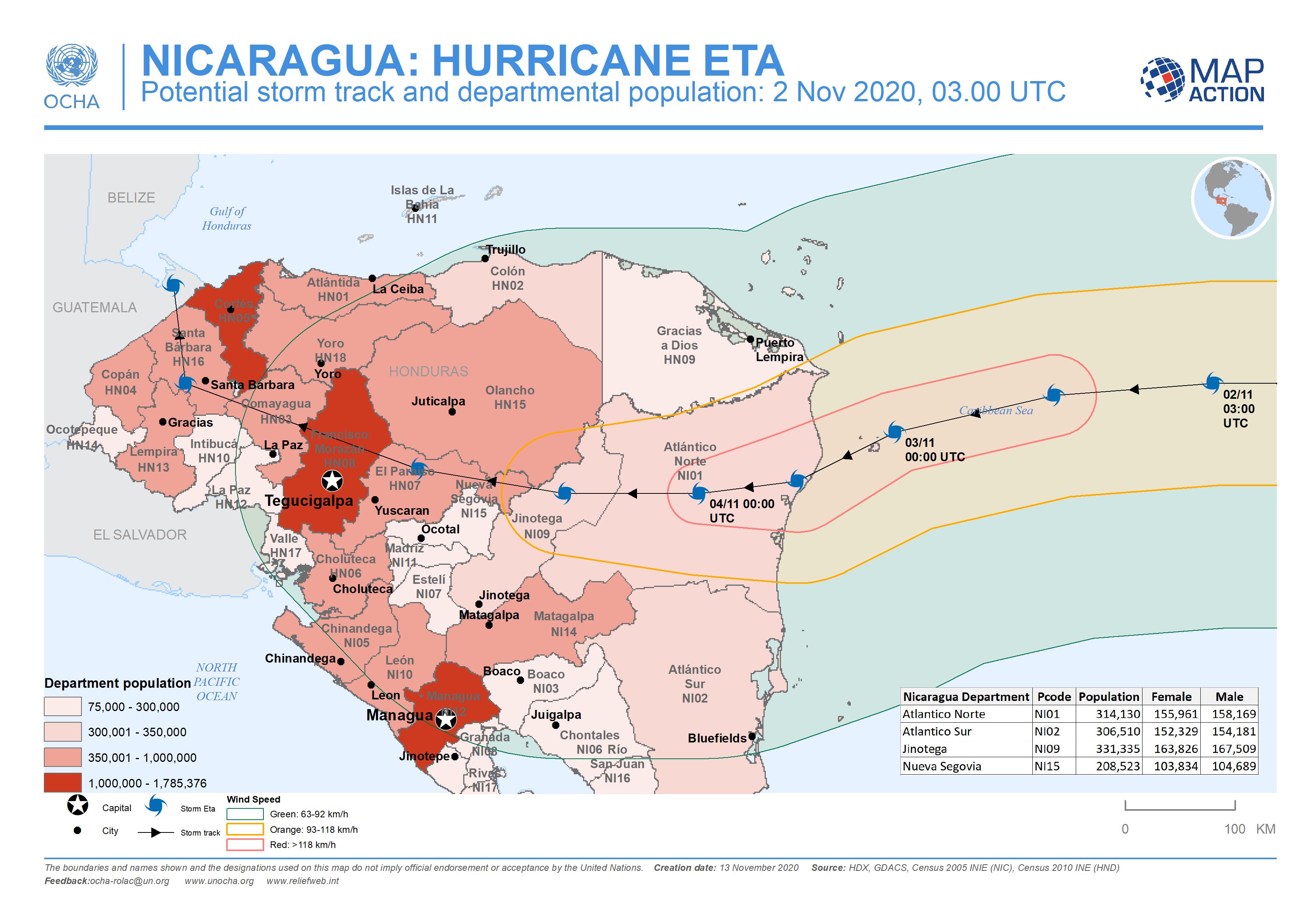
Nicaragua: Potential storm track and departmental population: 2 Nov 2020, 03....
This map shows the potentially affected administration level 1 departments for Nicaragua and Honduras, with departmental population and predicted wind speed cones. -

Nicaragua: Potential storm track, elevation and municipalities: 3 Nov 2020, ...
This map shows the affected administration level 2 municipalities for Nicaragua, with population estimates and predicted wind speed cones.