-
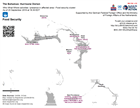
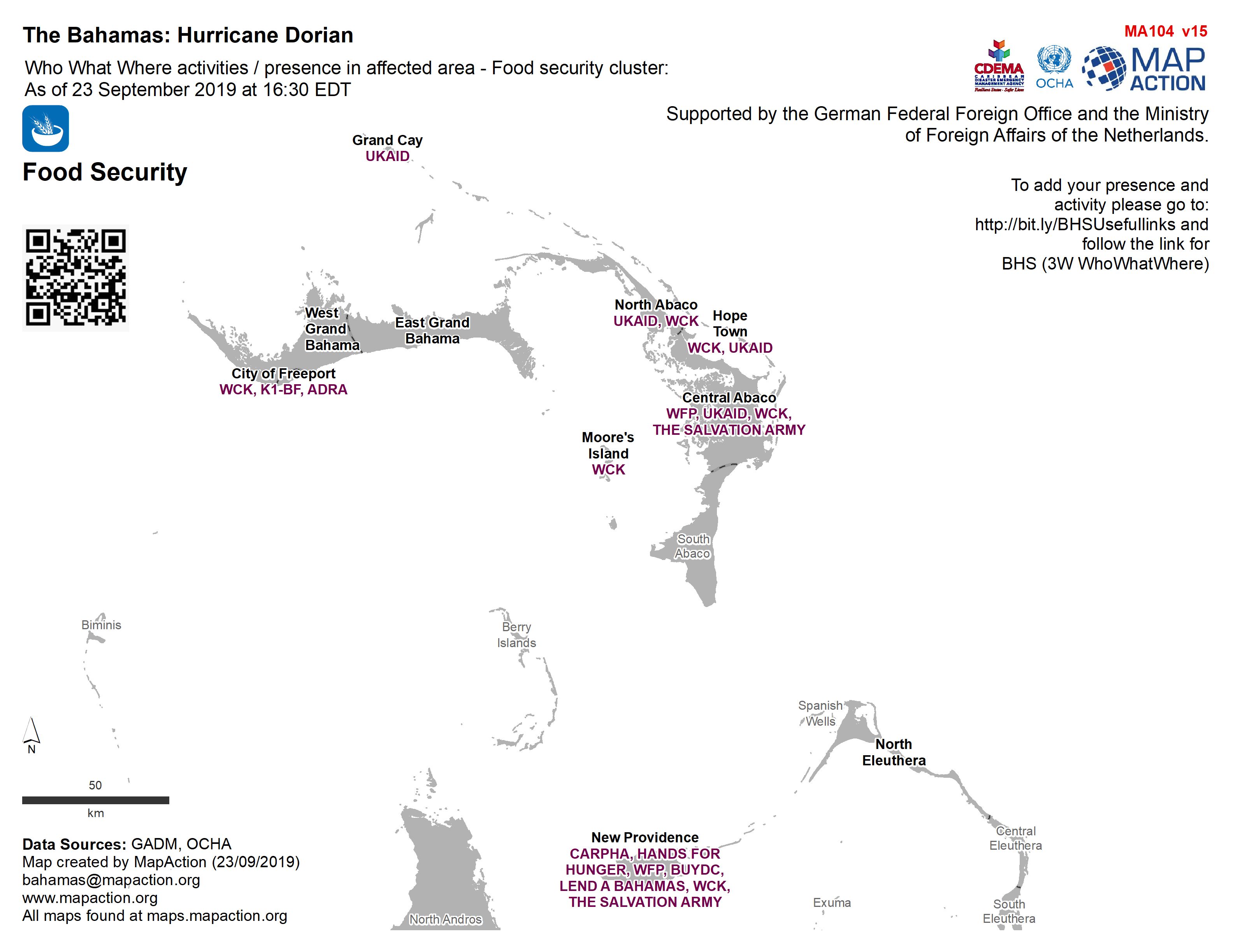
Who What Where activities / presence in affected area - Food security cluster...
Who, What, Where for Coordination - Food Security cluster -

Who What Where activities / presence in affected area - Early Recovery cluste...
Who, What, Where for Coordination -
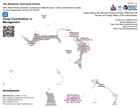
Who What Where activities / presence in affected area - Camp Coordination clu...
Who, What, Where for Coordination - Camp Coordination or Management cluster -
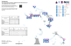
Who What Where activities / presence at sub-island level as of 14th September...
Who What Where activities / presence at sub-island level as of 14th September 2019 16:30 EDT -
-

-
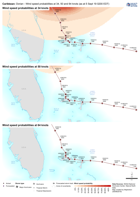
Caribbean: Dorian - Wind speed probabilities at 34, 50 and 64 knots (as at 5 ...
This dataset has no description
-

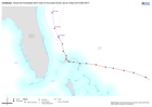
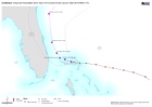
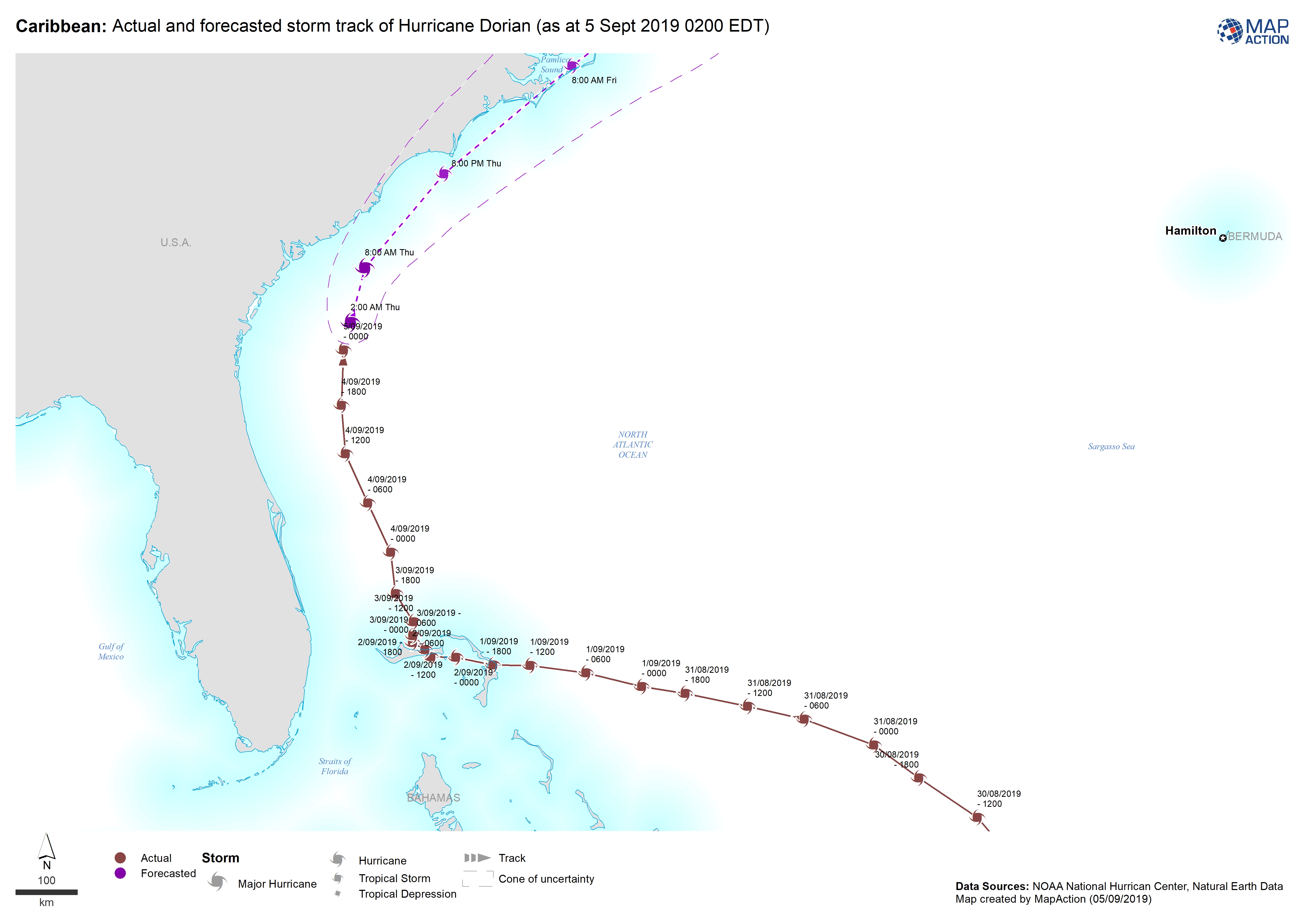
Caribbean: Actual and forecasted storm track of Hurricane Dorian (as at 5 Sep...
This dataset has no description
-

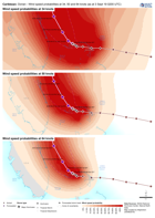
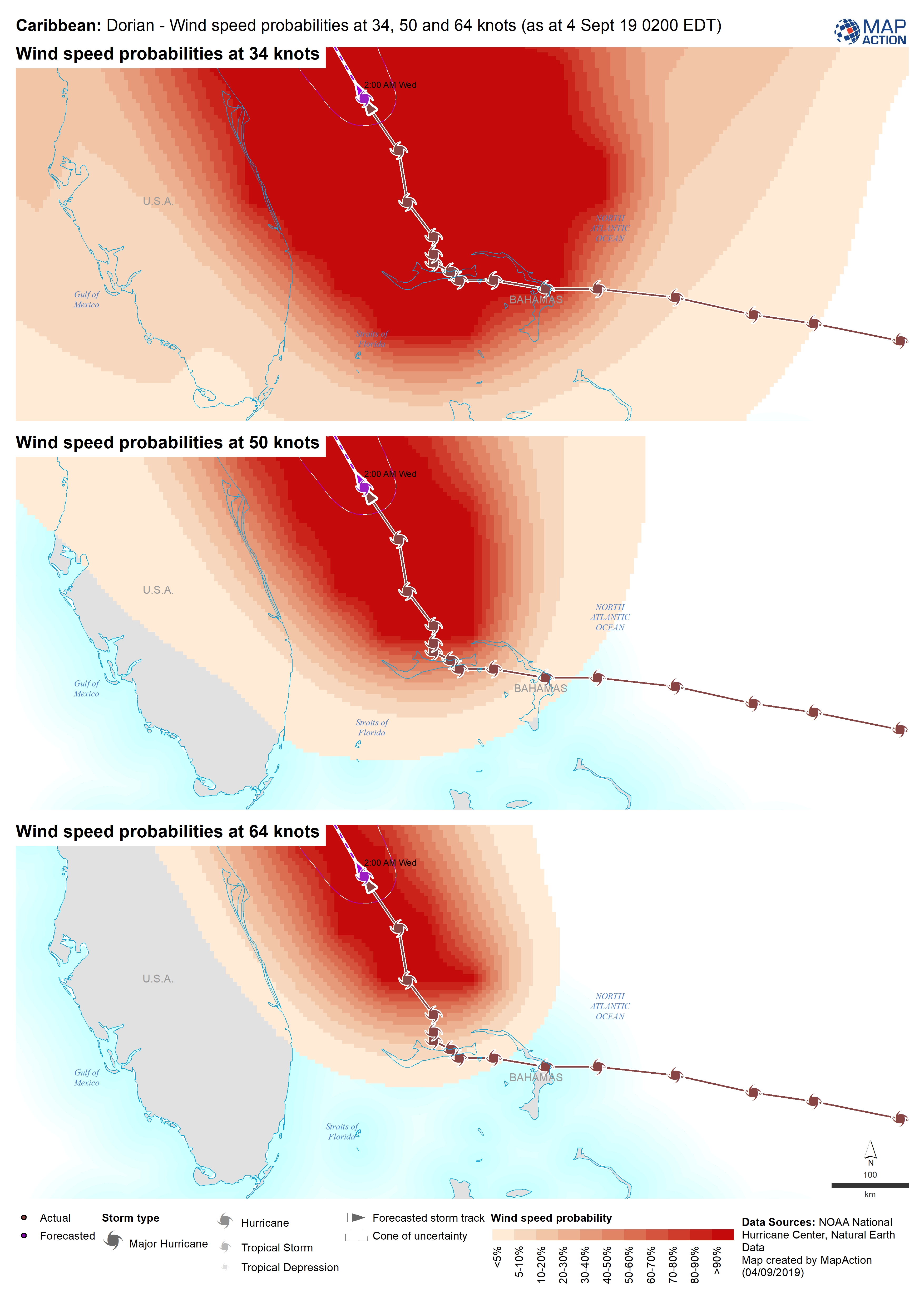
Caribbean: Dorian - Wind speed probabilities at 34, 50 and 64 knots (as at 4 ...
This dataset has no description
-
Caribbean: Actual and forecasted storm track of Hurricane Dorian (as at 4 Sep...
This dataset has no description
-
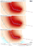
Caribbean: Dorian - Wind speed probabilities at 34, 50 and 64 knots (as at 3 ...
This dataset has no description
-
Caribbean: Dorian - Wind speed probabilities at 34, 50 and 64 knots (as at 2 ...
This dataset has no description
-

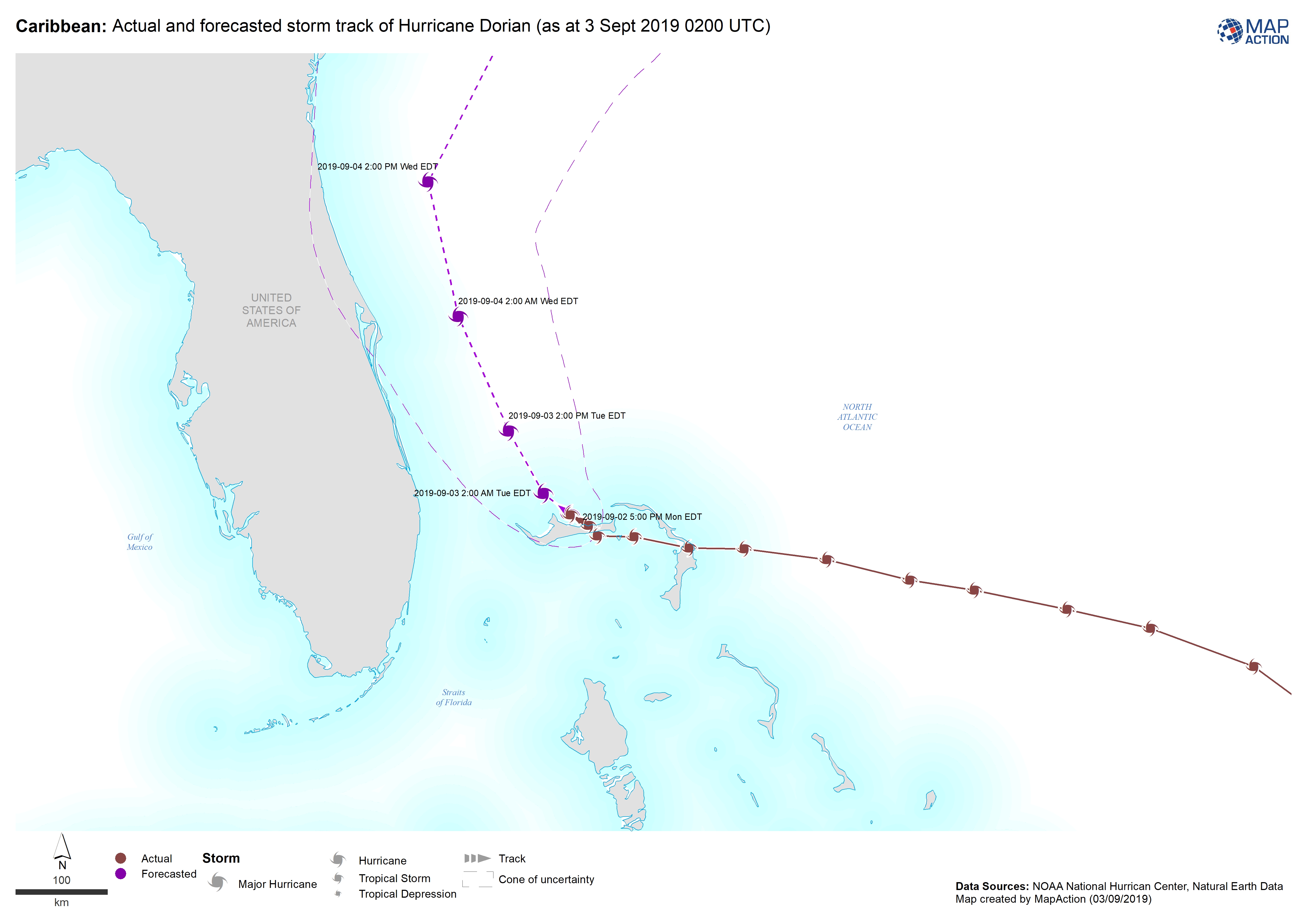
Caribbean: Actual and forecasted storm track of Hurricane Dorian (as at 3 Sep...
This dataset has no description
-
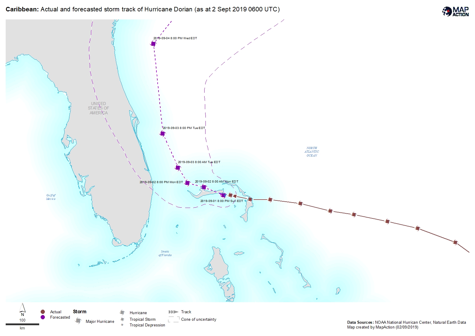
Caribbean: Actual and forecasted storm track of Hurricane Dorian (as at 2 Sep...
This dataset has no description
-
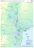
Mozambique: Cyclone Idai - Flood extent change between 20, 31 March and 7 Apr...
Map shows the change in flood extent between the 20, 31 of March and 7 April -

Sulawesi Earthquake 2018, Copernicus Building Damage Classification
This point dataset aggregrates Copernicus building damage data derived from post-event satellite imagery into a single dataset. Within the areas analysed, individual buildings... -
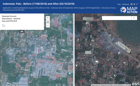
Indonesia: Palu - Before (17/08/2018) and After (02/10/2018)
Application created by MapAction as part of the efforts in Palu - Indonesia after 28 September 2018. Imagery: ©2018 DigitalGlobe - Disturbance Areas: ©Sentinel Asia and EOS-NUS -

Sulewesi Earthquake 2018 Assessment Photos
Central Sulawesi, Palu Region: Selection of Photos from assessments 6/10/2018 -

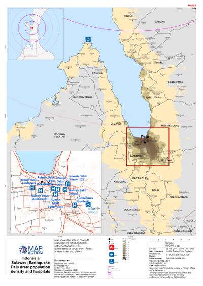
Sulawesi Earthquake - Palu area - Population density and hospitals
Map shows population density in the Palu area, hospitals, level 3 admininstration boundaries and settlements. -

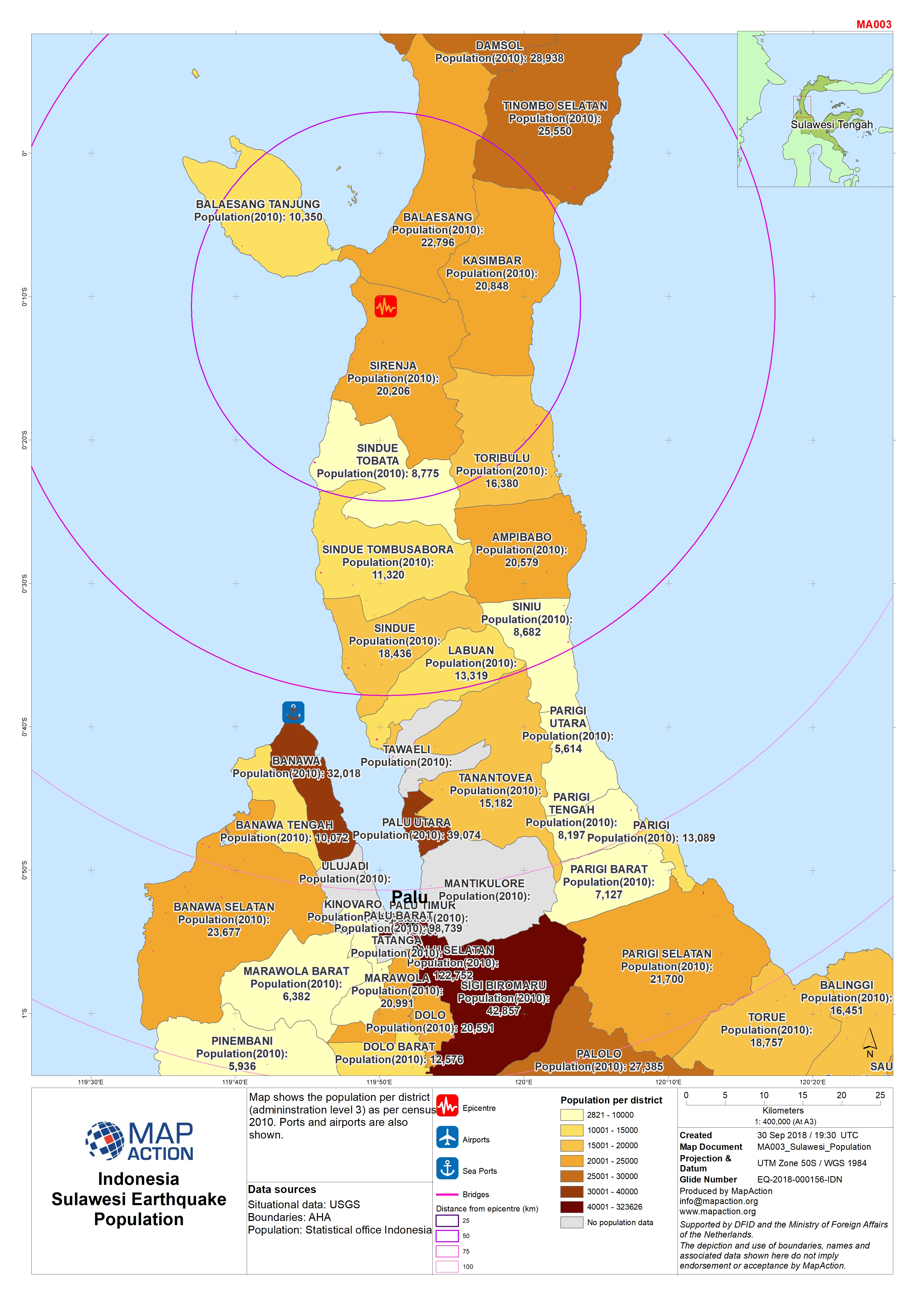
Sulawesi Earthquake - Population
Map shows population per district (admininstration level 3). Ports are also shown.