-

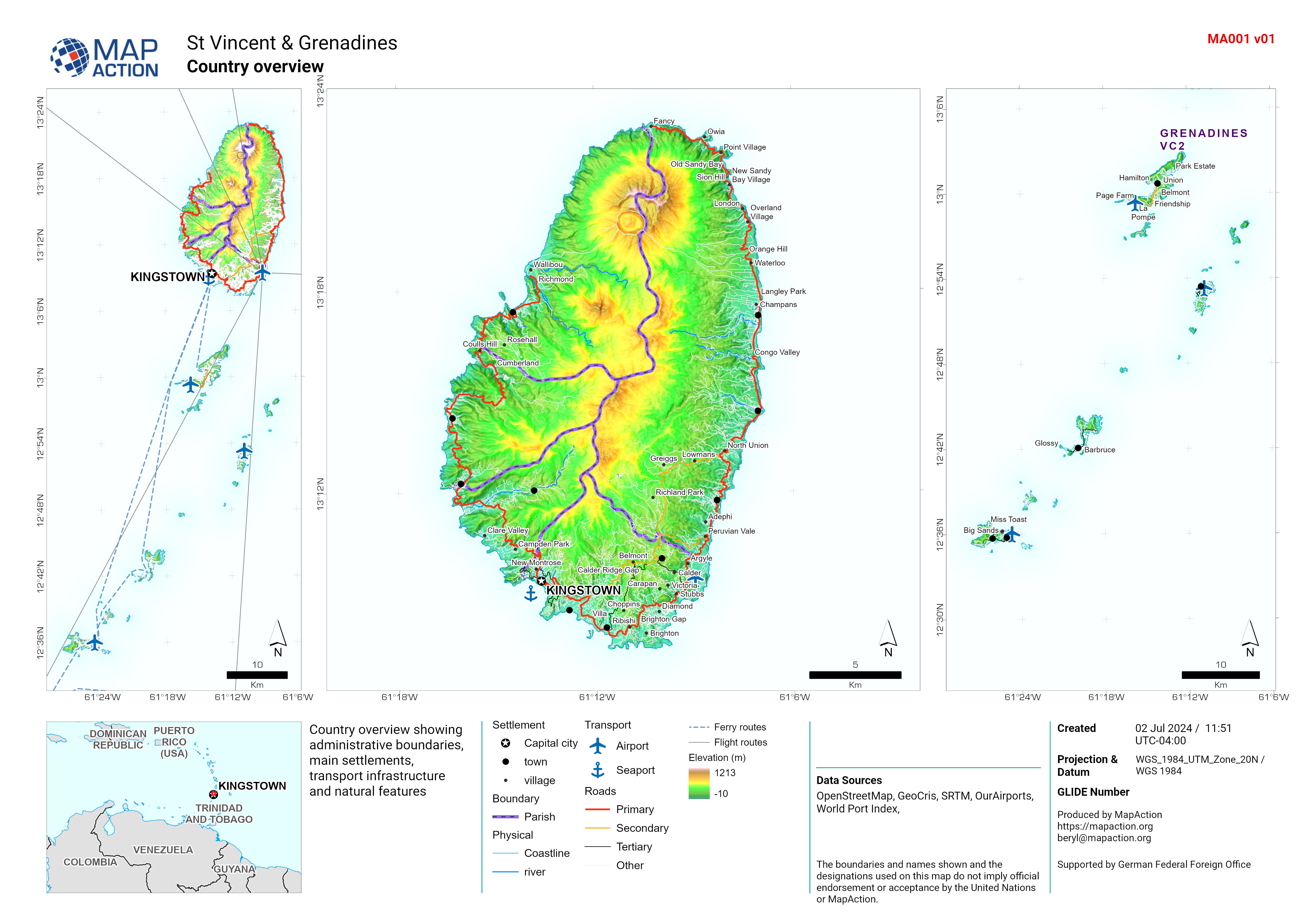
St Vincent overview
Country overview showing administrative boundaries, main settlements, transport infrastructure and natural features -

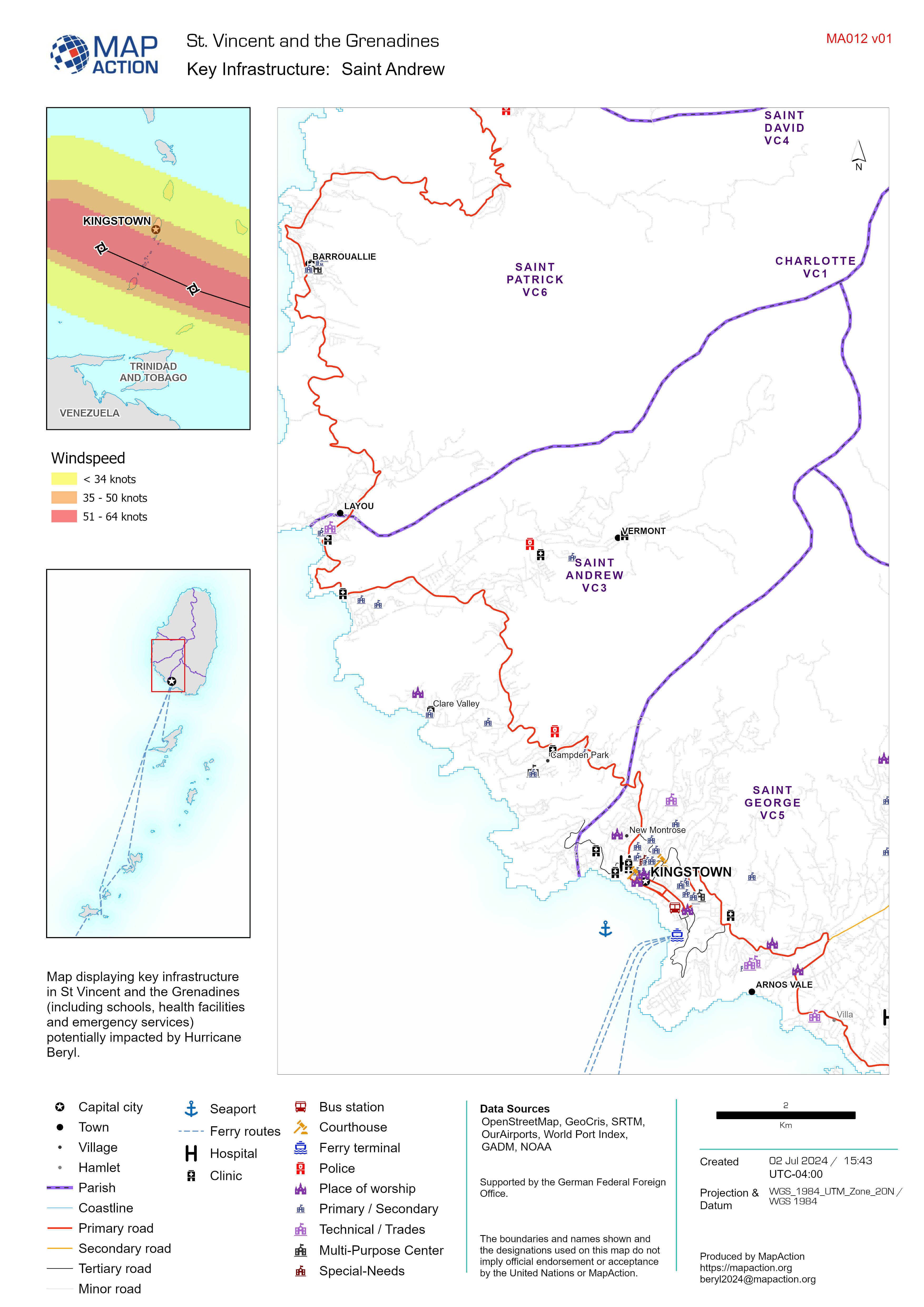
Key Infrastructure Map Atlas
Map displaying key infrastructure in St Vincent and the Grenadines (including schools, health facilities and emergency services) potentially impacted by Hurricane Beryl. -
Country overview
Country overview showing administrative boundaries, main settlements, transport infrastructure and natural features