-
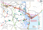
Mozambique: Cyclone Idai: Identified highly impacted areas with food drops, a...
Situation map showing areas of high impact, assessment locations, access and food drops to date. As at 9 April 2019. -

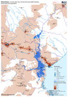
Mozambique: Reference map of flood effected postos
Map displays flood extent (as of 31.03.2018) for effected postos with additional reference data including physical and transport features. This is a "Map Book" and contains 17... -

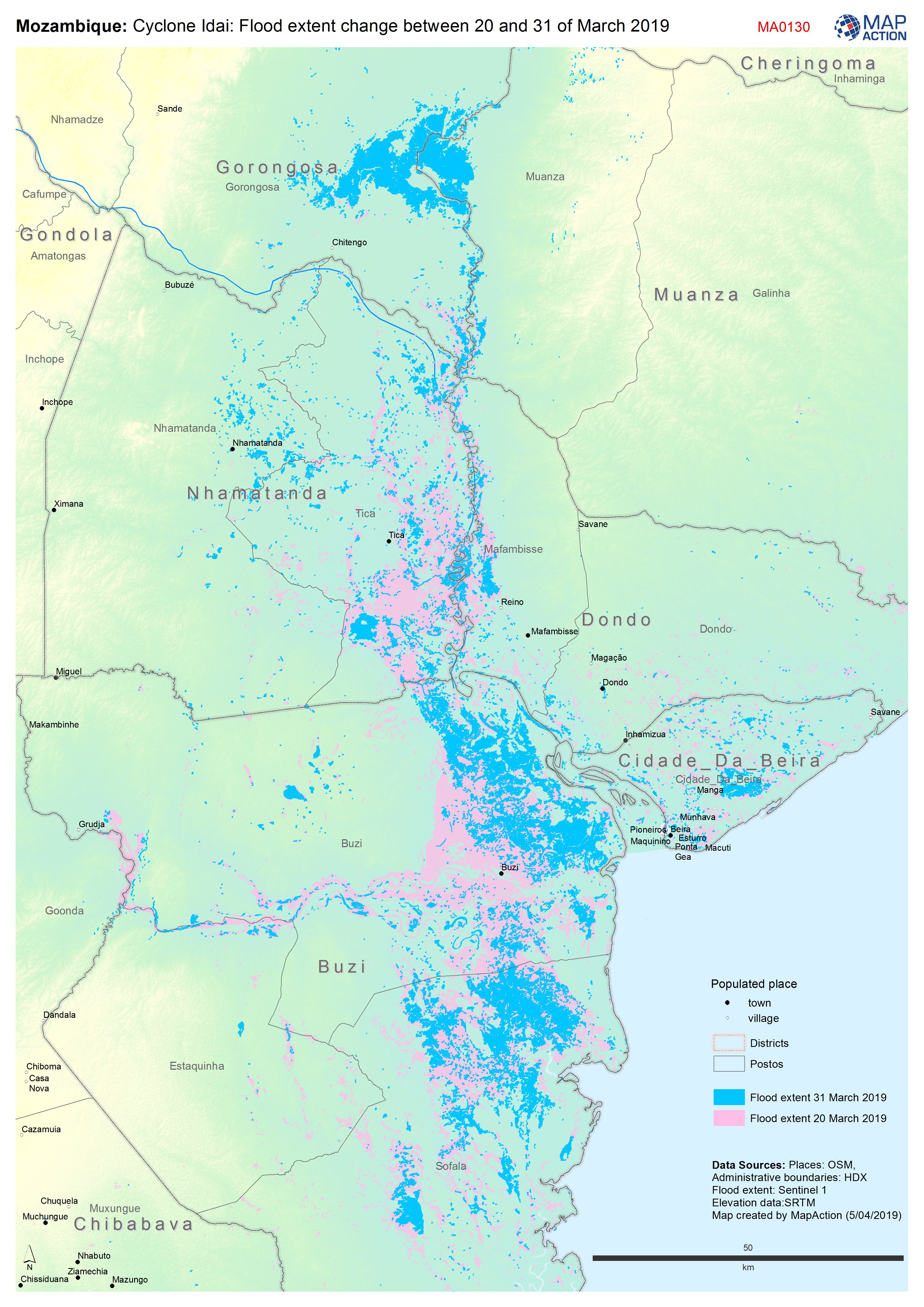
Mozambique: Cyclone Idai: Flood extent change between 20th and 31st March 2019
Map shows the change in flood extent between the 20th and 31st March -
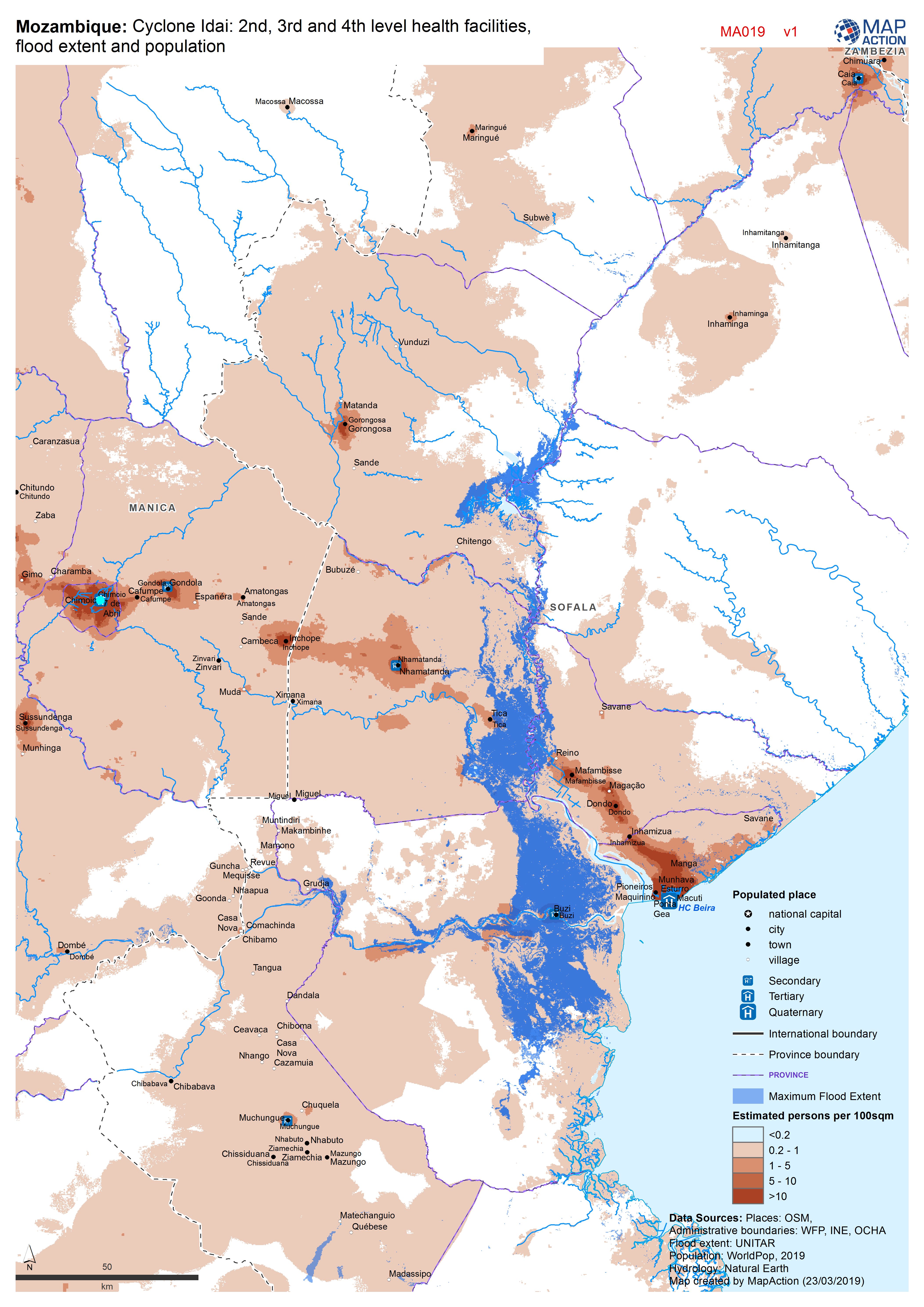
Mozambique: Cyclone Idai - 2nd, 3rd and 4th level health facilities, flood ex...
Map shows the population (based on WorldPop at 100m resolution generating through AI) and the Flood Extents known as of 19/20 March 2019 plus Health facilities