-

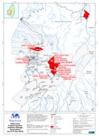
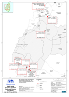
Saint Lucia Tropical Cyclone Reported Shelter Locations (as of 07 Nov 2010)
Map shows the location and population of reported shelters in Saint Lucia. Also shown are the quarter boundaries of the worst affected areas. -
Saint Lucia Tropical Cyclone Soufriere Damage Assessment (as of 07 Nov 2010)
Map shows the localised damage assessment of Soufriere Quarters taken from National Damage Assessment Report #1 dated 30-Oct-2010 & NEMO Sit Rep, 07-Nov-2010. Also shown are... -
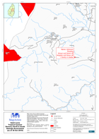
Saint Lucia Tropical Cyclone Dennery North & South Damage Assessment (as of 3...
Map shows the localised damage assessment of Dennery North and South Quarters taken fromNational Damage Assessment Report #1 dated 30-Oct-2010. Also shown are the major... -

Saint Lucia Tropical Cyclone Anse La Raye \ Canaries Damage Assessment (as of...
Map shows the localised damage assessment of Anse La Raye & Canaries Quarters taken fromNational Damage Assessment Report #1 dated 30-Oct-2010. Also shown are the major... -
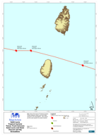
Saint Lucia Tropical Cyclone Tomas Track between Saint Lucia and Saint Vincen...
Map shows the track of Tropical Cyclone Tomas between Saint Lucia and Saint Vincent & The Grenadines. Also shown are the wind speeds for points tracked. -
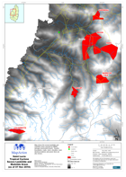
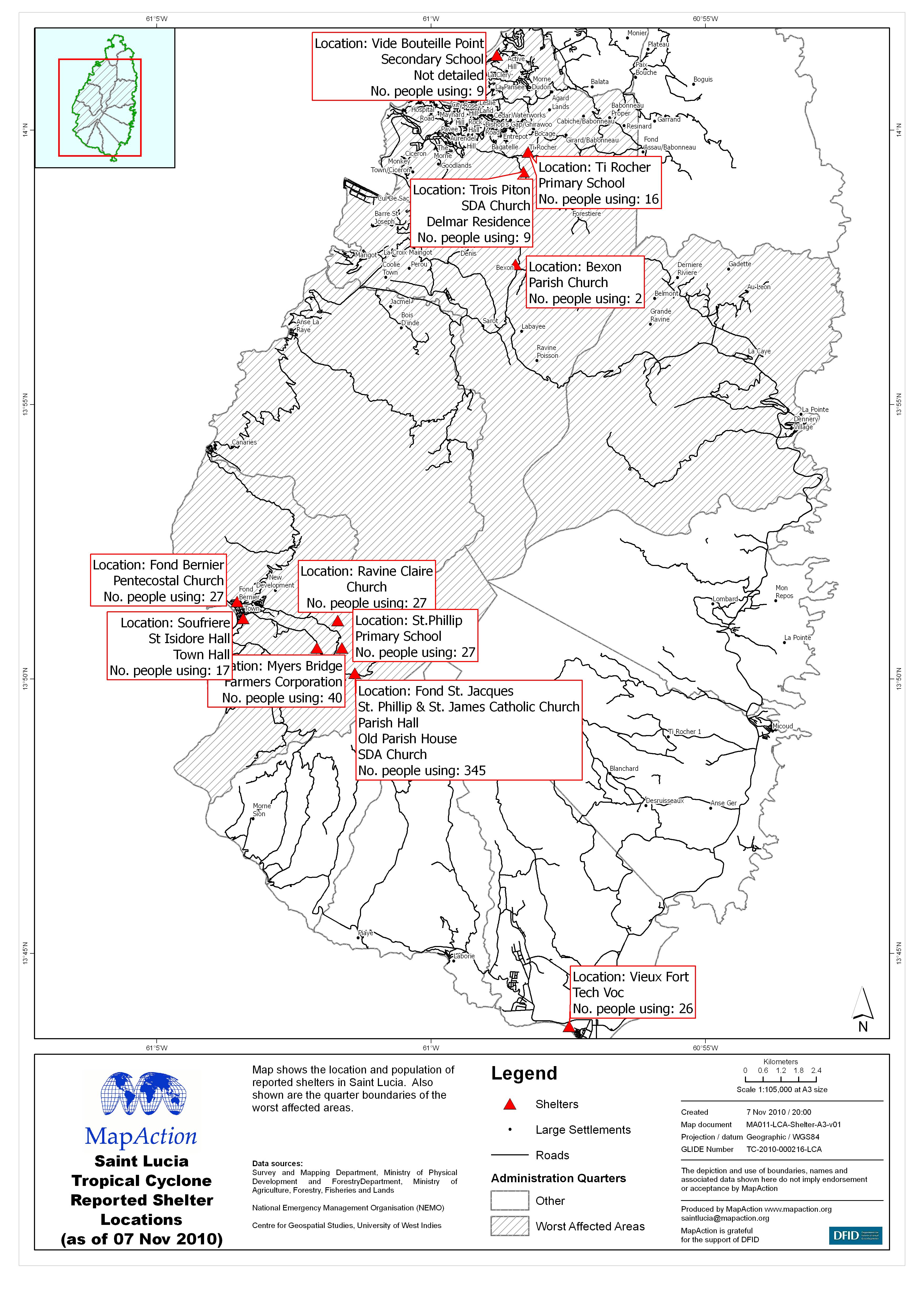
Saint Lucia Tropical Cyclone Severe Landslide and Mudslide Areas (as of 07 No...
Map shows the severe landslide and mudslide areas reported by NEMO damage assessment teams. Quarter boundaries, roads, rivers, elevation, main electrical stations and power... -
Saint Lucia Tropical Cyclone Reported Shelter Locations (as of 07 Nov 2010)
Map shows the location and population of reported shelters in Saint Lucia. Also shown are the quarter boundaries of the worst affected areas. -
Saint Lucia Tropical Cyclone Castries South East Damage Assessment (as of 30 ...
Map shows the localised damage assessment of Castries South East from National Damage Assessment Report #1 dated 30-Oct-2010. -

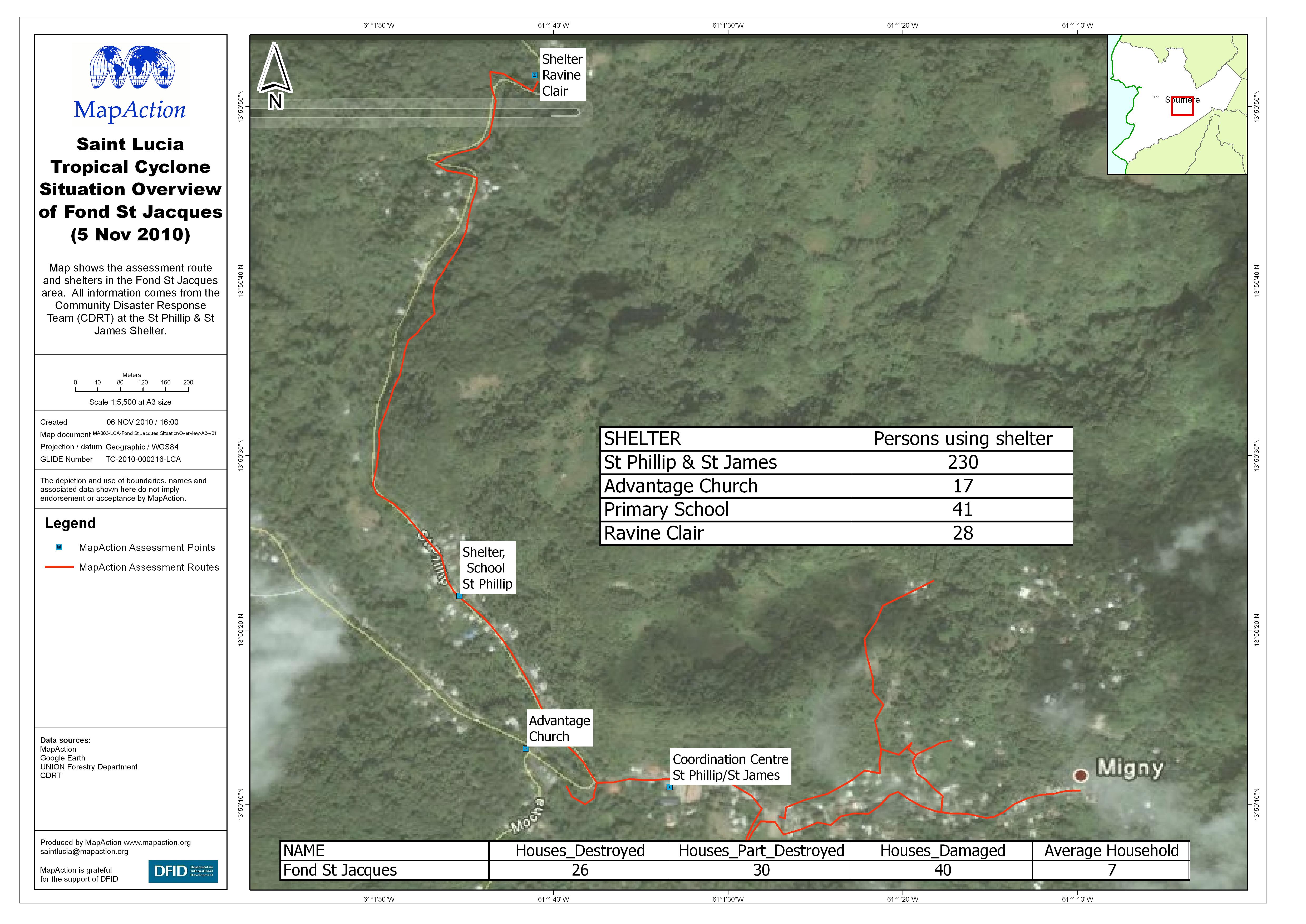
Saint Lucia Tropical Cyclone Situation Overview of Fond St Jacques (5 Nov 2010)
Map shows the assessment route and shelters in the Fond St Jacques area. All information comes from the Community Disaster Response Team (CDRT) at the St Phillip & St James... -
Saint Lucia Tropical Cyclone Assessment of Fond St Jacques (5 Nov 2010)
Map shows the assessment route and photographs taken by MapAction of the Fond St Jacques area of Soufriere. -

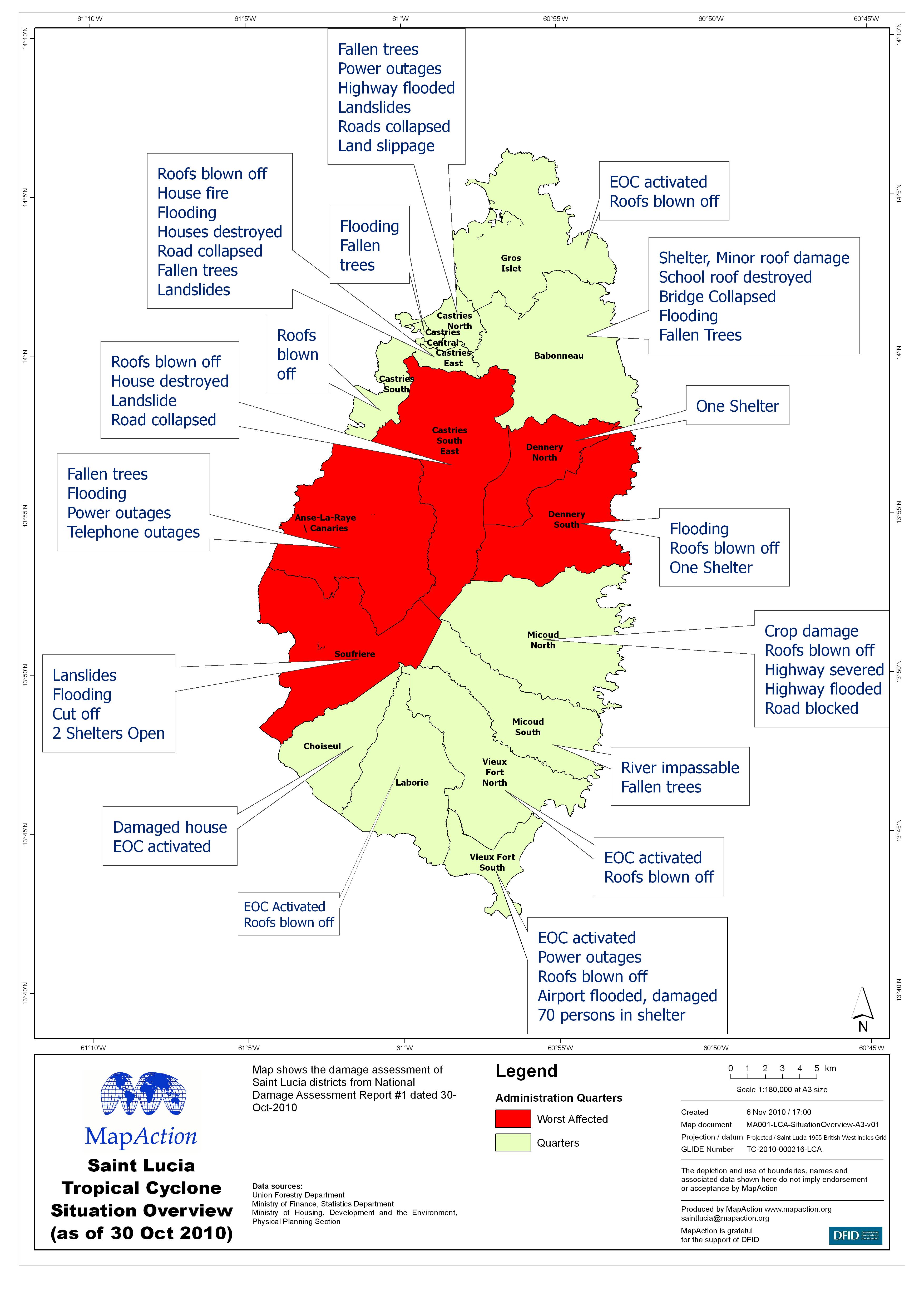
Saint Lucia Tropical Cyclone Situation Overview (as of 30 Oct 2010)
Map shows the damage assessment of Saint Lucia districts from National Damage Assessment Report #1 dated 30-Oct-2010