-

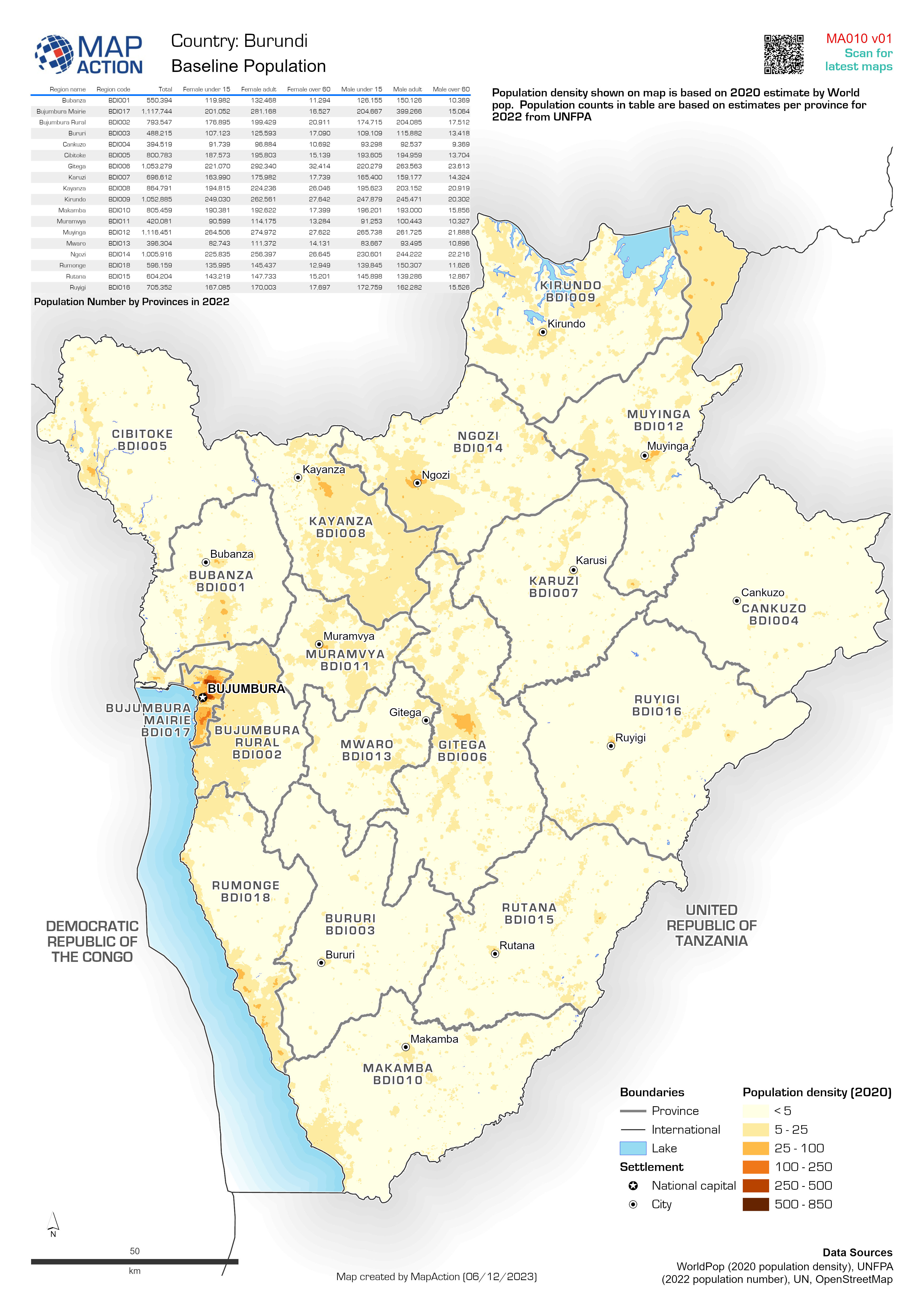
Baseline population
Population density shown based on Worldpop estimates for 2020. Population totals in table and labels are based on data from Seychelles National Bureau of Statistics for each... -

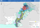
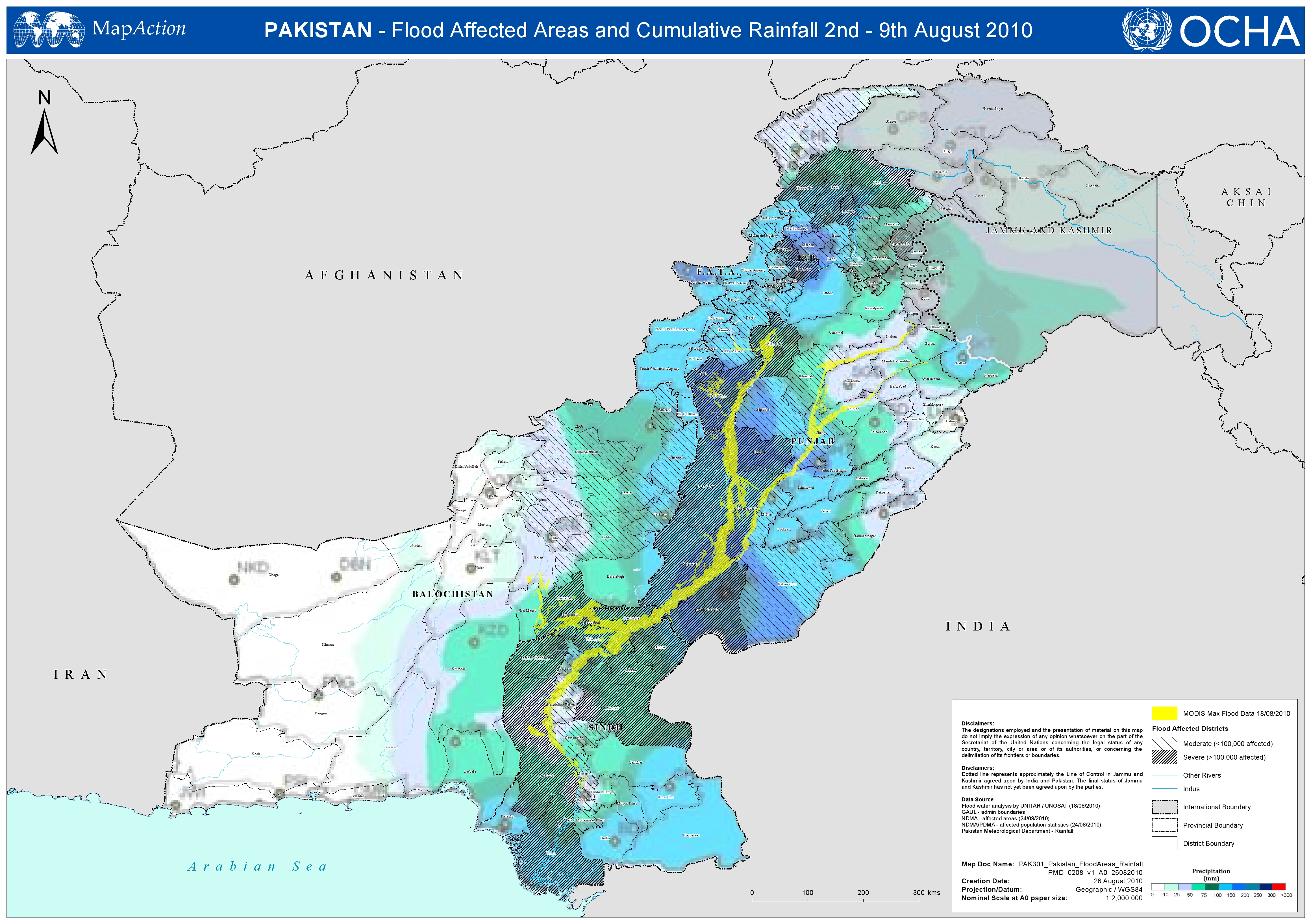
Pakistan - Flood Affected Areas and Cumulative Rainfall 2nd - 9th August 2010
This dataset has no description
-
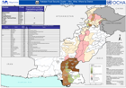
Pakistan Flood Affected Areas and Cumulative Rainfall 26th - 29th July 2010
This dataset has no description
-

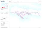
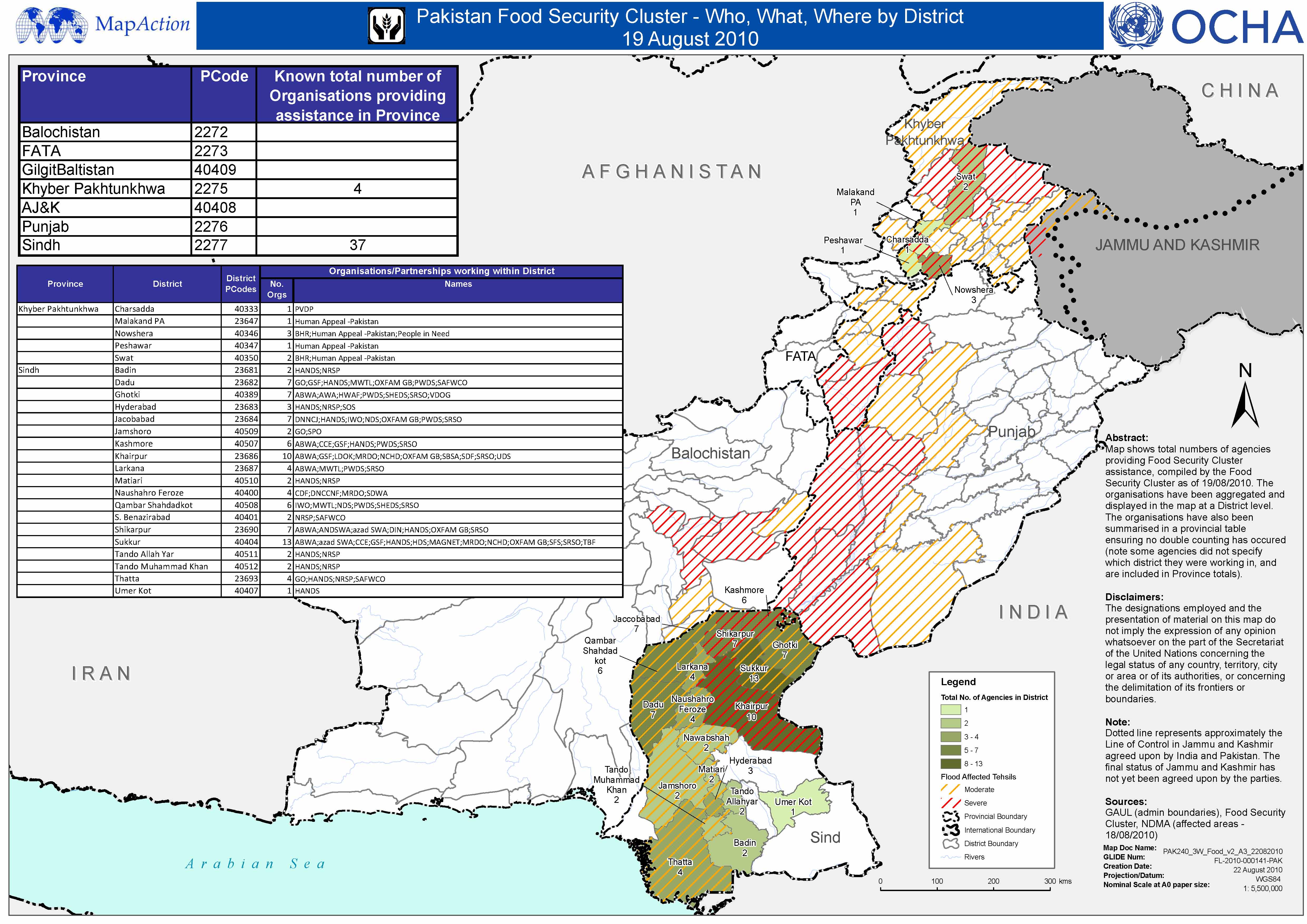
Pakistan Food Security Cluster - Who, What, Where, by District - 19 August 2010
This dataset has no description
-
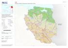
Pakistan Food Security Cluster - Who, What, Where by District - 19 August 2010
This dataset has no description
-

-

-

Population Density for Affected Provinces
Morocco population density for affected provinces at 1 km2 spatial distribution from 2020 WorldPop data. Tabular population data at province level supplied by Haut Commissaire... -

Provinces (Level-1 Administrative Boundaries)
Map showing administrative boundaries and major settlements at province level. -
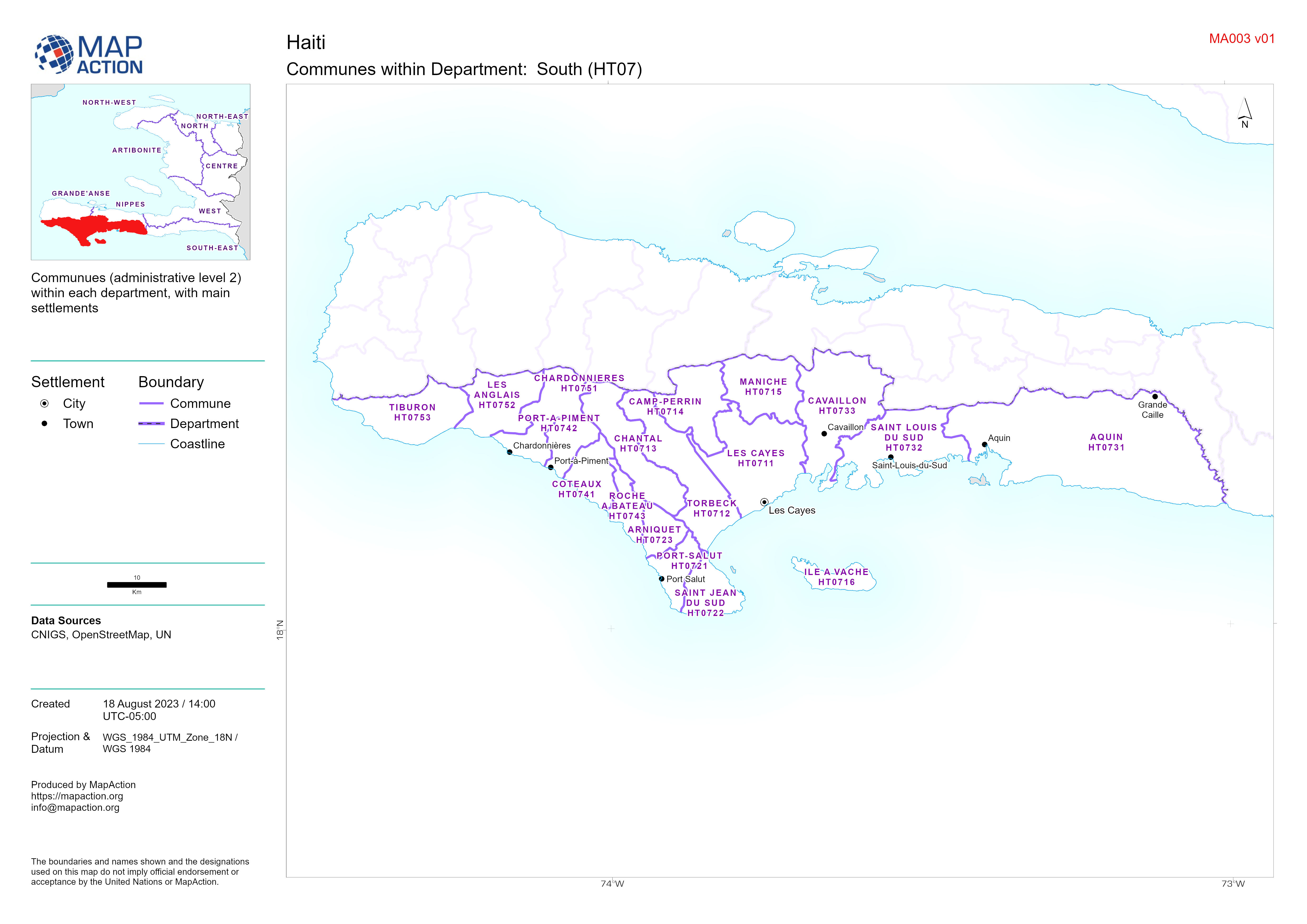
Atlas of Communes within Departments of Haiti
Communues (administrative level 2) within each department, with main settlements -

-

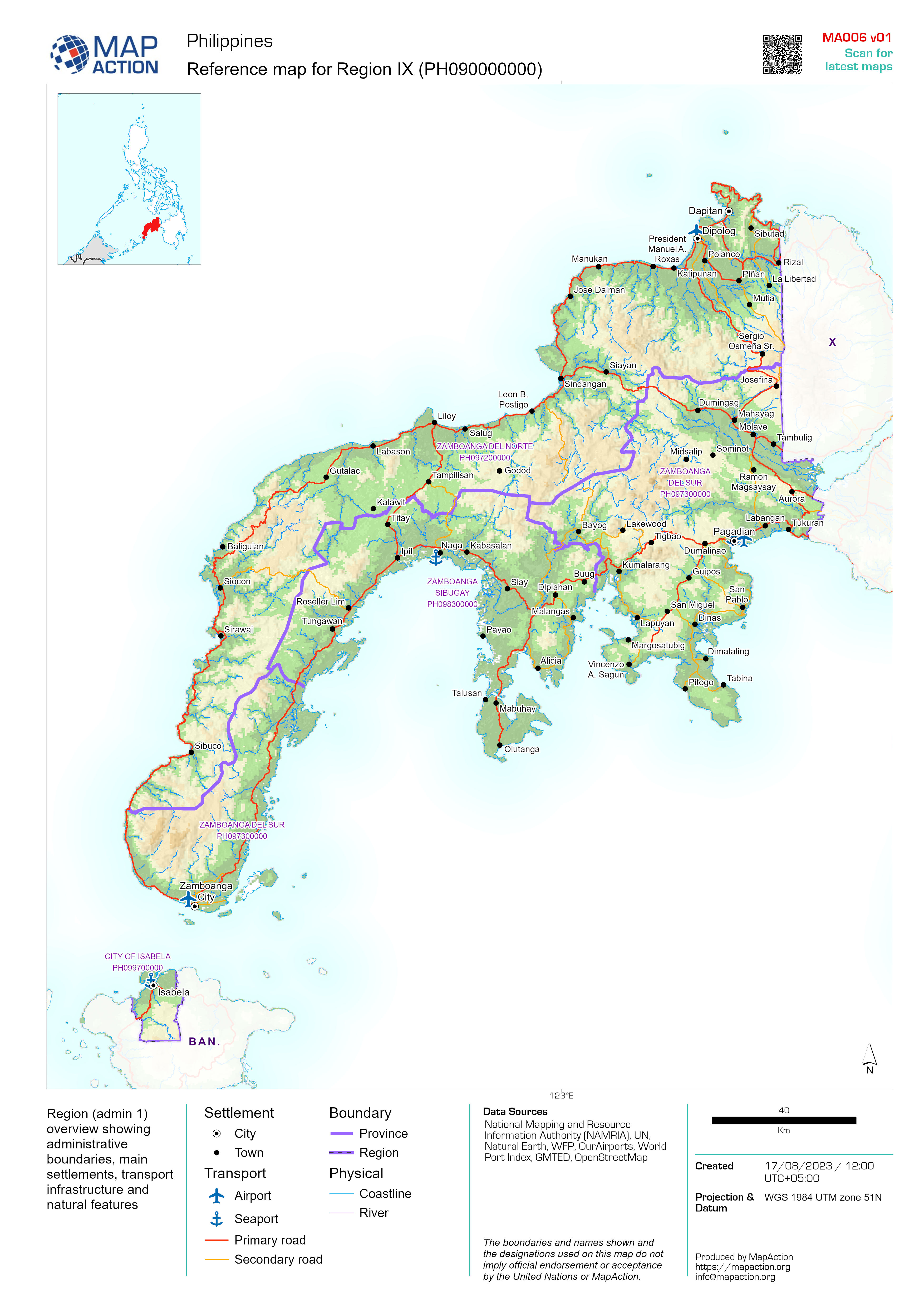
Reference map atlas for regions of the Philippines
Region (admin 1) overview showing administrative boundaries, main settlements, transport infrastructure and natural features -
Reference Map for Department:
Reference Map Atlas showing communes (admin level 2), settlements, transport infrastructure and natural features per department (admin level 1) -

Flood Extents (As of 02 Dec 2023) and Baseline Population
Table shows estimated baseline population in 2022 for affected regions in South Somalia. Population distribution shown on map is based on Worldpop estimate for 2020. Flood... -
Districts of Province:
Map atlas showing districts (administrative level 2) of each province (administrative level 1) in Zimbabwe -

Baseline population
Population density shown on the map is based on 2020 estimates by Worldpop. Counts in table are based on estimates for 2023 by the Philippines Statistics Authority (PSA)


