thumbnail.png
From the dataset abstract
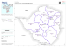
Provinces of Zimbabwe (Admin 1) with PCodes. Also showing major settlements
Additional Information
| Field | Value |
|---|---|
| Data last updated | April 11, 2023 |
| Metadata last updated | April 11, 2023 |
| Created | April 11, 2023 |
| Format | PNG |
| License | License not specified |
| Has views | True |
| Id | 2b86b66d-5123-4646-a7da-0f1aa7728544 |
| Mimetype | image/png |
| On same domain | True |
| Package id | debb9333-168e-4940-bb90-49a48e750705 |
| Position | 2 |
| Revision id | f180f87b-6540-49ed-8169-e6e9ddcdd548 |
| Size | 13.3 KiB |
| State | active |
| Url type | upload |