MA005_Affected_Wards_Popn_v2-300dpi.jpeg
From the dataset abstract
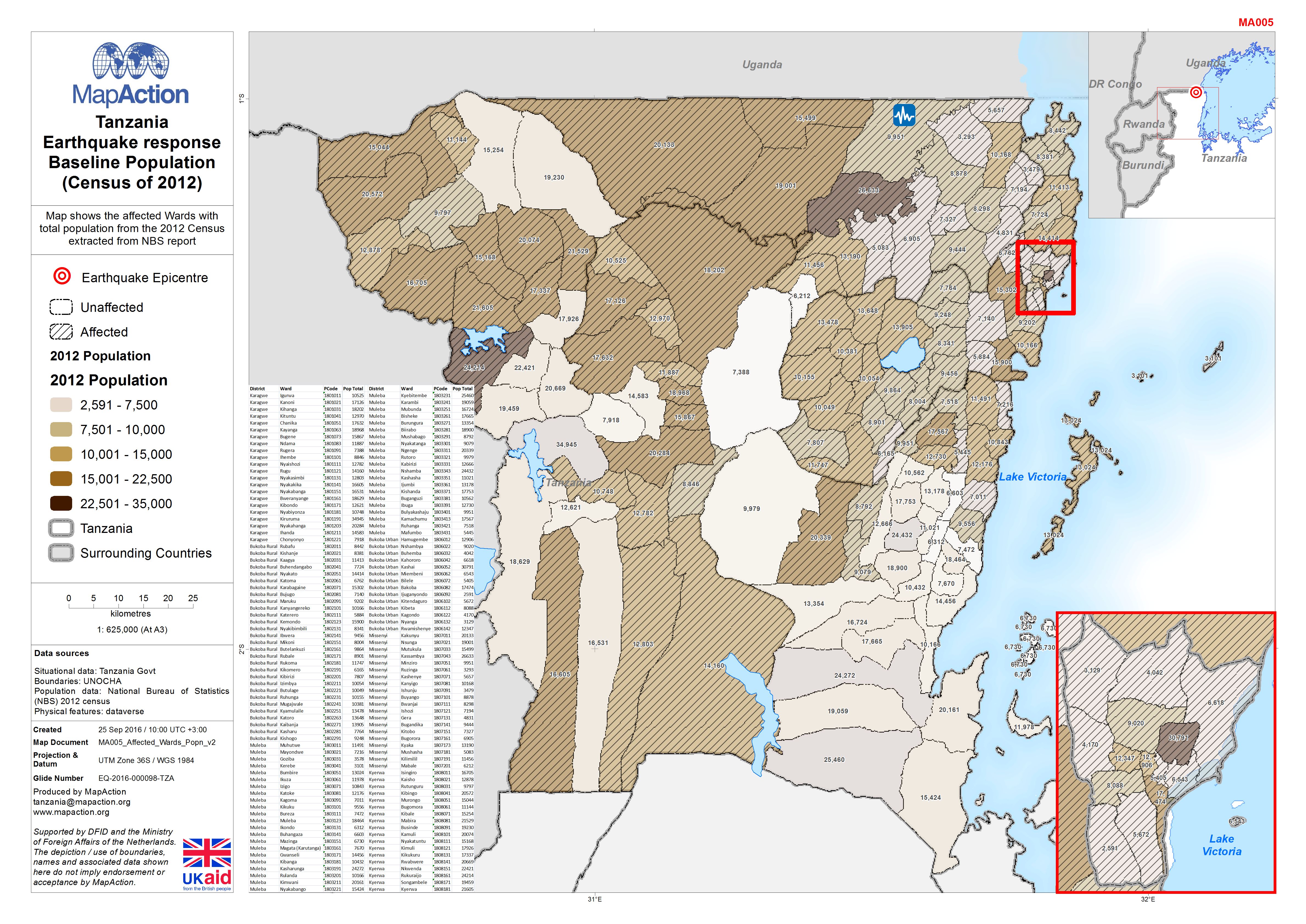
Map shows the affected Wards with total population from the 2012 Census extracted from NBS report
Source: Tanzania Earthquake response Baseline Population (Census of 2012)
Additional Information
| Field | Value |
|---|---|
| Data last updated | September 25, 2016 |
| Metadata last updated | September 25, 2016 |
| Created | September 25, 2016 |
| Format | JPEG |
| License | License not specified |
| Has views | True |
| Id | ff11564e-0329-4f94-9ae9-5907c577985c |
| On same domain | True |
| Package id | 486dbbb8-b59f-4b9c-873c-787d070f64c5 |
| Revision id | e0b28949-478a-4c86-8e74-3ee23bb65fc9 |
| State | active |
| Url type | upload |