thumbnail.png
From the dataset abstract
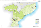
Location of Dams in four affected Provinces (Nampulam Zambezia, Manica and Sofala plus Tete which is only slightly affected
Source: Mozambique: Cyclone Idai - Location of Dams in affected Provinces with Watersheds
Additional Information
| Field | Value |
|---|---|
| Data last updated | March 29, 2019 |
| Metadata last updated | March 29, 2019 |
| Created | March 29, 2019 |
| Format | PNG |
| License | License not specified |
| Has views | True |
| Id | 85f4c1ef-1fc8-43a8-8263-8290cd1f280d |
| Mimetype | image/png |
| On same domain | True |
| Package id | ea956e7d-3a2e-4b3e-8788-a965ad2bf6b0 |
| Position | 2 |
| Revision id | 708d6934-6670-4df8-99d7-cbe0fa86d302 |
| Size | 18.7 KiB |
| State | active |
| Url type | upload |