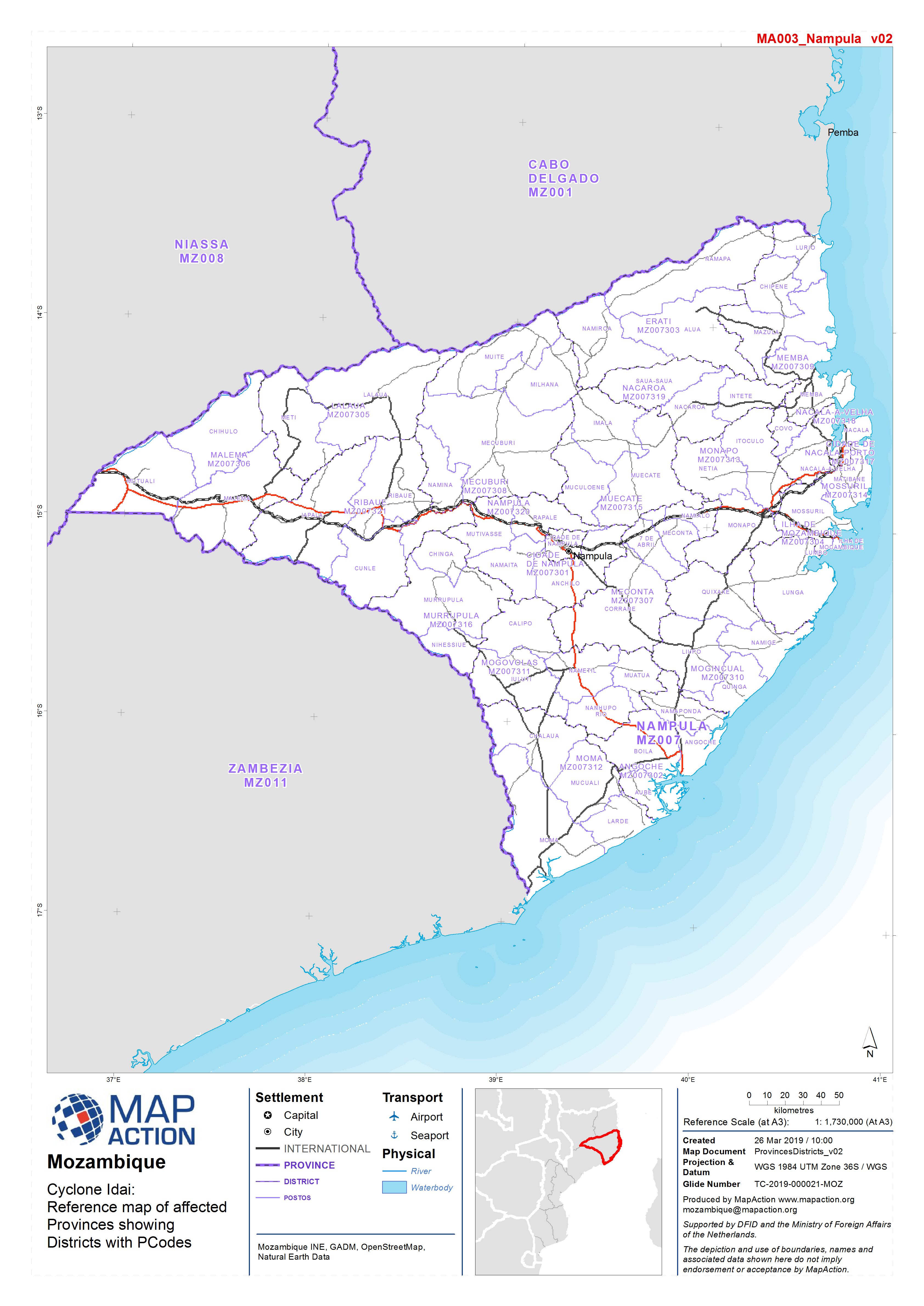
ProvincesDistricts_v02-300dpi.jpeg
From the dataset abstract
Reference map of affected Provinces showing Districts with PCodes
Source: Reference map of Mozambique - Administrative and P-Codes
Additional Information
| Field | Value |
|---|---|
| Data last updated | March 27, 2019 |
| Metadata last updated | March 27, 2019 |
| Created | March 27, 2019 |
| Format | JPEG |
| License | License not specified |
| Has views | True |
| Id | fbddecdd-50b6-4616-939c-824ff982c695 |
| Mimetype | image/jpeg |
| On same domain | True |
| Package id | 3461d987-1f6f-4922-bc0f-d49cf4329166 |
| Position | 1 |
| Revision id | c817ae85-5880-443d-ac71-1b8ec761da95 |
| Size | 1.1 MiB |
| State | active |
| Url type | upload |
