MA614-Access-South-South-East-300dpi.jpeg
From the dataset abstract
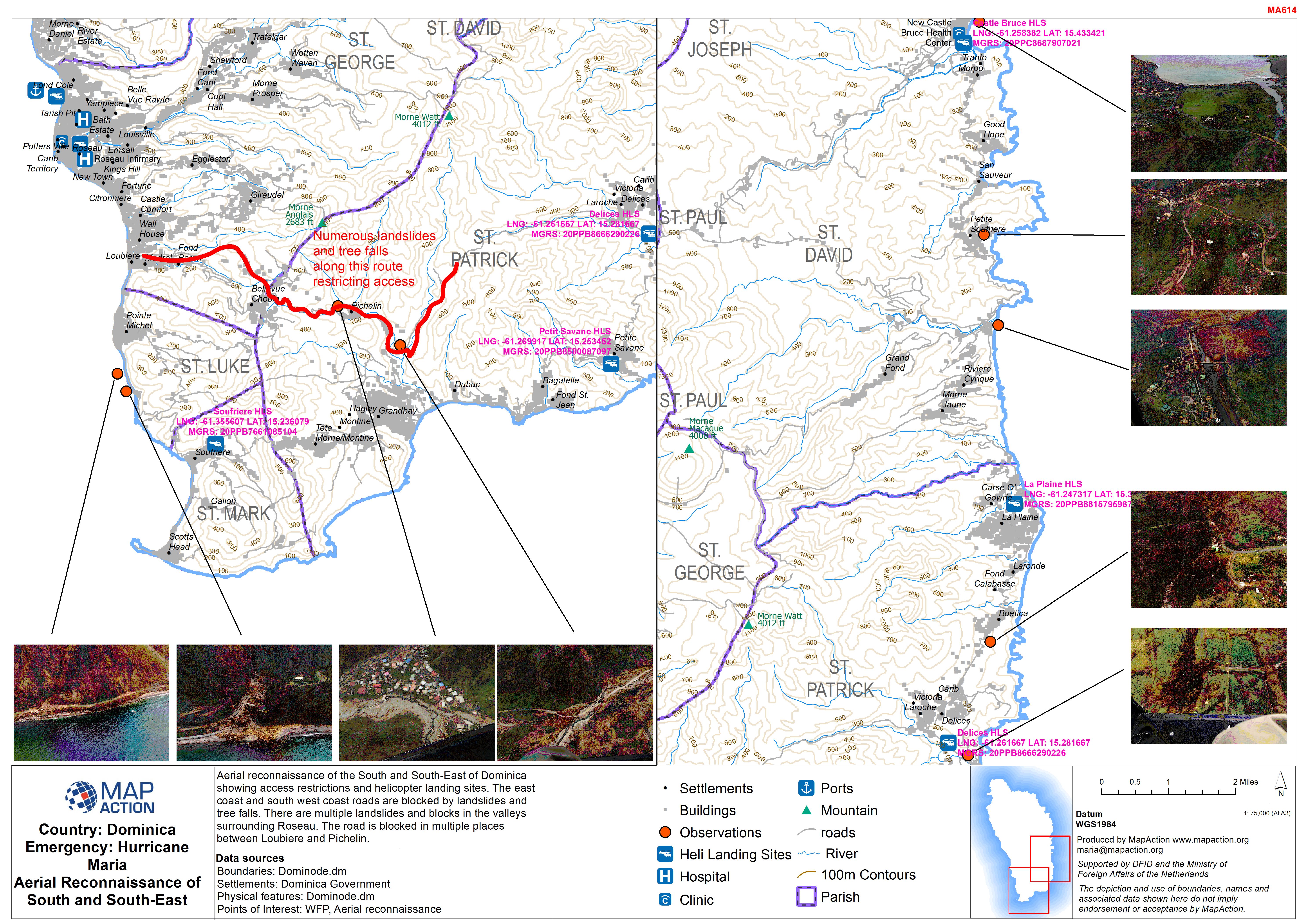
Aerial reconnaissance of the South and South-East of Dominica showing access restrictions and helicopter landing sites. The east coast and south west coast roads are blocked by landslides...
Source: Country: Dominica Emergency: Hurricane Maria Aerial Reconnaissance of South and South-East
Additional Information
| Field | Value |
|---|---|
| Data last updated | September 27, 2017 |
| Metadata last updated | September 27, 2017 |
| Created | September 27, 2017 |
| Format | JPEG |
| License | License not specified |
| Has views | True |
| Id | 7934075c-9735-4101-acf3-c6a64cf02c5c |
| On same domain | True |
| Package id | 5d3ca32b-7ce7-458d-926c-2bb628d578a7 |
| Revision id | 606f3089-b3d8-4f27-8065-d210f2e95682 |
| State | active |
| Url type | upload |