MA405_Sitational_GrandTurks_v3-300dpi.jpeg
From the dataset abstract
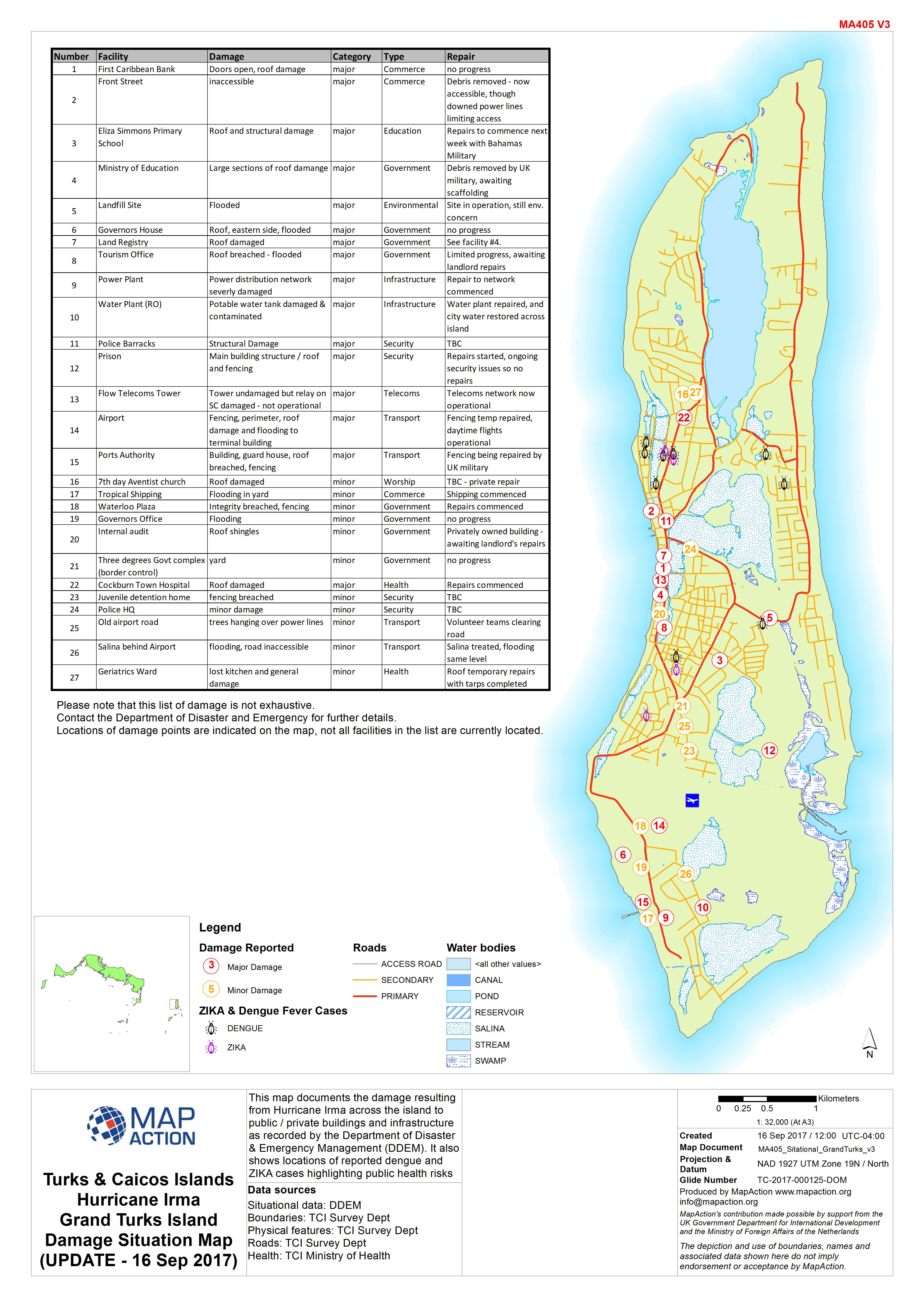
This map documents the damage resulting from Hurricane Irma across the island to public / private buildings and infrastructure as recorded by the Department of Disaster & Emergency...
Source: Turks & Caicos Islands Hurricane Irma Grand Turks Island Damage Situation Map (UPDATE - 16 Sep 2017)
Additional Information
| Field | Value |
|---|---|
| Data last updated | September 18, 2017 |
| Metadata last updated | September 18, 2017 |
| Created | September 18, 2017 |
| Format | JPEG |
| License | License not specified |
| Has views | True |
| Id | 20d1c483-5684-44f9-890f-575a64159017 |
| On same domain | True |
| Package id | 8b61725e-a8c4-4fcc-9f83-3129147bfedf |
| Revision id | 43609875-837e-4342-8b69-2e81d69c3656 |
| State | active |
| Url type | upload |