MA405_Sitational_GrandTurks_v1-300dpi.jpeg
From the dataset abstract
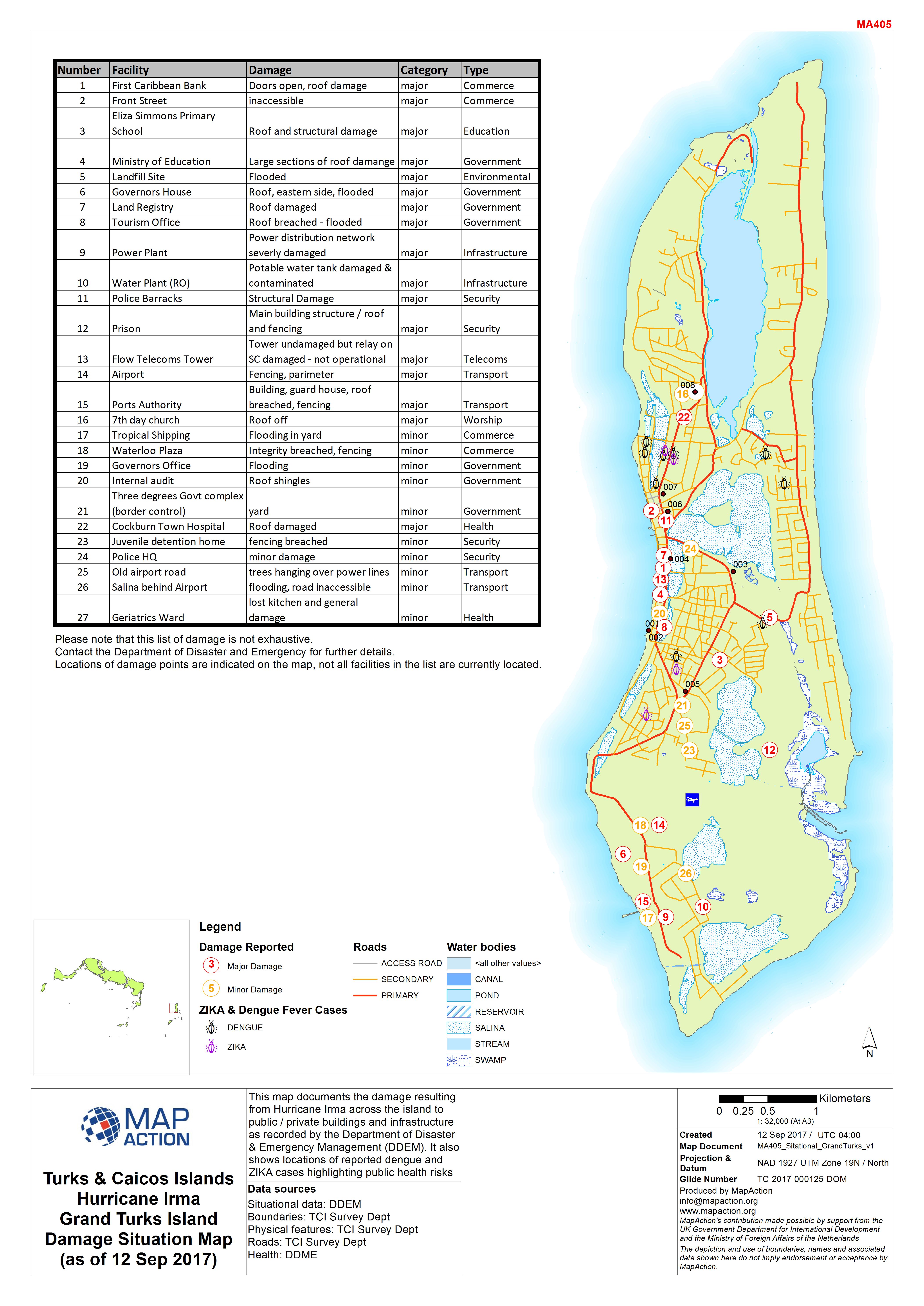
This map documents the damage resulting from Hurricane Irma across the island to public / private buildings and infrastructure as recorded by the Department of Disaster & Emergency...
Source: Turks & Caicos Islands Hurricane Irma Grand Turks Island Damage Situation Map (as of 12 Sep 2017)
Additional Information
| Field | Value |
|---|---|
| Data last updated | September 18, 2017 |
| Metadata last updated | September 18, 2017 |
| Created | September 18, 2017 |
| Format | JPEG |
| License | License not specified |
| Has views | True |
| Id | e8a6bda3-d18a-478d-81dc-1c83d97c2f98 |
| On same domain | True |
| Package id | b0bfc677-4ba3-45da-88f6-7dc831963c65 |
| Revision id | 5cd6080c-f65b-4fee-a424-ce6d3e630a7e |
| State | active |
| Url type | upload |