MA401_Reference_Turks_Caicos_Isl_v1-300dpi.jpeg
From the dataset abstract
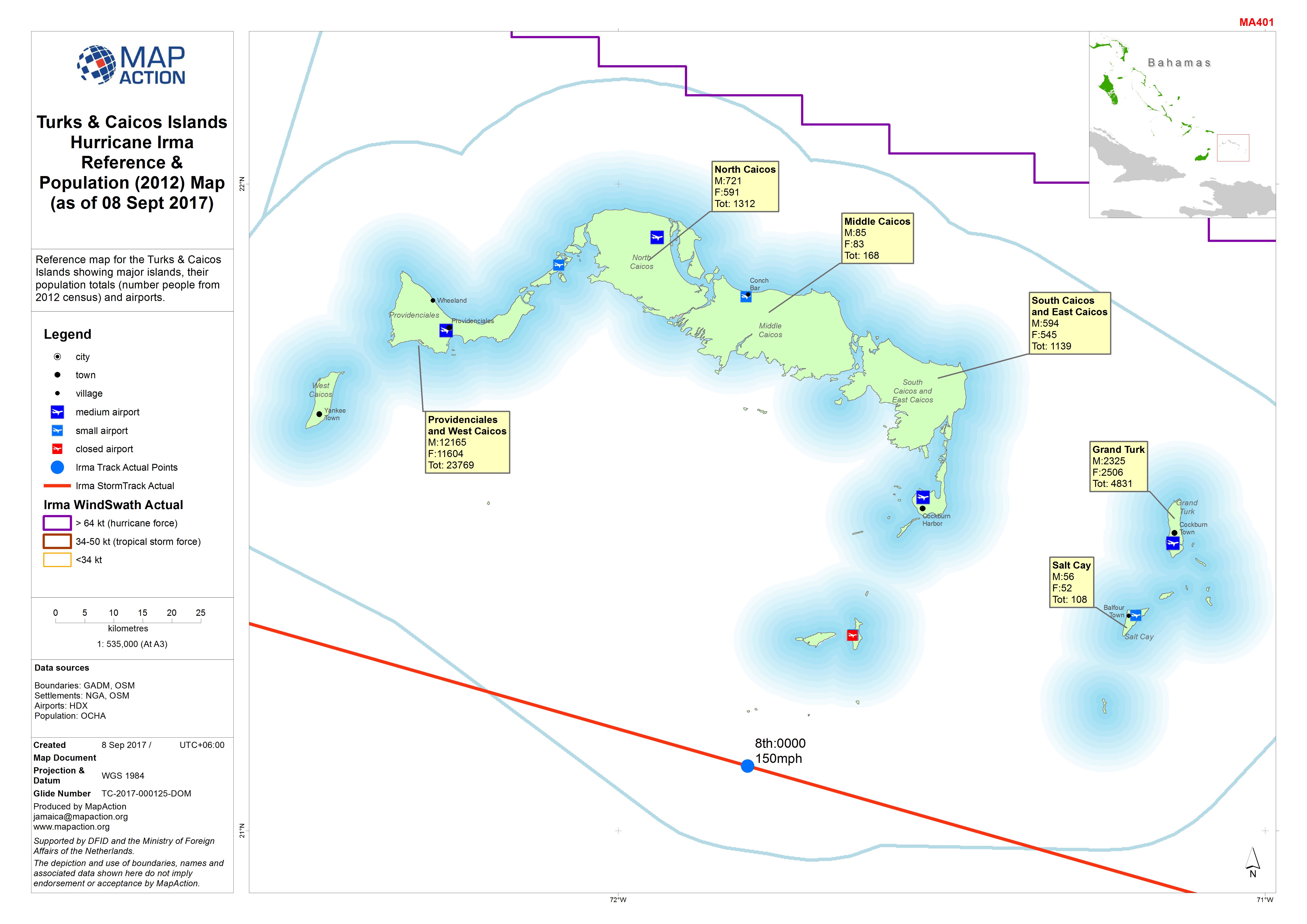
Reference map for the Turks & Caicos Islands showing major islands, their population totals (number people from 2012 census) and airports.
Source: Turks & Caicos Islands Hurricane Irma Reference & Population (2012) Map (as of 08 Sept 2017)
Additional Information
| Field | Value |
|---|---|
| Data last updated | September 10, 2017 |
| Metadata last updated | September 10, 2017 |
| Created | September 10, 2017 |
| Format | JPEG |
| License | License not specified |
| Has views | True |
| Id | bdfd890b-1c6d-4a38-b54c-29d4fa33ecaf |
| On same domain | True |
| Package id | 5b689fae-1bac-40bf-aec9-acbb53fcd9f5 |
| Revision id | ec207a85-3048-410a-9ae5-9a5fd43ff364 |
| State | active |
| Url type | upload |
