MA220_BVIBuildingDensity_v01-300dpi.jpeg
From the dataset abstract
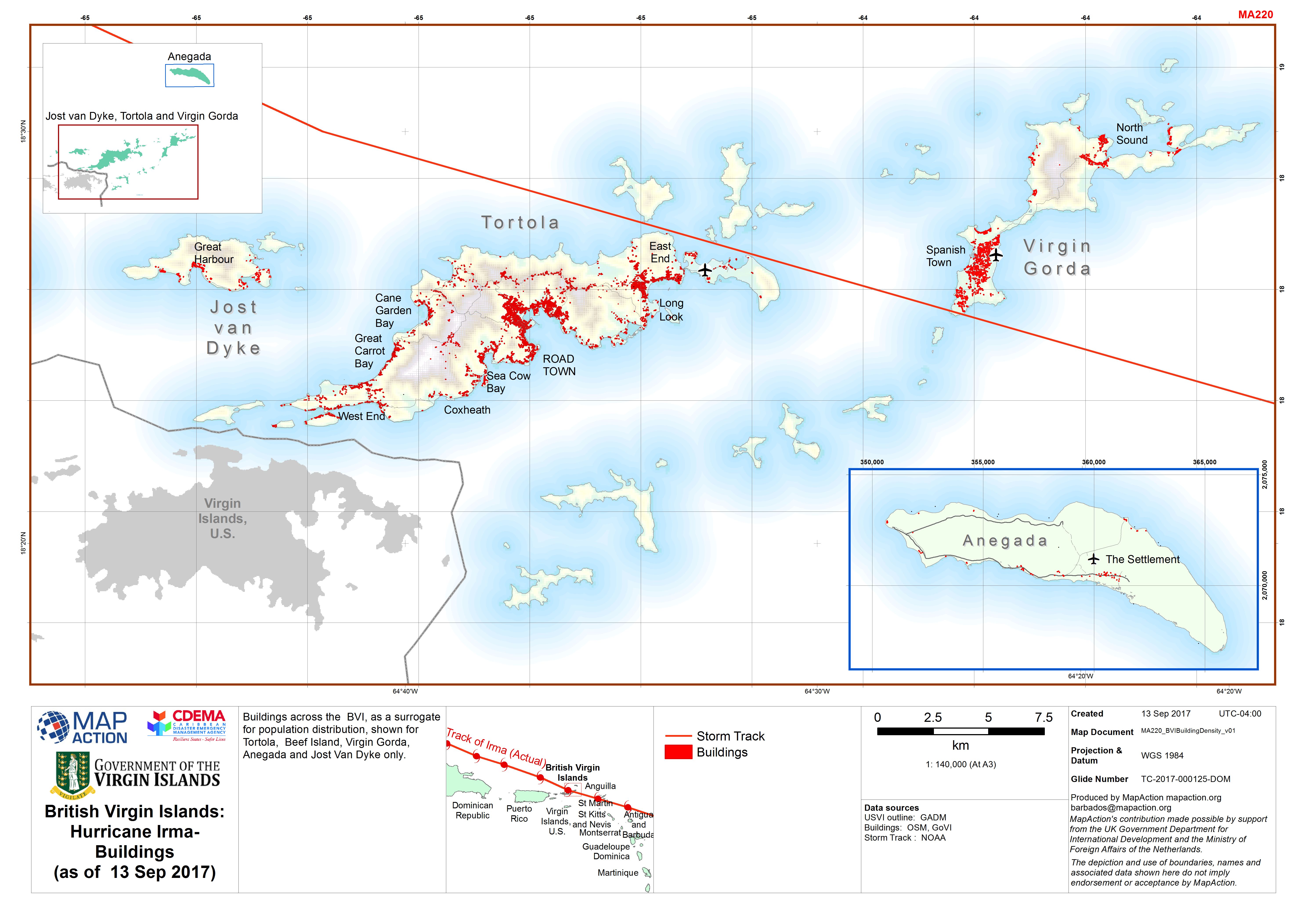
Buildings across the BVI, as a surrogate for population distribution, shown for Tortola, Beef Island, Virgin Gorda, Anegada and Jost Van Dyke only.
Source: British Virgin Islands: Hurricane Irma- Buildings (as of 13 Sep 2017)
Additional Information
| Field | Value |
|---|---|
| Data last updated | September 14, 2017 |
| Metadata last updated | September 14, 2017 |
| Created | September 14, 2017 |
| Format | JPEG |
| License | License not specified |
| Has views | True |
| Id | f2455bad-4f6b-4771-a85c-1cc0dc431a23 |
| On same domain | True |
| Package id | 6d18ec1f-8f01-41cd-84fb-906321a9f123 |
| Revision id | bbb1d590-cdf5-4f31-af6d-90bf4bf46b71 |
| State | active |
| Url type | upload |