MA209_TransportInfrastructure_v01-300dpi.jpeg
From the dataset abstract
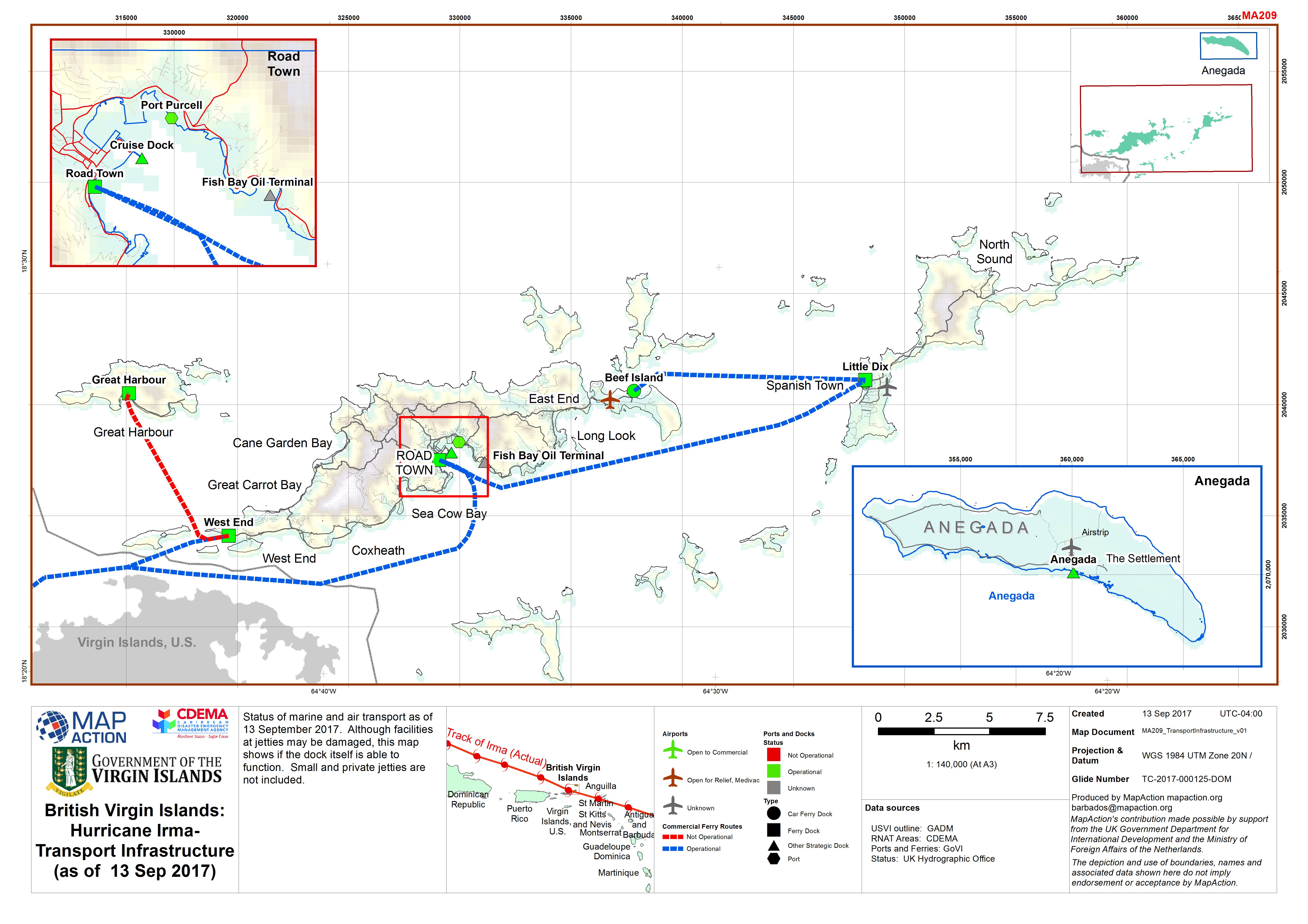
Status of marine and air transport as of 13 September 2017. Although facilities at jetties may be damaged, this map shows if the dock itself is able to function. Small and private...
Source: British Virgin Islands: Hurricane Irma- Transport Infrastructure (as of 13 Sep 2017)
Additional Information
| Field | Value |
|---|---|
| Data last updated | September 13, 2017 |
| Metadata last updated | September 13, 2017 |
| Created | September 13, 2017 |
| Format | JPEG |
| License | Other (Public Domain) |
| Has views | True |
| Id | d908dee7-bb4c-4277-b0c4-3ce96a8c9ff5 |
| On same domain | True |
| Package id | 380908a4-8c83-427b-849e-36435e0fc68a |
| Revision id | 3225f4bb-77dc-4da3-9f53-4c893f70d4d6 |
| State | active |
| Url type | upload |