MA101_AnguillaOverview_v02-300dpi.jpeg
From the dataset abstract
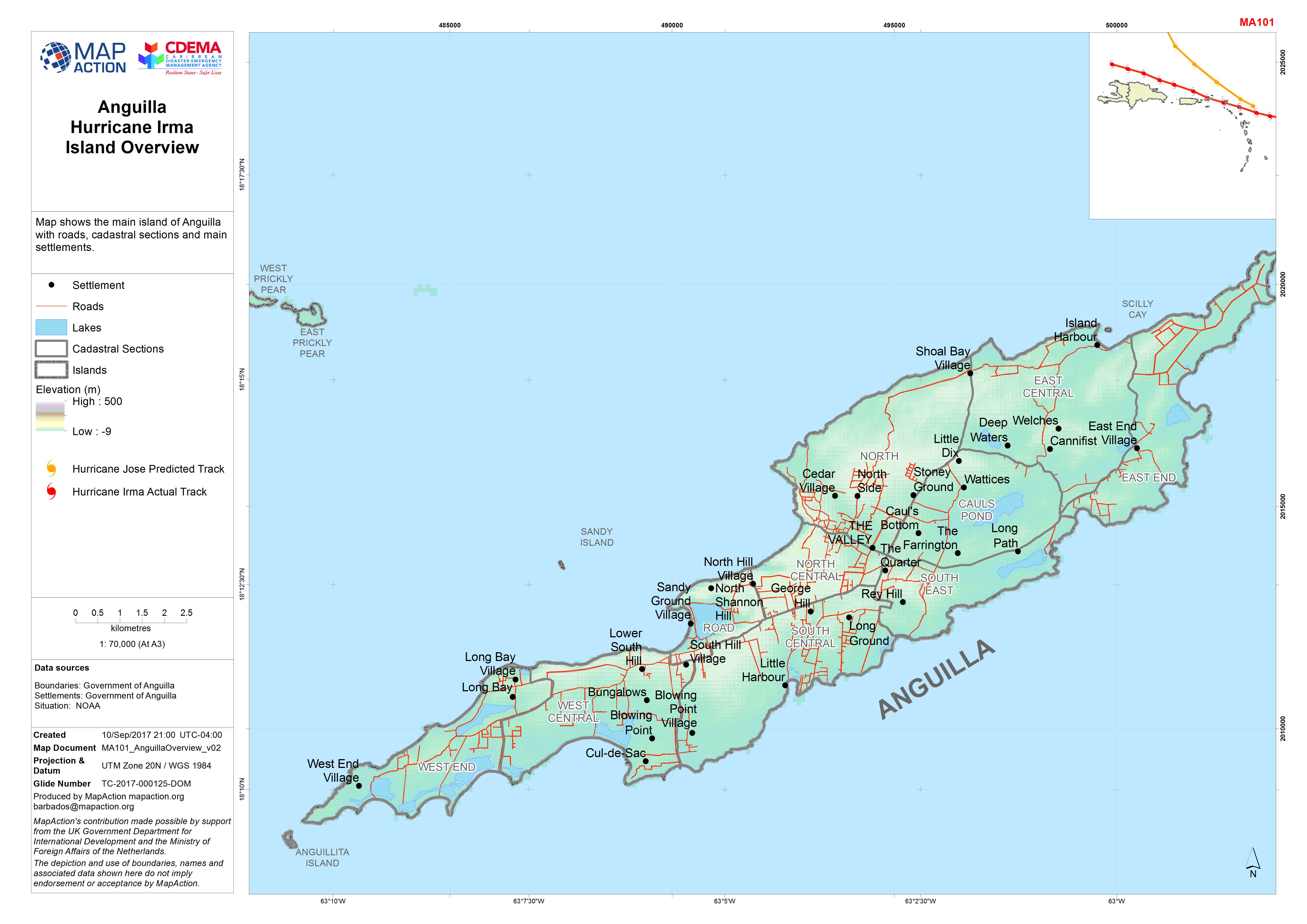
Map shows the main island of Anguilla with roads, cadastral sections and main settlements.
Additional Information
| Field | Value |
|---|---|
| Data last updated | September 16, 2017 |
| Metadata last updated | September 16, 2017 |
| Created | September 16, 2017 |
| Format | JPEG |
| License | License not specified |
| Has views | True |
| Id | 8ee6a451-b59f-4f7f-a19b-11fe10ac0ee0 |
| On same domain | True |
| Package id | 4858155b-491e-4f14-bccd-bf2415813cbb |
| Revision id | bffe0026-61a6-4303-a1cb-42913a21f327 |
| State | active |
| Url type | upload |