MA024_Palu_Water_Points-300dpi.jpeg
From the dataset abstract
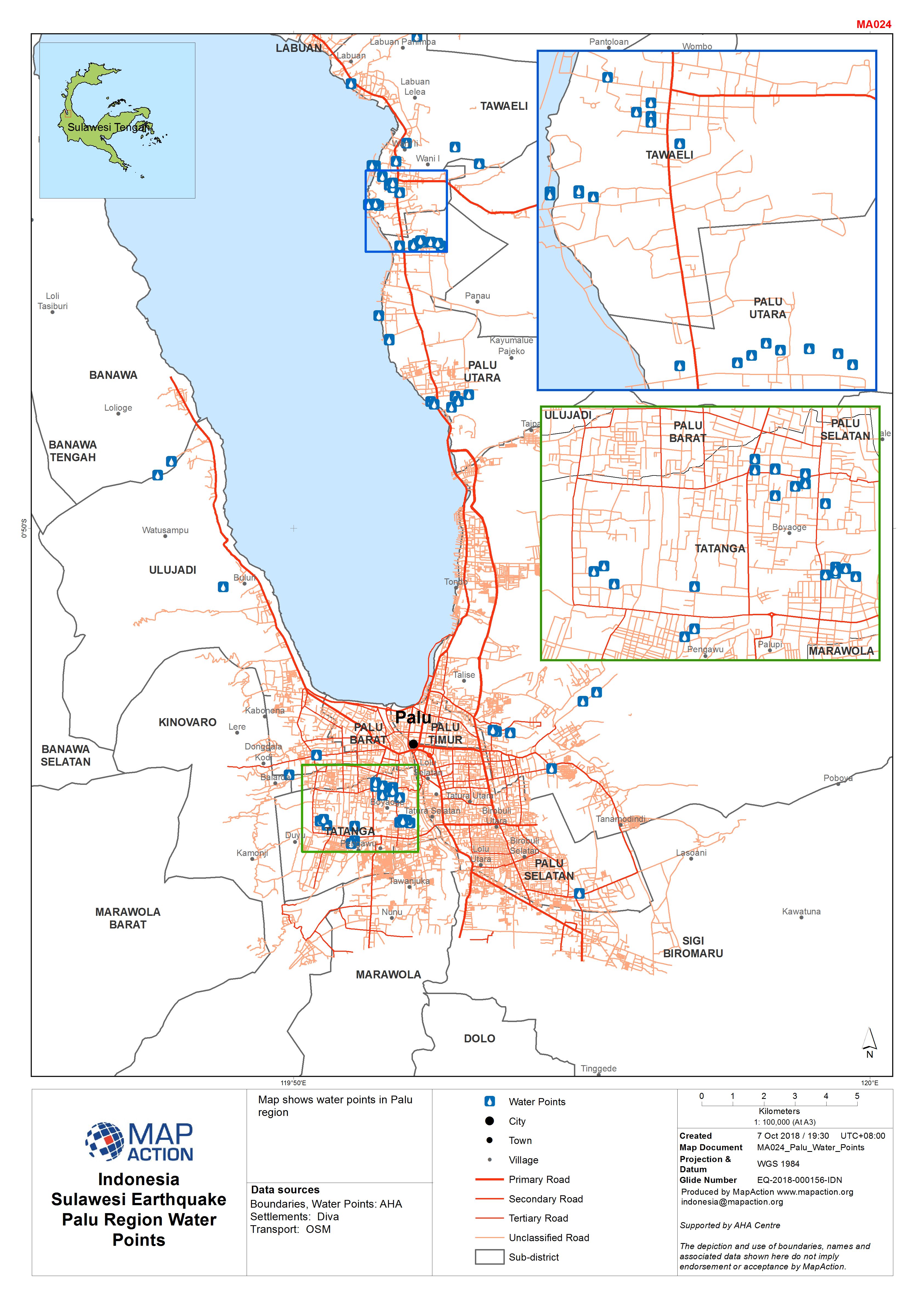
Map shows water points in Palu region
Source: Indonesia Sulawesi Earthquake Palu Region Water Points
Additional Information
| Field | Value |
|---|---|
| Data last updated | October 7, 2018 |
| Metadata last updated | October 7, 2018 |
| Created | October 7, 2018 |
| Format | JPEG |
| License | License not specified |
| Has views | True |
| Id | b8a02c00-d778-4bde-9306-27020aa5a663 |
| On same domain | True |
| Package id | 7608d244-38df-4f60-a416-cf206e75f63f |
| Revision id | 0abc7d4b-4844-4cd3-b083-0d8ec45d9a8a |
| State | active |
| Url type | upload |
