MA022_tsunami_liquefaction_Assessment_Prioritis ...
From the dataset abstract
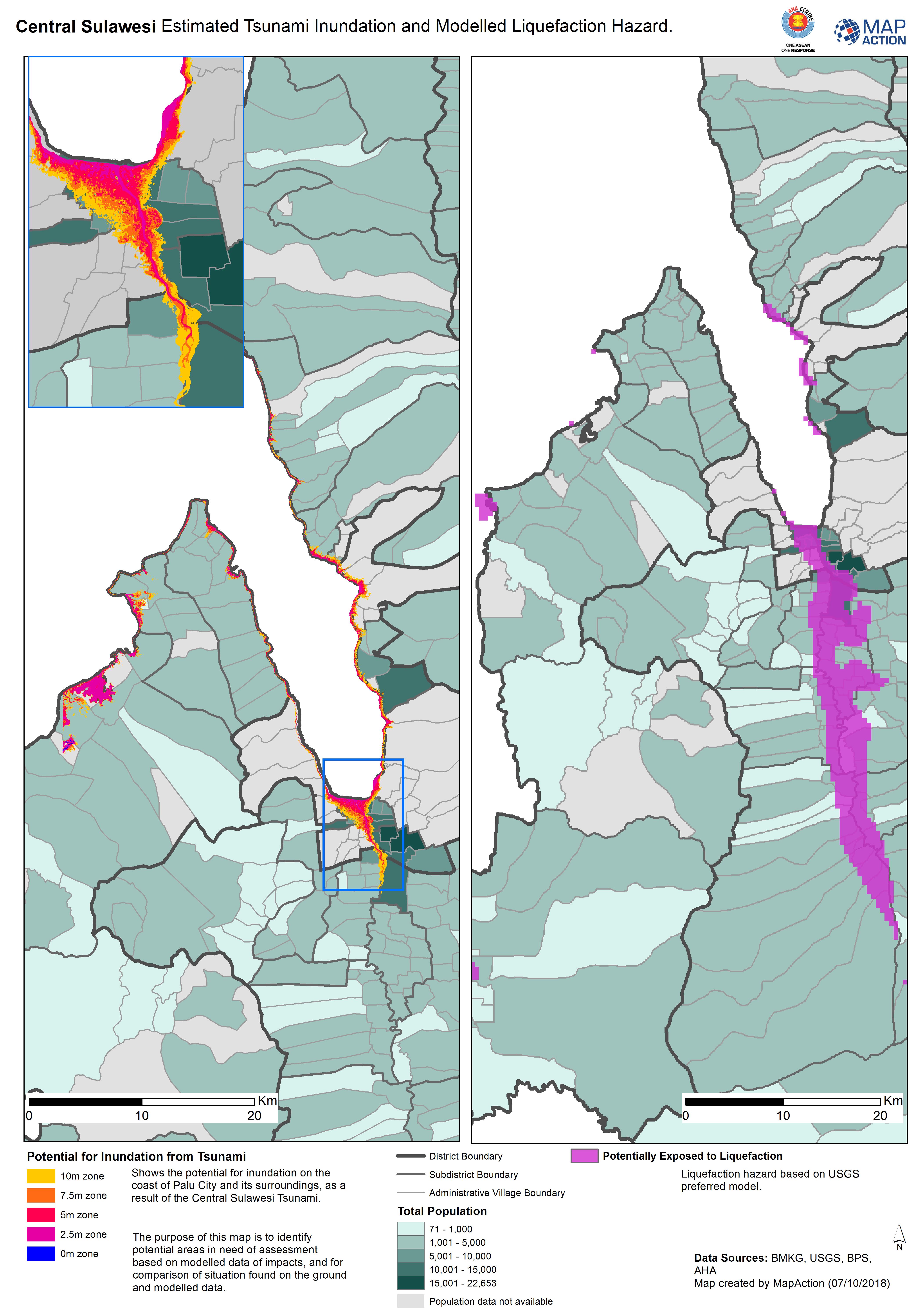
Shows the potential for inundation on the coast of Palu City and its surroundings, as a result of the Central Sulawesi Tsunami. The purpose of this map is to identify potential areas in...
Source: Central Sulawesi Estimated Tsunami Inundation and Modelled Liquefaction Hazard.
Additional Information
| Field | Value |
|---|---|
| Data last updated | October 7, 2018 |
| Metadata last updated | October 7, 2018 |
| Created | October 7, 2018 |
| Format | JPEG |
| License | License not specified |
| Has views | True |
| Id | 5a37b143-cb97-4b45-96e9-f7d75cc6b208 |
| On same domain | True |
| Package id | 67017095-dc25-49b0-b2e3-4b1c49da7a54 |
| Revision id | 662ef2e3-e46d-4013-887b-ad7fe007ee17 |
| State | active |
| Url type | upload |