MA017_Palu_Caseload_Admin3-300dpi.jpeg
From the dataset abstract
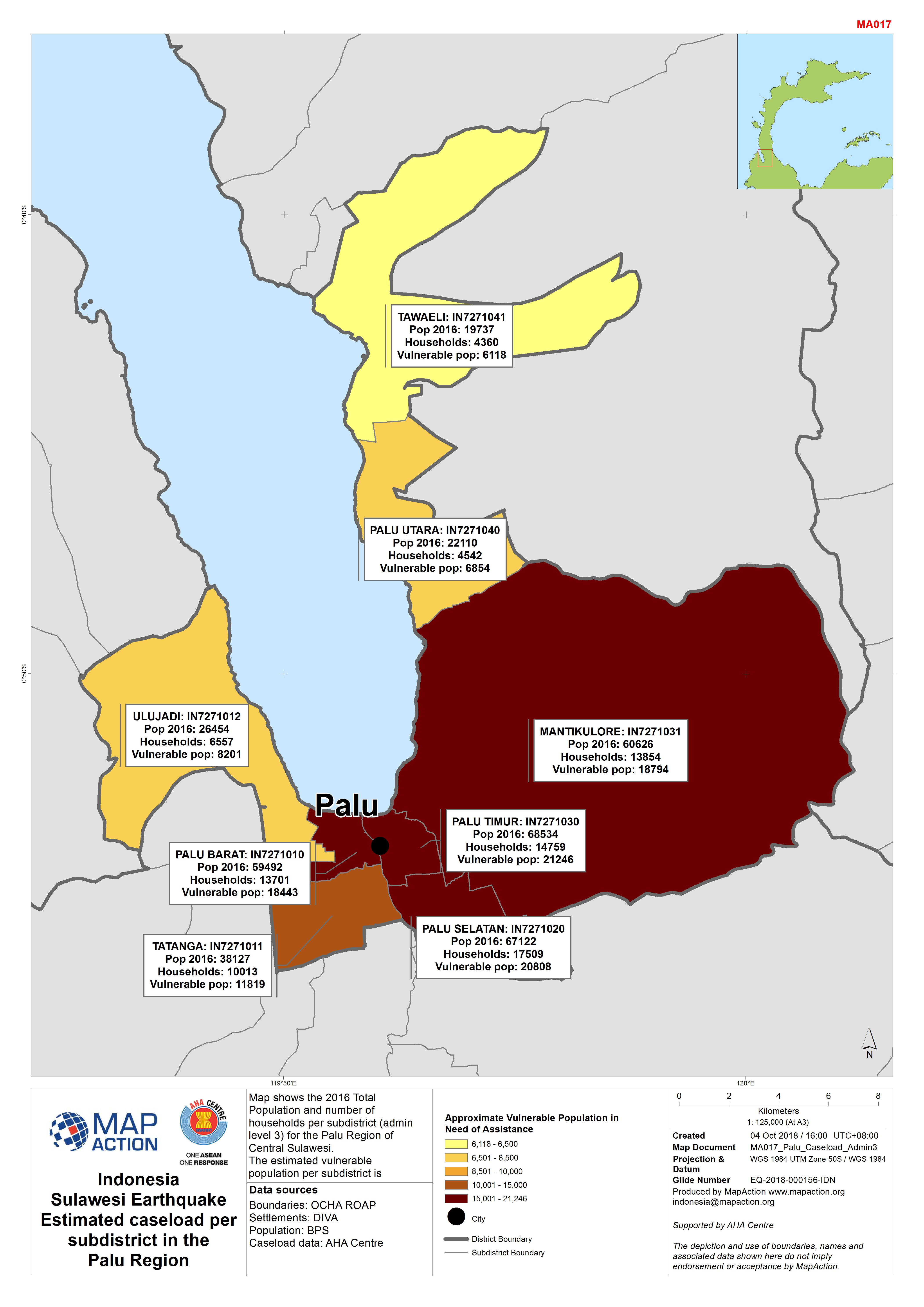
Map shows the 2016 Total Population and number of households per subdistrict (admin level 3) for the Palu Region of Central Sulawesi. The estimated vulnerable population per subdistrict...
Source: Indonesia Sulawesi Earthquake Estimated caseload per subdistrict in the Palu Region
Additional Information
| Field | Value |
|---|---|
| Data last updated | October 5, 2018 |
| Metadata last updated | October 5, 2018 |
| Created | October 5, 2018 |
| Format | JPEG |
| License | License not specified |
| Has views | True |
| Id | 6c1631e1-b9db-4ece-b7fe-6797fe011d55 |
| On same domain | True |
| Package id | 9388ef33-f7c5-4f1a-8ef7-db85ac0007af |
| Revision id | 677e3bc4-541b-4904-9319-28d941753551 |
| State | active |
| Url type | upload |