MA002_Sulawesi_Health-300dpi.jpg
From the dataset abstract
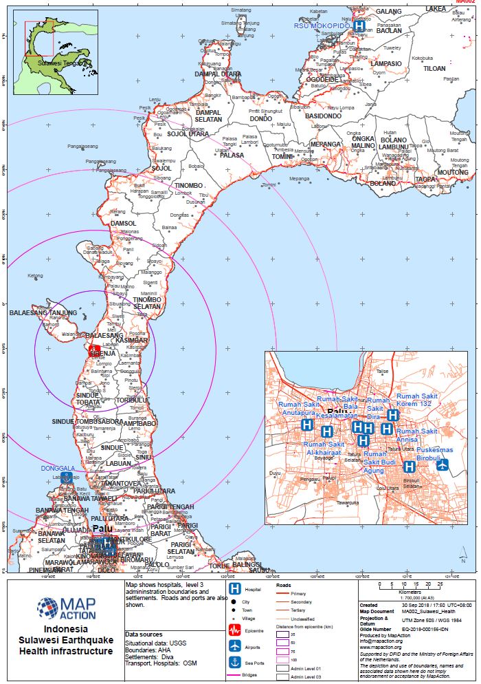
Map shows hospitals, level 3 admininstration boundaries and settlements. Roads and ports are also shown.
Source: Sulawesi Earthquake - Health
Additional Information
| Field | Value |
|---|---|
| Data last updated | October 1, 2018 |
| Metadata last updated | October 1, 2018 |
| Created | October 1, 2018 |
| Format | JPEG |
| License | Creative Commons Attribution |
| Has views | True |
| Id | 7f58da71-3001-4e3f-9de5-8838ac1947b5 |
| On same domain | True |
| Package id | aa8472e3-a0f5-485c-85c3-43786241dd4f |
| Revision id | e5dbe31b-34f9-48e2-b1f9-ed748c4e7921 |
| State | active |
| Url type | upload |