MA006_Haiti_Grand-Anse_Pop_v2_A3-300dpi.jpeg
From the dataset abstract
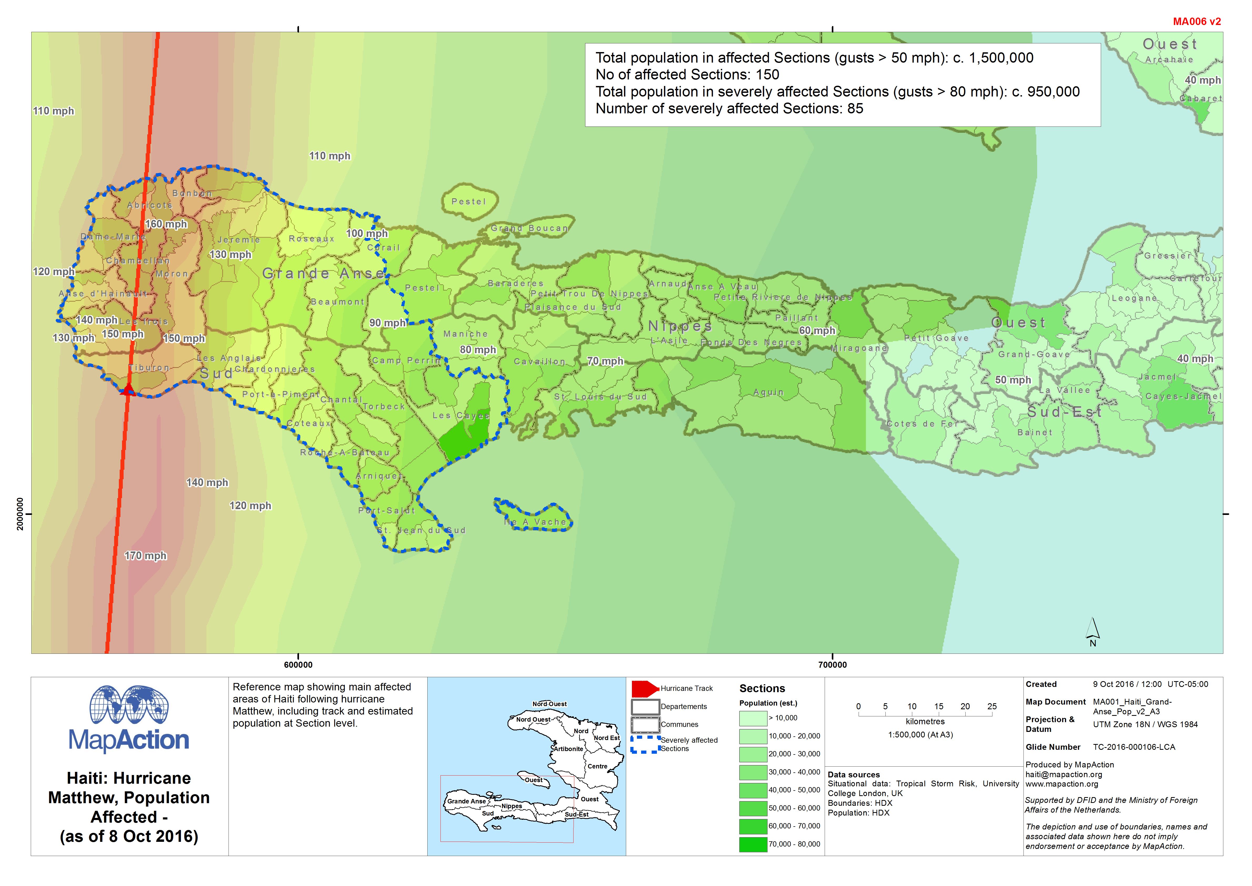
Reference map showing main affected areas of Haiti following hurricane Matthew, including track and estimated population at Section level.
Source: Haiti: Hurricane Matthew, Population Affected - (as of 8 Oct 2016)
Additional Information
| Field | Value |
|---|---|
| Data last updated | October 9, 2016 |
| Metadata last updated | October 9, 2016 |
| Created | October 9, 2016 |
| Format | JPEG |
| License | License not specified |
| Has views | True |
| Id | 3b906f2c-fd54-4b34-9b1b-da3eaf8ac814 |
| On same domain | True |
| Package id | 8d9305db-3dc0-4c54-b294-59db24a38071 |
| Revision id | 81ec1cb5-989f-4856-b4bf-758555800d27 |
| State | active |
| Url type | upload |