MA211_v1-300dpi.jpg
From the dataset abstract
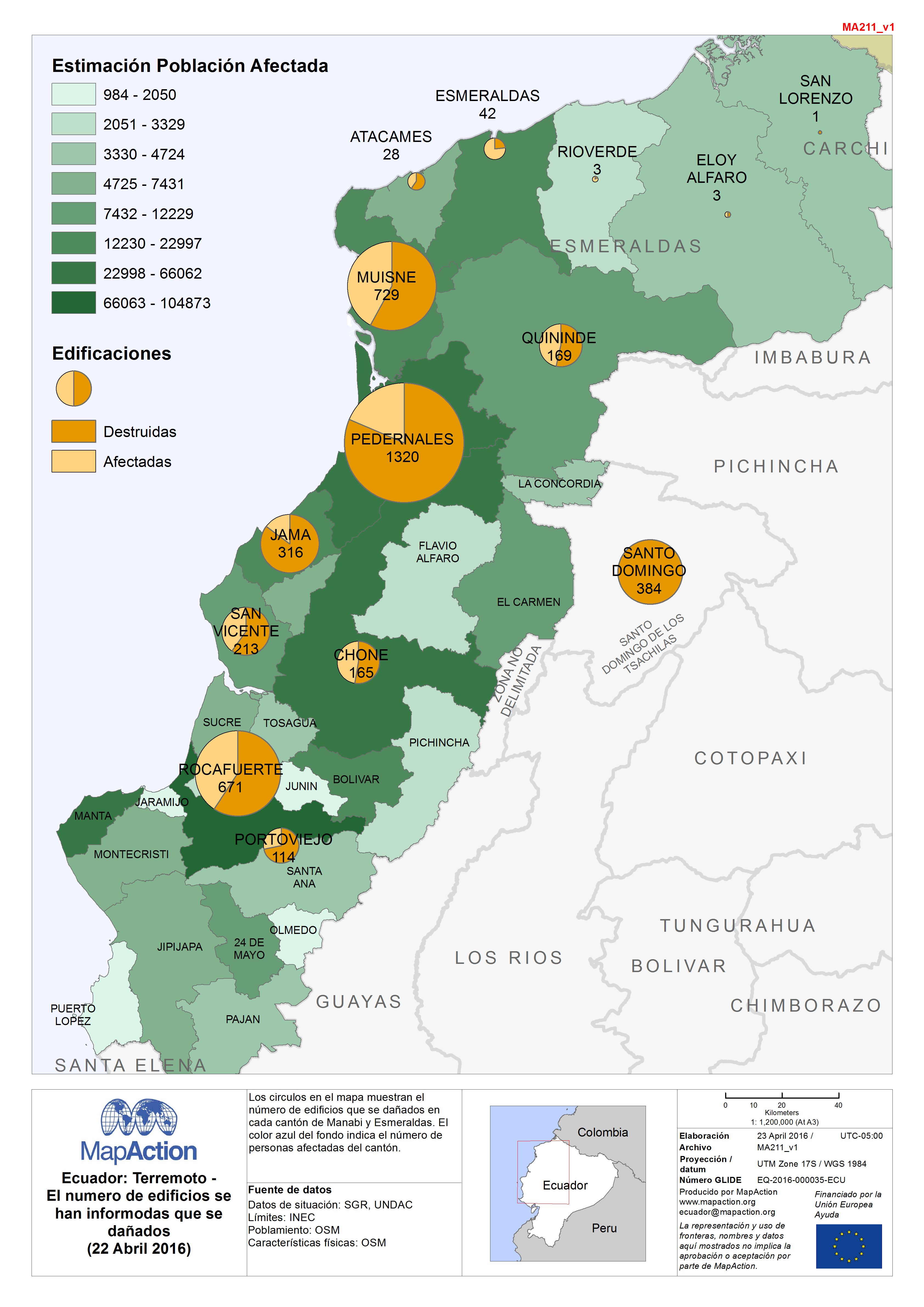
Los circulos en el mapa muestran el número de edificios que se dañados en cada cantón de Manabi y Esmeraldas. El color azul del fondo indica el número de personas afectadas del cantón.
Source: Ecuador: Terremoto - El numero de edificios se han informodas que se dañados (22 Abril 2016)
Additional Information
| Field | Value |
|---|---|
| Data last updated | May 20, 2017 |
| Metadata last updated | May 20, 2017 |
| Created | May 20, 2017 |
| Format | JPEG |
| License | Open Data Commons Attribution License |
| Has views | True |
| Id | f38bfcb6-1d62-418e-9e93-7eb63ca76cc7 |
| On same domain | True |
| Package id | c989ace9-0c3d-45c7-b1e3-883016e57415 |
| Revision id | a6cd0546-f8c9-4089-93f0-d4cc555e402a |
| State | active |
| Url type | upload |