thumbnail.PNG
From the dataset abstract
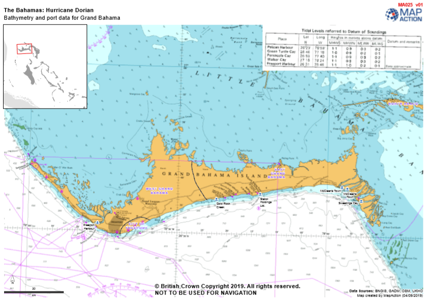
Bathymetry and ports data for Grand Bahama and Abaco. NOT TO BE USED FOR NAVIGATION. These charts are based on pre-hurricane Dorian data.
Additional Information
| Field | Value |
|---|---|
| Data last updated | September 6, 2019 |
| Metadata last updated | September 6, 2019 |
| Created | September 6, 2019 |
| Format | PNG |
| License | License not specified |
| Has views | True |
| Id | 3c950bcc-335b-4dfd-86ee-e930ac0bd326 |
| Mimetype | image/png |
| On same domain | True |
| Package id | 15eb4faf-856d-4891-9d43-f8db2e72e898 |
| Position | 3 |
| Revision id | cdc7ddb5-6358-43df-8d7a-ad6e1fa94bae |
| Size | 402 KiB |
| State | active |
| Url type | upload |