thumbnail.png
From the dataset abstract
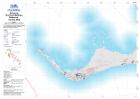
1:250 000 Reference maps for Bahamas showing islands, settlements, transport infrastructure, districts and topographic features
Additional Information
| Field | Value |
|---|---|
| Data last updated | October 24, 2016 |
| Metadata last updated | October 24, 2016 |
| Created | October 24, 2016 |
| Format | PNG |
| License | License not specified |
| Has views | True |
| Id | 12f5efb1-2645-4da1-9bec-4af97c33ecf8 |
| On same domain | True |
| Package id | 9e3f69b3-b8ce-4b65-9043-7d29fc0d200c |
| Position | 2 |
| Revision id | 5b795620-d5ba-451f-ad60-cb65c1da99a4 |
| State | active |
| Url type | upload |