thumbnail.png
From the dataset abstract
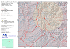
Daily overview map showing known road status and selected towns and localities in affected areas.
Source: Situation overview map (large)
Additional Information
| Field | Value |
|---|---|
| Data last updated | July 28, 2016 |
| Metadata last updated | July 28, 2016 |
| Created | July 28, 2016 |
| Format | PNG |
| License | License not specified |
| Has views | True |
| Id | 52bb3fa0-0695-4904-b64e-a041e9526a00 |
| On same domain | True |
| Package id | 1d89aa8a-e4b6-4ae8-b58d-314a95506aeb |
| Position | 1 |
| Revision id | 5956f799-0fea-44bd-a63c-40306837a81e |
| State | active |
| Url type | upload |