thumbnail.png
From the dataset abstract
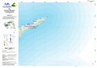
1:100,000 topographical map of Fiji showing physical, transport, settlement and other key features.
Source: Fiji: Cyclone Winston - Topographical - 7 - Nagasauva
Additional Information
| Field | Value |
|---|---|
| Data last updated | July 28, 2016 |
| Metadata last updated | July 28, 2016 |
| Created | July 28, 2016 |
| Format | PNG |
| License | License not specified |
| Has views | True |
| Id | 21eb26ba-92e1-467f-a381-b1af3b40a0b6 |
| On same domain | True |
| Package id | 6faea5ac-88ad-4a2a-b596-2cebb3e51a66 |
| Position | 2 |
| Revision id | dd76bd20-7483-4fe8-b498-9c5a1c992979 |
| State | active |
| Url type | upload |