thumbnail.png
From the dataset abstract
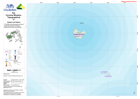
1:100,000 topographical map of Fiji showing physical, transport, settlement and other key features.
Source: Fiji: Cyclone Winston - Topographical - 37 - Naitaba and Malima
Additional Information
| Field | Value |
|---|---|
| Data last updated | July 28, 2016 |
| Metadata last updated | July 28, 2016 |
| Created | July 28, 2016 |
| Format | PNG |
| License | License not specified |
| Has views | True |
| Id | a274c853-1ef7-45db-9d59-1b4bd481dcbd |
| On same domain | True |
| Package id | ba1dfca7-98da-443c-b5d7-59274137404d |
| Position | 2 |
| Revision id | fd7721bc-3c42-4d1d-917a-1c56f02eb3c1 |
| State | active |
| Url type | upload |