thumbnail.png
From the dataset abstract
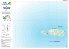
1:100,000 topographical map of Fiji showing physical, transport, settlement and other key features.
Additional Information
| Field | Value |
|---|---|
| Data last updated | July 28, 2016 |
| Metadata last updated | July 28, 2016 |
| Created | July 28, 2016 |
| Format | PNG |
| License | License not specified |
| Has views | True |
| Id | 14969804-c2f1-4b6c-a940-0f32e309f368 |
| On same domain | True |
| Package id | b67517f5-1e6c-498b-83ea-6f9da213005b |
| Position | 2 |
| Revision id | 7df9ae91-6719-4792-b2cf-34a2c47799cf |
| State | active |
| Url type | upload |