thumbnail.png
From the dataset abstract
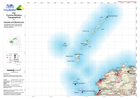
1:500,000 topographical map of Fiji showing physical, transport, settlement and other key features.
Source: Fiji: Cyclone Winston - Topographical - 5 - Yasawas and Mamanucas
Additional Information
| Field | Value |
|---|---|
| Data last updated | July 28, 2016 |
| Metadata last updated | July 28, 2016 |
| Created | July 28, 2016 |
| Format | PNG |
| License | License not specified |
| Has views | True |
| Id | 2db8a561-6506-46fd-a157-b3cbf7eca79b |
| On same domain | True |
| Package id | 2e0c2287-7885-42ee-b22e-7f2711391199 |
| Position | 2 |
| Revision id | e432cb50-a45f-4f44-a080-377ecdc81245 |
| State | active |
| Url type | upload |