MA018_Yemen_Affected_Settlements-300dpi.jpeg
From the dataset abstract
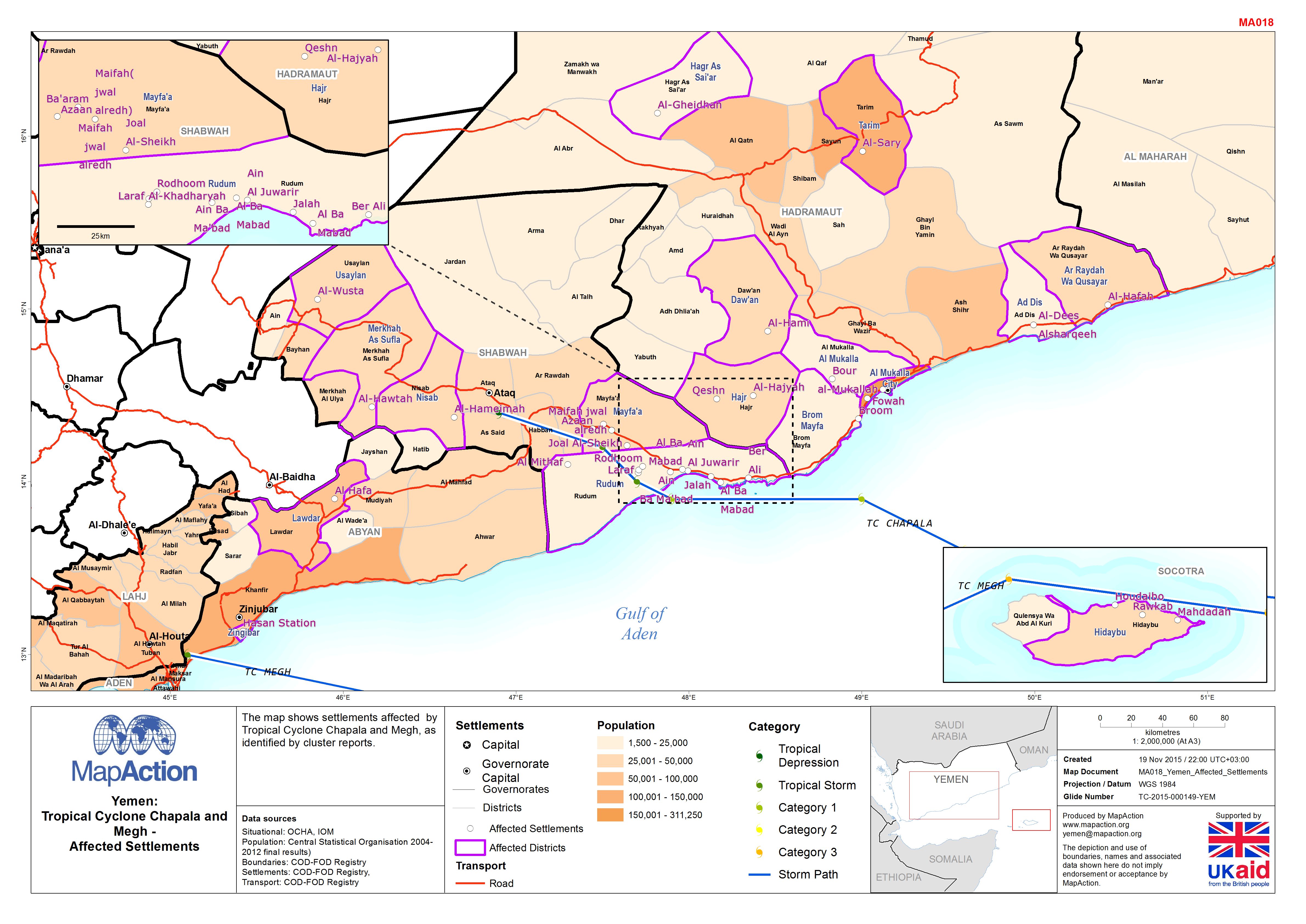
The map shows settlements affected by Tropical Cyclone Chapala and Megh, as identified by cluster reports.
Source: Yemen: Tropical Cyclone Chapala and Megh -Affected Settlements
Additional Information
| Field | Value |
|---|---|
| Data last updated | July 4, 2016 |
| Metadata last updated | July 4, 2016 |
| Created | July 4, 2016 |
| Format | JPEG |
| License | License not specified |
| Has views | True |
| Id | fa2f106c-ffc7-496c-9874-4ce3767b8929 |
| On same domain | True |
| Package id | ed28bdbf-1f87-4e73-be41-3bde3ab695ad |
| Revision id | a3e1ad7c-4dec-47cf-9b92-2bedabccab73 |
| State | active |
| Url type | upload |