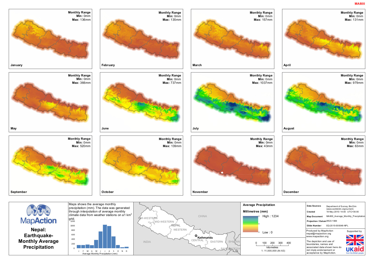
MA800_Average_Monthly_Precipitation.jpeg
From the dataset abstract
Maps shows the average monthly precipitation (mm). The data was generated through interpolation of average monthly climate data from weather stations on a1 km2 grid.
Additional Information
| Field | Value |
|---|---|
| Data last updated | July 4, 2016 |
| Metadata last updated | July 4, 2016 |
| Created | July 4, 2016 |
| Format | JPEG |
| License | License not specified |
| Has views | True |
| Id | d4b09288-c098-4c57-a4c3-1e1dee72eb17 |
| On same domain | True |
| Package id | 6e435f15-3e0a-430d-8524-89e810b3eea8 |
| Revision id | 0365e806-817c-41f2-95b5-30c8646cfa59 |
| State | active |
| Url type | upload |
