MA137_V01_AffectedPopulationDiff_20150514_11_MA ...
From the dataset abstract
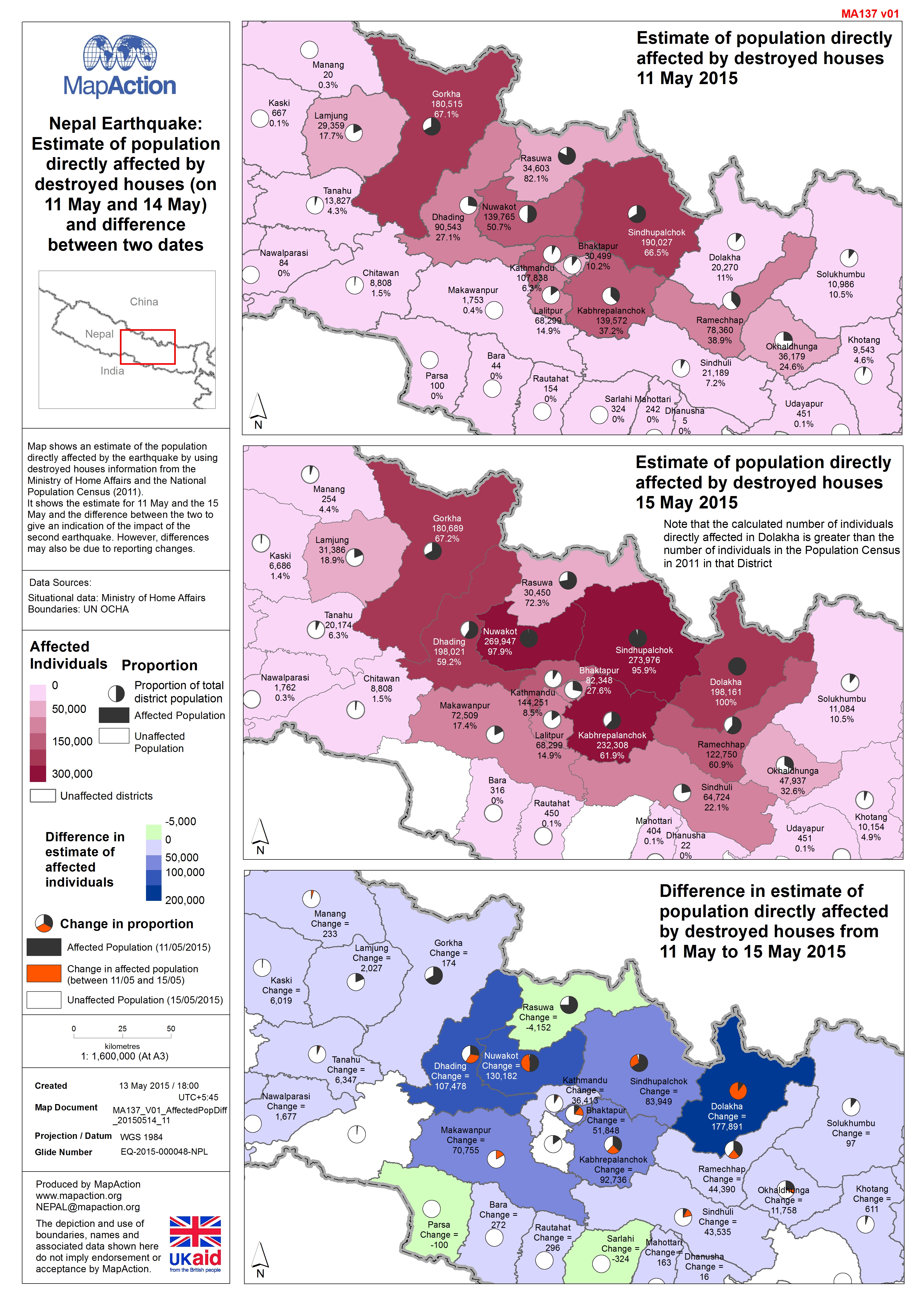
Map shows an estimate of the population directly affected by the earthquake by using destroyed houses information from the Ministry of Home Affairs and the National Population Census...
Additional Information
| Field | Value |
|---|---|
| Data last updated | July 4, 2016 |
| Metadata last updated | July 4, 2016 |
| Created | July 4, 2016 |
| Format | JPEG |
| License | License not specified |
| Has views | True |
| Id | dd70016c-f53d-4aa7-a210-1e7078049009 |
| On same domain | True |
| Package id | c541dd2f-097c-47dc-b244-3a110a11c372 |
| Revision id | 98b02ed4-4335-4fe1-bbcc-9cb6f58cffcb |
| State | active |
| Url type | upload |