MA136_v01_LocalTopo_Charicot-300dpi.jpeg
From the dataset abstract
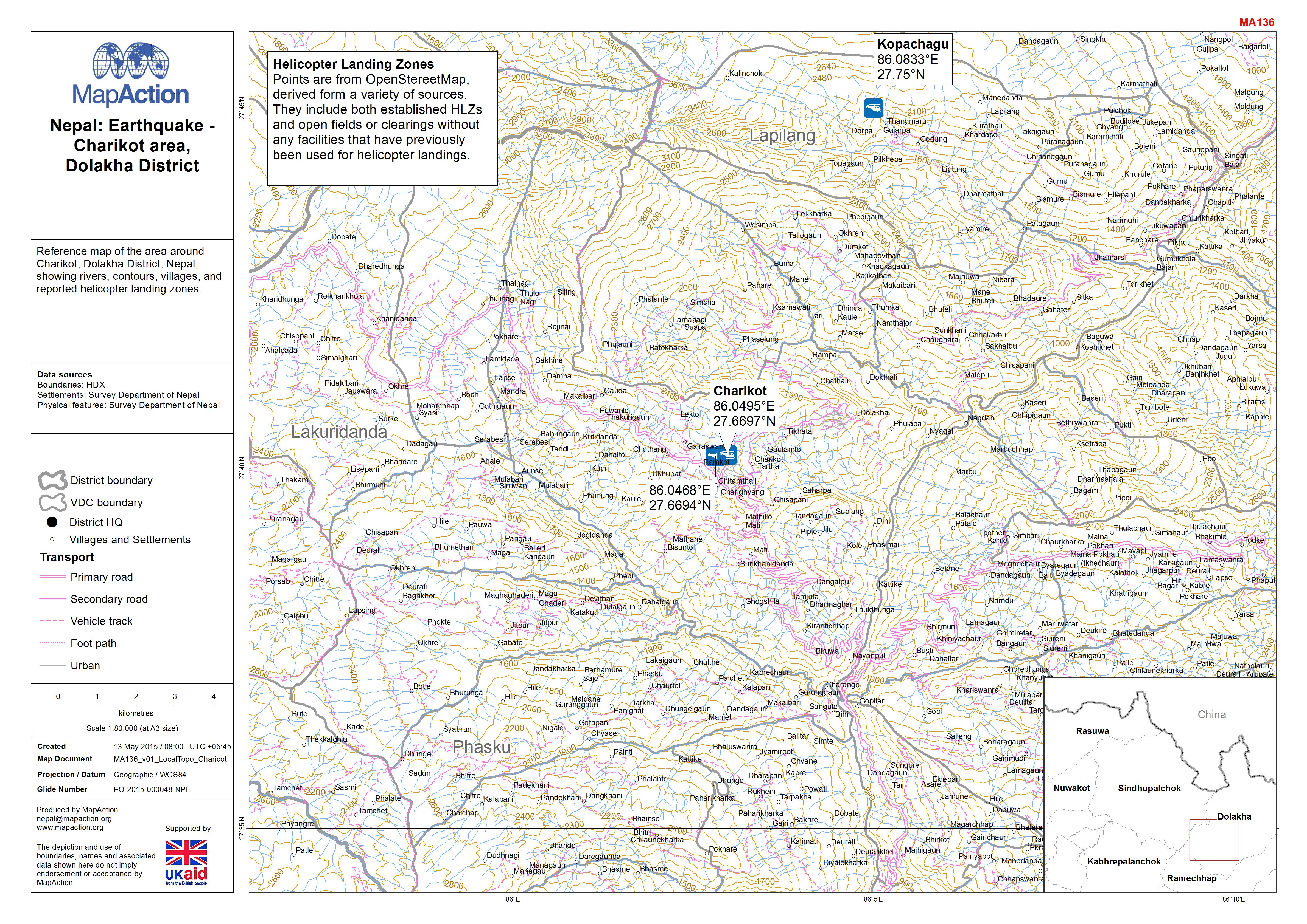
Reference map of the area around Charikot, Dolakha District, Nepal, showing rivers, contours, villages, and reported helicopter landing zones.
Additional Information
| Field | Value |
|---|---|
| Data last updated | July 4, 2016 |
| Metadata last updated | July 4, 2016 |
| Created | July 4, 2016 |
| Format | JPEG |
| License | License not specified |
| Has views | True |
| Id | 5694dda0-5764-469c-8dfd-2cfa36f74d2c |
| On same domain | True |
| Package id | ee91fb13-7265-4d53-83e4-1b0d975f5d03 |
| Revision id | 137176db-4eb8-48bb-8060-8d49462805b1 |
| State | active |
| Url type | upload |